MikeC
Admin
Reged:
Posts: 4646
Loc: Orlando, FL
|
|
The and Euro (and a few ensembles) have been hinting at a few things the second week of June. Not too concerned about it yet, but worth mentioning in the lounge.
The 12Z Euro has backed off anything happening in the Gulf, so I'd put money on nothing happening, but watch the west carib anyway as ensembles have increased in the area though..
|
MikeC
Admin
Reged:
Posts: 4646
Loc: Orlando, FL
|
|
Gfs still mostly alone, but noting the east pacific pop up here as well. Something to watch, but doubt either of the runs from today materialize. In other words, it's likely if something happens, the east pacific is more likely.
|
IsoFlame
Weather Analyst

Reged:
Posts: 375
Loc: One block off the Atlantic Oce...
|
|
Quote:
Gfs still mostly alone, but noting the east pacific pop up here as well. Something to watch, but doubt either of the runs from today materialize. In other words, it's likely if something happens, the east pacific is more likely.
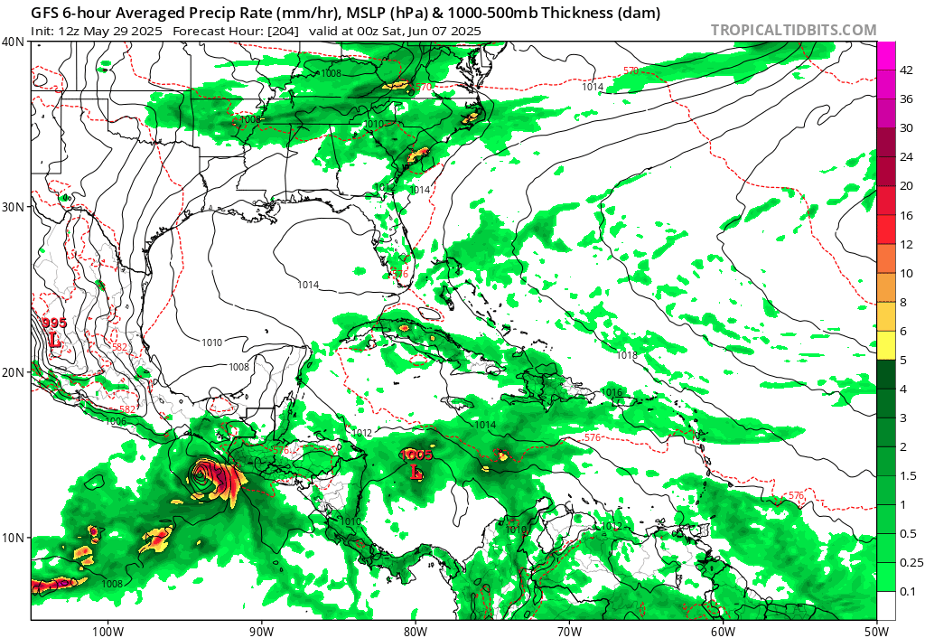
Yeppers... may be crying wolf, but the 06Z run doubled down on a strong TC in the GOMEX June 9/10th eyeballing landfall near Biloxi as a fairly strong hurricane. Yes, hurricanes are rare in early June and we have a deep trough setting us up for an unusual June 1st FROPA, but SST's in the central and eastern GOMEX are climbing into the mid-80's and the atmospheric parameters will become favorable the second week in June when the Atlantic ridge re-establishes. Either other models start to hit on this, or the totally abandons the idea in future runs. We shall see...
06zMay30
--------------------
CoCoRaHS Weather Observer (FL-VL-42) & Surf Forecaster: https://www.surf-station.com/north-florida-surf-forecast-3/
Edited by IsoFlame (Fri May 30 2025 08:38 AM)
|
MikeC
Admin
Reged:
Posts: 4646
Loc: Orlando, FL
|
|
6z is a bit on the crazy side for kicking off on the 20th anniversary year of , euro operational doesn't show anything, however several ensembles do. And the ensembles are also suggesting something could form in a week.from Monday or so.
|
MikeC
Admin
Reged:
Posts: 4646
Loc: Orlando, FL
|
|
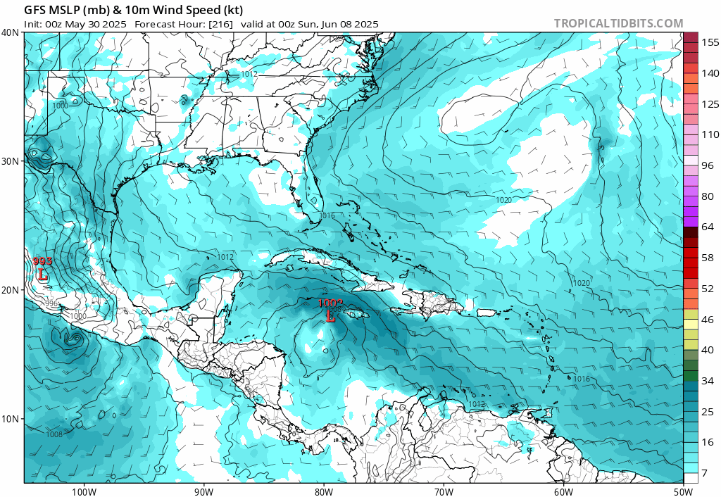
12z shifted back to a hurricane impact on florida
Probably the best idea is to watch ensembles a bit more until the day range closes, the euro still has a few ensemble members, but mostly west. Too soon to really say on it. But in this run the starts to develop it on June 7th in the West Caribbean.
The typically overdoes this situation, but there is a few euro ensembles also involved, so there's a slight chance something may develop, but unlikely to be this powerful.
|
MikeC
Admin
Reged:
Posts: 4646
Loc: Orlando, FL
|
|
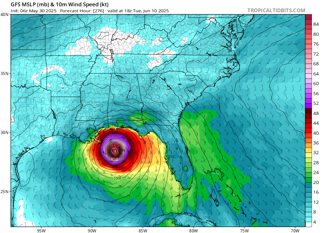
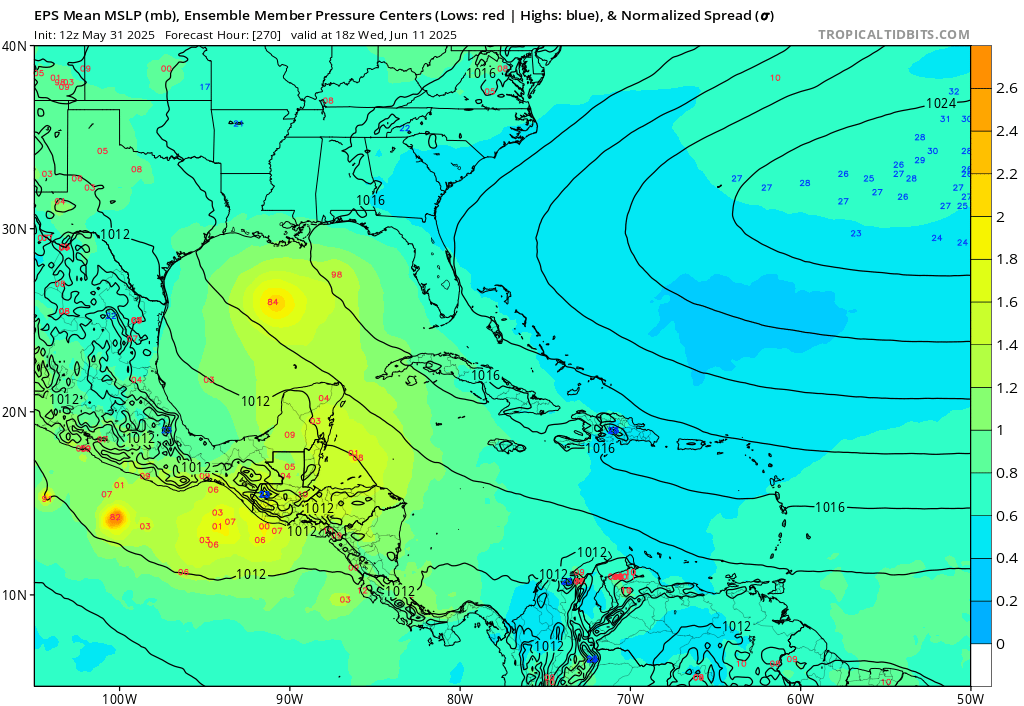
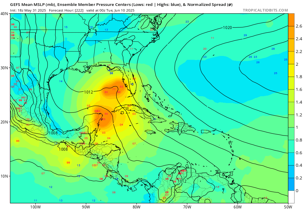
The operation continues to show development, whereas the others do not. (18z is back to a major hit on LA/MS)
However there still are signals on the Euro Ensembles for something
Euro Ensembles:
GFS Ensembles:
There is also a weak area off the SE (and FLorida) that the Euro and Canadian pick up.
Normally I'd write of the , and mostly I do, but the , Euro ensembles, make me think there's a chance something tries to develop, I just doubt it'll be anything like the has been showing. (And may not succeed)
Another view of the Euro Ensembles:
Overall, the East Pacific is much more likely to see another system than the Atlantic
|
MikeC
Admin
Reged:
Posts: 4646
Loc: Orlando, FL
|
|
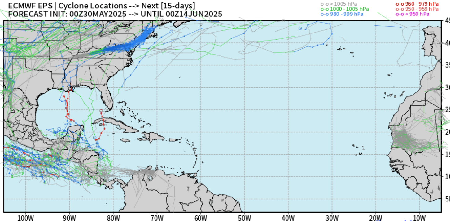
The southeast coast looks more liekly than the at this point, however there's still long range ensemble members showing something in the gulf also, but later on (June 12th or so)
The euro ensemble tracks for the Southeast System, which may get a lemon on the outlook tomorrow.
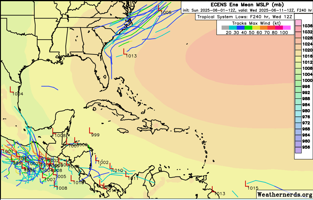
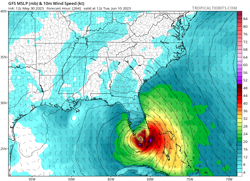
The is falling back on the idea it had earlier, going later and further west, which may wind up getting pushed into the east pacific. However worth noting is the euro ensembles here:
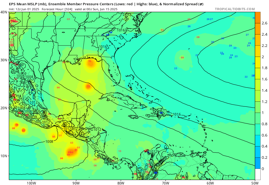
which are showing something there in the very long range. Just not what the was showing.
|


 Threaded


