Current Radar or Satellite Image

Flhurricane.com - Central Florida Hurricane Center - Tracking Storms since 199530 Years of Hurricanes Without the Hype - Since 1995


The area over the northeast Gulf extending into offshore the Southeast now has a 40% chance to develop into a tropical or subtropical system this weekend or early next week. Lots of off/on rain in Florida in the meantime.
Days since last H. Landfall - US: Any 265 (Milton) , Major: 265 (Milton) Florida - Any: 265 (Milton) Major: 265 (Milton)
23.0N 99.2W
Wind: 30MPH
Pres: 1008mb
Moving:
Nw at 12 mph
Click for Storm Spotlight
COMMUNICATION
STORM DATA
CONTENT
FOLLOW US


General Discussion >> 2025 Forecast Lounge

Pages: 1 | 2 | (show all)
cieldumort
Moderator


Reged:
Posts: 2517
Loc: Austin, Tx
Re: General Long Range Lounge [Re: MikeC]
      #115560 - Fri Jun 27 2025 02:04 PM

Have started a thread just for the BOC Area of Interest over in The Tropics Today: W Gulf this weekend .

NHC now up to 30% if/once the disturbance has moved into the Bay of Campeche.

In order to realize its potential, the disturbance would have to spend enough time over the water and within what looks to be a rather small corridor of lower shear. No Invest tag yet, but will consider inclusion to the Forecast Lounge if these preconditions look to be coming together.


Post Extras: Print Post   Remind Me!   Notify Moderator  
MikeCAdministrator
Admin


Reged:
Posts: 4673
Loc: Orlando, FL
Re: General Long Range Lounge [Re: cieldumort]
      #115566 - Sat Jun 28 2025 12:55 PM

Multiple models showing something next weekend around the southeast, mostly offf the Southeast, but the GFS is pushing for something in the Gulf near the Panhandle over the energy going off the southeast where most of the other models have it developing, including hte CMC, Icon, and Euro and the google deepmind model has a large spread here also.

Nothing stronger than a weak TS in any of these though.


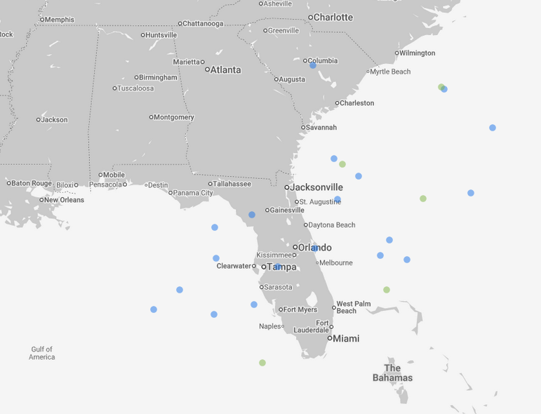
Image frame targeting sunday morning next week


Post Extras: Print Post   Remind Me!   Notify Moderator  
MikeCAdministrator
Admin


Reged:
Posts: 4673
Loc: Orlando, FL
Re: General Long Range Lounge [Re: MikeC]
      #115570 - Sat Jun 28 2025 07:35 PM

18z GFS went a bit wild, but doesn't have much support elsewhere


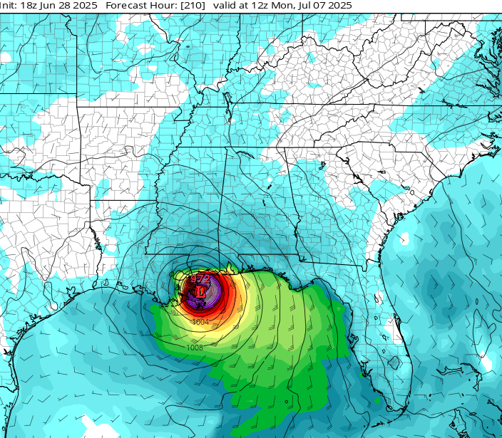
This is very unlikely, however it does show the heat content in that part of the Gulf (which is very hot right now)


12z Euro keeps it weak and moves it off the southeast (icon does also)
Euro ensembles are mostly off the southeast coast, where GFS ensembles have it more in the northwast Gulf. It's looking more likely there may be something to watch for on the holiday weekend. Note, before this it means it's likely to be HEAVY ranfall over much of Central and North FLorida later in the week, regardless of development.


Post Extras: Print Post   Remind Me!   Notify Moderator  
MikeCAdministrator
Admin


Reged:
Posts: 4673
Loc: Orlando, FL
Re: General Long Range Lounge [Re: MikeC]
      #115571 - Sun Jun 29 2025 06:40 AM

Overnight model runs have backed off on development, but the general area of heavy rain remain.

Post Extras: Print Post   Remind Me!   Notify Moderator  
Pages: 1 | 2 | (show all)


Extra information
1 registered and 4 anonymous users are browsing this forum.

Moderator:  

Print Topic

Forum Permissions
      You cannot start new topics
      You cannot reply to topics
      HTML is disabled
      UBBCode is enabled

Rating:
Topic views: 5307

Rate this topic

Jump to

Note: This is NOT an official page. It is run by weather hobbyists and should not be used as a replacement for official sources. 
CFHC's main servers are currently located at
Hostdime.com in Orlando, FL.
Image Server Network thanks to Mike Potts and Amazon Web Services. If you have static file hosting space that allows dns aliasing contact us to help out! Some Maps Provided by:
Great thanks to all who donated and everyone who uses the site as well. Site designed for 800x600+ resolution
When in doubt, take the word of the National Hurricane Center