MikeC
Admin
Reged:
Posts: 4739
Loc: Orlando, FL
|
|
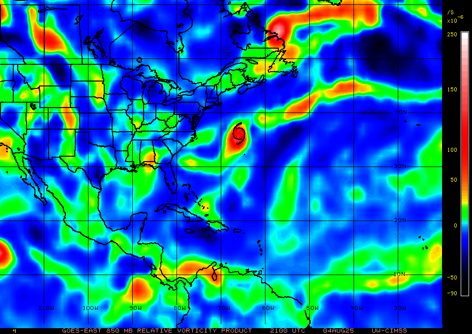
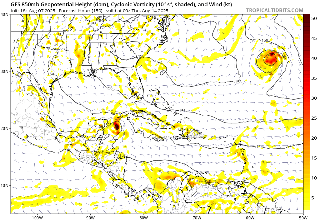
I'd call the area in the Bahamas right now another potential watch area, along with the current 30% area off Georgia. There's some vorticity and spin down there also. Models in the east Atlantic need to actually develop before anything on the long range can even begin to be taken seriously.
|
MikeC
Admin
Reged:
Posts: 4739
Loc: Orlando, FL
|
|
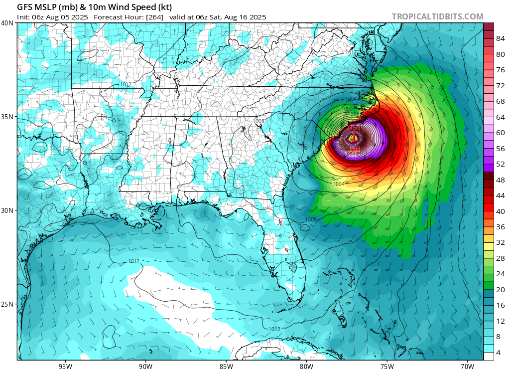
After shifting to recurve last night on the 0z the 6z shifted west back to landfall near Lamp Lejune/Jacksonville, NC on the 16th.
It doesn't do much at wall with the other area though.
:the 0z Euro still recurves the east Atlantic wave east of Bermuda , but does develop the wave behind that, which reaches deep into the Caribbean. It's a depression or tropical storm over the lesser antilles, and develops into a hurricane, gets close/over Jamaica, and
Euro does take the area of interest off the Southeast and develops it a little before clipping the outer banks, then it meanders offshore and strengthens for days but doesn't make landfall.
The long range is still not aligned.
|
Kraig
Weather Hobbyist

Reged:
Posts: 87
Loc: Jupiter, Fl
|
|
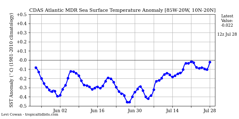
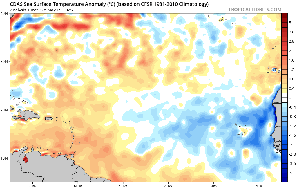
Not sure where you are getting the Atlantic SST, but the MDR has had below average SST for the entire season except for a recent quick blip that has come and gone and it's back below normal!
|
MikeC
Admin
Reged:
Posts: 4739
Loc: Orlando, FL
|
|
Interestingly the 12Z has shifted back west toward Cape Canaveral
Icon shifted to be SSW of Bermuda, but the 12Z Euro still keeps it east of Bermuda. Euro still likes the followup wave better and
My guess for the track of this area is still somewhere in the middle, which may make it get closer to Bermuda (but not much... still safely east), but very unlikely to get to the US mainland.
The followup behind this wave is the one the Euro really likes. However, MDR may be a little more favorable overall on some parameters -- but not all, it's still not enough to support something larger, although it makes it more likely for later when the waves get further west.
Both major models show a follow able area on Friday, which is probably the day the models start to reconcile a bit more.
Ensembles spell out the more likely paths I think
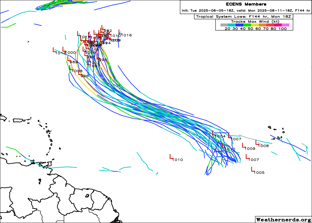
The ensembes (GEFS) has also backed off quite a bit on the idea of the first wave making all the way west. It's also making me watch the area over the Bahamas now. (See the ensemble members that start in the Gulf) The wave east of the wave in the outlook is still the favored one by the euro set.
|
MikeC
Admin
Reged:
Posts: 4739
Loc: Orlando, FL
|
|
The 18Z Euro ensembles are a pretty strong indicator the 50% area in the east Atlantic will stay well east of Bermuda. I do think the system east of it may be more interesting to watch.
|
MikeC
Admin
Reged:
Posts: 4739
Loc: Orlando, FL
|
|
Overnight runs of the shifted to be more in line with the Icon, and Euro models with the African wave, recurving well east of the US. For me, the remaining question is how close it gets to Bermuda, and if it makes to Newfoundland. Those in Bermuda will want to keep close eyes on it.
The wave beyond that is now being picked up by both models, which generally is more concerning as it's a long tracker, although probably won't develop much until much later.
The wave off the southeast depends on how close it gets to the outer banks, I do think it'll develop later this week, and it may be close enough to the outer banks to cause issues, but not sure about landfall.
|
CFHC

Reged:
Posts: 182
Loc: East Central Florida
|
|
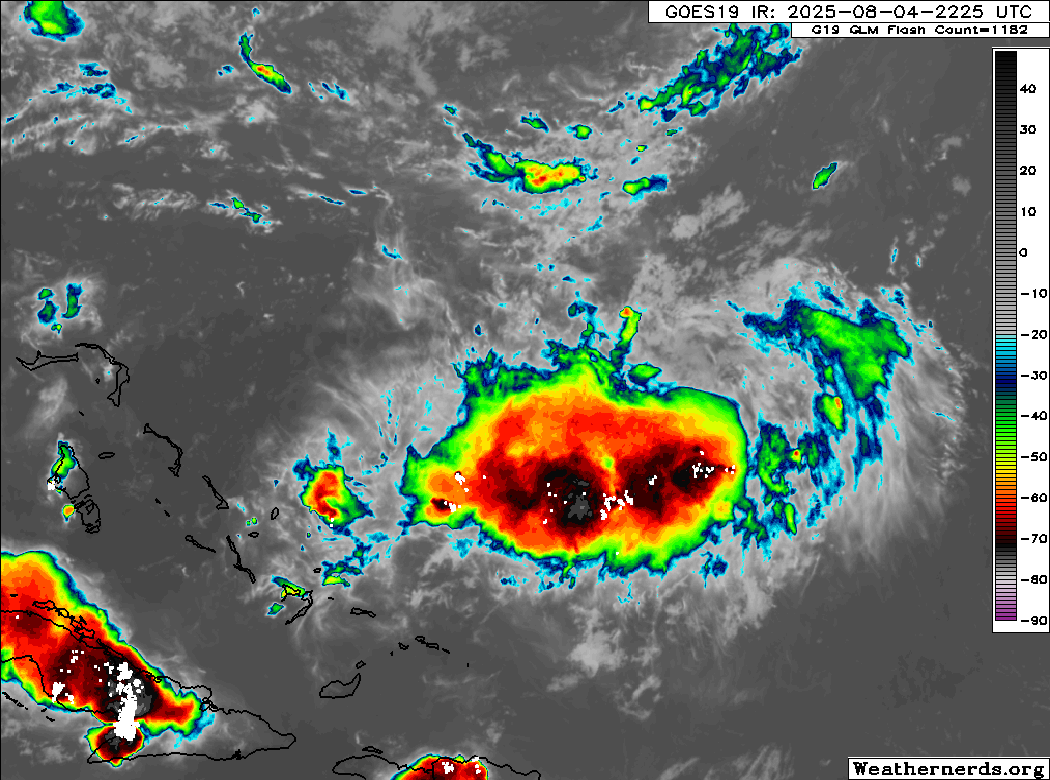
12z Euro is now recurving the wave behind Invest 96L way before the islands. Hopefully that trend continues there too. SE Area probably will develop, but stay offshore. The area of the Bahamas is looking less likely to develop, but should still be watched. Anything in this part of the MDR is unlikely to get very strong. The Euro AI is still showing something moving west, but it doesn't handle undeveloped systems well.
The trend of nothing concerning continues.
|
MikeC
Admin
Reged:
Posts: 4739
Loc: Orlando, FL
|
|
18z is highligting multiple, 6-7 areas by the end of the run, some like the area currently east of the leewards around 53w may even get a lemon soon. not sure if all of them will actually happen, but the idea of activity really picking up by mid-late this month seems solid at this point. Where they wind up is something different.
|
MikeC
Admin
Reged:
Posts: 4739
Loc: Orlando, FL
|
|
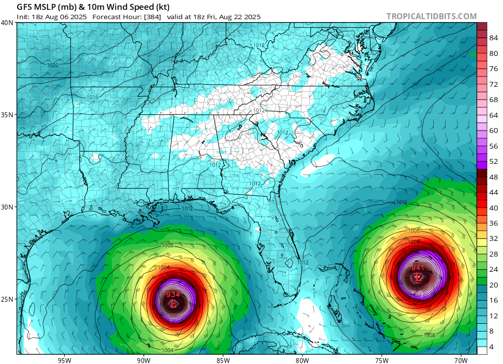
This isn't going to happen, but showing off one of the most classic "Happy Hour" runs I've seen.
with double vision cat 4 hurricanes
|
MikeC
Admin
Reged:
Posts: 4739
Loc: Orlando, FL
|
|
Overnight models show the wave behind 96L being the one to watch the closest. The two low key areas, Bahamas and east of the Lesser Antilles have dropped off for the most part although the lesser Antilles one less so, and 96L itself may still get close to Bermuda, so it's important for those there to watch.
Models generally show a very active mid to late August, but too early to say specifics on where things wind up.
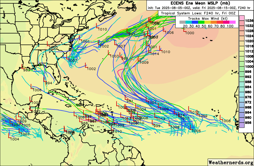
Euro ensembles below:
0z shows the wave east of 96L entering the Caribben potentially affecting some of the leewards, Jamaica, Caymans, Cuba, and eventually toward Northeastern Texas. The 0z euro surprisingly aligns with that as well. But also has a system east of it (Similar to the 18Z ) but this one goes over Berumda. the 0z also takes 96L over Bermuda, but Euro takes 96L well east of it. It does try to develop the wave east of the lesser antilles, but is on/off with it .
The 6z takes 96L slightly west of Bermuda, and the system behind it is north of the Caribbean and follows 96L -- much weaker. It also develops the minor wave east of the lesser Antilles again in the Caribbean, but keeps it weak. Bermuda should definitely continue to watch 96L closely.
General climatology and odds favor both 96L and the wave behind it both recurving before the US, but it's a lot less a sure bet for the wave behind 96L. With the uptick in activity about to come in mid to late August there should be plenty to watch. The in Africa wave doesn't have a shot to become an invest area until Sunday or Monday though, so lots of time for things to change on it, even longer for anything to really develop, which is the next milestone, which because of the situation in the MDR, isn't a sure thing it will.
|
IsoFlame
Weather Analyst

Reged:
Posts: 387
Loc: One block off the Atlantic Oce...
|
|
Quote:
With the uptick in activity about to come in mid to late August there should be plenty to watch. The in Africa wave doesn't have a shot to become an invest area until Sunday or Monday though, so lots of time for things to change on it, even longer for anything to really develop, which is the next milestone.
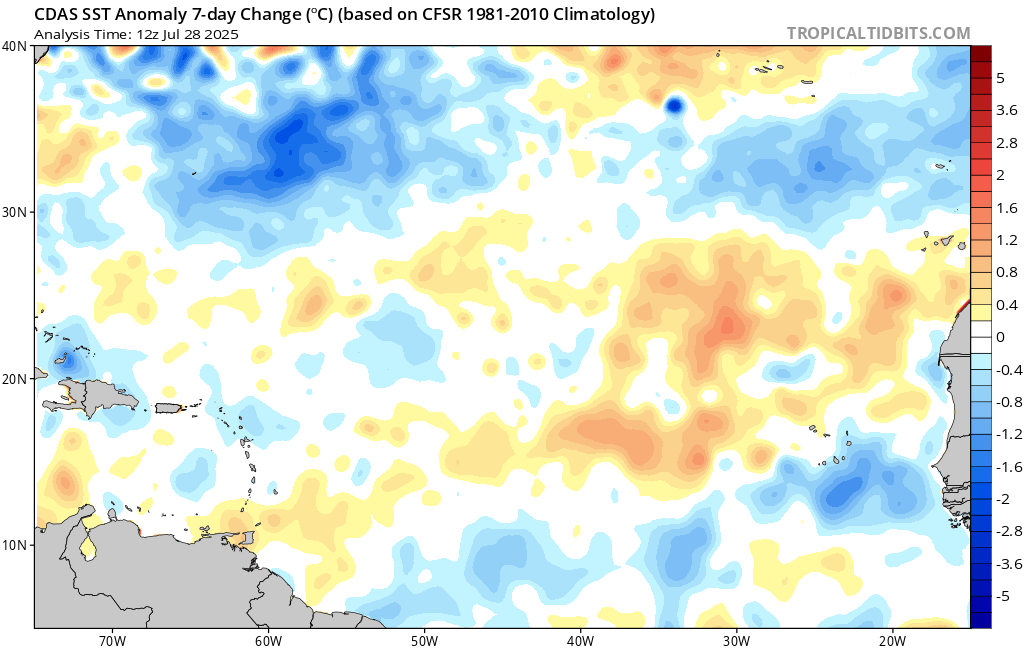
The MDR is waking up. My gut feeling is that it will progressively kick out multiple disturbances through the heart of the season, but they will be slow to develop much until reaching 60 west where the sweet spot with abundant moisture, low shear and above normal SST's may persist.
While 2025 is a few weeks ahead of historical activity for named systems, and we will probably get the first hurricane of the season around the typical time in mid-August, I think we're on track for a near normal season for named storms and ACE, though we may fall short on the number of hurricanes and majors.
Guessing about the area that could be impacted by a significant Atlantic hurricane, I'd favor the southeast Florida peninsula (Miami/Dade) and Keys, followed by the far western Florida panhandle and/or Alabama. These parts of the coast are overdue given they escaped the brunt of the hyper-active last 5 seasons. A TC like Andrew', initially unimpressive until everything comes together, could be in store in late August or early September.
--------------------
CoCoRaHS Weather Observer (FL-VL-42) & Surf Forecaster: https://www.surf-station.com/north-florida-surf-forecast-3/
|
MikeC
Admin
Reged:
Posts: 4739
Loc: Orlando, FL
|
|
18Z shifted west with a stronger ridge, and long range landfalls around the SC/NC border, just north of Myrtle Beach in 2 weeks. It shifts 96L to recurve sooner like the other models giving the ridge a chance to build in stronger. It avoids the caribbean islands to the north, just barely, and misses the Bahamas to the north in the run. But it's a bit of a signal to keep watch on that wave.
Additionally it shows potential development in the West Caribbean late next week (something to watch at least).
The next name on the list is Erin. Erin of 1995 happens to be the very first hurricane we covered here, it made a double florida landfall, first as a hurricane in Vero Beach and a second landfall near Pensacola.
|
MikeC
Admin
Reged:
Posts: 4739
Loc: Orlando, FL
|
|
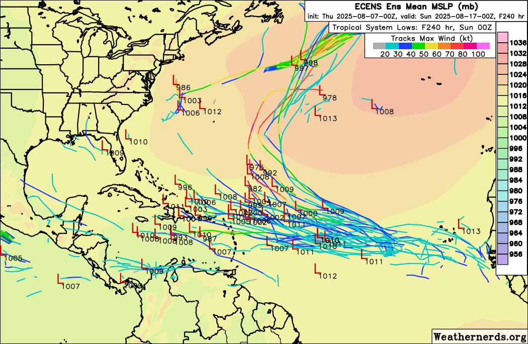
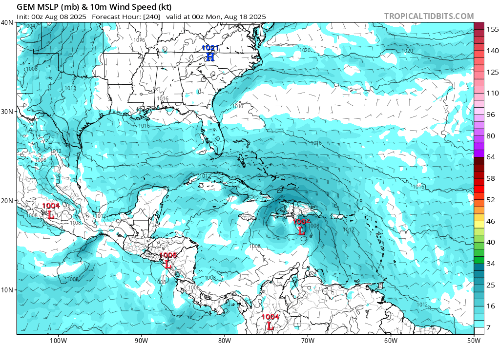
Overnight runs, except for the Canadian, miss the Caribbean Islands. The Euro now recurves the system before the southeast, but threatens new England. The 0z has a south Florida then gulf then Destin hit. There's a long track system coming, although probably days before anything develops so the door is pretty wide open. Any land impacts are 10-15 days out, assuming it doesn't curve before then.
The 6z makes no us landfall at all, but gets very close to the Outer Banks and Cape Cod / Martha's Vineyard (brushes by) as well as brushes Nova Scotia. The notable thing about the 6z is how long it keeps 96L around as a hurricane, which seems to impact the waves track.
One notable thing about the 6z run this morning it stalls 96L in the central atlantic for days.
Something to watch closely over the next two weeks, but nothing definitive or overly concerning now, The current model run set don't even really develop anything for another week, where prior ones did around tue-wed of next week.
last frame of 0z euro
0z
 = =
0z canadain (Weak south of Hispaniola)
euro ensemble spread
In short no guarantee for land impacts, but enough to monitor it for a while. Ensembles + Climatology shifts the odds to very slightly favor no landfall right now.
|
MikeC
Admin
Reged:
Posts: 4739
Loc: Orlando, FL
|
|
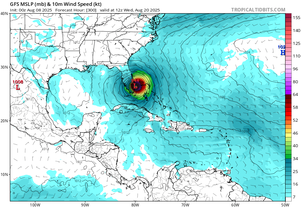
12z has a few notable changes, it develops the system fairly quickly, gets it to a depression by Sunday or Monday, possibly a storm by Tuesday, and also kicks 96l out of the picture much sooner. Giving some time for a ridge to build west, which it takes advantage of and moves over the Bahamas through the Florida straits and into the Gulf, making landfall in Texas.
I'll be curious to see the other models and ensembles and if that shifts them more westward or not.
--
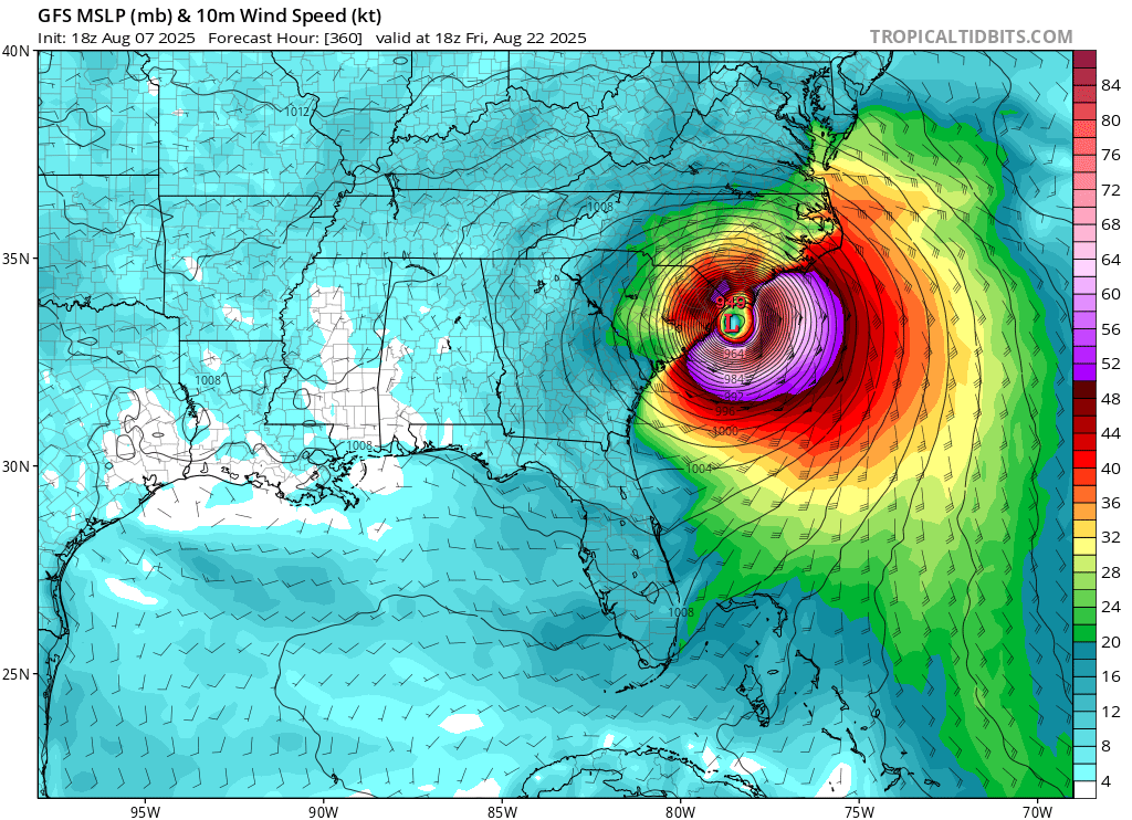
It did some, but most still recurve, Euro AI recurves this run. However the operation euro does get further west/stronger at 12Z and makes landfall in Eastern NC then goes over the outer banks and makes another landfall still really strong over Massachusetts.
|
MikeC
Admin
Reged:
Posts: 4739
Loc: Orlando, FL
|
|
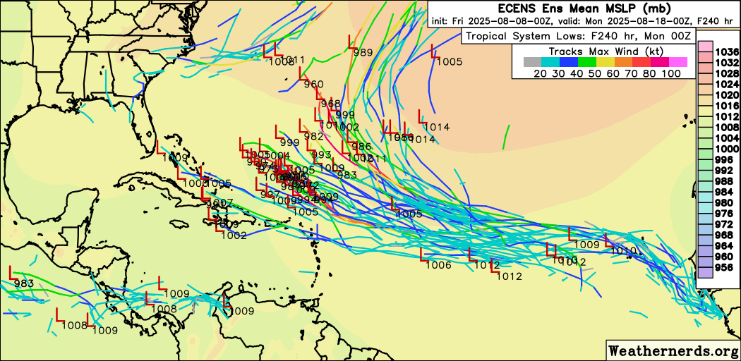
The euro Ensembles did push slightly westward, but most still are out to sea. Plenty of time to watch this wave. The ones went the other direction.
|
MikeC
Admin
Reged:
Posts: 4739
Loc: Orlando, FL
|
|
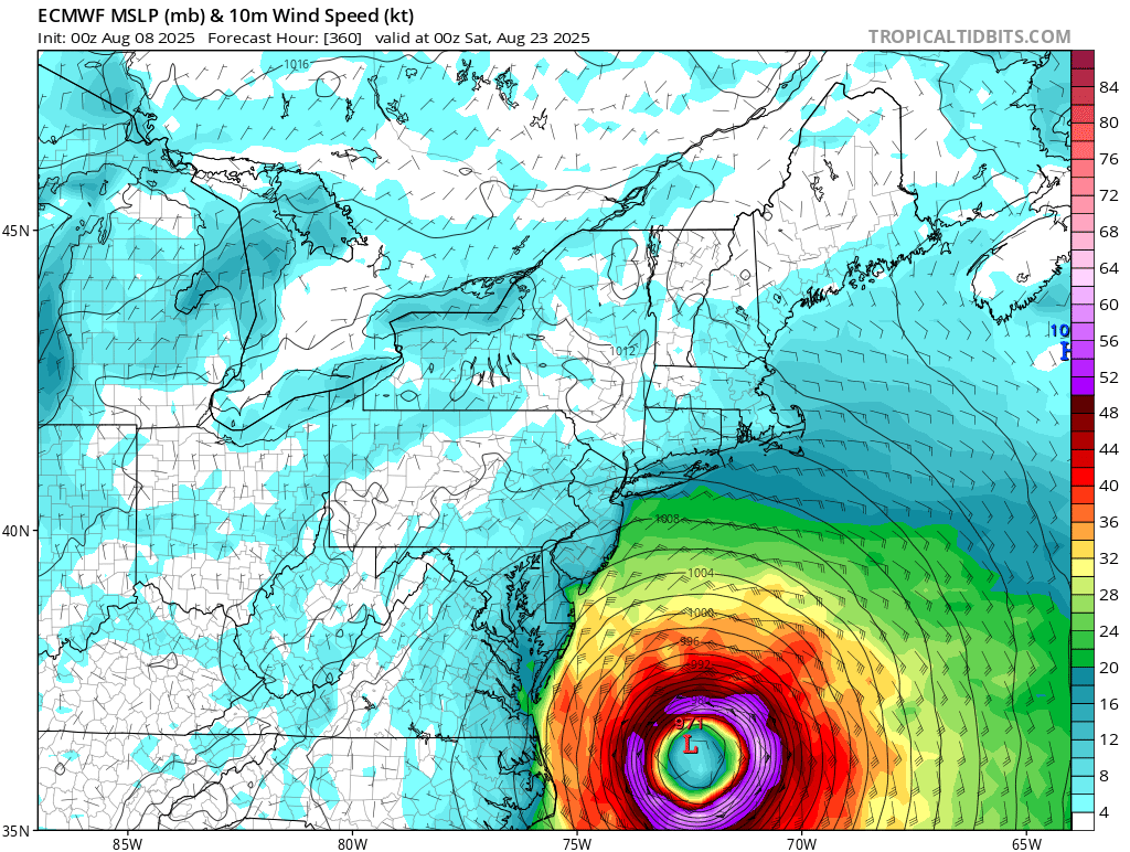
The 0z makes landfall in the eastern Bahamas and in eastern North Carolina on the 00Z, Euro stays offshore until it makes landfall in Eastern Massachusetts and again in Nova Scotia. Most ensembles recurve it, but there's enough to cause a long term watch as it crosses the Atlantic. Recurve is still the most likely, but not a strong likely. The Euro AI takes it into South Carolina around Georgetown, between Charleston and Myrtle Beach.
Both makor models show another system behind it, takes it into the Caribbean, euro north of there. impacts Jamaica and the Cyaman Islands on that system.
For the Caribbean Islands, euro is safely to the north, is north, but a bit too close for comfort.
0z Canadian recurve it
We'll probably make a new main page about this system when it develops.
Next post about this will be in its own lounge topic.
|


 Threaded


