7PM CDT Update 27 June 2025
Conditions for development of 91L appear to be going up and the system is now starting to move into the Bay of Campeche. Given its close proximity to land and what appear to be increasing odds of development, we have opened a Forecast Lounge (91L) for this one.
Ciel
5PM Update 27 June 2025
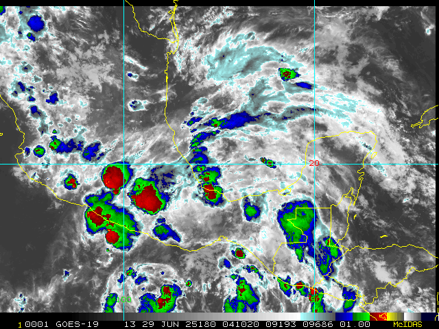
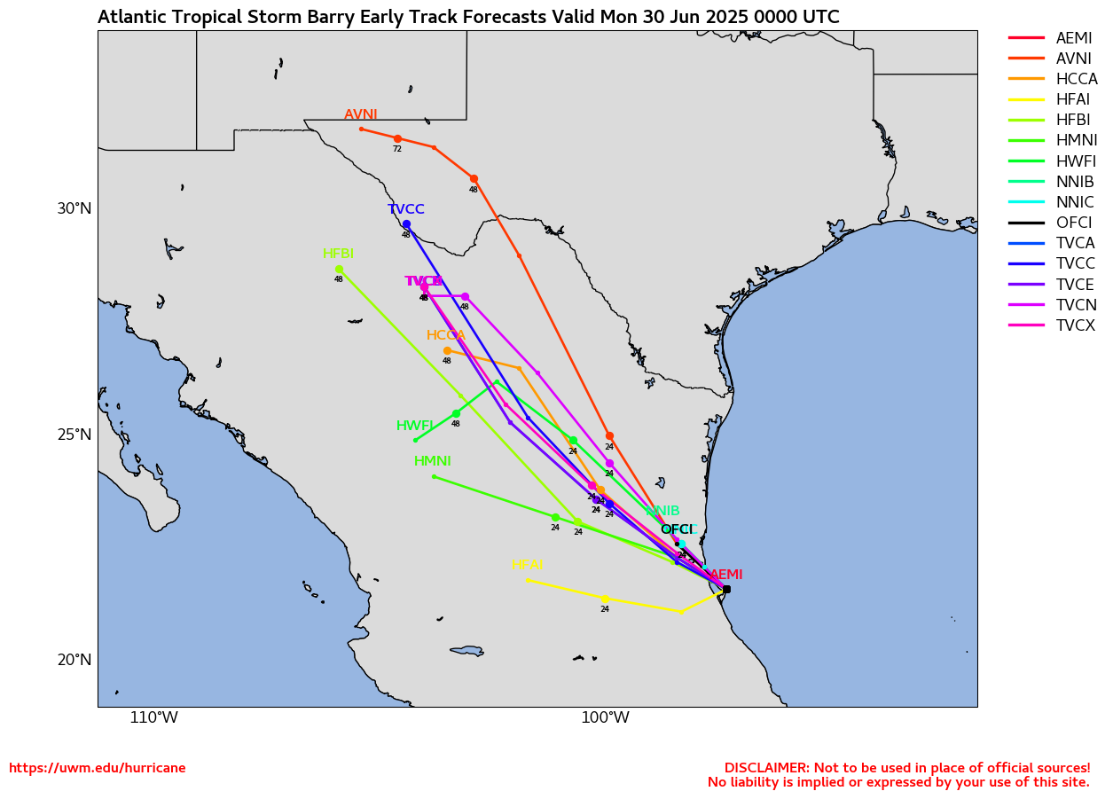
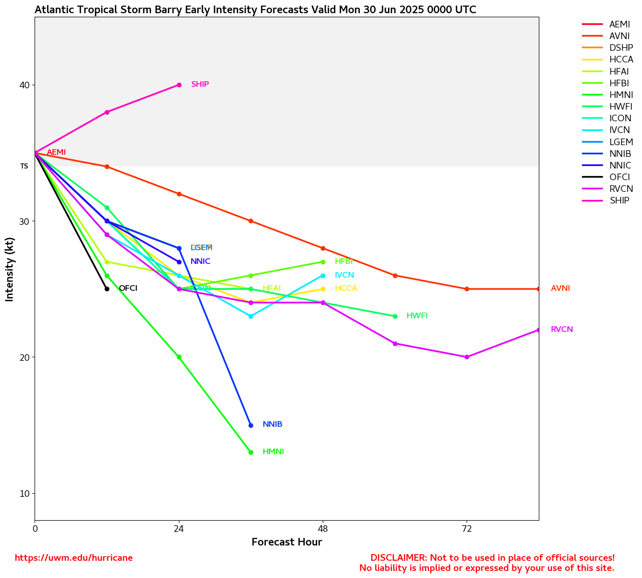
91L now being tracked over the Yucatan Peninsula with a 30% chance for development. Likely to be short lived if it develops at all, likely to landfall in Mexico near Tampico if it does.
Original Update
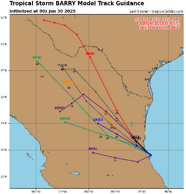
The area known as 90L has regained strength overnight, still sheared, but enough to be classified as the season's first Tropical Storm.
It is likely to remain short lived as the convection is getting sheared apart and moving into colder waters.
Outside of this, nothing on the immediate horizon. Although area to watch int he next few weeks include the Bay of Campeche and off the Southeast coast, nothing is terribly likely to develop.


 Threaded


