cieldumort
Moderator

Reged:
Posts: 2738
Loc: Austin, Tx
|
|
A majority of global model runs are now latching on to the potential for a home-grown system along an old frontal boundary somewhere in the vicinity of either side of Florida later in the new week and into the July 4th weekend, and given such a strong signal this far ahead and the implications of impactful weather in the region over the holiday, we are starting a lounge on this yet still unformed system at this time.
The weak surface trof (remnants of a stalling frontal boundary) off the east coast of Florida has been Invest tagged 92L on 07/04/0z, and we have updated the title accordingly.
Invest 92L was confirmed by recon during the afternoon of July 4 to have become a Tropical Cyclone, our third of this season, and also our third back-to-back Invests that went on to undergo TC Genesis, which is noteworthy. The title has been updated accordingly. 7/4/25/5PM.
THREE become Chantal the morning of July 5 and the title has been updated accordingly
Ciel
Edited by cieldumort (Sat Jul 05 2025 12:25 PM)
|
MikeC
Admin
Reged:
Posts: 4835
Loc: Orlando, FL
|
|
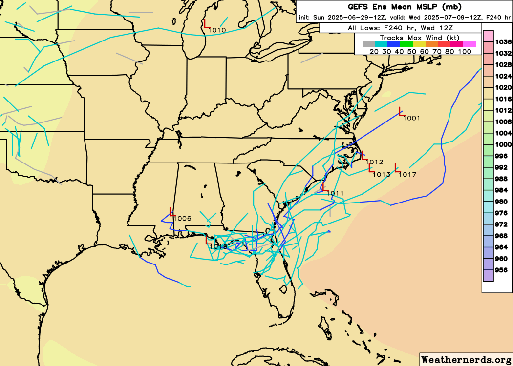
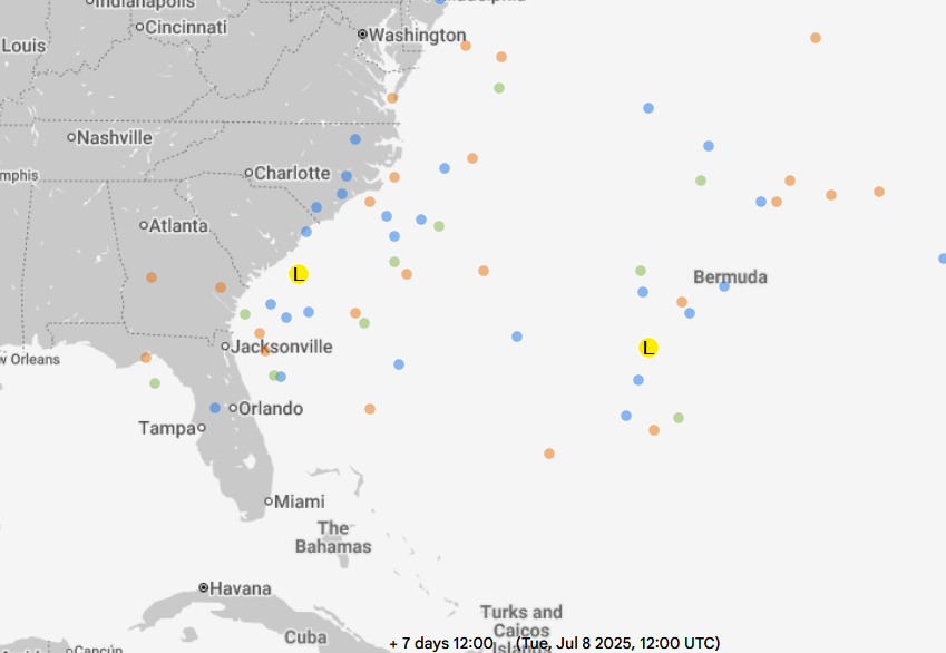
I don't think this will develop, but it will still cause a lot of rain and some localized flooding, here's the ensemble tracks. A lot rides on exactly where it consolidates, if it's over land it's not going to amount to much more than rain. Although if that occurs it's still possible for it to form off the Atlantic, but it'll be away from land at that point. Wet week in Florida mostly.
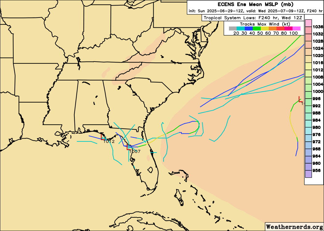
GFS Ensembles probably show the better spread, as does the google. Euro doesn't handle this situation very well (if something does form later it will however)
12 ensembles:
12z euro ensembles:
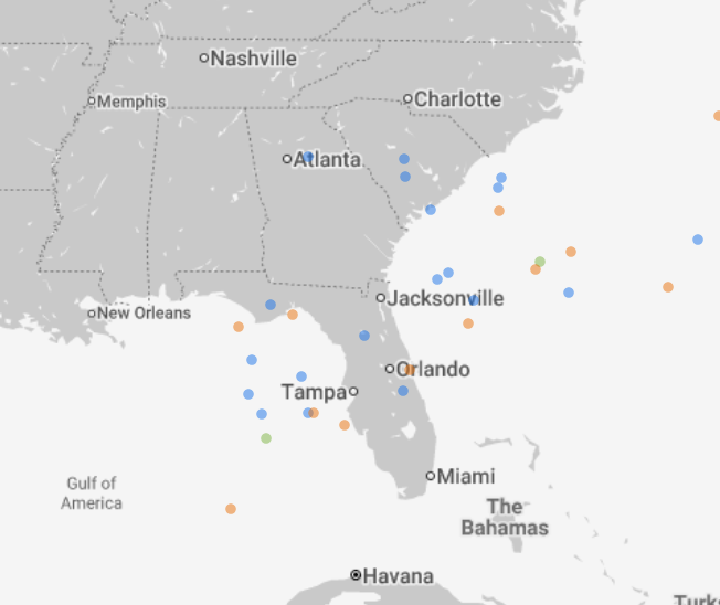
12z Google models:
turned on the long term radar recording for it though here
|
CFHC

Reged:
Posts: 211
Loc: East Central Florida
|
|
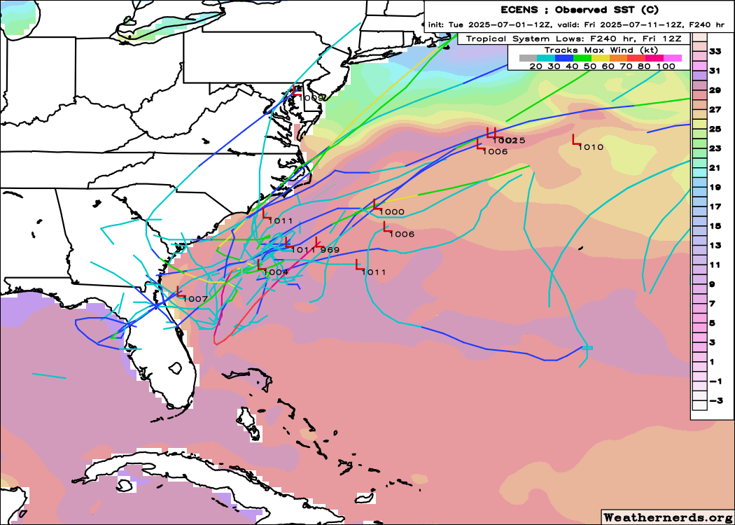
Model support is starting to drop off considerably this afternoon
|
MikeC
Admin
Reged:
Posts: 4835
Loc: Orlando, FL
|
|
12Z models dropped off considerably, but the 0z brings some back, just shifted back to the southeast again and away from the Gulf. The stronger, but the canadian and euro show it as well. Ensembles still not too active. The Euro has two areas off the Southeast in a week, weak one close to the Southeast coast and a stronger one near Bermuda.
|
MikeC
Admin
Reged:
Posts: 4835
Loc: Orlando, FL
|
|
The 06Z run on the shows a weak area off the Southeast, a weaker area in the Gulf, and a barly stronger one developing close to Bermuda Sun-Monday.
|
MikeC
Admin
Reged:
Posts: 4835
Loc: Orlando, FL
|
|
General concentration of models have shifted east, with the euro and also picking up on something near Bermuda. The broad nature of the front means it may (and probably will) change again later.
|
CFHC
Reged:
Posts: 211
Loc: East Central Florida
|
|
Euro side, afternoon ensembles jumped up quite a bit
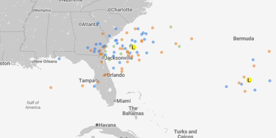
GFS Not as much, but almost all on the Southeast US side.
|
MikeC
Admin
Reged:
Posts: 4835
Loc: Orlando, FL
|
|
18z is back to something forming in the northeast gulf, although weak. Icon is still off the east coast.
|
IsoFlame
Weather Analyst

Reged:
Posts: 414
Loc: One block off the Atlantic Oce...
|
|
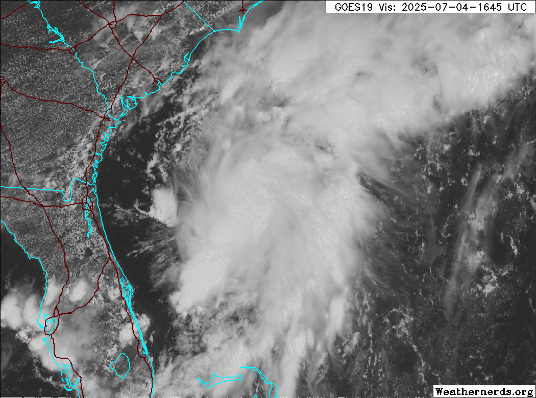
Impressive concentric convection flare-up over the Gulf Stream east of Jacksonville early this morning:
92L
--------------------
CoCoRaHS Weather Observer (FL-VL-42) & Surf Forecaster: https://www.surf-station.com/north-florida-surf-forecast-3/
|
cieldumort
Moderator
Reged:
Posts: 2738
Loc: Austin, Tx
|
|
Recon is now just starting to enter 92L. The most recent visible satellite strongly suggests a tropical cyclone, possibly even a storm, is forming or has already formed. The next name on the list is Chantal.
|
bob3d
Weather Hobbyist

Reged:
Posts: 65
Loc: Pasco County, Florida
|
|
Currently forecast to become a 50 mph storm just before landfall near Charleston, SC.
--------------------
bob
Time in West Central Florida: 52 years
|


 Threaded


