cieldumort
Moderator

Reged:
Posts: 2522
Loc: Austin, Tx
|
|
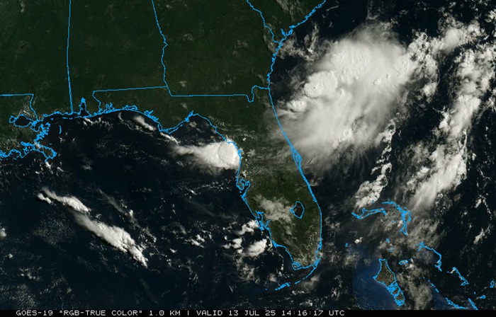
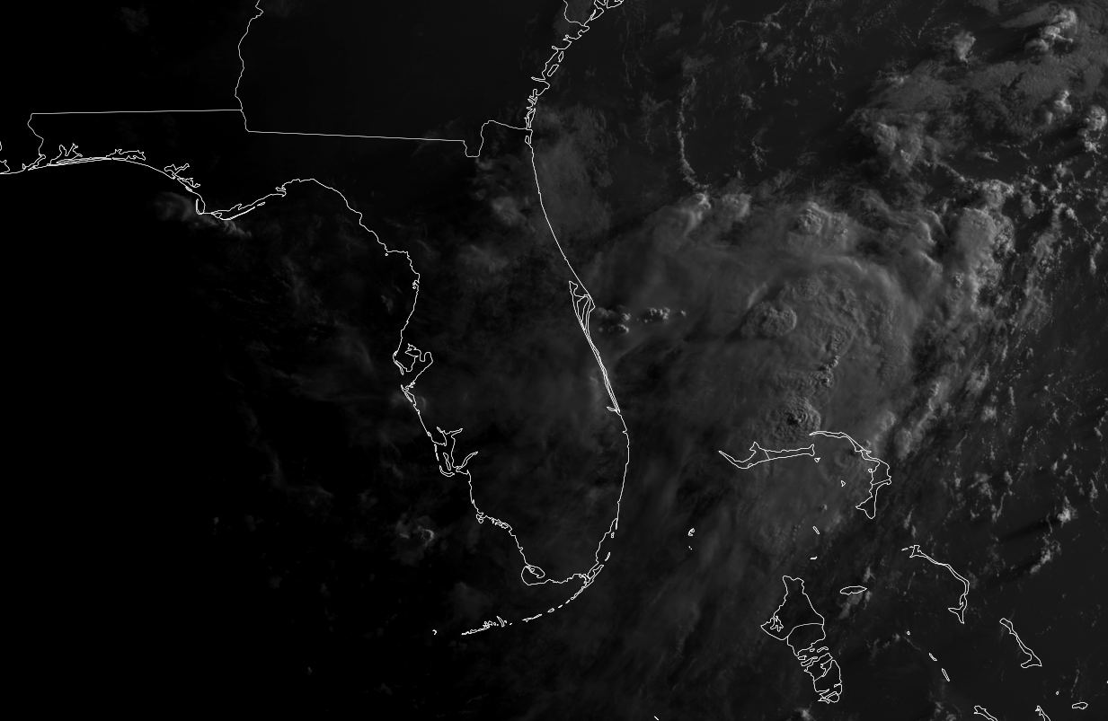
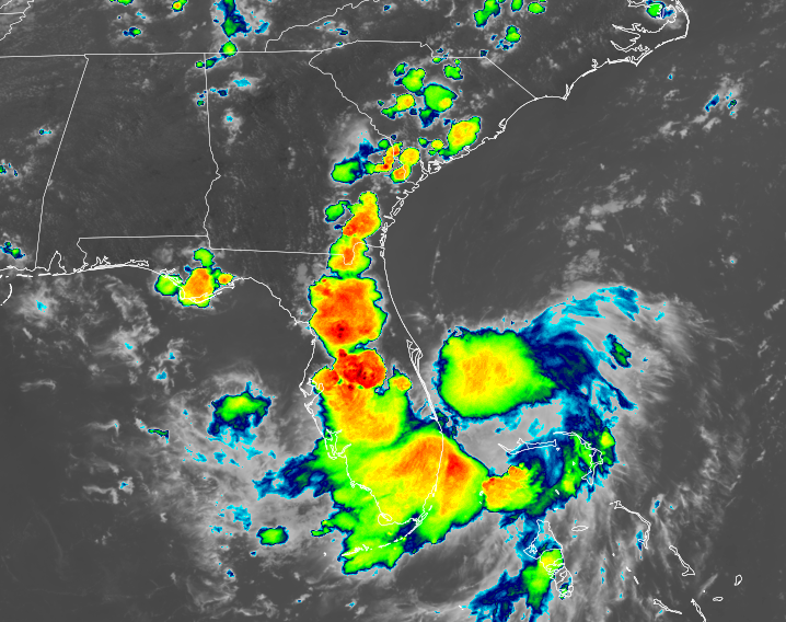
Above img cr: College of DuPage NEXLAB
We are now tracking an incipient trof of low pressure off the southeast coast, forecast by many models to develop into a closed low. Given its proximity to land and the overnight blowup of deep convection to the east and northeast of Florida, we are already starting a Forecast Lounge on this feature, despite the lack of an official Invest tag. The next tag on the list should be 93L.
While model support from most global operational runs has not been especially impressive, their individual ensemble members and several of the hyper-focused runs of convection allowing models (CAMS) advertise the potential for development into a TD even before crossing Florida from the east, ultimately to land into the northeastern Gulf, where conditions for more significant development could exist.
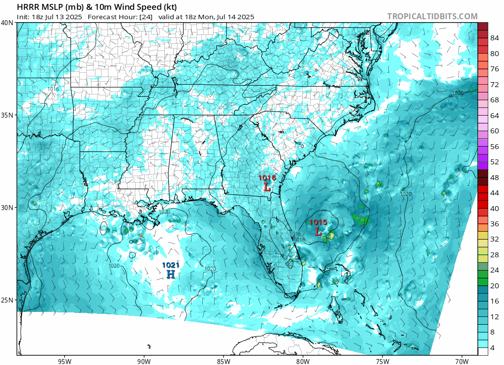
Tracking forecasts suggest that this area of low pressure could come ashore somewhere from as far east as between the far western Florida panhandle to as far west as the upper Texas coast, with more probable locations roughly in the middle of these points, but it is still very early and a bona fide low has yet to even form. Much more fine-tuning to come.
The title will be changed if/once an Invest tag is added to this feature. Current odds of development are near 0% within 48 hours and 20% within 7 days, but this seems likely to go up, perhaps substantially, by tonight.
The trof we have been following off the southeast coast has now been Invest tagged, 93L, and the title has been updated accordingly.
Ciel
Edited by cieldumort (Mon Jul 14 2025 02:18 PM)
|
MikeC
Admin
Reged:
Posts: 4692
Loc: Orlando, FL
|
|
Model's are struggling getting a handle on this system. is weak, but it's really not showing the current state very well either. Further south this thing gets the more likely it is to develop in the Gulf. I think the Icon is the worst case (Far west), middle of the road like the canadian is more likely. However, if it does manage to get going sooner than anticipated (I.e. right off the bat in the Gulf) it has a pretty decent chance to gain strength. If it struggles in the Gulf initially it'll likely remain weak. It's a prime candidate for things to change quickly with it, Conditions are more favorable than Chantal had for development, , so it's something to watch very closely throughout the week for sure. 2pm outlook keeps it at 20% though.
|
MikeC
Admin
Reged:
Posts: 4692
Loc: Orlando, FL
|
|
Added a vorticity animation here:
https://flhurricane.com/imageanimator.php?924
(Theres buttons to generate videos and animated gifs from it if needed)
|
MikeC
Admin
Reged:
Posts: 4692
Loc: Orlando, FL
|
|
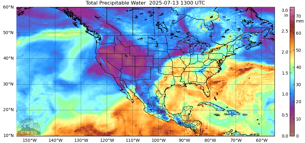
Global models aren't really picking up this system very well since it's likely to wind up pretty small area wise. Lots of rain for wherever it goes over though.
HRRR is not usually good for tropical systems (If it develops don't use it), but is picking it up decently off the east coast now.
|
cieldumort
Moderator
Reged:
Posts: 2522
Loc: Austin, Tx
|
|
Recent model runs including various Globals and CAMs out to 06Z Tuesday the 15th as to whether or not they have developed at least a fairly well defined, closed surface circulation in association with this disturbance.
ECMWF NO
ECMWF AI YES
GDPS YES
GFS NO
GFS AI YES
HRRR YES
ICON YES
NAM 12k NO
NAM 3k NO
RAP YES
RDPS YES
RRFS NO
UKMET NO
YES: 7
NO: 6
All runs that have developed a closed and fairly well defined surface circulation by 7-15-06z have done so with the system still east of Florida. Of the model runs above to have not developed this system into a closed and fairly well defined low by this time, most were close to closing off.
In summary, models suggest that it is more likely than not that an Invest will be tagged within the next 36 hours while this feature is still east of Florida, and that as (likely 93L or 94L) crosses the state from east to west, tropical cyclone conditions could occur.
|
MikeC
Admin
Reged:
Posts: 4692
Loc: Orlando, FL
|
|
The 18Z is similar to the 12Z with no development, although the area is visible on the 850 layer. Icon shows a bit further east. So still depends on how much develops before and immediately after Florida.
I still think the globals don't have a great handle on the main area yet.
KMLB (Melbourne) Radar is down unexpectedly this evening. (Jacksonville was already down for planned maintenance)
FTMMLB
MESSAGE DATE: SUN JUL 13 2025 5:35 PM EDT
THE MELBOURNE WSR-88D (KMLB) REMAINS DOWN DUE TO AN UNANTICIPATED
DISRUPTION. AT THIS TIME THERE IS NO ESTIMATION FOR WHEN IT WILL
RETURN TO SERVICE. PARTS ARE ON ORDER. THANK YOU FOR YOUR PATIE
The 18Z UKMET is showing development in the Gulf, but it only goes out 66 hours on the 18Z runs. 12Z didn't show development.
|
MikeC
Admin
Reged:
Posts: 4692
Loc: Orlando, FL
|
|
8pm outlook keeps it at 20% and in wait and see mode. May get the invest tomorrow.
|
MikeC
Admin
Reged:
Posts: 4692
Loc: Orlando, FL
|
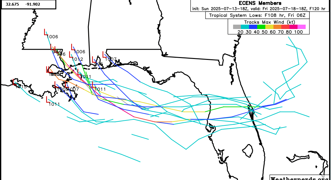
|
18z Euro Ensembles
|
MikeC
Admin
Reged:
Posts: 4692
Loc: Orlando, FL
|
|
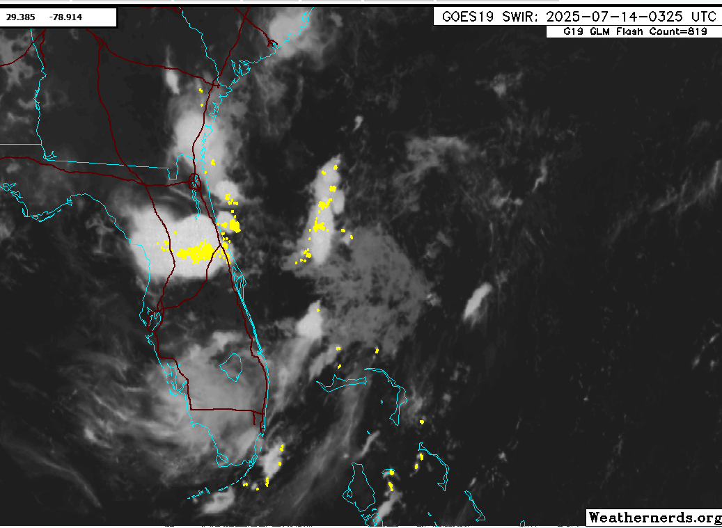
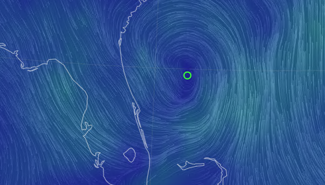
Area to watch is around 29.4N 78.8W (roughly due east of Flagler Beach) is the most interesting area on satellite tonight.to watch to see how it progresses through tommorow.
|
IsoFlame
Weather Analyst

Reged:
Posts: 382
Loc: One block off the Atlantic Oce...
|
|
Starting yesterday mid-afternoon, here in Daytona Beach Shores three rounds of thunderstorms that dropped down the coast from the NNW dumped 2.26 inches of welcome rain- more than measured in the past 30 days of what has been a relatively dry start to the wet season here in east central coastal Volusia. New Smyrna Beach CoCoRaHS station reported over 5 inches in the past 24 hours.
The last thunderstorm pushed through in the evening before midnight. This relatively unusual repetitive north to south movement of the storms is associated with the broad circulation of the low over the near shore Atlantic ENE of the Cape.
--------------------
CoCoRaHS Weather Observer (FL-VL-42) & Surf Forecaster: https://www.surf-station.com/north-florida-surf-forecast-3/
Edited by IsoFlame (Mon Jul 14 2025 09:26 AM)
|
CFHC

Reged:
Posts: 176
Loc: East Central Florida
|
|
Where the low appears to be forming
|
MikeC
Admin
Reged:
Posts: 4692
Loc: Orlando, FL
|
|
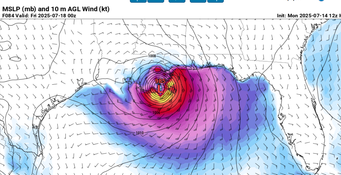
The 12Z Icon shows a Cat 1 into Louisiana Friday, but still pretty much the only model showing so.
However, the satellite is already looking better than Chantal did before south carolina, so I bet things change this afternoon (chances go way up) and the invest pops up sometime in the afternoon.
|
MikeC
Admin
Reged:
Posts: 4692
Loc: Orlando, FL
|
|
12Z is still struggling with the system, as the satellite shows a circulation forming, sheared north to south, which could push "formation" further south. It could disperse over the everglades too and nothing will form, so it's a bit of a mixed bag.
Global models like the /Euro tend to do their worst with weak, sheared systems. The lack of support makes it difficult to launch an invest, so it's still not a guarantee we'll get an invest for a while. (most of the hurricane models use the as a base)
|
CFHC
Reged:
Posts: 176
Loc: East Central Florida
|
|
AL, 93, 2025071418, , BEST, 0, 296N, 780W, 20, 1016, DB, 34, NEQ, 0, 0, 0, 0, 1017, 100, 60, 0, 0, L, 0, , 0, 0, INVEST, S, 0, , 0, 0, 0, 0, genesis-num, 008, SPAWNINVEST, al772025 to al932025,
Now Invest 93L
|
MikeC
Admin
Reged:
Posts: 4692
Loc: Orlando, FL
|
|
The system is likely to fade in a few hours on satellite, then come back again in the morning. Less convection may give a better clue where the center is.
|
MikeC
Admin
Reged:
Posts: 4692
Loc: Orlando, FL
|
|
Large amount of lightning in the outer band moving along the west part of the sate now, including a Tornado warning (that's since expired) Another band is approaching the east coast, and the first band is also bending through south Florida as well.
|
bob3d
Weather Hobbyist

Reged:
Posts: 63
Loc: Pasco County, Florida
|
|
93L spawned a line of severe thunderstorms that traveled NE to SW, which is an odd direction for my area of Florida. A severe thunderstorm within the line spawned a tornado around the Pasco/Hernando county line, about where I-75 crosses. There were lots of trees downed in that area. We were in the Tornado warning area in the strong thunderstorm complex for a good hour late this afternoon. Significantly strong winds shifted direction from east to west in an instant, but the funnel of the tornado never came through where we were, thankfully. Rain rates were about 3 inches per hour during the event (I've seen higher rates than that in my lifetime). Anyway, 93L can spawn some significant weather, so watch out if you live in Central to North Florida over the next few days as 93L goes over the state into the Gulf of America.
--------------------
bob
Time in West Central Florida: 52 years
|


 Threaded


