Current Radar or Satellite Image

Flhurricane.com - Central Florida Hurricane Center - Tracking Storms since 199530 Years of Hurricanes Without the Hype - Since 1995


Atlantic is quiet again
Days since last H. Landfall - US: Any 294 (Milton) , Major: 294 (Milton) Florida - Any: 294 (Milton) Major: 294 (Milton)


General Discussion >> 2025 Forecast Lounge

Pages: 1
cieldumort
Moderator


Reged:
Posts: 2545
Loc: Austin, Tx
Gulf Disturbance Round 2
      #115656 - Thu Jul 24 2025 06:07 PM


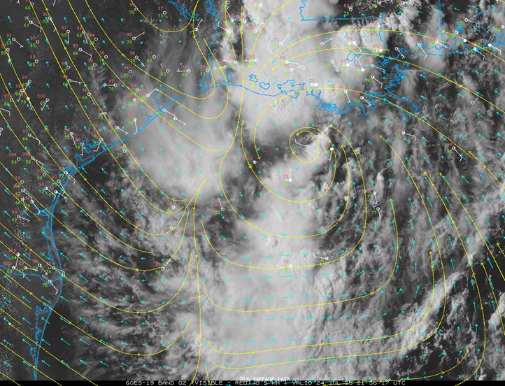
Above: VIS satellite, weather station plots, wind streamlines and vectors from 7/24/25/2146z
Image credit: College of DuPage NEXLAB

A feature now in the north central Gulf, comprised of vorticity along a decaying boundary as well as moisture and some leftover spin from former Invest 93L, looks to be trying to come together considerably south of where 93L tried to pull things off, with more very warm water to work with, and as such, chances for TC genesis appear to be going up and we are likely to have an Invest tagged assigned along with perhaps at least one corresponding recon mission into the system by late afternoon Friday.

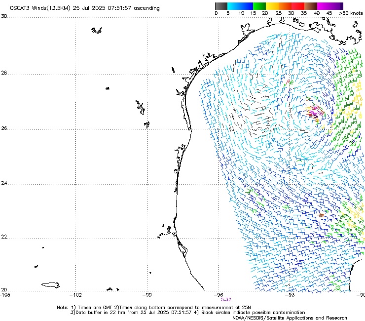
Given that this area of low pressure is landlocked, tracking across more of the very warm Gulf waters, tracking through a region of decreasing shear, and will almost certainly produce more heavy rains over portions of Texas and Louisiana that could be sensitive to any additional rainfall, we are starting a Lounge on this Invest TBD at this time, which will probably assigned 95L later tonight or tomorrow morning.


Post Extras: Print Post   Remind Me!   Notify Moderator  
cieldumort
Moderator


Reged:
Posts: 2545
Loc: Austin, Tx
Re: Gulf Disturbance Round 2 [Re: cieldumort]
      #115659 - Thu Jul 24 2025 10:55 PM


Possibly recentering south this evening.


Post Extras: Print Post   Remind Me!   Notify Moderator  
cieldumort
Moderator


Reged:
Posts: 2545
Loc: Austin, Tx
Re: Gulf Disturbance Round 2 [Re: cieldumort]
      #115660 - Fri Jul 25 2025 04:33 AM


Above: OSCAT (Oceansat-3) Scatterometer surface winds 07/25/25/0751z


Post Extras: Print Post   Remind Me!   Notify Moderator  
cieldumort
Moderator


Reged:
Posts: 2545
Loc: Austin, Tx
Re: Gulf Disturbance Round 2 [Re: cieldumort]
      #115662 - Fri Jul 25 2025 10:14 AM

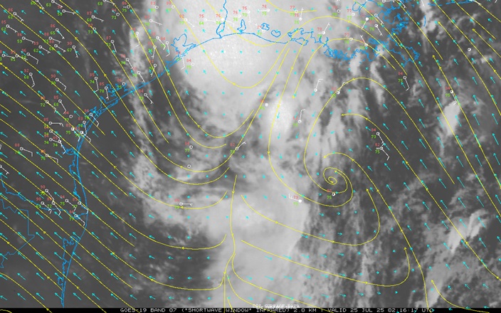
A respectable attempt at TC genesis overnight couldn't outrun the shear and the remnant swirl is left unremarkable this morning. The window for this system, now once again more of a trof, to develop, is rapidly closing. Nonetheless, this feature will pose a flood threat for areas recently impacted by much flooding in the wake of Tropical Storm Barry and 93L.

Post Extras: Print Post   Remind Me!   Notify Moderator  
Pages: 1


Extra information
0 registered and 1 anonymous users are browsing this forum.

Moderator:  

Print Topic

Forum Permissions
      You cannot start new topics
      You cannot reply to topics
      HTML is disabled
      UBBCode is enabled

Rating:
Topic views: 337

Rate this topic

Jump to

Note: This is NOT an official page. It is run by weather hobbyists and should not be used as a replacement for official sources. 
CFHC's main servers are currently located at
Hostdime.com in Orlando, FL.
Image Server Network thanks to Mike Potts and Amazon Web Services. If you have static file hosting space that allows dns aliasing contact us to help out! Some Maps Provided by:
Great thanks to all who donated and everyone who uses the site as well. Site designed for 800x600+ resolution
When in doubt, take the word of the National Hurricane Center