MikeC
Admin
Reged:
Posts: 4835
Loc: Orlando, FL
|
|
1:30PM EDT 4 September 2025 Update
Now in peak season and we have increasing threats in both oceans with U.S. states and territories: Pacific (Hawaii) and Atlantic (Caribbean, Gulf and up through the eastern seaboard).
Starting off in the Pacific, models continue converging on a track for Major Hurricane Kiko that takes it directly over, or at a minimum, impactfully close to the Hawaiian islands, including the Big Island. We have an official Forecast Lounge up on Kiko as it is threatening Hawaii:
Hurricane Kiko Forecast Lounge (Hawaii)
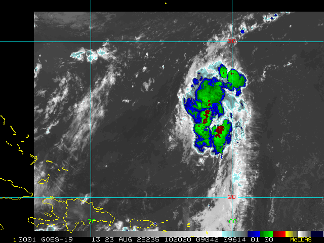
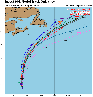
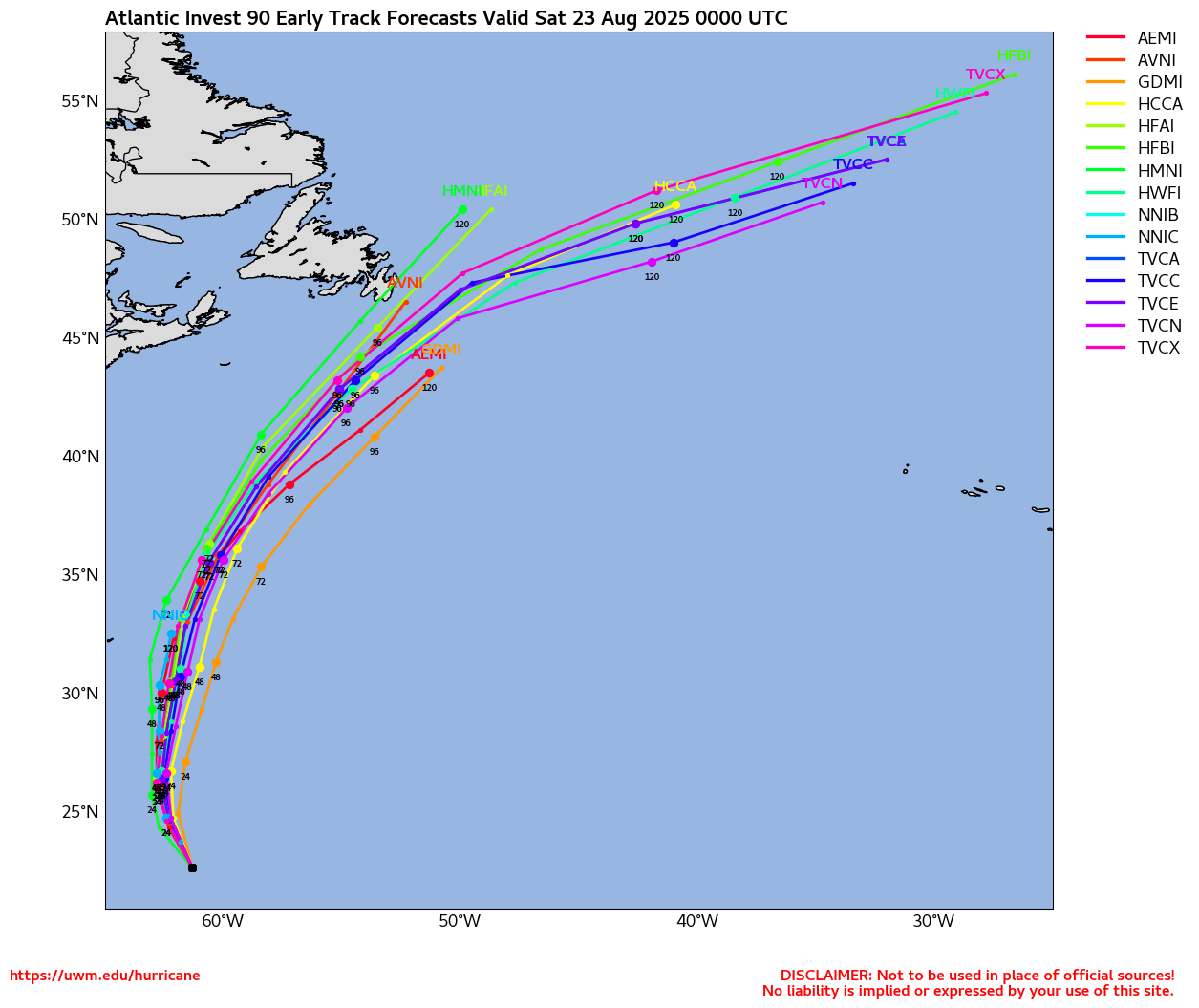
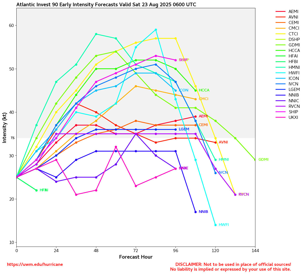
In the Tropical Atlantic, the wave we have been tracking for a few days has just been Invest tagged this morning, 91L. The most recent run of the has it now joining both the ("EURO") and Google DeepMind in a far more southerly track, which would directly threaten Caribbean islands and likely take the system into the Caribbean itself, if verified. More on this in the 91L Forecast Lounge:
91L Lounge (E ATL Wave)
Ciel
12:00PM EDT 3 September 2025 Update
Quick update to mention a feature in the East Pac that is now of concern for mainland southwestern US, mostly in the form of potentially flooding rains and possibly some isolated severe thunderstorms.
Lorena has become a hurricane south of Baja California. Models that have done the best handling this system are more likely to verify going forward and there is now near certain impactful Lorena-caused weather to affect several portions of the southwestern United States, in addition to landfalling impacts across Baja California and possibly northwestern mainland Mexico. There is an outside chance that the cyclone remains intact across mainland northwestern Mexico into southern Arizona, but for now that is more of an outlier. TCs coming from this direction usually get hung up over or just east of the Gulf of California. However, there is a good chance that Lorena's mid-level circulation will continue across and into the southwestern United States, potentially resulting in enhanced severe thunderstorm risks and a swath of wind damage across higher terrains directly related to its MLC.
We have a de facto "Lounge" up on this approaching hurricane in the Other Basins forum: Hurricane Lorena (Potential Southwest US Impacts)
Ciel
Original Update
Today marks the 20th anniversary of the Mississippi/Louisiana landfall of hurricane . The largest impact hurricane in modern times, even with a few storms since then that have come close. Thankfully events like these still remain very rare, but still could happen. was most notable for the storm surge, as it was weakening on approach, but massive, and made landfall close to populated areas and near New Orleans. The surge itself was mostly felt east of there, with coastal Mississippi seeing the worst of it, and surge extending well east into the Florida panhandle. Media coverage then was slow to react as it's a case where internet trackers were ahead of the media by hours. And that water, not wind, was the big story for .
Mainly because the information blackout was so stark, and those monitoring places before the blackout. The impact to people in all those areas still remains to this day. And this was the year following the 4 Florida hurricane year of 2004. It was the 10th year for this site, and likely the busiest of all of them, before or since.
Today there's a very large lull in activity in the Atlantic, no storms, and one area of interest in the east Atlantic, not invest tagged, that could develop, but faces bad conditions ahead ft it,. most notably a Tropical Upper-Tropospheric Trough, also known as a , which is a massive deterrent to tropical development that currently exists in the Central Atlantic just east of the Caribbean. Anything tropical going through there would get ripped to pieces. And this area, if it develops, is likely to hit that. (or go north and east of it and be no threat to land). Although this likely will only last a week or two, it's enough to dampen the first few weeks of September. Areas forming from fronts closer to shore are more likely though that time. Things do change mid to late September though. But it's unusual to see effectively no activity in early September in the Atlantic Although last year was similar, it wasn't until late in the month when Helene showed up.
We'll continue to monitor in case any surprises show up. But for now, enjoy the labor day weekend.
|
IsoFlame
Weather Analyst

Reged:
Posts: 414
Loc: One block off the Atlantic Oce...
|
|
The GOES 19 full disk illustrates the current "peak season" lull in the Atlantic basin should continue through Labor Day into the first week (or longer) in September. While I agree that the Atlantic basin (namely western Caribbean and GOMEX) will wake up later in September, I'm 50/50 on whether or not it will 180 and get hyper-active. Still, I believe we may be in for a significant home-grown TC in the GOMEX or east of the Yucatan peninsula in early October given the synoptics- possibly a -like spin-up.
Edited by IsoFlame (Fri Aug 29 2025 11:34 AM)
|
Psyber
Storm Tracker

Reged:
Posts: 242
Loc: Ontario, Canada
|
|
And here we are...20 years after "The levees will hold".
I saw an interesting show last night. Didn't catch the name but it had a Lt. General in it that when he showed up, he changed the whole deal.
He was incredible. It''s sad that there were so many who aimed their guns at everything that moved until he showed up.
"Getcha damn guns down, get em down!"
--------------------
The safest way to deal with a potential Hurricane hitting you...is to leave and just not be there at all.
|
daytona
Registered User
Reged:
Posts: 1
|
|
Quote:
And here we are...20 years after "The levees will hold".
I saw an interesting show last night. Didn't catch the name but it had a Lt. General in it that when he showed up, he changed the whole deal.
He was incredible. It''s sad that there were so many who aimed their guns at everything that moved until he showed up.
"Getcha damn guns down, get em down!"
Lt. Gen. Russel Honoré
https://www.npr.org/2025/08/25/nx-s1-5500576/hurricane-katrina-recovery-response-russel-honore
|
IsoFlame
Weather Analyst
Reged:
Posts: 414
Loc: One block off the Atlantic Oce...
|
|
Given the current administration's gutting of FEMA, we can only hope that residents and local government recognize their responsibility to prepare for each hurricane's potential impact, to have a well-thought-out plan, and to execute the plan with consideration for helping others as situations allow.
While I agree that it is safest to evacuate ahead of an impending, potentially catastrophic event if not confident in your pre-storm planning and ability to execute, I have safely and effectively sheltered in place during multiple hurricanes and several wildfires after evacuating family members and poorly prepared neighbors. Granted, if a massive Cat 4 or 5 is zeroing in, I will leave. In Cat 3 and lesser hurricanes I will stay. Over the years of living near the coast in east central Florida, if I had evacuated, severe water intrusion would've flooding my home and also would've sunk several sailboats.
While never personally experiencing looting, I have witnessed how disasters attract career criminals to come out of the woodwork and reported to authorities. I have helped out others when able- most who need help appreciate anything you do to mitigate the misery of a disaster.
--------------------
CoCoRaHS Weather Observer (FL-VL-42) & Surf Forecaster: https://www.surf-station.com/north-florida-surf-forecast-3/
|
|


 Threaded


