cieldumort
Moderator

Reged:
Posts: 2738
Loc: Austin, Tx
|
|
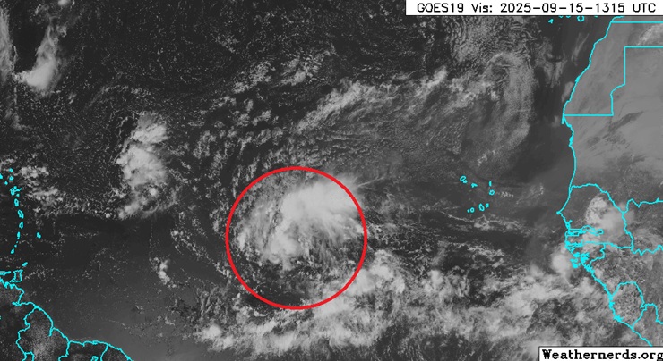
A hearty wave way out in the Tropical Atlantic, presently southwest of the Cabo Verde islands, is starting to produce more robust convection. Given strong model support for this feature to become a TC this week with a track that could put Bermuda in play down the road, we are starting a lounge on this system at this time.
This disturbance has just been Invest tagged, 92L
2025-09-15 12:00Z 11.9N 38.3W 25KTS
92L has been determined to have become a Tropical Depression this morning and the title has been updated accordingly.
2025-09-17 06:00 13.5N 45.5W 30KTS
With the 11AM update, "7" has just been upgraded to Tropical Storm Gabrielle, and the title has been updated accordingly.
From : 11:00 AM AST Wed Sep 17
Location: 17.5°N 46.6°W
Moving: NNW at 22 mph
Min pressure: 1006 mb
Max sustained: 45 mph
-Ciel
Edited by cieldumort (Wed Sep 17 2025 11:08 AM)
|
cieldumort
Moderator
Reged:
Posts: 2738
Loc: Austin, Tx
|
|
92L became a barely T.D. overnight. The system was actually still quite a bit troffy in appearance on IR satellite as well as scatterometer passes at the time of designation. Since that time, the system, being a touch troffy still in nature, has seemingly stretched out, rotated, and reorganized much further north, now centered somewhere about 19.5N, a large "jump" or center reformation, from its first Advisory position of 13.5N. Furthermore, the southernmost portion of the trof axis now appears to be developing another lobe, perhaps to become its own Invest-tagged disturbance.
This massive jump from 13.5N likely tosses all prior model runs and forecasts into doubt. Bermuda does not seem to be at serious threat from this currently very sloppy TD.
|
cieldumort
Moderator
Reged:
Posts: 2738
Loc: Austin, Tx
|
|
NHC is going with a "mean" center position of Gabrielle's multiple swirls. It is worth noting that the most robust swirl, also associated with at least some deep convection, is the northernmost feature, now centered around 19.5N. The mean center of the sprawling low remains almost void of convection.
|
cieldumort
Moderator
Reged:
Posts: 2738
Loc: Austin, Tx
|
|
Today's 12Z Track and Intensity runs out so far
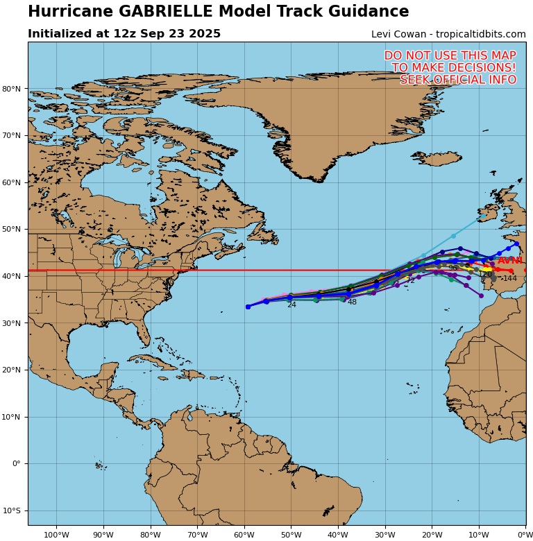
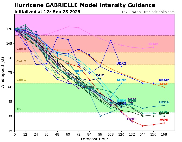
There is very strong consensus that Gabrielle will be impacting the Azores as a bona fide hurricane, likely a strong Cat 1/Cat 2.
|


 Threaded


