10:45PM EDT 10 October 2025 Update
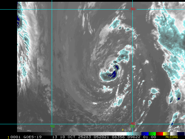
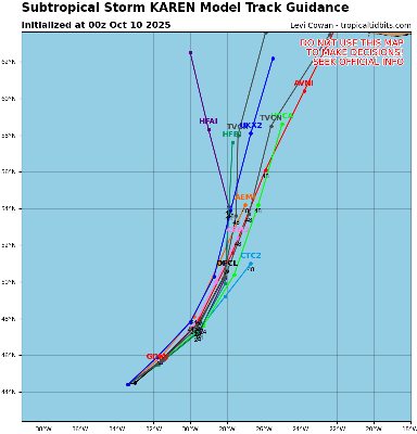
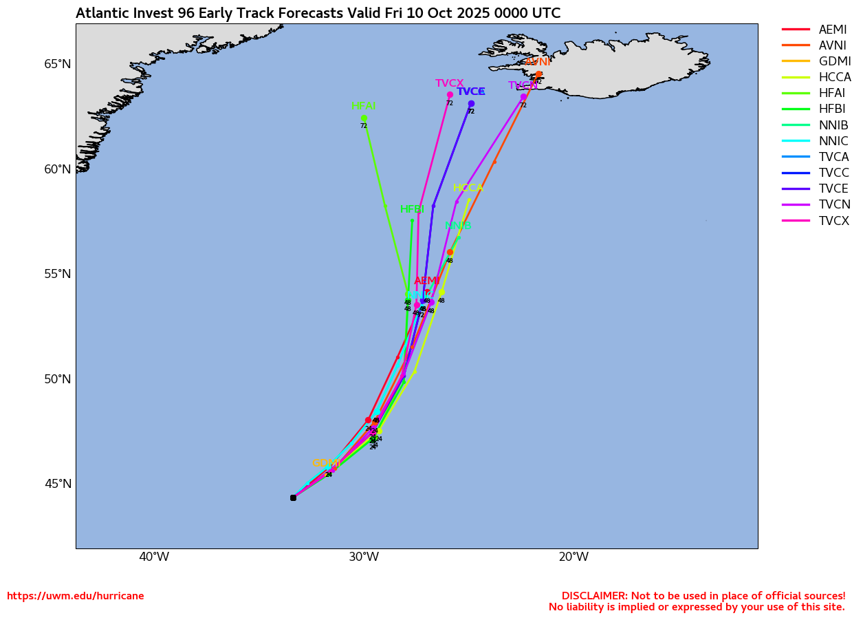
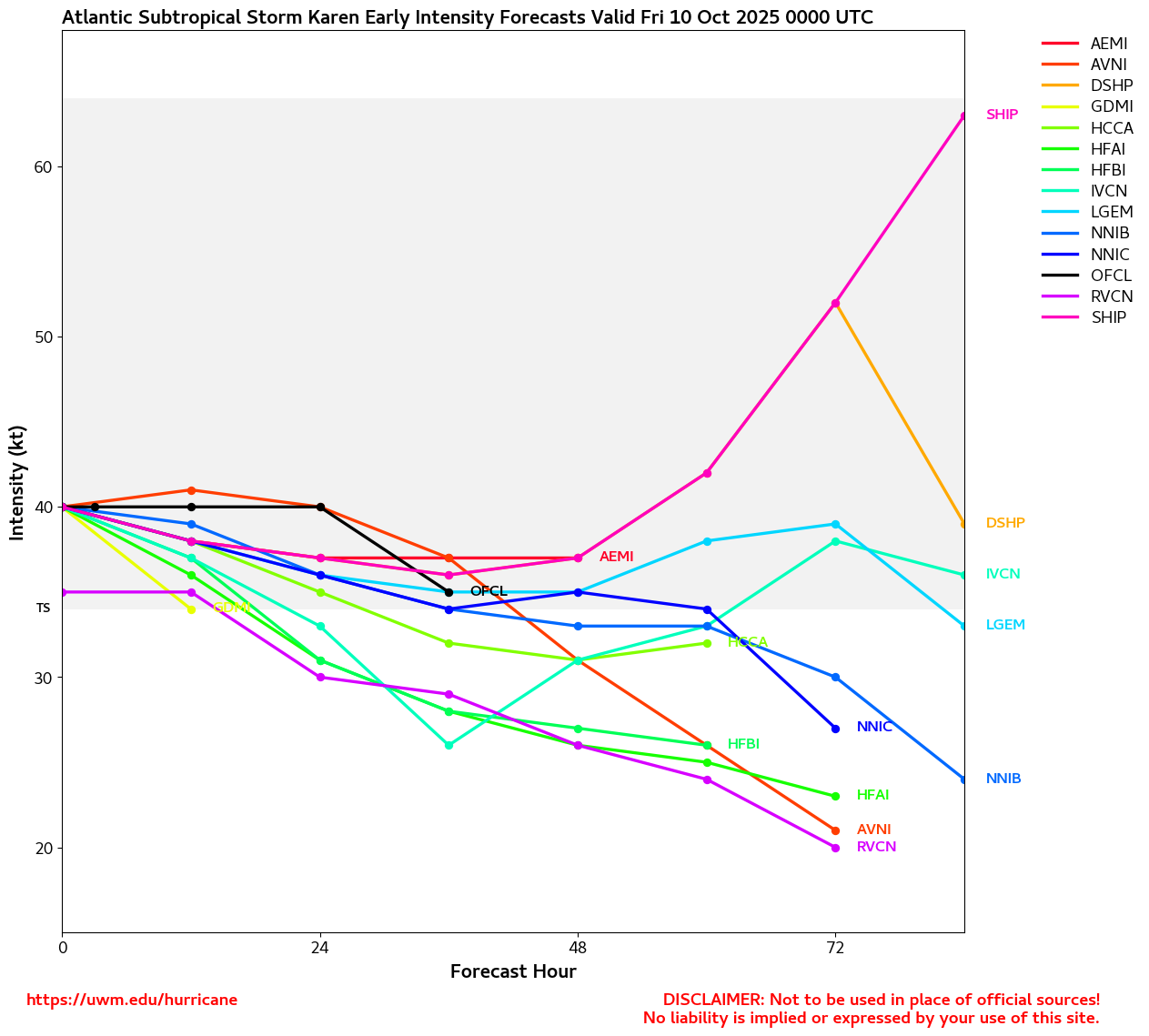
Invest 96L in the far northern Atlantic has become Subtropical Storm Karen. Karen is very much a fish spinner, presently near 44.5N 33W, also unlikely to add much at all to seasonal ACE, but does qualify as a legitimate name in this back-loaded 2025.
Ciel
10:45AM EDT 9 October 2025 Update
Jerry has been a little weaker and less organized that forecast, which may help explain why the storm continues to track southwest of consensus and the official line. But that is not to say that Jerry is weak. Tropical Storm conditions on portions of the Leeward Islands is becoming increasingly likely. The government of Antigua and Barbuda has issued a Tropical Storm Warning for Barbuda.
Ciel
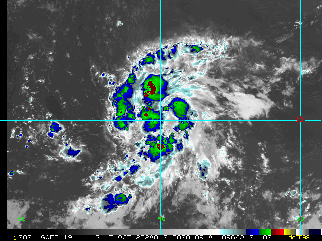
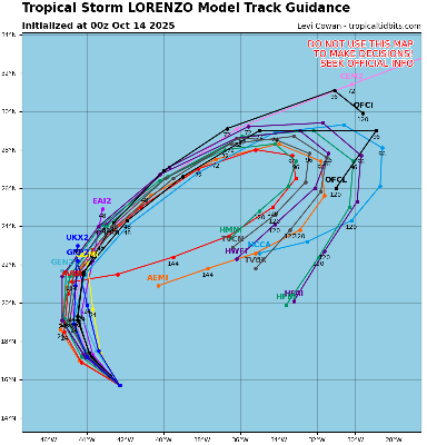
10:50PM EDT 7 October 2025 Update
Tropical Storm Jerry has formed from a wave we have been tracking for some time, and is now officially forecast to brush the northern Leeward Islands. While confidence in a "recurve" out to sea is fairly strong, just when that turn happens and by how much of an angle is less so, and even a little deviation to the south of the NHC cone may bring strong tropical storm or even hurricane conditions to these islands, or at least just off their coasts.
Tropical Storm Watches are up for much of this area, and the USVI and Puerto Rico also should monitor.
NHC:
Quote:
SUMMARY OF WATCHES AND WARNINGS IN EFFECT:
A Tropical Storm Watch is in effect for...
* Antigua, Barbuda, and Anguilla
* St. Kitts, Nevis, and Montserrat
* St. Barthelemy and St. Martin
* Sint Maarten
* Saba and St. Eustatius
* Guadeloupe and the adjacent islands
Interests elsewhere in the northern Leeward Islands, and the British and U.S. Virgin Islands should monitor the progress of Jerry.
Elsewhere, a very low risk NHC 10% lemon outline exists over the Bay of Campeche for the next 48 hours or so, probably a blustery rain-maker in northeastern Mexico, and in the eastern Pacific, remnant moisture and energy from Hurricane Priscilla will likely bring scattered to numerous showers and thunderstorms to the southwestern US later this week into early next week, and last but not least, off the southeast coast, a non-tropical low could become a powerful Nor'easter of the liquid variety over the weekend.
Ciel
Original Update
The month of October has kicked off with a few weak lows in the Gulf and east of Florida that struggled and faded away due to high shear. So far, the CONUS has remained protected for most of this year, fortunately.
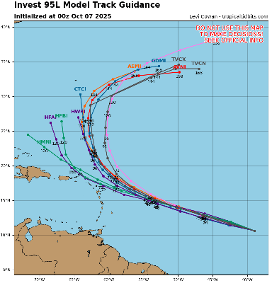
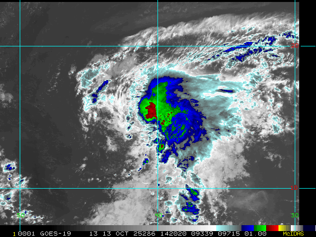
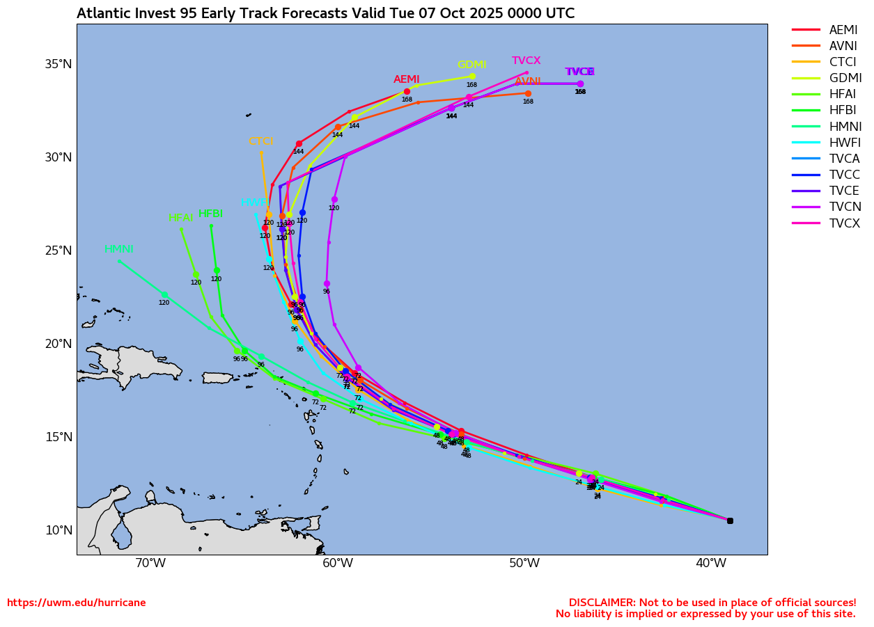
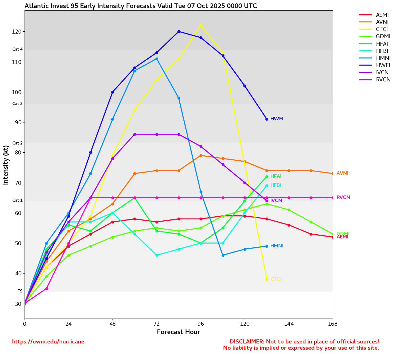
Out in the eastern Atlantic, we are watching what is now Invest 95L. This disturbance is widely expected by models to become our next named storm and could be something for the Antilles to keep an eye on late next week. A Forecast Lounge is available for this feature: 95L Forecast Lounge


 Threaded


