MikeC
Admin
Reged:
Posts: 4863
Loc: Orlando, FL
|
|
June 1st is the start of the official Atlantic Hurricane Season which runs until November 30th
This year is expected to be lower than average because of the el nino effect. This is basically a periodic event in the Pacific ocean that warms up temperatures there in the eastern Pacific, which tends to lower pressure there, and force trade winds to be stronger over the Atlantic, as well as the mid Atlantic back feed, which causes windshear and more stability in the atmosphere in general in the Atlantic, which dampens the hurricane season. However, it does not prevent it, some notable storms like hurricane Andrew happened in an El Nino year. So it's important to watch. It does favor storms doing odd tracks and patterns where it typically won't form as far out, for those that form.
In the near term although there is some moisture, there's nothing organized in the Atlantic that looks like it could develop in the next week or two. But the areas typically to watch this time of year are off the southeast coast and Gulf. Have a plan in place if you live in an evacuation area, and get be prepared now, not when a storm is bearing down on you.
Another year here 31st year for flhurricane.com. With some new features like the hurricane radar page on the left, focusing on Atlantic coastal hurricane radars (and Hawaii). We've also made it easier to share graphics like models, satellites and radar in the posts, just upload or even copy paste images into the forums this year, and crop/resize them right on the site.
Names for this year:
The National Hurricane Center is the official source for advisories, warnings, and more, use https://nhc.noaa.gov for the best information. floridadisaster.org for emergency information in Florida. And local media (Tv, radio, papers, etc) for the best information for your particular area if the need arises.
Flhurricane stays away from hype and engagement farming, we do have social media on X and facebook, that we update when necessary. Posting long range modeling runs without context on the main site/socials is something we actively avoid since this we think is generally unhelpful and just causes confusion to highlight them. However, it doesn't mean they are not discussed, for those interested it can be found on the forecast lounge here on flhurricane.com.
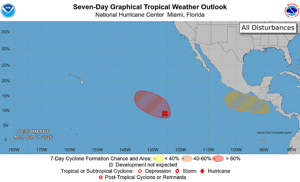
There's nothing for the first week in the Atlantic, and over the next two weeks the most likely place to see development is not in the Atlantic, but in the east Pacific.
Edited by cieldumort (Mon Jun 01 2026 10:51 AM)
|
MikeC
Admin
Reged:
Posts: 4863
Loc: Orlando, FL
|
|
The east pacific already has two areas to be watched, Invest 90E 90% Chance and another area just off Mexico (40%) Nothing in the Atlantic.
|
MikeC
Admin
Reged:
Posts: 4863
Loc: Orlando, FL
|
|
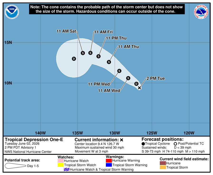
First tropical depression in the East Pacific for 2026:
|
Sarah Jones
Registered User
Reged:
Posts: 1
|
|
Great reminder. Even if this season ends up being less active than average, it only takes one strong storm to cause significant damage in a local area. A lot of homeowners focus on emergency supplies but forget to prepare the trees around their property.
Before hurricane season, it's a good idea to:
Remove dead or weak branches.
Check for trees that are leaning or have visible decay.
Trim limbs that are close to the roof or power lines.
Have mature trees inspected if they haven't been evaluated in a few years.
I also found the hurricane preparedness information and tree care resources from Panorama Tree Care useful for understanding how to reduce storm-related tree damage:
Staying proactive before a storm is much easier—and usually much less expensive—than dealing with fallen trees or property damage afterward. Hopefully, everyone has a safe hurricane season.
|
|




 Previous
 Index
Index
 Next
Next
 Threaded


 Edit
Edit
 Reply
Reply
 Quote
Quote


