cieldumort
Moderator

Reged:
Posts: 2681
Loc: Austin, Tx
|
|
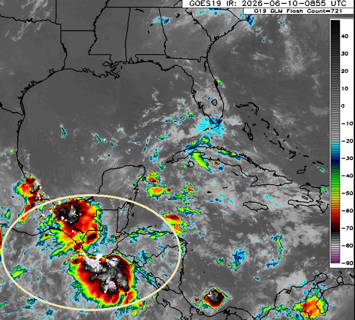
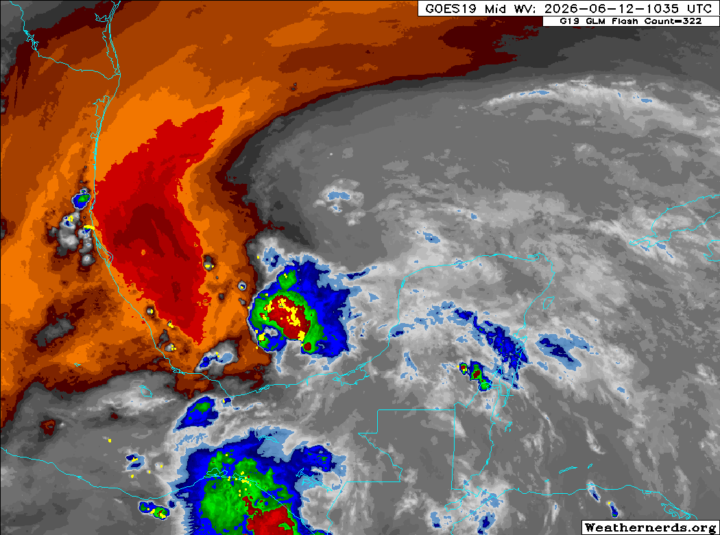
It is looking increasingly probable that a significant increase in precipitable water, and at least some variation of a mostly to completely closed-off lower-level vort, will be drawn into or reform over the western Gulf later this week from DNA remnants of soon-to-be former East Pac Tropical Storm Cristina, leftovers of former East Pac Tropical Storm Boris, and the general weak gyre-like feature associated with the regional monsoon. More and more, models are on alert for this mix to potentially become our first Atlantic Invest of the year - possibly also bringing significantly enhanced rainfall to portions of Texas and Louisiana that may already be susceptible to flooding after recent rains.
Given that models are almost insistent some type of coherent disturbance will track across central America to resurface in the western Gulf over the next 36-84 hours, we will start a Lounge on this forecast weather-maker (Invest unknown/tbd) at this time.
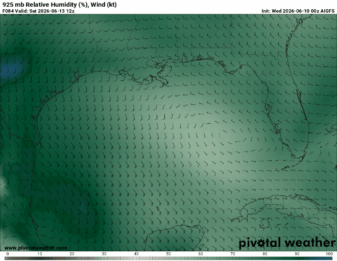
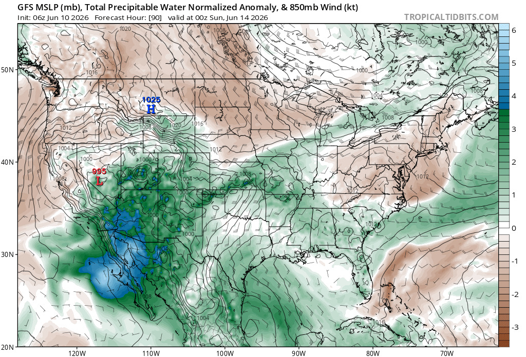
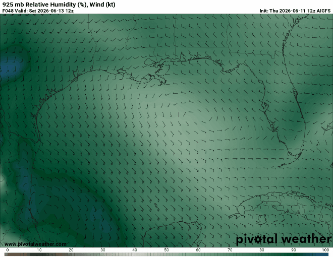
Below: Globals 925mb winds and relative humidity at 84 hours out from 6/10/0z Cr. Pivotal Weather
Below: EURO AI Ensemble Run 6/10/0z Cr. Weathernerds.org
Below: EURO (Traditional) Ensemble Run 6/10/0z Cr. Weathernerds.org
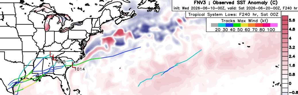
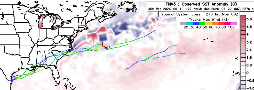
Below: Google DeepMind FNV3 (GDM-FNV3 is DeepMind's newest ensemble probabilistic machine learning weather model, optimized for cyclones) Cr. Weathernerds.org
6-12-26 7:45AM CT: The title has been updated to reflect that the well-advertised Area of Interest is now in the Bay of Campcheche and will likely soon be Invest tagged.
-Ciel
Edited by cieldumort (Fri Jun 12 2026 08:44 AM)
|
CFHC

Reged:
Posts: 205
Loc: East Central Florida
|
|
Cristina model guidance:
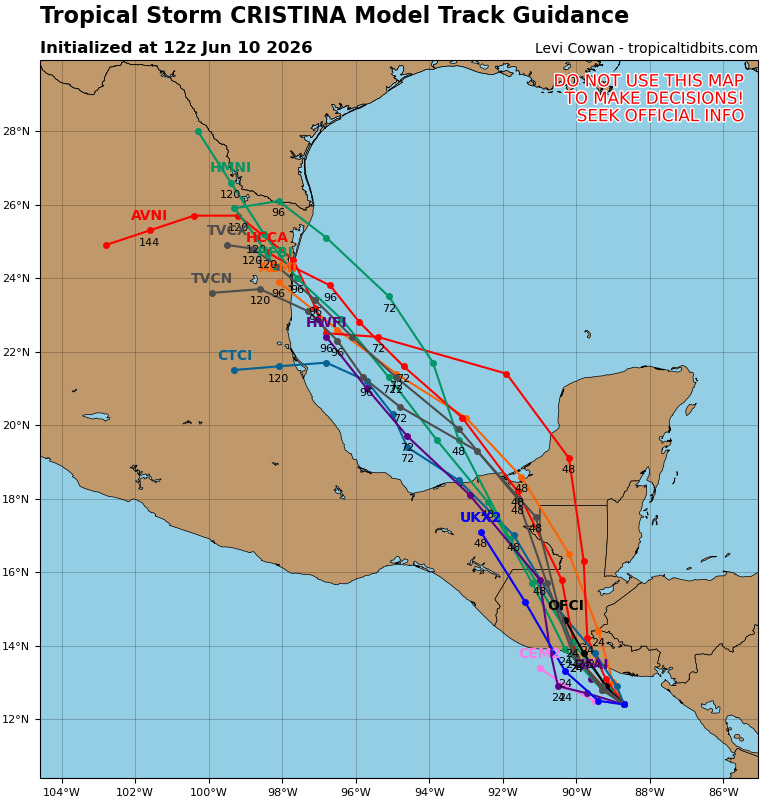
Water seems to be the biggest impact here, don't really expect development.
|
cieldumort
Moderator
Reged:
Posts: 2681
Loc: Austin, Tx
|
|
|
cieldumort
Moderator
Reged:
Posts: 2681
Loc: Austin, Tx
|
|
It now also appears likely that the forecast Area of Interest in the W Gulf will also be getting an assist from an approaching tropical wave, clearly visible in the western Caribbean this morning.
Western Gulf development odds are probably going to get nudged up.
|
cieldumort
Moderator
Reged:
Posts: 2681
Loc: Austin, Tx
|
|
The few GDM-FNV3 ensembles that generate a TC from this continue to hold off until early next week while in the vicinity of south Texas, with today's 12Z run
It will be helpful if recon does make that trip into the Bay of Campeche Friday
|
CFHC
Reged:
Posts: 205
Loc: East Central Florida
|
|
Still a very low chance of anything developing in the Gulf from the trough/Cristina, google deep mind really the only thing developing it still.
However there remains a good potential still for excessive rain across southern and eastern TX early next week for impacts there.
|
cieldumort
Moderator
Reged:
Posts: 2681
Loc: Austin, Tx
|
|
Model update: Nearly all of today's 06Z, 12Z and 15z runs of both the operational Globals and CAMs (Convection Allowing Models) continue to develop a closed low-level area of low pressure in the western Gulf in about 36-48 hours, of varying flavors of weak sauce. However, the western Gulf is a mechanically favored area for genesis and strengthening, often getting underbid by model runs that do not yet have an "Invest" to work off of.
As of this morning, the tropical wave starting to cross Central America from the western Caribbean has begun ingesting the remnant circulation of former east Pac tropical storm Cristina, and this could help jump start things enough for an Invest tag to be added once this conglomeration is in the Gulf. For now, a tentative recon mission into the Bay of Campeche has not been set.
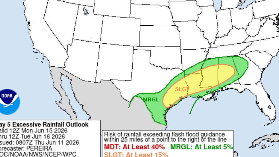
Trends are also being closely monitored for flooding potential, regardless of development.
Edited by CFHC (Fri Jun 12 2026 09:50 AM)
|
cieldumort
Moderator
Reged:
Posts: 2681
Loc: Austin, Tx
|
|
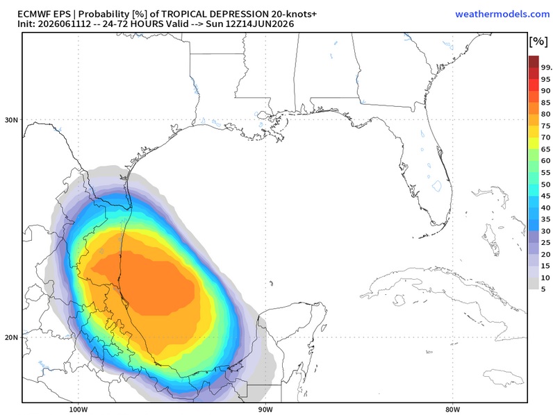
EURO Ensemble implied TD formation probability in the Western Gulf over the next 3 days is now 80%
|
cieldumort
Moderator
Reged:
Posts: 2681
Loc: Austin, Tx
|
|
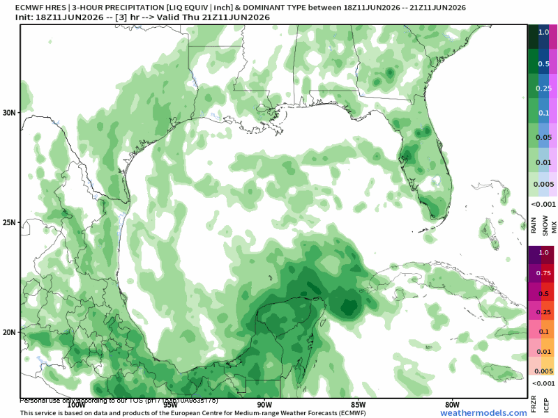
The most recent run of the 3-hour hi-res EURO implies that the area of low pressure/potential TD will be coming inland around Tampico, MX and then lingering around between eastern MX to deep south TX for at least 144 hours (end of run), driving copious moisture into south and coastal Texas for the duration, as well as suggesting potential for some flooding core rain events over eastern through northeastern Mexico.
|
CFHC
Reged:
Posts: 205
Loc: East Central Florida
|
|
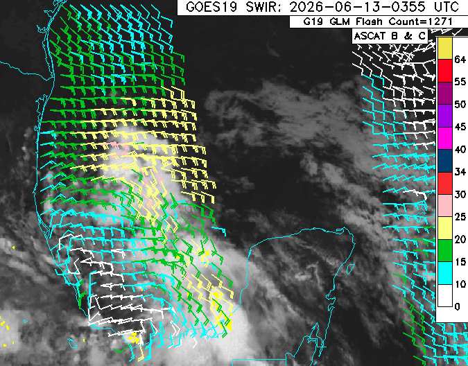
Decent attempt to get a little more organized, still has a lot to overcome, along with time. Very heavy Rain for anywhere it gets over, though. Still very doubtful this ever develops.
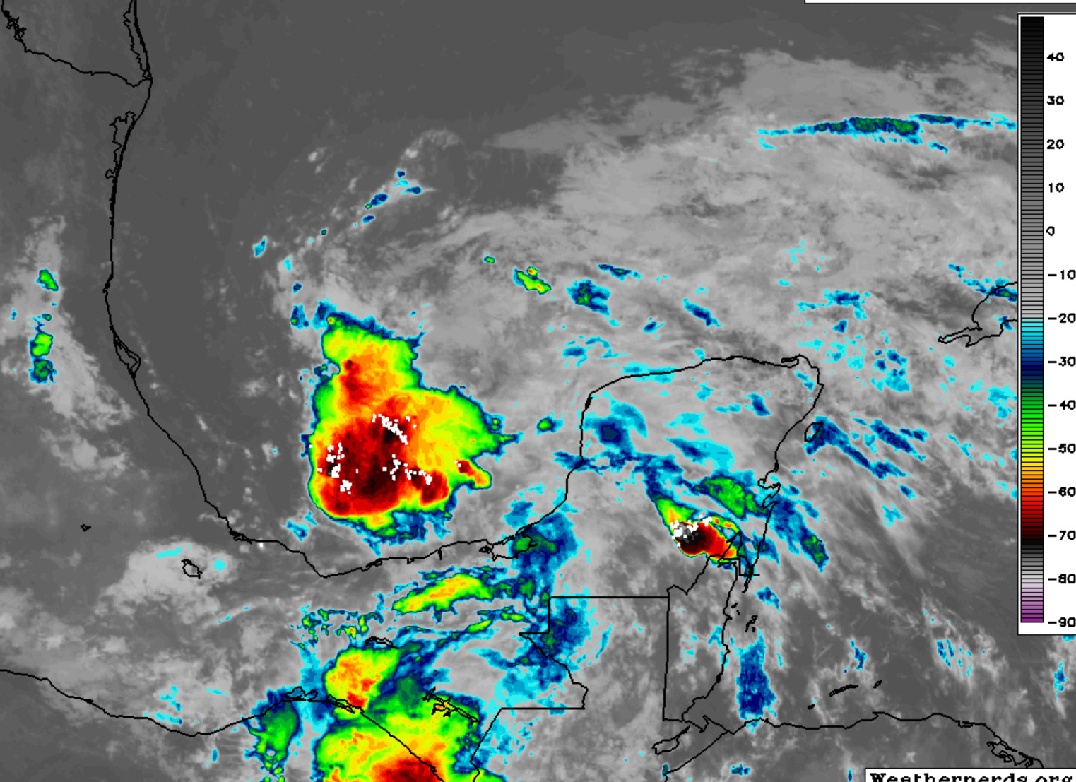
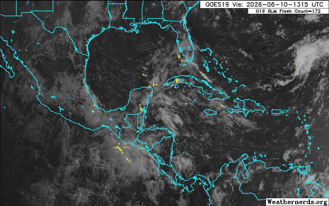
Water Vapor Satellite shows the hostile conditions better, and why I don't think it will do much. Dry air ahead of it will limit rainfall effectively to closer to the center and east of it.
It may try to develop, but I don't expect it will succeed.
|
cieldumort
Moderator
Reged:
Posts: 2681
Loc: Austin, Tx
|
|
A solid Scat pass arrived a while ago that also suggests a closed surface low exists, but that is wonky and elongated ~ and at the time ~ arguably located partially inland ~ south of the Bay of Campeche. Furthermore, most of the disturbance resembles a trof.
Below: analysis from the Tropical Analysis and Forecast Branch (TAFB) June 13 2:22z
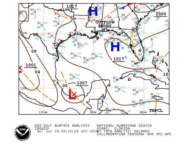
Recent Scatterometer data (surface winds):
Despite all of the above, the 1007mb Low continues to very gradually show improved convection, moisture and structure, and very importantly, no longer is it getting beaten up by high levels of dry air and shear. Increasingly, the disturbance finds itself in a moistening environment with upper-level high pressure building in aloft, and the fledgling surface circulation could be getting drawn further into the deeper convection to its north.
If trends continue, and Invest tag will likely be added and vort-centric, "Hurricane," model runs could begin.
|
cieldumort
Moderator
Reged:
Posts: 2681
Loc: Austin, Tx
|
|
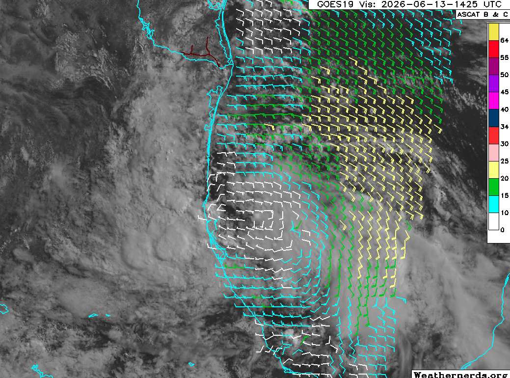
Just east of Tampico, TX this morning. ASCAT shows that while closed, the low is still a bit stretched with limited organized convection, but it continues improving. Time left over water is pivotal for near-term development odds. Modeling favors taking the system into northeast Mexico and lingering it around the MX/TX border for a couple of days, with about half of the models showing the tropical low slowly getting pulled back offshore ~ with another low chance of becoming a TC ~ and roughly the other half having it feeding if not merging with a stationary front draped across the gulf coast states, while inland.
|


 Threaded


