CFHC

Reged:
Posts: 217
Loc: East Central Florida
|
|
NHC will initiate advisories on Tropical Storm Dolly (formerly AL96) located in the central Tropical Atlantic, at 11:00 AM EDT (1500 UTC).
|
MikeC
Admin
Reged:
Posts: 4870
Loc: Orlando, FL
|
|
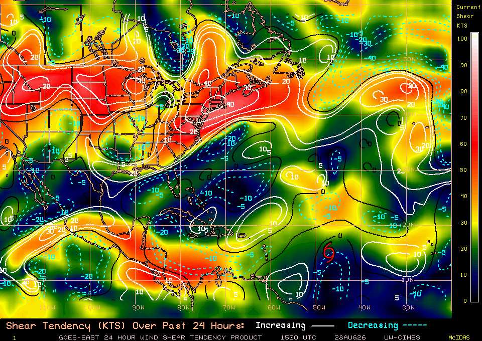
Long range models generally aren't favorible for Dolly down the road, UKMet and Canadian, not withstanding. (Although the UKMet develops a second system nearby) Timing is late next week for it being even potentially close to the US, but odds are high that nothing much comes of it. Dolly has at best 24 hours before getting ripped apart.
Edited by CFHC (Thu Aug 27 2026 02:09 PM)
|
cieldumort
Moderator

Reged:
Posts: 2935
Loc: Austin, Tx
|
|
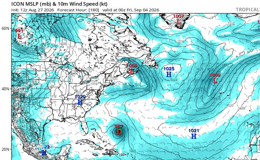
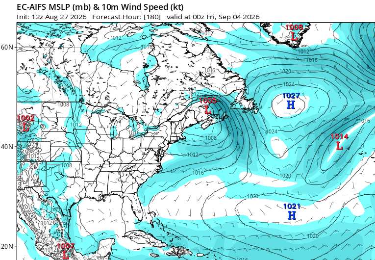
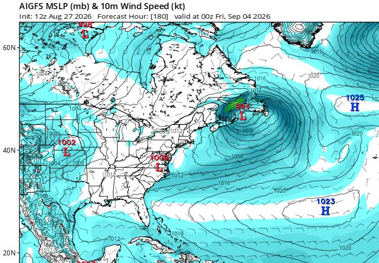
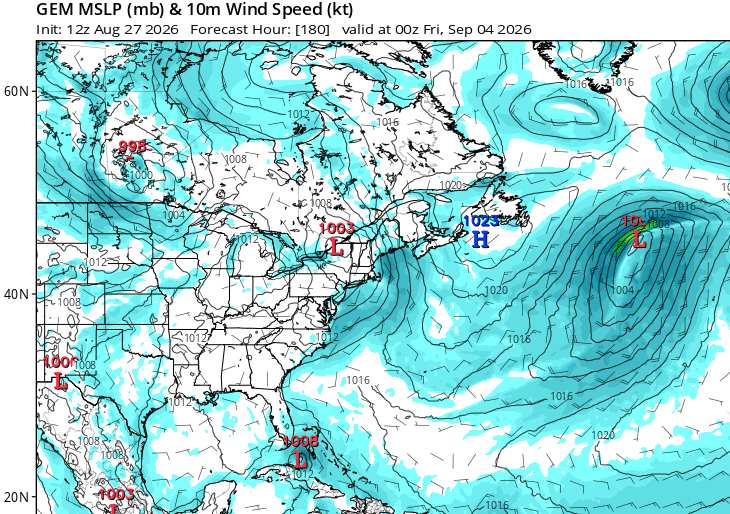
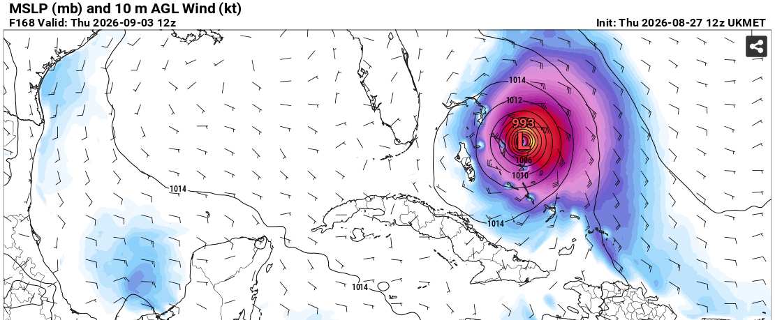
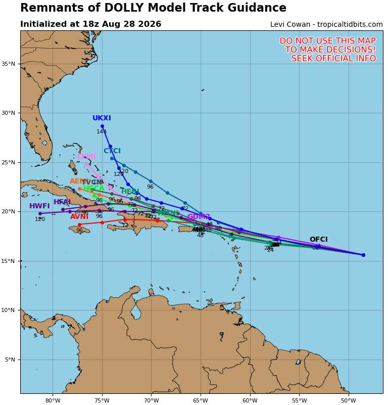
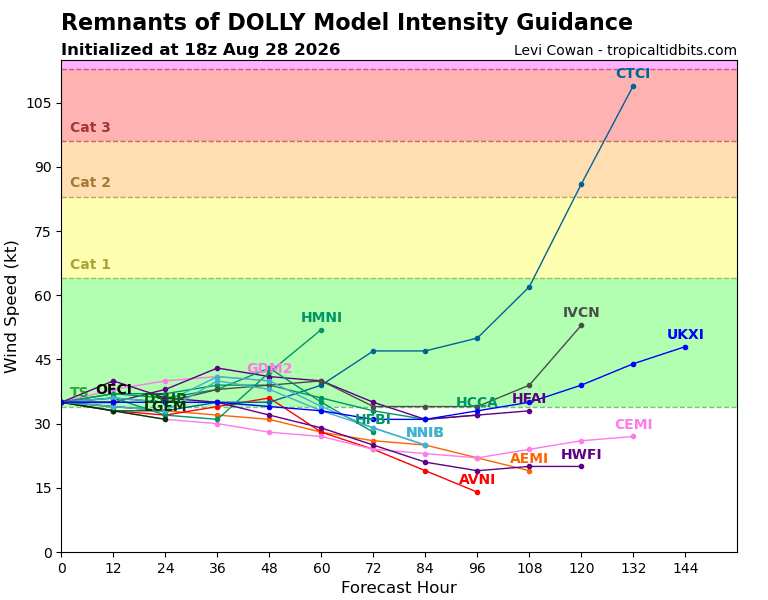
Looking at some of the 12Z Global runs on Dolly at 7.5 days out (180 hours)
ICON at 180 hours has Dolly near the Bahamas at 987mb
EURO AI has Dolly all washed out
GFS AI has Dolly all washed out
CANADIAN has Dolly just south of Florida, re-intensifying
UKMET (168 hours out is end of this run - 7 days) 993mb near or over the Bahamas
|
MikeC
Admin
Reged:
Posts: 4870
Loc: Orlando, FL
|
|
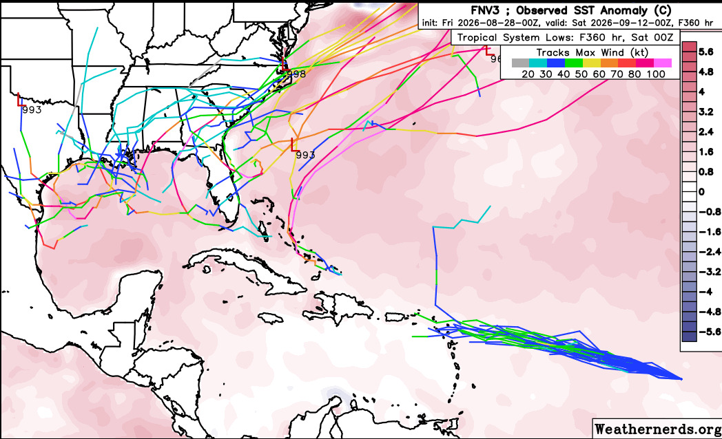
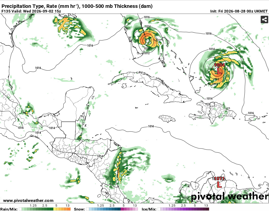
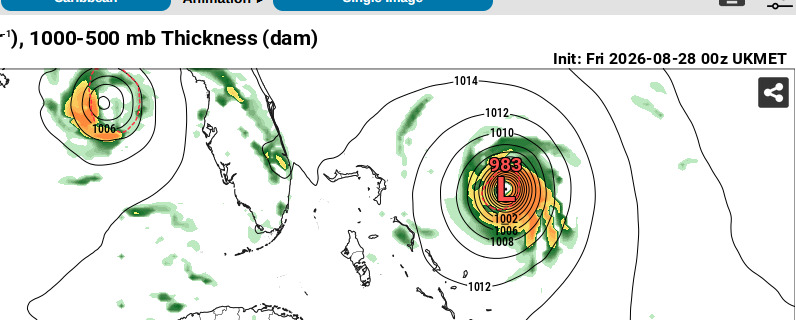
Overnight models mostly drop Dolly completely with a few exceptions.
The UK Met develops another system near the Bahamas mid next week that gets close to Florida, and the Canadian redevelops dolly near Bimini island in the Bahamas and stalls it offshore.
very few ensembles on the deep mind after the Caribbean. Dolly doesn't look great on satellite this morning.
|
cieldumort
Moderator
Reged:
Posts: 2935
Loc: Austin, Tx
|
|
|
cieldumort
Moderator
Reged:
Posts: 2935
Loc: Austin, Tx
|
|
|
cieldumort
Moderator
Reged:
Posts: 2935
Loc: Austin, Tx
|
|
Dolly is an exceptionally stout and resilient wave that continues deserving our attention. In the near to medium term, regeneration is unlikely. However, mid/late next week and into the holiday weekend is where things may get dicey.
The Gulf is a powder keg of untapped hot water and shear is largely expected to be on the light side during this time. There is a chance Invest Dolly makes its way into it during this favorable window.
The Gulf Stream extending well out into the southwest Atlantic is also anomalously very warm. Much of this region is also forecast to be under a lighter shear regime. Dolly may make its way over here during a favorable window.
Invest Dolly is much too robust to easily fall apart over the Antilles and is probably either going into the Gulf or the southwestern Atlantic during not only what is historically very near climo peak, but also at a time when conditions are just more favorable.
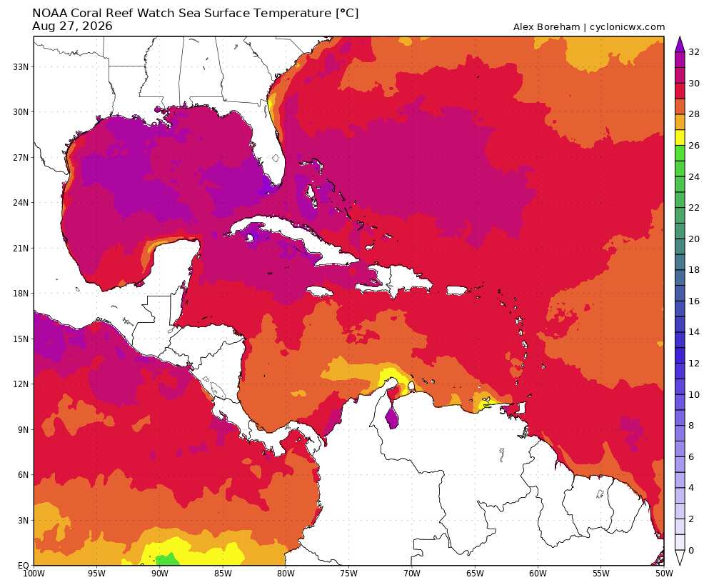
Above: SSTs Image credit: Cyclonicwx.com
Hurricane model runs are still going on Invest Dolly. This should be helpful. In addition, as Dolly draws closer, recon may get tapped to sample the environment at the very least.
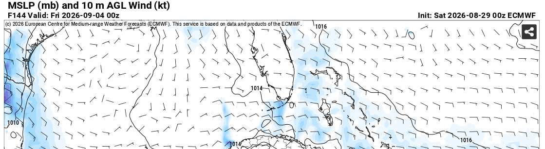
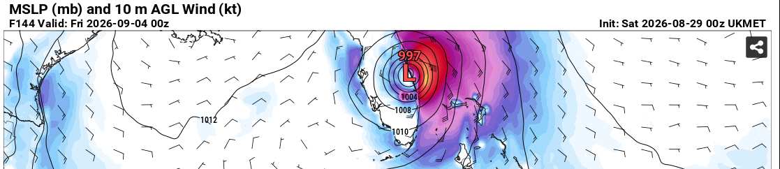
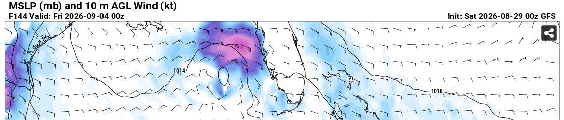
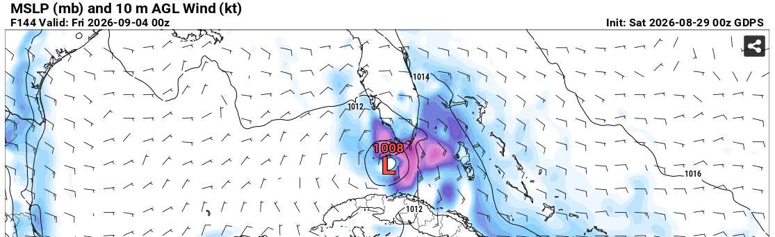
In the meantime, here are some of the 8/29/0z Global runs that extend far enough into the future to glean how the wave may respond to being in a much more favorable condition for development.
EURO at 144 hours out
UKMET at 144 hours out
GFS at 144 hours out
CANADIAN at 144 hours out
ICON at 144 hours out
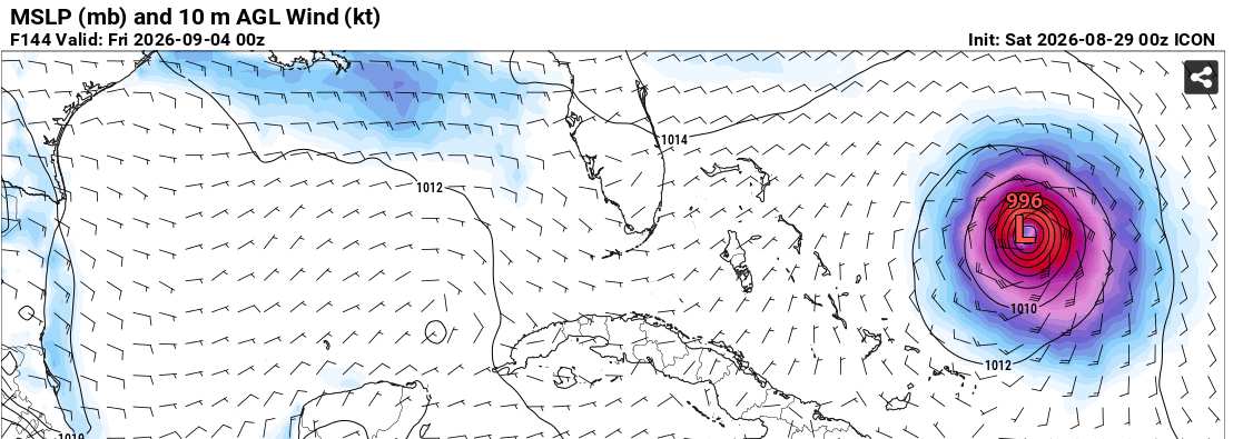
In summary
EURO - No redevelopment
UKMET - Redeveloped
GFS - Redeveloped
Canadian - Redeveloped
ICON - Redeveloped
|
MikeC
Admin
Reged:
Posts: 4870
Loc: Orlando, FL
|
|
The majority of the models and ensemble members still do not redevelop dolly, which is still the most likely outcome. Conditions ahead of the remnants of Dolly are still quite poor for any development. The exceptions like UK/Icon/CMC are finding holes, but are unlikely themselves. Concern level here is low. Strong wind shear, fast westward movement (~25 mph), and plenty of dry air are keeping a hard ceiling on organization. The rightly keeps redevelopment odds down at a low 10%.
|
MikeC
Admin
Reged:
Posts: 4870
Loc: Orlando, FL
|
|
Most models do not redevelop Dolly, but this one (12z icon) shows a possibility if most of the system stays north of the islands, where the system develops east of the Bahamas, and potentially loops out, in this case it would likely stay out to sea.

Other models like the 12Z don't develop dolly, and the canadian seems to be backing off from it also. The next 24-36 hours seem likely to kill the current convection.
|
cieldumort
Moderator
Reged:
Posts: 2935
Loc: Austin, Tx
|
|
The 06Z EPS 200-850mb wind shear forecast for late next week continues advertising a light shear regime in the Gulf and portions of the SW ATL
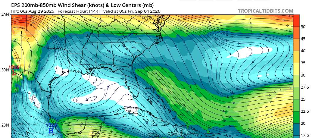
ECMWF model sounding average over the northern Gulf to just east of Florida advertises just 7 knots of shear and 300-850mb relative humidity of 57%
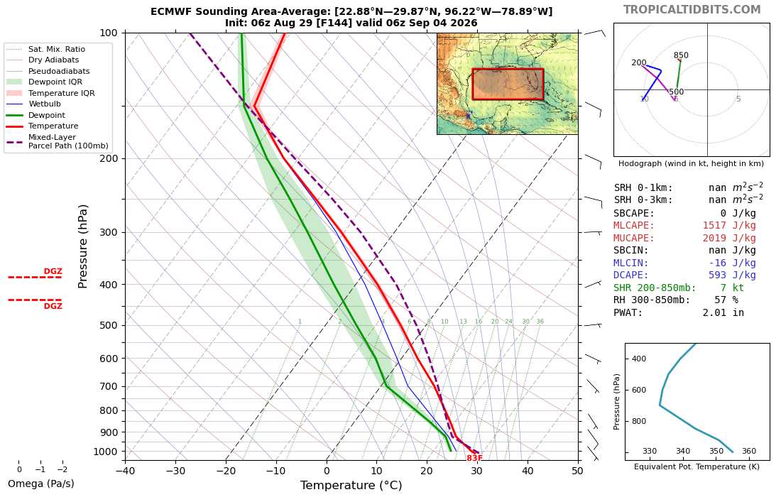
Atop very warm waters, this is more than sufficient to support tropical cyclone development. Favorable environment.
|
MikeC
Admin
Reged:
Posts: 4870
Loc: Orlando, FL
|
|
12z - No Development.
12z Canadian does develop it near Lousiana and shows a landfall on labor day. main difference with this run it stays over the islands more and delays development on it.
12zUK Met is the most aggressive, redevelops east/over the Bahamas on Tuesday.
Then makes landfall south of Miami midday Thursday as a strong tropical storm or category 1 hurricane, and exits near Tampa for another landfall as a cat 1 near Cedar key later on Friday.

No real change to the thoughts, ex-dolly still has a lot going against it, but there's a few spots that could allow it to re-spark. Odds still favor it not redeveloping, but things like this say keep an eye on it anyway.
|
cieldumort
Moderator
Reged:
Posts: 2935
Loc: Austin, Tx
|
|
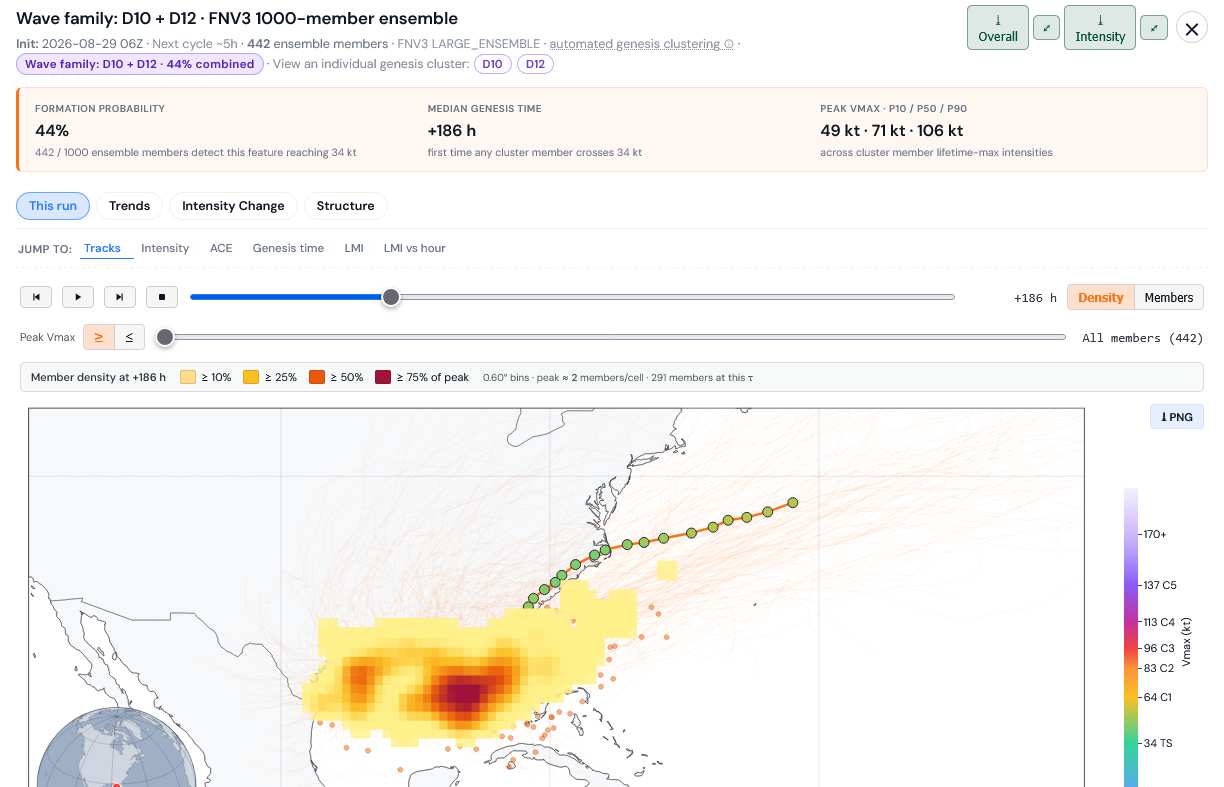
Most recent run of the DeepMind FNV3 1000-member ensembles is now advertising a 44% chance of at least a tropical storm developing from Wave Family D10+D12 (Remnants of Dolly),
with a median genesis time of 186 hours out from 06Z today to reach tropical storm strength (next weekend)
|
cieldumort
Moderator
Reged:
Posts: 2935
Loc: Austin, Tx
|
|
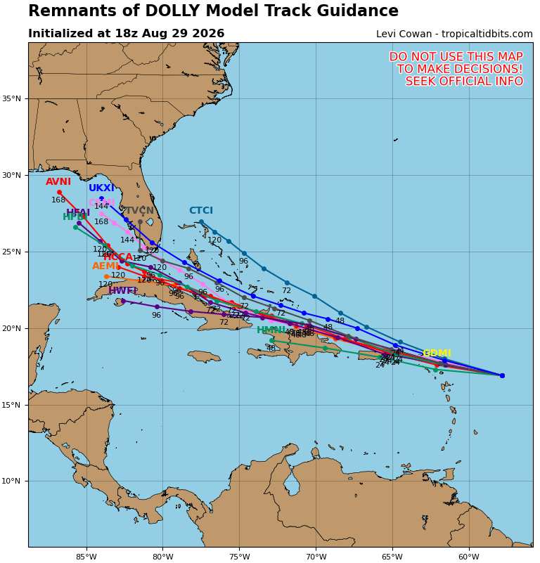
Many more models now tracking Dolly/Wave D10/Wave D12 into the Gulf, now that these runs go out far enough (many model runs end within 7 days, so this is starting to come into better focus)
|
cieldumort
Moderator
Reged:
Posts: 2935
Loc: Austin, Tx
|
|
8/30/0z EURO has joined the Invest Dolly redevelopment camp with a tropical depression in the eastern Gulf at 8 days out
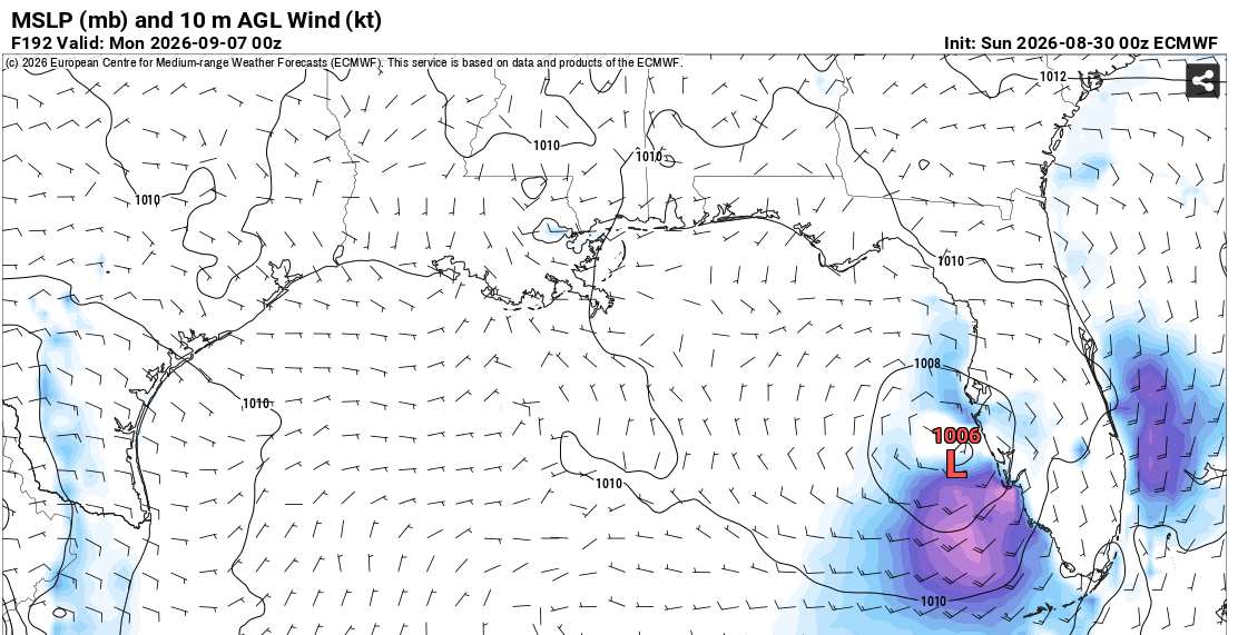
CANADIAN in the northern Gulf at 7.5 days out
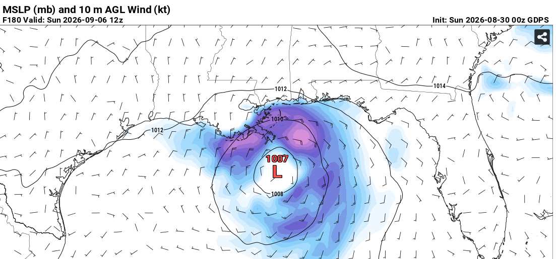
UKMET at just over 4 days out - approaching Florida
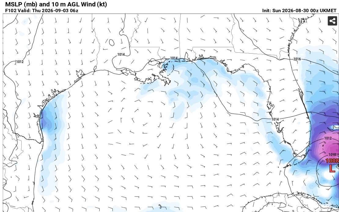
ICON at 5.5 days out
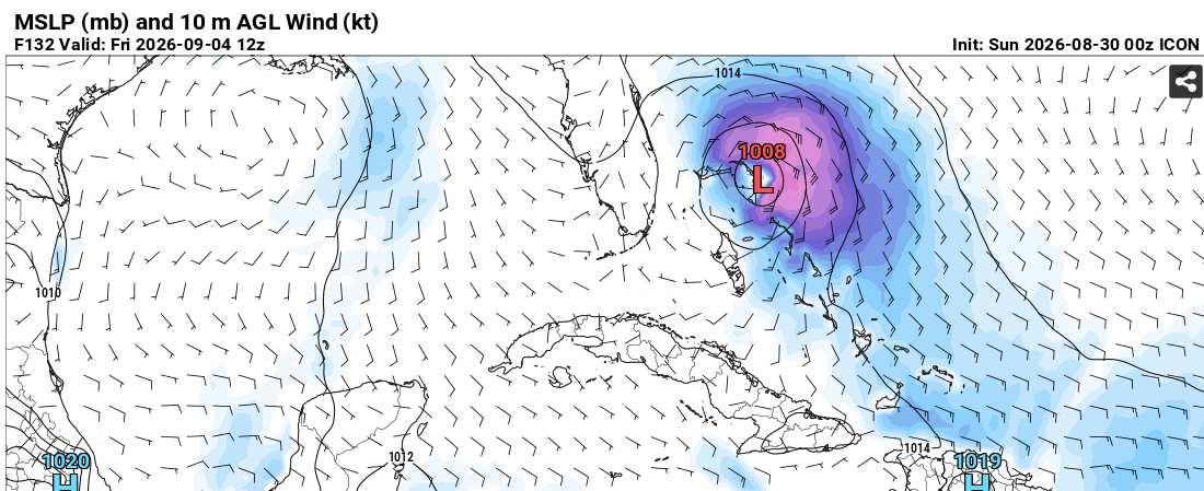
First, it remains to be seen just how much of Wave Dolly is left after traversing through all this shear ~ and then ~ how much, if any, the system travels over the Greater Antilles. A trip through Cuba could be its complete demise, for example. On the other hand, a voyage just skirting the islands to the north could overachieve once in the Gulf or SW Atlantic.
|
cieldumort
Moderator
Reged:
Posts: 2935
Loc: Austin, Tx
|
|
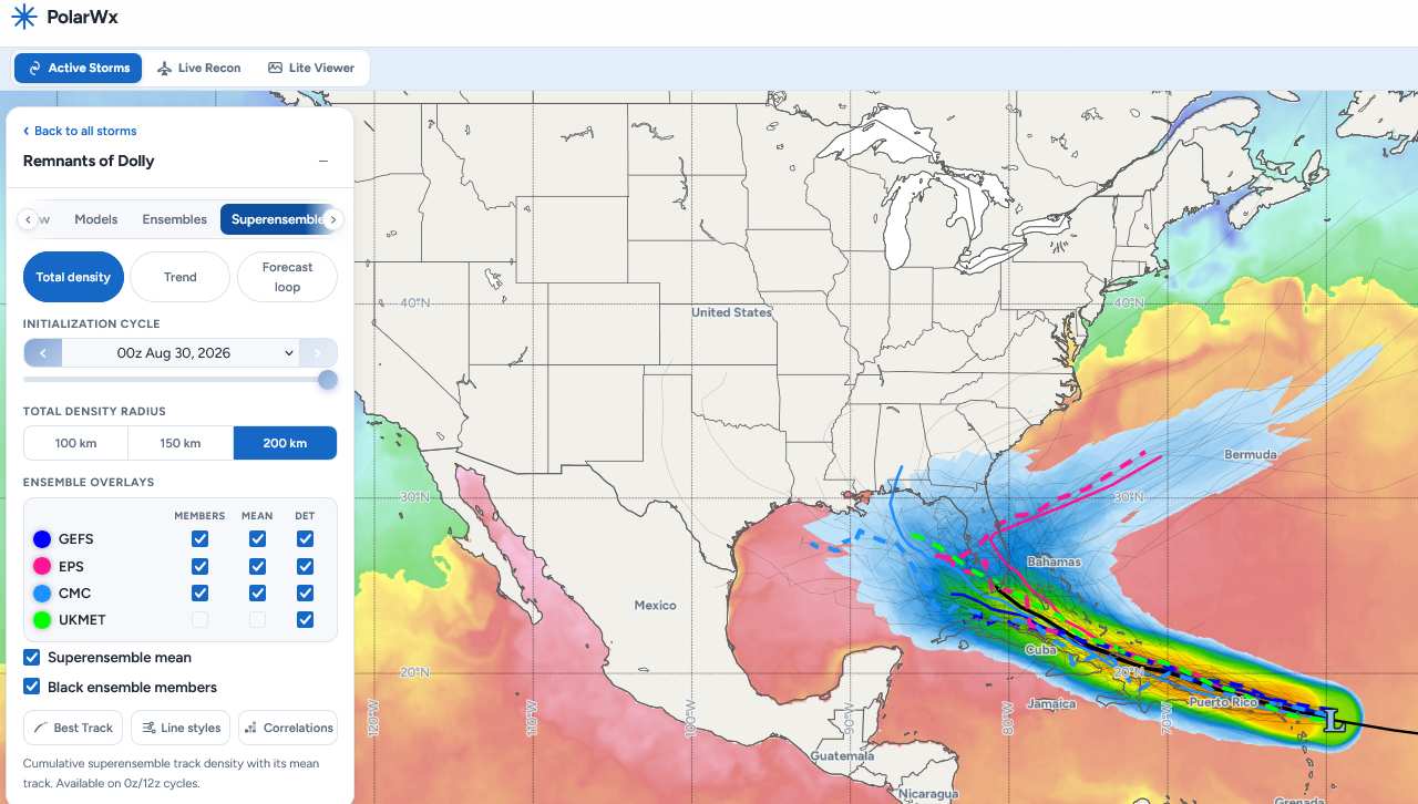
Today's 0z Superensemble plots. Credit: PolarWx.com
*TRACK ONLY - NO MENTION OF INTENSITY HERE*
|
Yaakov
Registered User
Reged:
Posts: 1
|
|
I see lots of model runs posted here, which are definitely interesting on a speculative level. However, IMHO the short-term/nowcast trends with Dolly are worth keeping track of.
Dolly has proven quite resilient vs. model expectations, with the recent 'explosion' of convection seemingly aided by the diffluent, highly sheared flow.
Surface obs from the Leeward Islands in the NE Caribbean have been quite interesting. Thread here:
https://x.com/yconsor/status/2094029423624310857
Edited by Yaakov (Sun Aug 30 2026 08:30 AM)
|
cieldumort
Moderator
Reged:
Posts: 2935
Loc: Austin, Tx
|
|
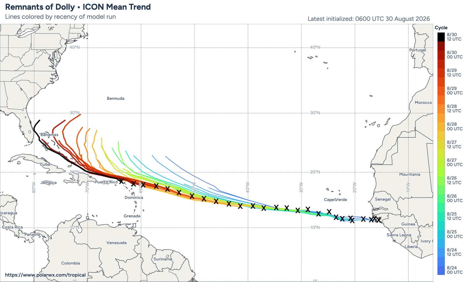
ICON keeps trying to ramp Dolly up/back up sooner and have it recurve (head out to sea) as a very strong tropical cyclone (sometimes this model has Dolly go Major even).
ICON is batting zero so far and keeps having to shift its forecast recurve further and further out
h/t: Tomer Burg
@burgwx
PolarWx.com
|
cieldumort
Moderator
Reged:
Posts: 2935
Loc: Austin, Tx
|
|
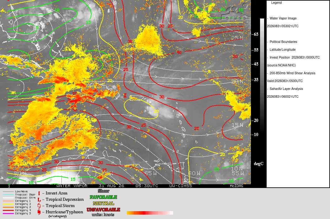
Invest Dolly is not enjoying that blast of dry air and models have dramatically backed off on their earlier more bullish redevelopment outcomes. In fact, there is now so little of "Dolly" left, it is not clear that should TC Genesis occur from the remnant trof, the name would stick.
In any event, if the trof doesn't completely fall apart during the next 24 hours or so, far less hostile conditions still appear to lie ahead, with both far less shear and far less dry air. By midweek we should have a clearer picture of the wave's prospects.
Where's Wal.. Dolly?
|
MikeC
Admin
Reged:
Posts: 4870
Loc: Orlando, FL
|
|
Yes Dolly is done, nothing beyond it (outside of 97L) at the moment. Just on the look out for short fuse systems near land and the N Atlantic for the moment. Any other waves in the MDR likely will have the same fate as Dolly and the others before it still.
|



 Previous
 Index
Index
 Next
Next
 Threaded


 [Re:
[Re:  Edit
Edit
 Reply
Reply
 Quote
Quote


