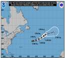
Wet weekend and next weekend, but tropical development very unlikely.
Days since last Hurricane Landfall —
US Any:
596 (Milton),
US Major:
596 (Milton),
FL Any:
596 (Milton),
FL Major:
596 (Milton)
Rich B
British Meteorologist
Reged:
Posts: 498
Loc: Gloucestershire, England, UK
|
|
Looks like the Australian east coast will take a thumping during the next 2 days. Ingrid is a Category 5 cyclone and intensifying. Should make landfall on Wednesday and will cause widespread and severe damage along its path.
-------------------- Rich B
SkyWarn UK
|
ShanaTX
Storm Tracker
Reged:
Posts: 226
Loc: Texas
|
|
Yikes. I saw an article about it at news.com.au
There is a very clear satellite picture accompanying the article.
Says it's the worst Cyclone in 30 years...
'shana
|
Ed Dunham
Former Meteorologist & CFHC Forum Moderator (Ed Passed Away on May 14, 2017)
Reged:
Posts: 2565
Loc: Melbourne, FL
|
|
Actually Ingrid is down to 105 knots this morning and will further weaken to about 70 knots at landfall near 14S - still a respectable storm, but nothing that the folks in that area are not used to. Think of a storm somewhat smaller than Jeanne and somewhat less intense than .
Cheers,
ED
|
|
0 registered and 11 anonymous users are browsing this forum.
Moderator:
Print Topic
|
Forum Permissions
You cannot start new topics
You cannot reply to topics
HTML is disabled
UBBCode is enabled
|
Rating:
Topic views: 7047
|
|
|
|
|
|
Note: This is
NOT an official page. It is run by weather hobbyists and should not be used as a replacement for official sources.
CFHC's main servers are currently located at
Hostdime.com in Orlando, FL.
Image Server Network thanks to Mike Potts and Amazon Web Services. If you have static file hosting space that allows dns aliasing contact us to help out! Some Maps Provided by:
Great thanks to all who
donated and everyone who uses the site as well.
Site designed for 800x600+ resolution
When in doubt, take the word of the
National Hurricane Center