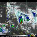
I would agree, the latest Dvorak image seems to indicate that she is getting her act together and the increased volocity forcast may be correct. I would say Cat 5 at landfall, TX - LA border
Intensity will be the hardest to determine even 24hrs out .... eye wall replacement cycle, shear forecast for the southern half of the storm. There are a lot of factors that the NHC forecasters are having to look at.
The geography of the area will cause Rita to make landfall as a Category 3 considering her current angle. Wind moving across land is slower than over water. The air over land is also drier which will cause Rita to beginning pulling in drier air . When over water, the water droplets picked up from ocean "lubricate" the wind allowing it to move much faster.