New Article: CSU releases 2026 season numbers, slightly below average. https://flhurricane.com
Days since last Hurricane Landfall —
US Any:
557 (Milton),
US Major:
557 (Milton),
FL Any:
557 (Milton),
FL Major:
557 (Milton)
Weather456
Verified CFHC User
Reged:
Posts: 14
|
|
Tropical Update/Wind Shear
The tropics are stirring today.
Tropical Storm Beryl
A front moved off the east coast of the United States and most of it began to dissipate, but the southern portion of the front remained intact and stalled. This allowed the former front, now separated into two tropical disturbances, to organize themselves while over the Gulf Stream. The northernmost disturbance quickly organized, but moved into the cold waters of the North Atlantic before it could become a tropical depression. Because of the weak steering currents, the southern disturbance slowly drifted south and organized itself to be designated the second tropical cyclone of the season, after over a month of inactivity.
Current Storm Information
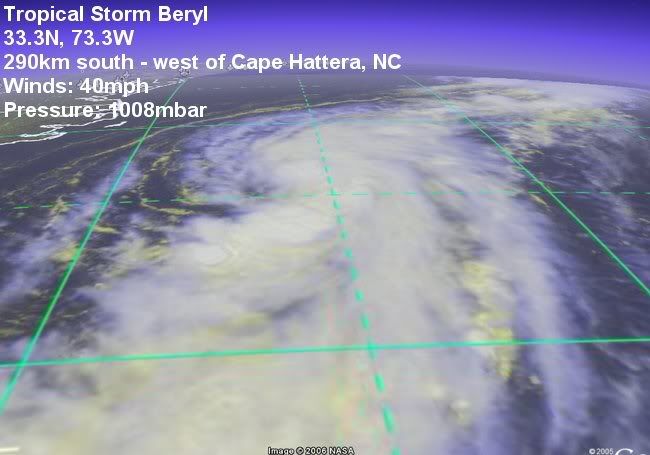
As of 5 p.m. EDT on 18 July (2100 UTC), Beryl was located near 32.8°N, 73.4°W. It had maximum sustained winds of 40 mph (55 km/h), with higher gusts. The storm was moving toward the north at about 6mph (8 km/h). The minimum central pressure was 1008 mbar (29.85 inHg).
Warnings and Watches
Coastal warnings and watches:
A tropical storm watch has been issued for the eastern coast of North Carolina, from north of Cape Lookout northward to south of Currituck Beach Lighthouse.
See the 's latest public advisory on Tropical Depression Two.
See the 's latest forecast discussion on Tropical Depression Two.
Note that your items 'b' and 'c' repeat information that is available on the left sidebar (and a link to ) and should not be repeated here (except for short excerpts to make a point). Note also that Eastern Pacific activity does not belong in this Forum.

Figure 1: Tropical Storm Beryl

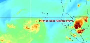
Figure 2: East Atlantic Wave

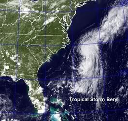
Figure 4: Tropical Storm Beryl

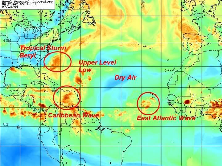
Figure 5: Tropical Atlantic
Edited by Weather456 (Tue Jul 18 2006 10:14 PM)
|
West FL Jess
Weather Hobbyist

Reged:
Posts: 50
Loc: Tampa Bay
|
|
http://www.ssd.noaa.gov/PS/TROP/DATA/RT/eatl-ir4-loop.html
anyone have any thoughts on this wave? 
--------------------
~jess~
|
Storm Cooper
User
Reged:
Posts: 1290
Loc: Panama City , FL
|
|
Several noticed that wave the in the past day or so but it does not look as pronounced tonight. It was mentioned in the discussion tonight but is a wait and see still... way far out yet.
--------------------
Hurricane Season 2017 13/7/1
|
|
0 registered and 6 anonymous users are browsing this forum.
Moderator:
Print Topic
|
Forum Permissions
You cannot start new topics
You cannot reply to topics
HTML is disabled
UBBCode is enabled
|
Rating:
Topic views: 4600
|
|
|
|
|
|
Note: This is
NOT an official page. It is run by weather hobbyists and should not be used as a replacement for official sources.
CFHC's main servers are currently located at
Hostdime.com in Orlando, FL.
Image Server Network thanks to Mike Potts and Amazon Web Services. If you have static file hosting space that allows dns aliasing contact us to help out! Some Maps Provided by:
Great thanks to all who
donated and everyone who uses the site as well.
Site designed for 800x600+ resolution
When in doubt, take the word of the
National Hurricane Center
G