Current Radar or Satellite Image

Flhurricane.com - Central Florida Hurricane Center - Tracking Storms since 199531 Years of Hurricanes Without the Hype - Since 1995


Nothing on the horizon for Atlantic development at the start of July.
Days since last Hurricane Landfall — US Any: 637 (Milton), US Major: 637 (Milton), FL Any: 637 (Milton), FL Major: 637 (Milton)
FlHurricane Atlantic Tropical Cyclone Tracking 🌀 Since 1995
None
HypeScale:
0.01
0510
Communication
Storm Data
Content
Follow & Connect


Archives 2002-2009 >> 2006 Forecast Lounge

Jump to first unread post. Pages: 1
allan
Weather Master


Reged:
Posts: 468
Loc: Palm Coast, Florida
Sub-tropical storm developing?
      #74138 - Thu Nov 09 2006 10:54 AM

Is it possible that the strong Low could gain Tropical characteristics in a few days? Satellite really looks good and shear map shows Favorable conditions though sea temps are not well. Large storm. To me, it looks like the low may cut off and gain a few tropical areas. Something to watch, really.

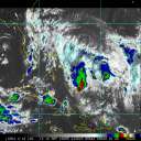
Heres some sources..
http://www.ssd.noaa.gov/goes/east/nwatl/vis-l.jpg - Satellite image (what a storm!)

http://www.wunderground.com/data/640x480/atlm_shear.gif - Shear forecast from wunderground.com


http://www.wunderground.com/satellite/vis/1k/US.html - Satellite zoom (nice Circualtion, cut off from the main stuff already.)

--------------------
Allan Reed - 18,9,5

Edited by allan (Thu Nov 09 2006 10:58 AM)


Post Extras: Print Post   Remind Me!   Notify Moderator  
Pages: 1


Extra information
0 registered and 2 anonymous users are browsing this forum.

Moderator:  

Print Topic

Forum Permissions
      You cannot start new topics
      You cannot reply to topics
      HTML is disabled
      UBBCode is enabled

Rating:
Topic views: 5287

Rate this topic

Jump to