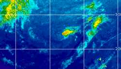
Current Radar or Satellite Image

Flhurricane.com - Central Florida Hurricane Center - Tracking Storms since 199531 Years of Hurricanes Without the Hype - Since 1995


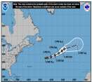
Josephine forms from 93L. Forecast to become a hurricane-force fish spinner. Watching off SE for potential new Area of Interest this weekend.
Days since last Hurricane Landfall — US Any: 13 (Isaias), US Major: 743 (Milton), FL Any: 13 (Isaias), FL Major: 743 (Milton)
FlHurricane Atlantic Tropical Cyclone Tracking 🌀 Since 1995
39.2N 67.3W
Wind: 65MPH
Pres: 988mb
Moving:
Present movement...ne or 45 degrees at 12 mph...19 km/h
Click for Storm Spotlight
HypeScale:
2.50
0510
Communication
Storm Data
Content
Follow & Connect


News Talkback >> 2007 News Talkbacks

Jump to first unread post. Pages: 1 | 2 | 3 | (show all)
cieldumort
Moderator


Reged:
Posts: 2948
Loc: Austin, Tx
Re: SSTs- 2007 vs 2005 [Re: Bloodstar]
      #74458 - Thu Apr 26 2007 03:36 PM

Eh. I think it's a little early to tell just yet. We had a lot of cold air pushing very far south the past few months, with plenty of it fanning out over the GOM

Here are the more recent SSTs in the area mid-late april 2007

http://www.esl.lsu.edu/webpics/CMI-GOES/...Esst%2Ecl%2Egif

vs mid-late april 2006

http://www.esl.lsu.edu/webpics/CMI-GOES/...Esst%2Ecl%2Egif


Post Extras: Print Post   Remind Me!   Notify Moderator  
Pages: 1 | 2 | 3 | (show all)


Extra information
0 registered and 0 anonymous users are browsing this forum.

Moderator:  MikeC, Ed Dunham, danielw 

Print Topic

Forum Permissions
      You cannot start new topics
      You cannot reply to topics
      HTML is disabled
      UBBCode is enabled

Rating: *****
Topic views: 41969

Rate this topic

Jump to