Current Radar or Satellite Image

Flhurricane.com - Central Florida Hurricane Center - Tracking Storms since 199531 Years of Hurricanes Without the Hype - Since 1995


POLO HEADS FOR BAJA, NW MX, SW US. LARGEST MODERATE RISK FOR FLOODING EVER ISSUED IN SW US THIS WEEK. NOLO HEADS FOR NW HAWAII. HANNA FORMS, GOIN FISHING..
Days since last Hurricane Landfall — US Any: 718 (Milton), US Major: 718 (Milton), FL Any: 718 (Milton), FL Major: 718 (Milton)
FlHurricane Atlantic Tropical Cyclone Tracking 🌀 Since 1995
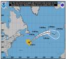
27.1N -44.6W
Wind: 35MPH
Pres: 1011mb
Moving:
Present movement...ssw or 210 degrees at 9 mph...15 km/h
Click for Storm Spotlight
36.6N -50.4W
Wind: 45MPH
Pres: 1006mb
Moving:
Present movement...e or 100 degrees at 17 mph...28 km/h
Click for Storm Spotlight
HypeScale:
5.00
0510
Communication
Storm Data
Content
Follow & Connect


General Discussion >> The Tropics Today

Jump to first unread post. Pages: 1
Ed DunhamAdministrator
Former Meteorologist & CFHC Forum Moderator (Ed Passed Away on May 14, 2017)


Reged:
Posts: 2565
Loc: Melbourne, FL
Bay of Campeche
      #88508 - Sat Jul 24 2010 04:11 PM

At 24/19Z, an unclassified tropical cyclone (probably a Tropical Depression) moved ashore at Cabo Rojo, Mexico, south of Tampico. The low level circulation was evident near 21.1N 97.6W at 24/20Z.
ED


Post Extras: Print Post   Remind Me!   Notify Moderator  
WesnWylie
Weather Guru


Reged:
Posts: 155
Loc:
Re: Bay of Campeche [Re: Ed Dunham]
      #88510 - Sat Jul 24 2010 06:53 PM

I am still noticing a flare up of convection in the area you have pointed out. There looks to be spin right along the coast drifting slowly northward, likely being pulled by the large upper-low to the north. Could it move back into the GOM
by rounding the base of the upper-low, or not?


Post Extras: Print Post   Remind Me!   Notify Moderator  
Ed DunhamAdministrator
Former Meteorologist & CFHC Forum Moderator (Ed Passed Away on May 14, 2017)


Reged:
Posts: 2565
Loc: Melbourne, FL
Re: Bay of Campeche [Re: WesnWylie]
      #88511 - Sat Jul 24 2010 07:26 PM

No, not very likely. At 24/23Z the center had moved inland near 20.9N 98.5W.
ED


Post Extras: Print Post   Remind Me!   Notify Moderator  
Ed DunhamAdministrator
Former Meteorologist & CFHC Forum Moderator (Ed Passed Away on May 14, 2017)


Reged:
Posts: 2565
Loc: Melbourne, FL
Re: Bay of Campeche [Re: Ed Dunham]
      #88515 - Sat Jul 24 2010 09:13 PM

Center still weakly defined near 21.2N 99.0W at 25/01Z. With the center well inland, further development in this area is nil.
ED


Post Extras: Print Post   Remind Me!   Notify Moderator  
Ed DunhamAdministrator
Former Meteorologist & CFHC Forum Moderator (Ed Passed Away on May 14, 2017)


Reged:
Posts: 2565
Loc: Melbourne, FL
Re: Bay of Campeche [Re: WesnWylie]
      #88522 - Sun Jul 25 2010 02:24 PM

It turns out that you were correct. During the night the low center drifted back to the east and at 25/12Z it was back at the coastline at 21.0N 97.6W - or just about the exact location that it first went ashore at yesterday afternoon. Wind at Tampico continues out of the ENE at 12-15 knots. The area has now been tagged as Invest 99L with almost no chance of development since the center is still over land.

Added: At 18Z the center has drifted northwest and was over land at approximately 21.6N 98.3W.
ED

Edited by Ed Dunham (Sun Jul 25 2010 02:47 PM)


Post Extras: Print Post   Remind Me!   Notify Moderator  
Pages: 1


Extra information
0 registered and 0 anonymous users are browsing this forum.

Moderator:  CFHC, MikeC, Ed Dunham, Colleen A., danielw, Clark, RedingtonBeachGuy, SkeetoBite, Bloodstar, tpratch, typhoon_tip, cieldumort 

Print Topic

Forum Permissions
      You cannot start new topics
      You cannot reply to topics
      HTML is disabled
      UBBCode is enabled

Rating:
Topic views: 6024

Rate this topic

Jump to