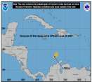
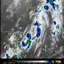
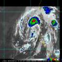
Current Radar or Satellite Image

Flhurricane.com - Central Florida Hurricane Center - Tracking Storms since 199531 Years of Hurricanes Without the Hype - Since 1995


93C in the Central Pacific is now PTC ONE. NHC Advisories for Hawaii are being created. Elsewhere, Atlantic Invest 93L is now Tropical Storm Cristobal, out at sea.
Days since last Hurricane Landfall — US Any: 672 (Milton), US Major: 672 (Milton), FL Any: 672 (Milton), FL Major: 672 (Milton)
FlHurricane Atlantic Tropical Cyclone Tracking 🌀 Since 1995
38.6N -38.2W
Wind: 35MPH
Pres: 1014mb
Moving:
Present movement...ne or 45 degrees at 16 mph...26 km/h
Click for Storm Spotlight
Invest 92LClick for Invest Information from CIMSS
Invest 94LClick for Invest Information from CIMSS
HypeScale:
2.20
0510
Communication
Storm Data
Content
Follow & Connect


General Discussion >> The Tropics Today

Jump to first unread post. Pages: 1
Ed DunhamAdministrator
Former Meteorologist & CFHC Forum Moderator (Ed Passed Away on May 14, 2017)


Reged:
Posts: 2565
Loc: Melbourne, FL
Tropical Wave Southwest of Cape Verde Islands
      #89231 - Mon Aug 30 2010 08:35 PM

Active tropical low near 10N 28W at 31/00Z moving west at 16 knots. Strong convection with pressure around 1007MB - at the moment it actually looks better than Fiona. This system may be far enough to the south that the SAL to the north will not be as significant a deterrent toward future development.
ED

Edited by Ed Dunham (Wed Sep 08 2010 02:50 PM)


Post Extras: Print Post   Remind Me!   Notify Moderator  
Random Chaos
Weather Analyst


Reged:
Posts: 1024
Loc: Maryland
Re: Tropical Wave Southwest of Cape Verde Islands [Re: Ed Dunham]
      #89240 - Tue Aug 31 2010 12:05 AM

Dvorak T-numbers from SSD are rating it 1.0. (reference)

It has just come into GOES range, so we should have a better view of it tomorrow. Models are not initializing the system yet. Tomorrow will tell if this will form or fizzle, I think.


Post Extras: Print Post   Remind Me!   Notify Moderator  
Random Chaos
Weather Analyst


Reged:
Posts: 1024
Loc: Maryland
Re: Tropical Wave Southwest of Cape Verde Islands [Re: Random Chaos]
      #89241 - Tue Aug 31 2010 12:26 AM

NRL just posted it as 98L Invest.

Post Extras: Print Post   Remind Me!   Notify Moderator  
WesnWylie
Weather Guru


Reged:
Posts: 155
Loc:
Re: Tropical Wave Southwest of Cape Verde Islands [Re: Random Chaos]
      #89258 - Tue Aug 31 2010 01:45 PM

98L does not that look really good at this time, but I think it will have a better chance in 2-3 days for some development. The SAL seems to be influencing it right now, and until it can distance itself some more, its chance for development will be low. I am noticing a circulation within the clouds/convection of 98L today.

Edited by danielw (Tue Aug 31 2010 02:09 PM)


Post Extras: Print Post   Remind Me!   Notify Moderator  
berrywr
Weather Analyst


Reged:
Posts: 387
Loc: Opelika, AL
Re: Tropical Wave Southwest of Cape Verde Islands [Re: WesnWylie]
      #89323 - Wed Sep 01 2010 07:19 PM

On the NHC website at the satellite link please use the following link: http://www.ssd.noaa.gov/goes/flt/t3/avn-l.jpg . I've posted the photo this evening.


--------------------
Sincerely,

Bill Berry

"Survived Trigonometry and Calculus I"


Post Extras: Print Post   Remind Me!   Notify Moderator  
Pages: 1


Extra information
0 registered and 12 anonymous users are browsing this forum.

Moderator:  CFHC, MikeC, Ed Dunham, Colleen A., danielw, Clark, RedingtonBeachGuy, SkeetoBite, Bloodstar, tpratch, typhoon_tip, cieldumort 

Print Topic

Forum Permissions
      You cannot start new topics
      You cannot reply to topics
      HTML is disabled
      UBBCode is enabled

Rating:
Topic views: 8089

Rate this topic

Jump to