New Article: CSU releases 2026 season numbers, slightly below average. https://flhurricane.com
Days since last Hurricane Landfall —
US Any:
565 (Milton),
US Major:
565 (Milton),
FL Any:
565 (Milton),
FL Major:
565 (Milton)
Ed Dunham
Former Meteorologist & CFHC Forum Moderator (Ed Passed Away on May 14, 2017)
Reged:
Posts: 2565
Loc: Melbourne, FL
|
|
A tropical wave near 12.5N 53W at 05/21Z is showing some signs of better organization as it moves westward toward the Caribbean Lesser Antilles.
ED
|
ftlaudbob
Storm Chaser

Reged:
Posts: 829
Loc: Valladolid,Mx
|
|
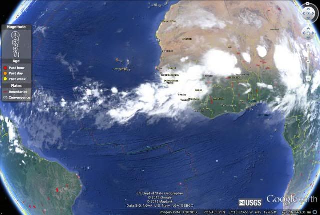
A lot of action over in Africa.
[image]  [/image] [/image]
--------------------
Survived: 10 hurricanes in Rhode Island,Florida and the Yucatan of Mexico .
Edited by ftlaudbob (Tue Aug 06 2013 02:36 PM)
|
Ed Dunham
Former Meteorologist & CFHC Forum Moderator (Ed Passed Away on May 14, 2017)
Reged:
Posts: 2565
Loc: Melbourne, FL
|
|
Well...not quite. If you look at the bottom of the satellite picture you will see an 'imagery date' of April 9th. Here is a good link to the current satellite image:
SSEC Met-Prime
Cheers,
ED
|
ftlaudbob
Storm Chaser

Reged:
Posts: 829
Loc: Valladolid,Mx
|
|
Too funny!My bad!
--------------------
Survived: 10 hurricanes in Rhode Island,Florida and the Yucatan of Mexico .
|
doug
Weather Analyst
Reged:
Posts: 1006
Loc: parrish,fl
|
|
Other than a generalized lowering of pressures in the west and SW Carribean over the next 10 days neither of the two most relied upon models develop anything in the basin over the next ten days.
I have read some speculation from a Met that the wave now entering the Carribean could (possible) be the impetus for development in the far western portion in the next few days... but I think he is an outlier...
--------------------
doug
|
doug
Weather Analyst
Reged:
Posts: 1006
Loc: parrish,fl
|
|
Updated speculation from many sources points to quiet period ending in next 7-10 days. A nice wave is exiting Africa now which should help moisten the atmosphere a bit and then there are things called CCKW's conectively-connected Kelvin Waves (what ever that is?) which apparently assisted the recent formation of the two most recent EPAC storms, and the rotating toward the WATL... near the end of that period...
We'll have to wait and see
--------------------
doug
|
|
0 registered and 7 anonymous users are browsing this forum.
Moderator:
Print Topic
|
Forum Permissions
You cannot start new topics
You cannot reply to topics
HTML is disabled
UBBCode is enabled
|
Rating:
Topic views: 5925
|
|
|
|
|
|
Note: This is
NOT an official page. It is run by weather hobbyists and should not be used as a replacement for official sources.
CFHC's main servers are currently located at
Hostdime.com in Orlando, FL.
Image Server Network thanks to Mike Potts and Amazon Web Services. If you have static file hosting space that allows dns aliasing contact us to help out! Some Maps Provided by:
Great thanks to all who
donated and everyone who uses the site as well.
Site designed for 800x600+ resolution
When in doubt, take the word of the
National Hurricane Center
G