Update - Monday, September 30th, 10:40AM EDT
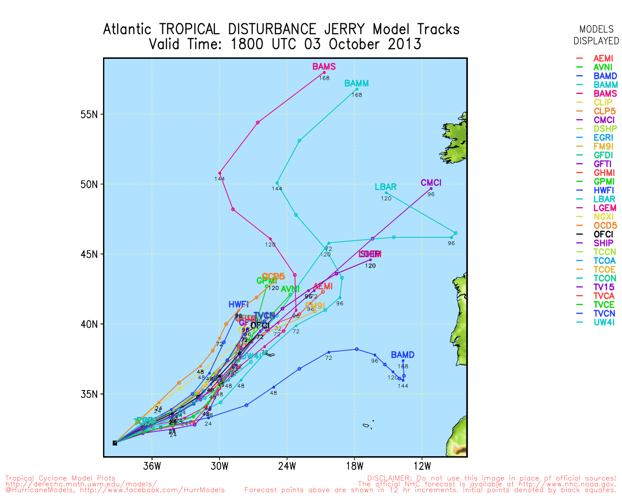
Tropical Depression 11 has been upgraded to Tropical Storm Jerry. Doing a loop in the central Atlantic, but staying far away from land.
Invest 97L likely may impact Florida later in the week, but it has a lot of dry air and shear to deal with, which makes it most likely a rain event. Still worth paying attention to this week in case of any surprises, but it has a low chance to develop this week, around 30%.
Update - Sunday, September 29th, 9:30AM EDT
There has been little change associated with TD#11 in the Central Atlantic as it slowly continues to drift in an anticyclonic loop.
A suspect area with a weak low pressure center has been designated as Invest 97L in the western Caribbean Sea south of Jamaica. The system is moving slowly to the northwest with most of the convection (which is increasing) displaced to the northeast and east of the center. Northerly windshear to the north of the system is expected to move to the north by Monday and provide for a slightly more favorable environment for development. The system is currently quite weak and disorganized so future development (if any) will be slow. Early model outputs suggest a movement to the northwest.
ED
Update - Sunday, September 29th, 1AM EDT
Invest 96L has been upgraded to Tropical Depression #11. Very little movement likely for a couple of days as system slowly loops in the central Atlantic. Southerly shear likely to eventually relax so some additional development is possible - but not a great deal as the environment will again turn hostile in a few days.
Also watching a very disorganized convective area in the central Caribbean Sea which currently shows no signs of organization.
ED
Update - Saturday, September 28th, 1AM EDT
A low pressure center has formed along the tropical wave in the Central Atlantic and there is a medium chance for additional development in the next few days as the system, currently moving at 20kts to the NW, turns more to the north and slows its forward motion. Additional details are in the Storm Forum .
ED
Original Post - Thursday, September 26th, 10:12AM EDT
An upper-level low near 19N 52W should move northwest to about 23N 56W by Friday evening. This movement should relax windshear for a complex but disorganized tropical wave near 12N 42W that is moving slowly west to west northwest.
Otherwise the basin is uncommonly quiet for this normally active timeframe in the hurricane season. In the past 60 years there have been three seasons with no named storms at any time from September 20th through September 26th: 1991, 1997 and 2009. All of these were El Nino seasons, however, there have been other El Nino seasons during this 60 year period - including 2002 and 2004 which were active seasons. In 1993, a slightly positive Neutral year, there were no named storms after September 21st. So far, 2013 is a slightly negative Neutral season.
ED
Edited by MikeC (Mon Sep 30 2013 10:44 AM)


 Threaded


