MikeC
Admin
Reged:
Posts: 4672
Loc: Orlando, FL
|
|
11:00PM EDT Update 21 August 2020
A shift left in the track this evening for Laura, bringing, which means likely a weaker system in the near term, and less impact on Florida, unless center reformation occurs that makes it avoid the islands. If the system survives it could regain strength in the Gulf. We should have a better idea of how much land interaction happens tomorrow night.
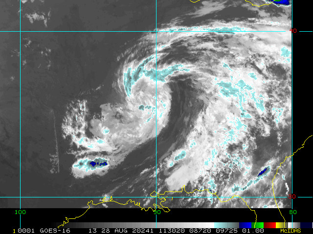
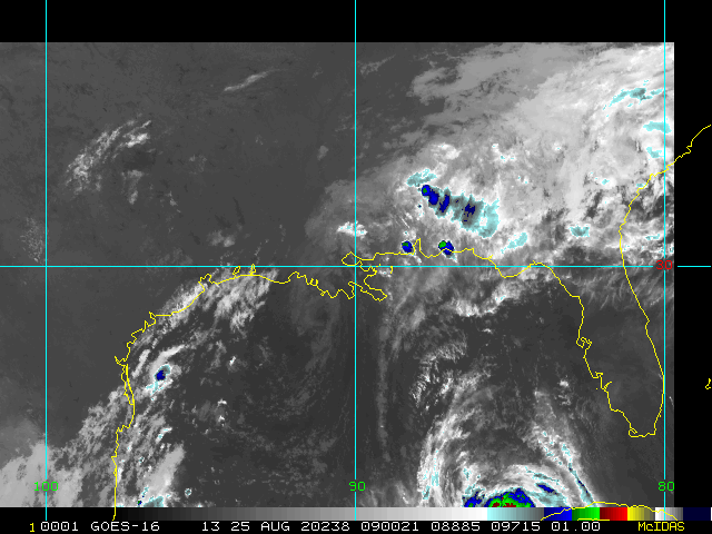
TD14 is now Tropical Storm Marco, but is also struggling to develop, and is no longer forecast to become a hurricane in the Gulf. Other issues that complicate it are when Laura reaches the Gulf, and impacts between the two systems.
Folks in the Gulf need to watch this closely, Florida needs to check tomorrow night or Sunday to see how much land interaction happens and to make sure a center reform to the north does not happen.
9:00AM EDT Update 21 August 2020
Data from a NOAA Hurricane Hunter aircraft indicate that Tropical Depression Thirteen has strengthened and is now Tropical Storm Laura with maximum sustained winds of around 45 mph (75 km/h).
The aircraft also found that the center of Laura is located south of the previously estimated position. These changes will be reflected in the track and intensity forecasts with the upcoming advisory that will be issued at 1100 AM AST.
5:00AM EDT Update 21 August 2020
Tropical Depression 13 (east of the Caribbean) and Tropical Depression 14 (In the West Caribbean) are a potential double hit on the US soon, but both strength and track is still mixed.
For Tropical Depression 13, Tropical Storm Watches are now up for the southeastern Bahamas, joining Puerto Rico, Virgin Islands, Saba and St. Eustatius, St. Maarten, St. Barthelemy, Antigua, Barbuda, St. Kitts, Nevis, and Anguilla under the watch. If the track holds, other parts of the Bahamas may get watches later today, and parts of the Florida Keys and/or South Florida may be under watches tomorrow.
Those in Florida will still want to monitor it closely, since TD13 isn't expected to do much until it is north or just northwest of Puerto Rico. So the state of it at that time may give us a better idea of where intensity may be. Particularly if it winds up going over Hispaniola, which would likely keep it weaker. Beyond Florida, those along the Gulf in the cone will need to watch TD13 as well as 14.
For Tropical Depression 14:
Fourteen is also struggling this morning, but it still forecast to be a hurricane, but a hurricane landfall before the Yucatan is no longer forecast. Currently it's on or just offshore right around the border of Honduras and Nicaragua.
Those in the watch areas in Nicaragua, Honduras,and the Yucatan of Mexico need to watch for any changes, and those along the cone i nthe Northwest Gulf, Texas/Louisiana should watch TD14 closely as well.
In short, the entire Gulf coast needs to be prepared for potential storm impact next week, either from TD13 or 14. The complex nature of both systems, plus the potential for either one of them to intensify at short notice (or not) makes this situation very fluid, so it's advised to keep tabs on these while they are out there since this is not entirely clear cut. TD13's proximity to the Islands Saturday evening is a key timeframe to watch, and the state of TD14 as it approaches the Yucatan, also on Saturday evening, is a key timeframe to watch there.
Another thing to watch with TD13 today is if the northern area of convection associated with it takes off or not, if it does, stronger impacts are more likely, if it does not, there is less chance of it intensifying once near Hispaniola.
8:00AM EDT Update 20 August 2020
Not much has changed overnight since Tropical Depression 13 formed late last evening. The closest approach to the the Caribbean islands is on Friday night and Saturday. More watches for the islands may go up later today. This morning watches have been added for St. Maarten, Antigua, Barbuda, St. Kitts, Nevis, and Anguilla.
Beyond the islands factors like dry air, shear, and land interaction could affect the systems strength, but if it were to avoid land the chances for strengthening are greater, so things could change quickly, particularly when closer to the Bahamas. So those in the rest of the Caribbean, and Florida should continue to watch this closely. It is a fast moving system. For Florida, be prepared in case this decides to rapidly strengthen, as it is late August and the potential for rapid strengthening does exist closer to the Bahamas.
More speculation/discussion in the Forecast Lounge
11:00PM EDT Update 19 August 2020
Tropical Depression 13 Forms east of the Caribbean, and The government of the Netherlands has issued a Tropical Storm Watch for Saba and St. Eustatius. More islands, including Puerto Rico and the Virgin Islands could get watches later tomorrow, and start seeing conditions deteriorate late Friday into Saturday.
This system is expected to move generally westward, and depending on how much land interaction happens with the islands, intensity could be less or much greater than the forecast indicates, also the forward speed and timing toward the end could change. Those along the Northeast Caribbean, Bahamas, and Florida should watch this system very closely the rest of the week.
Also 97L may develop tomorrow or Friday in the Western Caribbean.
4:30PM EDT Update 19 August 2020
Three areas of moderate to high interest, with the first likely to be declared a TD or PTC at any time later today, now tracked as Invest 98L, east of the Windward Islands. Global models do not seem to have a great handle on this system, and one would be forgiven for ignoring them, for now.
Second, and already in the Caribbean, is Invest 97L. This disturbance is slowly closing off, and may develop prior to reaching the western Caribbean, but probably has better odds closer to the Nicaragua - Yucatan zone.
Just entering the far eastern Atlantic, another large tropical wave will be watched for development. currently assigning it a 1-in-3 chance within the next 5 days.
Ciel
Original Entry
With the last advisories issued on Josephine and Kyle today, the attention turns toward the east, with, as of the 2PM outlook on the 16th, has two 40% chance areas.
The first area, closest to the Caribbean, is now being tracked as invest 97L. The other area, is not an invest, yet, but likely will be soon. 97L's chances will likely rise at the 8pm outlook.
Both of these areas have potential for land impacts and should be watched closely over the next week or two. Other areas may also show up at the end of the week. This article will be updated to track them.
August 16th is the start of the dramatic rise toward the peak of hurricane season in mid September, next week is likely to be very busy in the tropics, if not a few days sooner.
See the forecast lounge for more speculation and model talk for these areas.
|
cieldumort
Moderator

Reged:
Posts: 2517
Loc: Austin, Tx
|
|
Recon is finding that THIRTEEN has reformed a good deal south of the naked swirl being tracked last night, and that the cyclone's center is now much closer to 16.6N 59.6W this morning. If confirmed, this could significantly impact future track and intensity, and suggests a voyage that takes the system over more of the rugged island landscapes is now very possible.
|
cieldumort
Moderator

Reged:
Posts: 2517
Loc: Austin, Tx
|
|
This is a solid VORT. I expect an official update to 13's center location soon.
Product: NOAA Vortex Message (URNT12 KWBC)
Transmitted: 21st day of the month at 12:20Z
Agency: National Oceanic and Atmospheric Administration (NOAA)
Aircraft: Lockheed WP-3D Orion (Reg. Num. N42RF)
Tropical Depression: Thirteen (flight in the North Atlantic basin)
Mission Number: 2
Observation Number: 06
A. Time of Center Fix: 21st day of the month at 12:00:13Z
B. Center Fix Coordinates: 16.70N 59.51W
B. Center Fix Location: 153 statute miles (247 km) to the ENE (72°) from Basse Terre, Guadeloupe (France).
C. Minimum Height at Standard Level: 1,523m (4,997ft) at 850mb
D. Minimum Sea Level Pressure: 1011mb (29.86 inHg)
E. Dropsonde Surface Wind at Center: From 247° at 17kts (From the WSW at 20mph)
F. Eye Character: Not Available
G. Eye Shape: Not Available
H. Estimated (by SFMR or visually) Maximum Surface Wind Inbound: 41kts (47.2mph)
I. Location & Time of the Estimated Maximum Surface Wind Inbound: 130 nautical miles (150 statute miles) to the NNE (14°) of center fix at 11:23:08Z
J. Maximum Flight Level Wind Inbound: From 111° at 42kts (From the ESE at 48.3mph)
K. Location & Time of the Maximum Flight Level Wind Inbound: 161 nautical miles (185 statute miles) to the N/NNE (11°) of center fix at 11:14:13Z
L. Estimated (by SFMR or visually) Maximum Surface Wind Outbound: 33kts (38.0mph)
M. Location & Time of the Estimated Maximum Surface Wind Outbound: 6 nautical miles to the SSW (206°) of center fix at 12:01:55Z
N. Maximum Flight Level Wind Outbound: From 206° at 13kts (From the SSW at 15.0mph)
O. Location & Time of the Maximum Flight Level Wind Outbound: 9 nautical miles to the SSW (207°) of center fix at 12:02:42Z
P. Maximum Flight Level Temp & Pressure Altitude Outside Eye: 17°C (63°F) at a pressure alt. of 1,537m (5,043ft)
Q. Maximum Flight Level Temp & Pressure Altitude Inside Eye: 21°C (70°F) at a pressure alt. of 1,523m (4,997ft)
R. Dewpoint Temp (collected at same location as temp inside eye): 10°C (50°F)
R. Sea Surface Temp (collected at same location as temp inside eye): Not Available
S. Fix Determined By: Penetration and Wind
S. Fix Level: 850mb
T. Navigational Fix Accuracy: 0.01 nautical miles
T. Meteorological Accuracy: 7 nautical miles
Remarks Section:
Maximum Flight Level Wind: 42kts (~ 48.3mph) which was observed 161 nautical miles (185 statute miles) to the N/NNE (11°) from the flight level center at 11:14:13Z
Maximum Flight Level Temp: 24°C (75°F) which was observed 30 nautical miles (35 statute miles) to the N (354°) from the flight level center
|
cieldumort
Moderator

Reged:
Posts: 2517
Loc: Austin, Tx
|
|
Continuing the 2020 record-setting trend, Laura bests the prior earliest 12th named storm in the Atlantic Basin, previously held by Luis from August 29th, 1995.
|
MikeC
Admin
Reged:
Posts: 4672
Loc: Orlando, FL
|
|
Caribbean radar composite recording http://flhurricane.com/imageanimator.php?544
|
MikeC
Admin
Reged:
Posts: 4672
Loc: Orlando, FL
|
|
Looks like 14 will become Marco at 11PM
|
MikeC
Admin
Reged:
Posts: 4672
Loc: Orlando, FL
|
|
Marco seems to be having a interesting intensity run, from recon, with a small core, and a bit north of the official point on top of it. Really curious to see what recon finds with it this morning.
|
MikeC
Admin
Reged:
Posts: 4672
Loc: Orlando, FL
|
|
Recon fix for Marco: 20.5N 85.1W
8am position: 20.2N 85.2W
NNE of that, this may mean some changes coming up for 11AM.
best track has 993mb
|
MikeC
Admin
Reged:
Posts: 4672
Loc: Orlando, FL
|
|
Laura's Low Level center is on the Northeast part of Puerto Rico, but the Mid Level center is south southeast of the island (which is much much more obvious on radar).
San Juan Radar recording http://flhurricane.com/imageanimator.php?545
|
Robert
Weather Analyst

Reged:
Posts: 366
Loc: Southeast, FL
|
|
I don't know what any of you are looking at, and last night i was seeing the making a big mistake to.
The low level center out ran the mid level yesterday night and morning, and mainly over Hispaniola, the mid level trailing far behind, the low level hit the islands and is dying , the vigorous mid level is dropping the new center South south east of Puerto rico.... The system is also coming under the influence of building high moving off the , Ventilated North east by upper feature, and soon to be ventilate south west by a small upper low that is just southwest of hati! .....Hispanola and that little upper will kill the low level, Laura is now moving slower stacked and in a good environment, and looks to clear the islands through the mona passage and come up on the north coast and avoid the high mountains.... i see no reason this should not follow marcos trend of strengthening and become a hurricane before the bahamas, just miss the mountians, then watch models correct as stronger and stronger values get input into the runs.
Edited by Robert (Sat Aug 22 2020 11:55 AM)
|
doug
Weather Analyst
Reged:
Posts: 1006
Loc: parrish,fl
|
|
The mid level of Laura may become the dominant. That is the key to this storm’s future, if it becomes stacked it will become dangerous. If not it should fizzle.
As for Marco the Forecast is likely pretty reliable.
--------------------
doug
|
Joeyfl
Weather Guru

Reged:
Posts: 133
Loc: St.Pete,FL
|
|
Marco has been moving more North to NNW because it's become significantly stronger and deeper and is feeling more of the upper level steering new guidance is jumping further east for obvious reasons and I d expect changes in track coming with much bigger impacts for areas western FL panhandle to Louisiana. Interesting HMON had this pretty well advertised.
|
|


 Threaded

