MikeC
Admin
Reged:
Posts: 4636
Loc: Orlando, FL
|
|
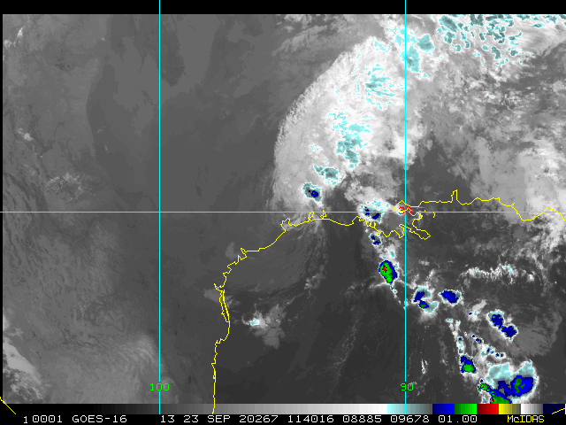
1:30AM CDT 16 September 2020 Update
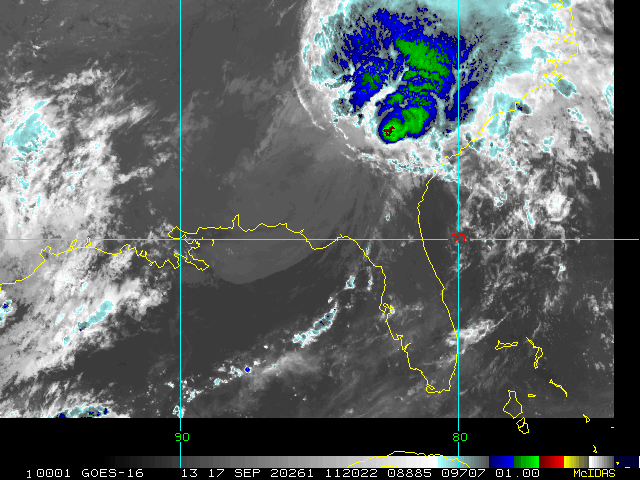
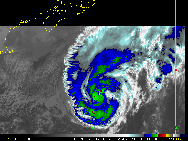
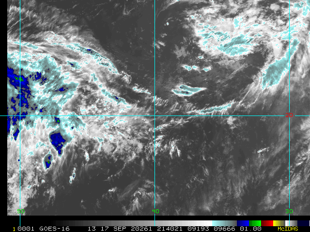
Sally is now a still-intensifying 105 MPH Cat 2 hurricane on the Saffir-Simpson Scale. Also, Teddy has rapidly jumped from Tropical Storm to an 85 MPH Hurricane Teddy. Teddy may become Bermuda's second direct hit this season, even stronger than Paulette, as a Major. Speaking of Major Hurricanes, there is a moderate to high chance that Sally becomes a Major hurricane by sunrise.
NHCQuote:
Hurricane Sally Special Advisory Number 20
NWS National Hurricane Center Miami FL AL192020
130 AM CDT Wed Sep 16 2020
...SALLY CONTINUES TO STRENGTHEN AS HURRICANE CONDITIONS SPREAD ONSHORE THE GULF COAST FROM PENSACOLA BEACH FLORIDA WESTWARD TO DAUPHIN ISLAND ALABAMA...
...HISTORIC LIFE-THREATENING FLOODING LIKELY ALONG PORTIONS OF THE NORTHERN GULF COAST...
SUMMARY OF 130 AM CDT...0630 UTC...INFORMATION
----------------------------------------------
LOCATION...29.9N 87.8W
ABOUT 60 MI...95 KM SSE OF MOBILE ALABAMA
ABOUT 55 MI...90 KM SW OF PENSACOLA FLORIDA
MAXIMUM SUSTAINED WINDS...105 MPH...165 KM/H
PRESENT MOVEMENT...NNE OR 30 DEGREES AT 2 MPH...4 KM/H
MINIMUM CENTRAL PRESSURE...968 MB...28.59 INCHES
WATCHES AND WARNINGS
--------------------
CHANGES WITH THIS ADVISORY:
A Storm Surge Warning has been discontinued from the Mouth of the
Mississippi River to the Mouth of the Pearl River.
SUMMARY OF WATCHES AND WARNINGS IN EFFECT:
A Storm Surge Warning is in effect for...
* Mississippi/Alabama border to the Walton/Bay County Line Florida
* Mobile Bay
A Hurricane Warning is in effect for...
* East of Bay St. Louis Mississippi to the Okaloosa/Walton County line Florida
A Tropical Storm Warning is in effect for...
* East of the Okaloosa/Walton County line Florida to Indian Pass Florida
* Bay St. Louis Mississippi westward to Grand Isle Louisiana
-Ciel
11:30PM CDT 15 September 2020 Update
Technical note, Sally's advisory in the Current Storms bar is not updating and so please disregard.
Sally is now likely a Cat 2 and may have some regions of gusts into Cat 3 (in gusts). Still strengthening.
Epic flooding underway. NWS Mobile, Al just reported **OVER 16 INCHES** so far and counting.
Efforts to protect life and property should have already been completed, and in the evac zones one should only be on the road if clearly safe to do so and heading for higher ground pronto. It may already be too late, and loss of property and life in this hurricane could be much higher than feared with many disregarding it for 'only being Cat 1.'
-Ciel
7:45PM CDT 15 September 2020 Update
Sally is strengthening into landfall, with both pressure lowering, and with more parts of the now expansive wind field hitting Category 1 force, with indications that gusts to Cat 2 may becoming somewhat widespread in the northeast quadrant. Additionally, mini-supercells within the banding are starting to spin waterspouts and as these travel further onto land, tornadoes.
But the wind and tornado threat as bad as they are, Sally's calling card is most likely to be her flooding, both storm surge, and inland flooding. As examples, rivers may back up due to the combination of surge from the south, and runoff from everywhere else, then spill out over towns and roads to become storm-made lakes suddenly appearing seemingly out of nowhere, etc. The surge susceptible northeast Gulf will likely see some places with water reaching very dangerous and life-threatening levels, etc.
Update Watches, Warnings and Discussions
WPC:
THERE IS A HIGH RISK OF EXCESSIVE RAINFALL ACROSS PORTIONS OF THE GULF COAST ACROSS SOUTHERN ALABAMA AND WESTERN FLORIDA PANHANDLE... ...WIDESPREAD SIGNIFICANT FLASH FLOODING, POTENTIALLY LIFE-THREATENING, IS EXPECTED ALONG THE SLOW-MOVING TRACK OF HURRICANE SALLY...
*Weather conditions indicate that significant flooding can be expected during the outlook period.
* The latest forecast storm total rainfall from Sally calls for 10 to 20+ inches of rain from far southeastern Mississippi to the western Florida Panhandle, with 4 to 8 inches (and locally higher amounts) farther inland along the track through the Southeast U.S.
NHC:
TROPICAL-STORM-FORCE WINDS CONTINUE TO SPREAD ONSHORE ALONG THE NORTH-CENTRAL GULF COAST...
...HISTORIC LIFE-THREATENING FLOODING LIKELY ALONG PORTIONS OF THE NORTHERN GULF COAST...
A Storm Surge Warning is in effect for...
* Mouth of the Mississippi River to the Okaloosa/Walton County Line Florida * Mobile Bay
A Hurricane Warning is in effect for... * East of Bay St. Louis Mississippi to Navarre Florida
A Tropical Storm Warning is in effect for... * East of Navarre Florida to Indian Pass Florida * Bay St. Louis Mississippi westward to Grand Isle Louisiana
SPC:
The NWS Storm Prediction Center has issued a Tornado Watch for portions of a small part of southwest Alabama and much of the Florida Panhandle Coastal Waters. Effective this Tuesday afternoon and Wednesday morning from 550 PM until 600 AM CDT.
-Ciel
6:45AM CDT 15 September 2020 Update
Hurricane Sally, after a quick intensification run yesterday, has leveled off and weakened slightly back to an 85MPH category 1 hurricane.
It may make be making another strengthening run this morning, but the time for that is short as shear may be picking up as it moves slowly toward land and will likely be on a weakening trend then. However, surge and ultra flooding rainfall are already a problem in certain areas along the GUlf coast, and the rain likely won't stop all day in areas it has started, particularly from about Destin, FL to Gulfport, MS. Areas east of there will get lots of banding rain, but not as frequently. Flooding likely will be historic for the area. Landfall isn't even forecast until late Wednesday morning.
The hurricane warning now is from East of the Mouth of the Pearl River to the Navarre Florida
3:30AM CDT 15 September 2020 Update

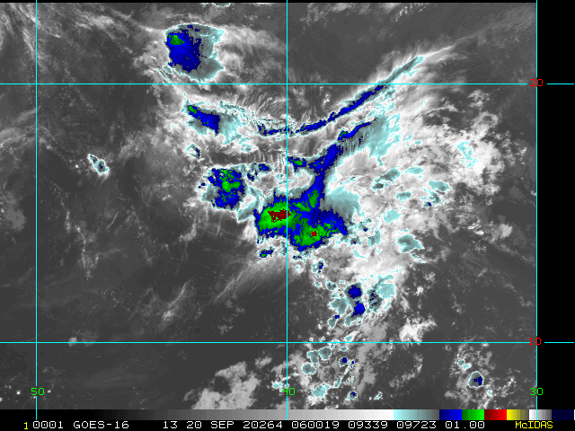
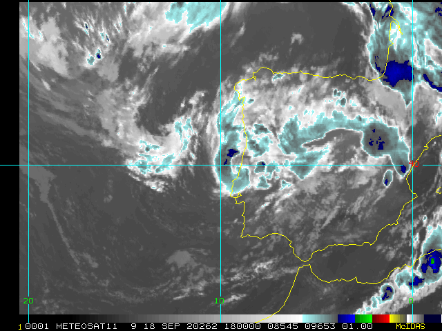
Right now all eyes are rightly focused on the northern Gulf of Mexico with Hurricane Sally. However, while we are in the middle of track intermission as the cyclone is pulling up to a crawl and maybe even a stall, it is worth pointing out that 2020 is also presently extremely active in the rest of the Atlantic basin - and even the Mediterranean basin! (which in many ways is sort of an extension of the Atlantic at this time of year).
2020 is a hyperactive season. We are on the cusp of entering the Greek alphabet, and sooner than we did in '05. Now is a perfect time to recheck and update preps - even those not in the path of Sally - as it looks like the season is nowhere near wrapping up just yet.
-Ciel
10:00PM CDT 14 September 2020 Update
Hurricane Sally has slowed strengthening (at least for now) as a 100mph hurricane and is moving extremely slowly to the west northwest. This makes the track very difficult to pinpoint as it may drift east or west for unknown periods of time.
Basically, from the , There continues to be a significant amount of uncertainty on exactly where and when Sally turns northward and makes landfall, with model solutions ranging from a landfall on the Florida panhandle to a landfall in extreme southeastern Louisiana. It should be emphasized that it is always challenging to forecast the track of hurricanes in weak steering currents, and in Sally's case the weak steering is occurring very near land.
There is a chance Sally could have another strenghtening run before landfall, so be aware, but somewhere between about 12-24 hours shear will likely start to pick up to hold off any further intensification.. Surge and rainfall will be a large problem, so far the bands have slipped onto parts of the Panhandle and Alabama and will expand further west and more inland over time tomorrow.
The Hurricane Warning west of Grand Isle to Morgan City, Louisiana, has been downgraded to a Tropical Storm Warning. But The Hurricane warning remains up east of Grand isle to the Florida/Alabama border.
Surge estimates have shifted east from 6-9 feet across most of Missisippi and Mobile bay, and 4-7 feet east toward Pensacola.
3:00PM EDT 14 September 2020 Update
The 2020 Atlantic Hurricane Season. It goes without saying that 2020 is a record-setting, hyperactive year. Just how record-setting and hyperactive? Here are a few tidbits.
The National Hurricane Center is issuing advisories on five tropical cyclones in the Atlantic basin, tying the record for the most number of tracked TCs there at one time, for the first time since September 1971.
We now have Vicky. We've only had a "V" storm one other time. Vince, of 2005. Of October, 2005. Vicky is also the earliest 20th Atlantic named storm. The prior record was held when Tammy was named on October 5, 2005. (There was a previously unnamed storm identified post-season in 2005 between Stan and Tammy).
Sally will now likely make landfall as a hurricane. This would be the 4th hurricane landfall this year, and potentially as a Major. The most recent year with 4 or more US hurricane landfalls was 2005, with a total of 5 that year.
Sally has become the 4th hurricane in the Gulf of Mexico this season. Only 5 other years in the official record have had four or more GOM hurricanes by this date. Those years were 1886, 1933, 1936, 2005 and 2017.
Sally has become the 7th hurricane of 2020 Atlantic hurricane season. Only six other years in the official record have had seven or more hurricanes by this date. Those years were 1886, 1893, 1933, 1995, 2005, and 2012.
Sources: Dr. Phil Klotzbach, Dr. Marshall Shepherd,
-Ciel
12:00PM EDT 14 September 2020 Update
...NOAA HURRICANE HUNTERS FIND THAT SALLY HAS RAPIDLY STRENGTHENED TO A HURRICANE...
7:00AM EDT 14 September 2020 Update
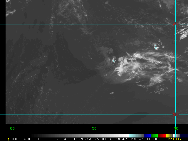
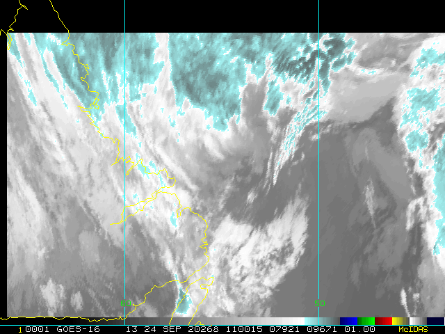
Busy in the tropics, Tropical Storm Teddy has formed in the east Atlantic, Hurricane Paulette is over Bermuda, Tropical Depression 21 has formed.off the coast of Africa, and Rene is still holding on as a tropical Depression, and Sally...
The organization of Sally hasn't changed much during the overnight as thought judging by the convection burst that started last night, based on recon flights it did not translate into any intensification this time. It also shifted a bit west, that said the current forecast track looks fairly good, slow movement, category 1 or 2 hurricane landfall and shortly after (or just during) landfall the storm is expected to weaken quickly. The flooding rains and surge will likely be the biggest impact, although short lived tornadoes and cat 1/2 wind damage is still likely in some airs.
The system is expected to move very slowly toward Southeast Louisiana then curve slowly northward into coastal Mississippi, with very heavy rains at times, especially near the center. Most of the rain is currently offshore except for bands right near Panama City, FL, they will become more and more frequent into Tuesday Evening.
Storm surge flooding depends on the relative timing of the surge and the tidal cycle, and can vary greatly over
short distances. Rainfall will likely be 8 to 24 inches in various areas depending on the exact path of the storm.

Hurricane Paulette is has moved directly over Bermuda and most of the island is currently within the eye.
11:30AM EDT 13 September 2020 Update
Sally is now a strengthening 60mph Tropical Storm, Hurricane Warnings are up for much of Southeast Louisiana and coastal Mississippi.
Changes now, the Hurricane Warning along the coast of Louisiana has been extended westward to Morgan City.
A Tropical Storm Warning has been issued for the coast of Louisiana from west of Morgan City to Intracoastal City.
Today will be the last full day to prepare in the area. Please listen to local media
Storm Surge is forecast to be between 4-11 feet ins parts of SE Lousiana, and 4-7 in Mississippi, depending on the exact angle of approach of the system.
3:30PM EDT 12 September 2020 Update
TD19 is now Tropical Storm Sally. Additional Watches/Warnings may be issued at 5PM.
Original Update
Tropical Depression 19 is affecting the Florida Keys and South Florida right now, and is currently over the everglades and expected to move into the Gulf later today. The forecast now calls for a hurricane at landfall in the northern gulf, and hurricane and storm surge watches may be issued for areas in the cone later today.
There is some potential for this system to develop to be even stronger than currently forecast before reaching the northern Gulf, so please pay attention to updates surrounding it and listen to local media and officials for any information specific to your area. Or look at the Local Storm Statements from your local national weather service office.
One interesting bit to note, the track direction is one that has high surge potential for those to the right of landfall as it gives longer periods of onshore winds than a typical track to the north Gulf. So look for high potential for surge flooding along a wider area.
Right now only a Tropical Storm watch is up for Ochlockonee River to Okaloosa/Walton County Line
Recon is scheduled to investigate TD19 in a few hours. If it gets named, which is likely today, it will be Sally.
Hurricane Warnings are now up for Bermuda from Paulette, now forecast to be a category 2 when near Bermuda.
Model analysis, discussion and more in the Hurricane Sally Forecast Lounge
Model analysis, discussion and more in the 95L Forecast Lounge
Keys Webcams
Invest 90L Forecast Lounge
Edited by cieldumort (Wed Sep 16 2020 06:06 AM)
|
cieldumort
Moderator

Reged:
Posts: 2497
Loc: Austin, Tx
|
|
Based on radar, satellite, lightning and recon, it appears that the center has definitely reformed to the northeast, and a period of Rapid Intensification is likely underway.
|
MikeC
Admin
Reged:
Posts: 4636
Loc: Orlando, FL
|
|
Sally is now a hurricane.
|
MikeC
Admin
Reged:
Posts: 4636
Loc: Orlando, FL
|
|
Eastern bands of Sally are intense, it looks like it's making another strengthening run tonight. The rain from this is going to be one of the worst ever for the area.
|
MikeC
Admin
Reged:
Posts: 4636
Loc: Orlando, FL
|
|
Recon finding 969mb, it is going for another strengthening run. 972 in the vortex message.
|
Psyber
Storm Tracker

Reged:
Posts: 237
Loc: Ontario, Canada
|
|
Sandy, at least Part 1 looks to be so much like a damn Havey. 2MPH is going to absolutely smash floodway systems on a storm that is FULL of water. And if it recurves SOUTH once it hits water for Sandy Part 2 on the other side of the Carolinas? Sheesh.
The way 99L has organized, it must be pretty close to a classification.
--------------------
The safest way to deal with a potential Hurricane hitting you...is to leave and just not be there at all.
|
cieldumort
Moderator

Reged:
Posts: 2497
Loc: Austin, Tx
|
|
Radar and recon data is starting to suggest that Sally is on the cusp of Cat 2 now. has not yet confirmed this. 10:00PM CDT update held at 85MPH.
|
cieldumort
Moderator

Reged:
Posts: 2497
Loc: Austin, Tx
|
|
Quote:
Hurricane Sally Tropical Cyclone Update
NWS National Hurricane Center Miami FL AL192020
1200 AM CDT Wed Sep 16 2020
...12 AM CDT POSITION UPDATE...
...SALLY STRENGTHENS INTO A CATEGORY 2 HURRICANE AS IT INCHES NORTH-NORTHEASTWARD...
Recent data from An Air Force Reserve reconnaissance aircraft and the Mobile Alabama Doppler weather radar indicate that Sally has strengthened to 100 mph (160 km/h).
If further strengthening becomes likely before Sally's center reaches the northern Gulf coast later this morning, then a Special Advisory will be issued at 100 AM CDT.
A sustained wind of 76 mph (122 km/h) with a gust to 96 mph (155 km/h) was recently reported in Sally's northern eyewall by NOAA buoy 42012, located about 50 miles southeast of Mobile, Alabama. An unofficial report of a wind gust to 60 mph (97 km/h) was recently received from an amateur radio operator in Navarre Beach, Florida.
SUMMARY OF 1200 AM CDT...0500 UTC...INFORMATION
-----------------------------------------------
LOCATION...29.8N 87.8W
ABOUT 65 MI...105 KM SSE OF MOBILE ALABAMA
ABOUT 60 MI...95 KM SW OF PENSACOLA FLORIDA
MAXIMUM SUSTAINED WINDS...100 MPH...160 KM/H
PRESENT MOVEMENT...NNE OR 030 DEGREES AT 2 MPH...4 KM/H
MINIMUM CENTRAL PRESSURE...970 MB...28.64 INCHES
$$
Forecaster Stewart
|
cieldumort
Moderator

Reged:
Posts: 2497
Loc: Austin, Tx
|
|
Quote:
Hurricane Sally Tropical Cyclone Update
NWS National Hurricane Center Miami FL AL192020
100 AM CDT Wed Sep 16 2020
...SALLY CONTINUING TO STRENGTHEN, A SPECIAL ADVISORY IS COMING OUT SHORTLY...
Recent data from An Air Force Reserve reconnaissance aircraft and the Mobile Alabama Doppler weather radar indicate that Sally'smaximum sustained winds have increased to 105 mph (165 km/h).
Further strengthening is possible, and a Special Advisory will be issued within 15 minutes in lieu of the intermediate advisory to update the intensity forecast.
SUMMARY OF 100 AM CDT...0600 UTC...INFORMATION
----------------------------------------------
LOCATION...29.9N 87.8W
ABOUT 60 MI...95 KM SSE OF MOBILE ALABAMA
ABOUT 55 MI...85 KM SW OF PENSACOLA FLORIDA
MAXIMUM SUSTAINED WINDS...105 MPH...165 KM/H
PRESENT MOVEMENT...NNE OR 030 DEGREES AT 2 MPH...4 KM/H
MINIMUM CENTRAL PRESSURE...968 MB...28.58 INCHES
|
Psyber
Storm Tracker

Reged:
Posts: 237
Loc: Ontario, Canada
|
|
It would be interesting to find out how a hurricane that had been knocked east by a small ridge not only maintained but increased its inflow and now that it's N/W edge is over land, the barometer has dropped to 968 as it INTENSIFIES.
Perhaps a Met can explain this to me? You would think that this storm would bet getting smashed down due to its size being so small.
PRESENT MOVEMENT TOWARD THE NORTH-NORTHEAST OR 30 DEGREES AT 2 KT
ESTIMATED MINIMUM CENTRAL PRESSURE 968 MB
EYE DIAMETER 30 NM
MAX SUSTAINED WINDS 90 KT WITH GUSTS TO 110 KT. 105MPH gusts to 130MPH
64 KT....... 35NE 20SE 0SW 25NW.
50 KT....... 70NE 40SE 30SW 50NW.
34 KT.......110NE 110SE 80SW 80NW.
12 FT SEAS..120NE 120SE 90SW 90NW.
--------------------
The safest way to deal with a potential Hurricane hitting you...is to leave and just not be there at all.
Edited by Psyber (Wed Sep 16 2020 02:53 AM)
|
|


 Threaded


