cieldumort
Moderator

Reged:
Posts: 2517
Loc: Austin, Tx
|
|
2:45AM CDT 30 October 2020 Update
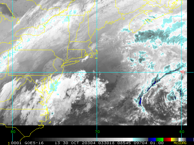
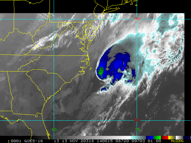
A new disturbance has just been Invest tagged in the eastern Caribbean and we have begun tracking 96L. Odds favor development by early next week as it comes closer to Central America.
We remain in an active late-season pattern close to home during this hyperactive year with echos of 2005 in it, and as much as we all would like to say things are over, it's not over until it's over.
4:30PM CDT 28 October 2020 Update
Zeta landfalls near Cocodrie, LA. The most recent recon pass suggests landfall as a Cat 2/3 borderline 110 MPH +/- hurricane. Storm surge risk has increased again, now 7-11 feet. A wave fetch has also been recorded at a stunning 50'.
2:30AM CDT 28 October 2020 Update
Zeta could be undergoing Rapid Intensification tonight. Recon is on the way, and we should know within a few hours just how much stronger the hurricane has already become. On satellite it has the appearance of a tropical cyclone that wants to Major.
Interests in southern and southeastern Louisiana should be rushing preparations to protect life and property to completion, as deadly storm surge and vicious wind is just hours away.
5:30AM EDT 26 October 2020 Update
Recon continues to find Zeta rapidly intensifying this late overnight/predawn morning, and a direct impact from a formidable hurricane on the northeastern Yucatan looks likely, especially with conditions favoring further intensification until landfall.
Before midweek, Zeta will probably recurve and head north or north-northeast ahead of an ejecting trough now over the southwest. This will act to accelerate Zeta's forward speed so that there shouldn't be much in the way of upwelling. While some weakening from traveling over the Yucatan may make it a little harder for Zeta to rapidly intensify back up before making landfall along the US gulf coast, models that have digested all the recent additional data suggest that the cyclone could pull it off, and locations from Louisiana to northwestern Florida may want to begin preparing for a strong hurricane.
Original entry
4:30PM EDT 24 October 2020 Update
Recon has found just enough organization for Invest 95L to qualify as a TD, and advisories are being issued. Interests in the north-northwest Caribbean and north-northeast Gulf of Mexico may want to begin paying close attention.

Conditions for development in the western Atlantic are going up this week and forecast to remain at least somewhat favorable in spots for a while. Given that we are in a record-setting hyperactive season that started early and may very well end late, and with several additional disturbances possible over the next few weeks, this region, much closer to home, deserves more attention than usual at this time of year.
Today, October 23rd, we are watching a vigorous disturbance in the Caribbean that has rapidly pulled itself together in just the past 18 hours, Invest 95L. This Low may become a Tropical Cyclone as soon as later today or tonight, and interests from Cuba to the Yucatan, S Florida, the Keys, and maybe the Bahamas or even the north central Gulf, may want to begin following closely.
Recon is scheduled to fly 95L tomorrow. It is possible that they will find a Tropical Storm at that time. The next Greek name on the list to be used is Zeta, and would tie 2005 for the most named storms at twenty-seven. 2005 also had an unnamed storm added post-season, for a total of 28 cyclones with sustained winds at or above 39 MPH.
Elsewhere, Hurricane Epsilon is now heading out to sea, but may become a very powerful post-tropical cyclone while approaching Europe next week.
Zeta Forecast Lounge
Invest 96L Forecast Lounge
Edited by MikeC (Sat Oct 31 2020 11:23 PM)
|
MichaelA
Weather Analyst

Reged:
Posts: 952
Loc: Pinellas Park, FL
|
|
Seriously! Louisiana has had enough this season! Models seem to be coalescing on the same area that Laura and Delta have affected. Gamma fizzled and just rained itself out there. Sally missed them to their east.
--------------------
Michael
PWS
|
OrlandoDan
Weather Master

Reged:
Posts: 456
Loc: Longwood, FL
|
|
I don't know about this track. I think a stall by Zeta will cause a late curvature to the east as more higher latitude fronts come in from the NW. It's possible.
--------------------
Keith (1988), Charley (2004), Frances (2004) , Jeanne (2004), Fay (2008), Mathew (2016), Irma (2017), Dorian (2019)
Personal Weather Station: https://www.wunderground.com/dashboard/pws/KFLLONGW67
|
cieldumort
Moderator

Reged:
Posts: 2517
Loc: Austin, Tx
|
|
Been a rough year for the Bayou State.

Image credit: Sam Lillo
With Zeta continuing to drift farther south (and now maybe even a bit southeast), the odds of it following just within the cone may be going down. I'm sure Louisianans wouldn't complain if it went elsewhere.
|
cieldumort
Moderator

Reged:
Posts: 2517
Loc: Austin, Tx
|
|
For a little history and levity Saga of Epsilon and Zeta (2005).
NHC has done amazing work in the face of yet another insanely hyperactive season, and this time during the worst pandemic in a century, among other challenges. We are very lucky to have such great men and women working around the clock to provide us all with ever increasingly accurate, reliable, life-saving forecasts.
|
cieldumort
Moderator

Reged:
Posts: 2517
Loc: Austin, Tx
|
|
SUMMARY OF 500 PM EDT...2100 UTC...INFORMATION
----------------------------------------------
LOCATION...17.7N 83.4W
ABOUT 305 MI...490 KM SSE OF THE WESTERN TIP OF CUBA
ABOUT 300 MI...480 KM SE OF COZUMEL MEXICO
MAXIMUM SUSTAINED WINDS...50 MPH...85 KM/H
PRESENT MOVEMENT...NEARLY STATIONARY
MINIMUM CENTRAL PRESSURE...999 MB...29.50 INCHES
WATCHES AND WARNINGS
--------------------
CHANGES WITH THIS ADVISORY:
The government of Mexico has issued a Hurricane Warning for the
Yucatan Peninsula from Tulum to Rio Lagartos, including Cozumel.
SUMMARY OF WATCHES AND WARNINGS IN EFFECT:
A Hurricane Warning is in effect for...
* Tulum to Rio Lagartos Mexico
* Cozumel
A Tropical Storm Warning is in effect for...
* Pinar del Rio Cuba
|
cieldumort
Moderator

Reged:
Posts: 2517
Loc: Austin, Tx
|
|
Recon is finds that Zeta may now be Cat 2, and still intensifying.
|
MikeC
Admin
Reged:
Posts: 4673
Loc: Orlando, FL
|
|
105mph at the surface at 3pm.
|
cieldumort
Moderator

Reged:
Posts: 2517
Loc: Austin, Tx
|
|

|
kspkap
Weather Watcher
Reged:
Posts: 35
|
|
Mike, as I’ve wrote before I now live on the MS Gulf Coast across the street from the Gulf. Zeta has come knocking! My daughter is visiting there. I happen to be visiting at the moment in my home town of St. Cloud here in Florida, She just called me to inform me I’ve lost my porch screening I recently had replaced from Cristobol in June. It also appears the house is losing it’s metal underbelly on top of my truck. They’ve lost power and the house, on 16 inch concrete piers is shaking. She and my Yorkie have moved into the pantry.
The Gulf has covered the beach and preparing to breach the seawall to flow onto U S 90. The MS Gulf Coast has been spared this season until now. LA, AL & FL have received the brunt of the storms this year, so now a decision was made not to forget good old Mississipi.
Daughter just called again. Driving rain is pouring through my front door, glass side panels from top to bottom, and through the transom. I was informed today part of my roof is hanging beating my Hardie Board siding. My porch ceiling fans are in pieces. It was a freak storm with gusts up to 122 mph! It took everyone by surprise...even the Weather Channel.
————————————-
Donna-1960, -2004, -2004, Jeanne-2004, Issac-2012, Zeta-2020 
Edited by kspkap (Thu Oct 29 2020 08:18 PM)
|


 Threaded


