MikeC
Admin
Reged:
Posts: 4675
Loc: Orlando, FL
|
|
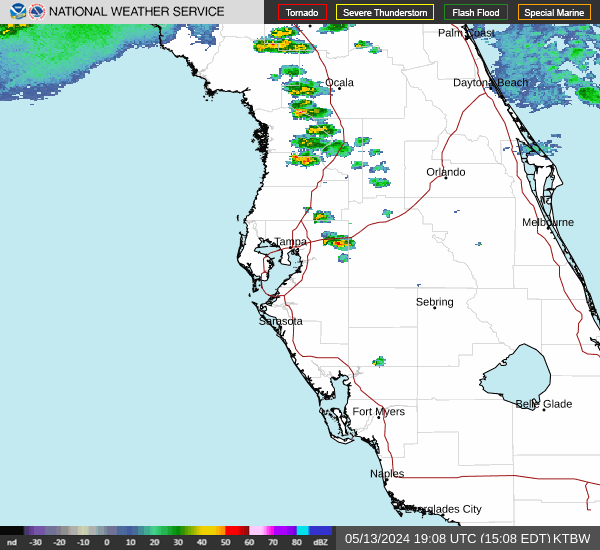
6:30PM EST Update 11 November 2020
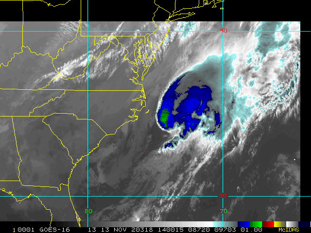
Eta is moving up just west of Tampa tonight, around 60mph winds, and some surge has been seen in Sarasota to Tampa, some tornadic action, but in general so far so good. So far 18,632 outages have been reported.
8:00AM EST Update 11 November 2020
Reports from a NOAA Hurricane Hunter aircraft and Doppler radar data indicate that Eta has re-strengthened into a hurricane offshore the southwestern coast of Florida, with maximum sustained winds of 75 mph (120 km/h), with higher gusts.
8:00AM EST Update 10 November 2020
Tropical Storm Eta is a little better organized this morning, now with 60mph winds. It is expected to stall out today then start moving back generally north all while bringing occasional heavy bands of rain across Florida off and on through the next several days. The forecast track has it slowly dying out as it moves north due to dry air and increasing shear. A weaker storm in this situation would likely be more like this cone, but if Eta strengthens more than expected this may shift back more to the northeast, so it's still worth watching especially since the latest radar and satellite suggest it may be drifting or reforming back a bit to the northeast .
Also Subtropical storm Theta has formed in the East Atlantic and is moving out to sea. There is also an area in the Caribbean with a 70% chance to develop.
11:15P EST Update 8 November 2020
Eta makes landfall in Lower Matecumbe Key, FL as a 65mph tropical storm. Tropical Storm Eta is moving over the Florida Keys now, and forecast to become a hurricane as it moves away from the Keys, it is forecast to meander in the Gulf for a few days before bending back toward Florida.
11:30AM EST Update 7 November 2020
Eta is once again a tropical storm, with winds of 50mph (Based on a special advisory issued on recon findings). Tropical Storm watches have been extended north along the Florida east
coast from Sebastien Inlet to the Brevard/Volusia county line and on the west coast Florida west coast north of Bonita Beach to Englewood.. The watches the east coast north of Golden Beach Florida to the Brevard/Volusia county line and the west coast north of Chokoloskee to Englewood and also Lake Okeechobee.
Tropical Storm Warnings replaced the watches in from Golden Beach to Chokoloskee, including Florida Bay, and The Florida Keys.
WInd is slowly starting to pick up in Florida, but it's not directly related to Eta yet, but it is impacted by the fringes and outer rush in.
11PM EST Update 6 November 2020
Tropical Storm watches are now up for the coast of South Florida from Jupiter Inlet southward on the east coast and from Bonita Beach southward on the west coast, including Lake Okeechobee. Also included in this watch are the Florida Keys from
Ocean Reef southward to the Dry Tortugas, including Florida Bay.
The northwestern Bahamas area also under a Tropical Storm Watch, including the Abacos, Andros Island, Berry Islands, Bimini, Eleuthera, Grand Bahama Island, and New Providence.
Eta is expected to regain tropical storm strength overnight tonight, there remains a small chance that it may regain hurricane strength, but it's more likely to turn subtropical making a very ugly few days in Central and Southern Florida next week.
10PM EST Update 5 November 2020
Eta is back over the water and much weaker, and the forecast has it near the Keys Sunday evening, tropical storm watches could go up tomorrow night or Saturday for parts of that area. The forecast remains very difficult with strong trough interactions, but may become slightly more clear tomorrow.
Original Update
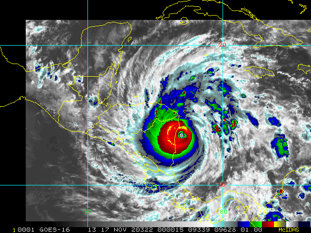
Hurricane Eta is rapidly strengthening this morning and likely will hit Nicaragua as a category 4 or 5 hurricane, along with very slow movement, it is likely to be a catastrophic event for the Central American country, and neighboring Honduras as well.
Beyond this it or a spin off may re-emerge in the Caribbean so there may be more to come.
Eta Forecast Lounge
|
MikeC
Admin
Reged:
Posts: 4675
Loc: Orlando, FL
|
|
Recon, after two failed attempts to get out today, is en route to Eta, with now 150mph winds. It is very close, if not already, to a cat 5 threshhold, and numbers are approaching 8.0, which is a very extreme hurricane. Those in Nicaragua are going to get slammed.
|
MikeC
Admin
Reged:
Posts: 4675
Loc: Orlando, FL
|
|
Raw T number of 7.9, which supports around 180-190mph winds recon is heading in.
|
MikeC
Admin
Reged:
Posts: 4675
Loc: Orlando, FL
|
|
Raw Satellite estimate of 8.1 which puts it in the top 10 of all time most powerful storms worldwide. Recon getting close, so we'll have a better idea of true numbers
|
MikeC
Admin
Reged:
Posts: 4675
Loc: Orlando, FL
|
|
As Recon is making the approach Raw T#s are at 8.4 (Scale ends at 8.5) Which is the Raw #s seen in Patricia.
|
cieldumort
Moderator

Reged:
Posts: 2520
Loc: Austin, Tx
|
|
927.4mb, ouch
|
MikeC
Admin
Reged:
Posts: 4675
Loc: Orlando, FL
|
|
Recon missed the center slightly on the first pass, but found 924mb and 130-140knot winds. Drop off gradient is extremely steep, no dropsonde in the first pass.
|
MikeC
Admin
Reged:
Posts: 4675
Loc: Orlando, FL
|
|
927mb with the first dropsonde, likely just offset from the center. 150mph for the 10pm official, more passes may force it up, though.
|
MichaelA
Weather Analyst

Reged:
Posts: 952
Loc: Pinellas Park, FL
|
|
Eta is definitely a historic storm in November in a historic season. Will it continue to intensify, or start an eye wall replacement cycle? Satellite imagery shows a small, compact system. These types of systems don’t always obey the norms. The model runs at 4 - 5 days out are not very comforting either. If Eta survives being over land, we may be dealing with it for quite some time. I have to go check the latest floater imagery to see if Eta is going to actually move inland or loop offshore. These compact storms tend to defy reason. It’s certainly worth keeping a close eye on.
--------------------
Michael
PWS
|
Bloodstar
Moderator

Reged:
Posts: 467
Loc: Tucson, AZ
|
|
925 mb dropsonde, with the unofficial readings showing a 922 in the eye. I really didn't expect Eta to RI. Just wow.
--------------------
M. S. Earth and Atmospheric Sciences, Georgia Tech - May 2020
NOAA MADIS/HADS Programmer
U. Arizona PhD Student
|
kspkap
Weather Watcher
Reged:
Posts: 35
|
|
Mike, look at the crazy model. It shows Eta doing loops several times ending up going after the northern gulf states again...Florida included! I’m driving home to MS from Florida to tackle a peeled back roof from Zeta. I live across the street from the Gulf. As I wrote prior my daughter heard flying debris hitting my house which was shaking. My neighbor’s house was swaying! Another house in the area was blown off it’s piers with two elderly people inside. They were hurt, but survived. We finally had our power restored late Sunday evening.
Our area had over 101 sustained winds with gusts of 122 mph! Zeta was one for the record books. Cold on top over much cooler water...yet she increased to almost a Cat 3 at landfall on LA!
------------------
Donna-1960, -2004, -2004, Jeanne-2004, Issac-2012, Zeta-2020 
|
IsoFlame
Weather Analyst

Reged:
Posts: 381
Loc: One block off the Atlantic Oce...
|
|
From NWS Melbourne this morning's discussion:
Regarding the Tropics, the 00Z and models bring some
remnants of Hurricane Eta north of Honduras, back over the far
northwestern Caribbean late this week. It is not clear if this
would be the old SFC circulation from "Eta" or some of its
mid/upper remnants. Regardless, reliable model guidance shows a
mid level low developing over the central Gulf coast which would
push this system toward the E/NE over the NW caribbean with some
(re)strengthening. Both and show an abrupt turn to the
west near or over Cuba this weekend as strong upper high over the
mid ATLC coast of the US blocks its northward progress. While
highly uncertain, it should be noted that such a tight easterly
pressure gradient between a strong high to our north and low
pressure near or over Cuba would produce very windy conditions
along the FL east coast with potential for bands of heavy rain
pushing onshore and significant beach erosion.
as mentioned above in the last sentence, looks like Florida's east coast
may be in for a significant coastal erosion event. Check out next Sunday:
https://www.tropicaltidbits.com/analysis/models/gfs/2020110312/gfs_mslp_pcpn_watl_20.png
--------------------
CoCoRaHS Weather Observer (FL-VL-42) & Surf Forecaster: https://www.surf-station.com/north-florida-surf-forecast-3/
|
MikeC
Admin
Reged:
Posts: 4675
Loc: Orlando, FL
|
|
Hurricane Warnings now up for the Florida Keys.
|
MikeC
Admin
Reged:
Posts: 4675
Loc: Orlando, FL
|
|
Eta's looking a lot better on satellite than it was early this time of night, it may be going for a restrengthening round right now. Still a lot of uncertainty in the future track, a stronger storm would trend more NE later on than a weaker one in this setup, so it'll be interesting to follow.
|
tinahdee
Registered User

Reged:
Posts: 5
Loc: tampa
|
|
Hey all, where's everyone? This thing is heading right for an impact on Tampa/Central Florida and I don't see any new updates or comments - this is my favorite site for finding out what's up! <3
|
MikeC
Admin
Reged:
Posts: 4675
Loc: Orlando, FL
|
|
It's generally weak with some heavy rain, in places, and surge. It thankfully weakened, there's still about 18,000 power outages reported statewide, however (so far). I wouldn't go out in this weather.
|
Tazmanian93
Weather Master

Reged:
Posts: 495
Loc: Tampa
|
|
Here in Safety Harbor, the day was fairly quiet all things considered, but the last hour has had more sustained winds vs gusts
--------------------
Don't knock the weather; nine-tenths of the people couldn't start a conversation if it didn't change once in a while.
Go Bucs!!!!!!!!!
****************
Ed
|


 Threaded


