F
Current Radar or Satellite Image

Flhurricane.com - Central Florida Hurricane Center - Tracking Storms since 1995Hurricanes Without the Hype! Since 1995


Philippe and Rina both currently no near-term threats to land, but later in the period this may change as steering currents are very much in flux
Days since last H. Landfall - US: Any 31 (Idalia) , Major: 31 (Idalia) Florida - Any: 31 (Idalia) Major: 31 (Idalia)
16.3N 56.5W
Wind: 50MPH
Pres: 999mb
Moving:
Sw at 5 mph
Click for Storm Spotlight
22.6N 51.5W
Wind: 45MPH
Pres: 1002mb
Moving:
Nw at 14 mph
Click for Storm Spotlight
COMMUNICATION
STORM DATA
CONTENT
FOLLOW US


Archives 2020s >> 2021 News Talkbacks

Jump to first unread post. Pages: 1
MikeCAdministrator
Admin


Reged: Sun
Posts: 4542
Loc: Orlando, FL
Late July Activity
      #113869 - Fri Jul 23 2021 09:00 AM

8:30 AM EDT 25 July 2021 Update:
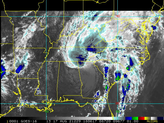
The system east of Florida (90L) still has a 50% chance for development. In this case the circulation is well defined, but it lacks convection, as lot has been shared off. Thus a fairly dry system, but it is capable of enhancing afternoon showers. It likely will eventually drift over Florida, and barely be noticeable other than the breeze.

What could change (even if unlikely) is it developing convection near the center that persists and expands. Conditions are very borderline for that to happen, so it's more of a wait and see, even if it does, there is not much time for it to organize. So the most likely outcome is that the circulation moves over Florida barely noticed.
Original Update:

For the end of July, a new area off the southeast coast of the US (Invest 90L) has about a 40% chance for development over the next 5 days or so, as this surface trough sits near or over the Gulf Stream for the next few days.

Parts of the system may drive up rainfall quite a bit over the weekend in parts of Florida, especially in South Florida where it may be enough to cause some flooding rainfall when the interaction of seabreeze storms kick in.

The rain likely will impact more of central and North Florida/GA later in the weekend into Monday. If the system develops it could be a tropical/subtropical system if aided enough by the warm gulf stream waters, working against it is northwesterly shear of about 20-25 knots.

Future models suggest it may meander of the same area and either slowly drift southwest over Florida or move into South Carolina, causing a lot of rain when it does. It's something to watch over the next several days.

If this manages to develop, the next name on the list is Fred. Recon aircraft are tentatively scheduled to investigate tomorrow.
Forecast lounge for 90L


Invest 90L Event Related Links


float6latest.gif stormplotthumb_6.gif

SFWMD Model Plot (Animated Model Plot) SFWMD Hurricane Page


[https://flhurricane.com/floatanimator.php?year=2021&storm=6 Flhurricane Satellite Floater Animation of 90L
GOES Floater
Animated Skeetobite Model Plot of 90L


Clark Evans Track Model Plot of 90L (Animated!) Model Plots in Google Earth - In Google Maps
Clark Evans Intensity Model Plot of 90L (Animated!)

Clark Evans Track Plot of 90L

Other Model Charts from Clark

Clark Evans Top 10 Analog Storms for 90L
More model runs on from RAL/Jonathan Vigh's page
NRL Info on 90L -- RAMMB Info
COD Atlantic Satellite View


East Florida Links Southeast Composite Radar Loop (Latest Static) South to North:

Key West, FL Radar Radar Loop (Latest Static)

Miami, FL Radar Radar Loop (Latest Static)

Melbourne, FL Radar Radar Loop (Latest Static)

Jacksonville, FL Radar Radar Loop (Latest Static)


Caribbean/South East Coast Satellite Imagery


SFWMD Radar Loop of South Florida with storm Track


SFWMD Full Florida Radar Loop with Storm Track


Area Forecast Discussions: FLorida Keys - Miami/South Florida - Melbourne/East Central Florida - Jacksonville/Northeast Florida -


Post Extras: Print Post   Remind Me!   Notify Moderator  
IsoFlame
Storm Tracker


Reged: Wed
Posts: 287
Loc: One block off the Atlantic Oce...
Re: Late July Activity [Re: MikeC]
      #113870 - Fri Jul 23 2021 11:40 AM

Your analysis is spot on regarding heavy rainfall potential for southf Florida. If 90-L develops some more east of the Cape, then retrogrades WSW/SW across the Space/Treasure coast as forecast, the NE surge kicking in Saturday along the coast north of the Cape associated with the frontal trough and low will drive the bulk of moisture across the south half of Florida.

Drier air entrained into the circulation from the NW will lead to considerably lower rain chance for the north half of Florida, and the heaviest showers/storms will congregate just inland along and to the south of the I-4 corridor, then drop SW away from my still-thirsty central coastal Volusia rain gauge (2"+ July deficit, 6" annual deficit to date).

--------------------
CoCoRaHS Weather Observer (FL-VL-42) & Surf Forecaster: https://www.surf-station.com/north-florida-surf-forecast-3/


Post Extras: Print Post   Remind Me!   Notify Moderator  
Pages: 1


Extra information
0 registered and 0 anonymous users are browsing this forum.

Moderator:  CFHC, Ed Dunham, Colleen A., Atricks, danielw, Clark, Christine H, RedingtonBeachGuy, SkeetoBite, Bloodstar, tpratch, typhoon_tip, cieldumort, Jackie M, Wigeon, Hank Buck 

Print Topic

Forum Permissions
      You cannot start new topics
      You cannot reply to topics
      HTML is disabled
      UBBCode is enabled

Rating:
Topic views: 4708

Rate this topic

Jump to

Note: This is NOT an official page. It is run by weather hobbyists and should not be used as a replacement for official sources. 
CFHC's main servers are currently located at
Hostdime.com in Orlando, FL.
Image Server Network thanks to Mike Potts and Amazon Web Services. If you have static file hosting space that allows dns aliasing contact us to help out! Some Maps Provided by:
Great thanks to all who donated and everyone who uses the site as well. Site designed for 800x600+ resolution
When in doubt, take the word of the National Hurricane Center