MikeC
Admin
Reged:
Posts: 4677
Loc: Orlando, FL
|
|
11:00PM EDT 27 August 2021 Update
Hurricane Ida is now in the Gulf of Mexico, still intact after crossing the western part of Cuba. It made landfall 20 miles east of La Coloma in Cuba. It continues be forecast to be an extremely dangerous category 4 hurricane when it reaches the coast of Louisiana Sunday afternoon and evening. Hurricane-force winds are expected Sunday in portions of the Hurricane Warning area along the Louisiana coast, including metropolitan New Orleans, with potentially catastrophic wind damage possible where the core of Ida moves onshore.
Surge of up to 15 feet is possible from Morgan City, LA to Mouth of the Mississippi River, and other areas, including a lot of the Mississippi coastline, can see surge up to .7-11 ft in some areas. Places at and just to the right of the landfall point will see the most onshore surge flow, there will be decreasing surge even to the FL/AL line. Please check the hurricane local statement and public advisory for more information.
Actions to protect life and property should be rushed to completion in the warning area on Saturday before dark, if possible, conditions will begin to deteriorate in the Warning area early Sunday morning. There are many active evacuation orders in parts of Southeastern Louisiana, listen to local media and officials to gain more information. If you live in a mandatory evacuation zone, please plan to evacuate.
For the best information for your local area consult local media and officials, an the area National Weather Service office.
5:30PM EDT 27 August 2021 Update
Hurricane Ida currently moving over Western Cuba, is forecast to be an extremely dangerous category 4 hurricane when it reaches the coast of Louisiana Sunday afternoon and evening. Hurricane-force winds are expected Sunday in portions of the Hurricane Warning area along the Louisiana coast, including metropolitan New Orleans, with potentially catastrophic wind damage possible where the core of Ida moves onshore.
Surge of up to 15 feet is possible from Morgan City, LA to Mouth of the Mississippi River, and other areas, including a lot of the Mississippi coastline, can see surge up to .7-11 ft in some areas. Places at and just to the right of the landfall point will see the most onshore surge flow, there will be decreasing surge even to the FL/AL line. Please check the hurricane local statement and public advisory for more information.
Actions to protect life and property should be rushed to completion in the warning area. Today and Tomorrow. There are active evacuation orders in parts of Southeastern Louisiana, listen to local media and officials to gain more information. If you live in a mandatory evacuation zone, please plan to evacuate.
For the best information for your local area consult local media and officials, an the area National Weather Service office.
1:30PM EDT 27 August 2021 Update
Ida is now officially a hurricane with the recon reporting winds enough for 75mph..
11:00AM EDT 27 August 2021 Update
Ida's stronger this morning and may become a hurricane this afternoon. Hurricane Warnings are now up for Cuba and the Isle of Youth. Hurricane Watches remain along the coast for most of Louisiana and all of Mississippi.
Those along the gulf coast under the watch, today is the best day to prepare. You also have tomorrow, but Sunday will be very limited. Rule of thumb here, plan for 1 category above forecast (aka 4) and hope for the best.
4:30AM EDT 27 August 2021 Update
The second, third and fourth recon missions into Ida are underway, and we need them. While models are almost unanimously now forecasting a Louisiana landfall, this is still based on what was a bit of a diffuse surface center+robust mid-level circulation being tracked, as opposed to a more fully matured TD.
Recon #2 is presently out sampling the upper air data surrounding Ida. Missions #3 and #4 will probably be focused on ascertaining storm structure and current intensity. This and additional critical information coming in this morning should make for more reliable model output tonight.
Caveats aside, all indications are that Ida will be a very dangerous and powerful hurricane - and quite possibly a Major - and possibly even a sizeable Major - heading into landfall somewhere along the central Gulf coast bounded by the upper Texas coast to the left and possibly even the MS/AL/FL area to the east, and as quickly as this has come together, preps to protect life and property will not have the usual several days lead time.
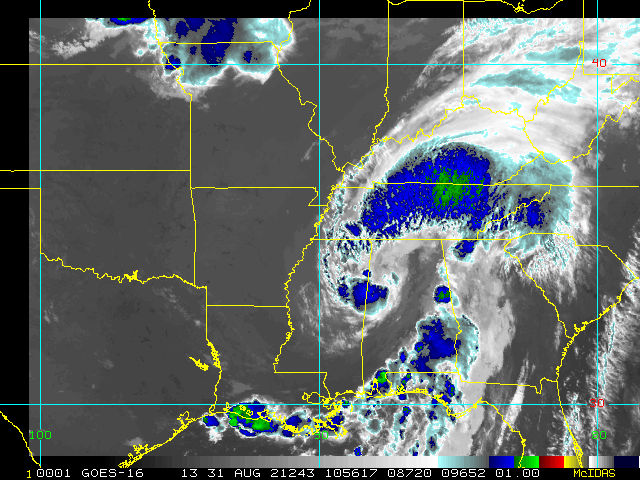
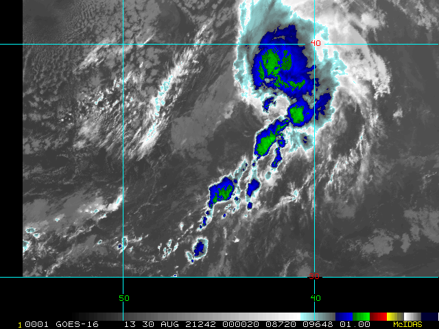
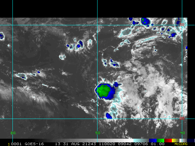
Elsewhere, Invest 97L is headed out to sea. Invest 98L has a non-zero chance of getting further west than forecast, and we are monitoring it closely in case of this. Also, a weak area of low pressure with a well-defined but small surface circulation is approaching the central Texas coast this morning with bursts of locally heavy and blustery thunderstorms that could catch some morning commuters off guard.
As a reminder, less restricted model talk (analysis, speculation, curiosities,etc.) on Ida and more is open in the 2021 Forecast Lounge
-Ciel
11:00PM EDT 26 August 2021 Update
Ida is still a tropical storm, but forecast to become a hurricane, so a Hurricane Watch has been issued from Cameron, LA eastward to the MS/AL border, including Lakes Pontchartrain, Maurepas, and the city of New Orleans.
Although Ida has been seeing shear today causing the system to be asymmetric, the models and conditions become quite favorable tomorrow night, and the water temperatures are warm. It is currently forecast to become a category 2 hurricane at landfall, but there is a distinct possibility it could become a major hurricane before landfall. Ida likely will make landfall in Louisiana late Sunday or early Monday, however conditions may extend quite well eastward, thus the Mississippi Gulf coast is also under a hurricane warning.
Based on all of this information, there is higher-than-normal confidence that a significant hurricane will be approaching the Gulf coast late in the weekend. Time to prepare is tomorrow and Saturday. Listen to local officials and media for the best information for your local area.
8:00PM EDT 26 August 2021 Update
Tropical Storm Ida has formed west of Jamaica, with it currently approaching the Cayman islands and western Cuba, beyond there it is expected to become a hurricane in the Gulf of Mexico as it goes over very warm waters.
The forecast calls for a category 2 hurricane in the north central Gulf coast, but there is room for it to reach major status before landfall. Those in the cone area should be preparing tomorrow and Saturday, as Sunday will begin to deteriorate in the area. There's still some uncertainty how strong it may get, which should become clearer a bit after it enters the Gulf on Saturday. However, it would be wise to use tomorrow for preparations regardless because Saturday will be the last practical day to prepare.
5:20PM EDT 26 August 2021 Update
An Air Force Reserve hurricane hunter aircraft data indicate that the depression has strengthened to Tropical Storm Ida. The maximum sustained winds are estimated to be 40 mph (65 km/h) with higher gusts.
The left bar and graphics will update with the 8pm advisory, but it is officially Tropical Storm Ida now.
Original Update
Tropical Depression Nine has formed west of Jamaica this morning and is expected to Cross the western tip of Cuba later tonight into tomorrow. Ida is the next name on the list.
Tropical Storm Warnings are up for the Cayman Islands and Western Parts of Cuba and the Isle of Youth.
Those in the cone along the Gulf of Mexico should start to prepare today or tomorrow, if possible, as Conditions may begin to deteriorate by early to midday Sunday. The current forecast has a strengthening category 2 hurricane making landfall in Central Louisiana Sunday night, but there is a good chance it will become a major hurricane right before landfall. Some shifts in the track are likely until the system consolidates and becomes better defined.
|
cieldumort
Moderator

Reged:
Posts: 2520
Loc: Austin, Tx
|
|
|
cieldumort
Moderator

Reged:
Posts: 2520
Loc: Austin, Tx
|
|
Recon is finding that Ida's surface center appears to be jumping deeper into the very stout mid-level center to the north, and becoming a much more cohesive Tropical Cyclone.
Flight level winds in the eastern semicircle are already coming it at just under 100 MPH at 10,000' altitude. With the expansive region of Tropical Storm force winds and also the potential for storm surge and heavy squalls, considering this northward jog and possible track bias owing to the much improved structure, interests in the Florida Keys and along the west coast of Florida may want to begin paying closer attention.
|
MikeC
Admin
Reged:
Posts: 4677
Loc: Orlando, FL
|
|
Hurricane upgrade at 2pm is very likely, recon is finding winds that probably support 80mph.
|
kspkap
Weather Watcher
Reged:
Posts: 35
|
|
Here I am again in Long Beach, MS waiting for yet another major storm. Zeta hit us badly last year making a Cat 3 at landfall. We have had severe weather for the last 2 days. We will be so inundated with rain prior to Ida we could be looking at another . This lot which I built on had a 32 foot storm surge!
For the last 1 1/2 years the Mississippi Gulf Coast has been targeted with many tropical storms and now another major hurricane within less than a year. Part of my metal roof peeled back from Zeta plus other damage. The area was similar to Florida in 2004 when we saw so many “blue†roofs.
My house is on the market as I’m moving back home to Central Florida where major hurricanes are an anomaly!
Edited by kspkap (Fri Aug 27 2021 02:08 PM)
|
cieldumort
Moderator

Reged:
Posts: 2520
Loc: Austin, Tx
|
|
Last center fix from Mission 6 into Ida confirms that the eye has returned, albeit open in the south. Stout temp differential from inside/outside the eye as well as pressure dropping w/ every fix indicates intensification has also resumed.
Quote:
A. Time of Center Fix: 28th day of the month at 5:28:40Z
B. Center Fix Coordinates: 23.33N 84.61W
B. Center Fix Location: 143 statute miles (231 km) to the W (276°) from Havana, Cuba.
C. Minimum Height at Standard Level: 3,024m (9,921ft) at 700mb
D. Minimum Sea Level Pressure: 988mb (29.18 inHg)
E. Dropsonde Surface Wind at Center: From 150° at 20kts (From the SSE at 23mph)
F. Eye Character: Open in the south
G. Eye Shape & Diameter: Circular with a diameter of 24 nautical miles (28 statute miles)
H. Estimated (by SFMR or visually) Maximum Surface Wind Inbound: 65kts (74.8mph)
I. Location & Time of the Estimated Maximum Surface Wind Inbound: 23 nautical miles (26 statute miles) to the ENE (65°) of center fix at 5:21:00Z
J. Maximum Flight Level Wind Inbound: From 167° at 65kts (From the SSE at 74.8mph)
K. Location & Time of the Maximum Flight Level Wind Inbound: 38 nautical miles (44 statute miles) to the ENE (76°) of center fix at 5:16:30Z
L. Estimated (by SFMR or visually) Maximum Surface Wind Outbound: 59kts (67.9mph)
M. Location & Time of the Estimated Maximum Surface Wind Outbound: 15 nautical miles (17 statute miles) to the N (2°) of center fix at 5:33:00Z
N. Maximum Flight Level Wind Outbound: From 105° at 64kts (From the ESE at 73.6mph)
O. Location & Time of the Maximum Flight Level Wind Outbound: 30 nautical miles (35 statute miles) to the N (2°) of center fix at 5:37:00Z
P. Maximum Flight Level Temp & Pressure Altitude Outside Eye: 9°C (48°F) at a pressure alt. of 3,046m (9,993ft)
Q. Maximum Flight Level Temp & Pressure Altitude Inside Eye: 15°C (59°F) at a pressure alt. of 3,053m (10,016ft)
R. Dewpoint Temp (collected at same location as temp inside eye): 7°C (45°F)
R. Sea Surface Temp (collected at same location as temp inside eye): Not Available
S. Fix Determined By: Penetration, Radar, Wind, Pressure and Temperature
S. Fix Level: 700mb
T. Navigational Fix Accuracy: 0.02 nautical miles
T. Meteorological Accuracy: 3.5 nautical miles
Remarks Section:
Maximum Flight Level Wind: 74kts (~ 85.2mph) which was observed 39 nautical miles (45 statute miles) to the NE (44°) from the flight level center at 3:17:00Z
|
|


 Threaded


