cieldumort
Moderator

Reged:
Posts: 2529
Loc: Austin, Tx
|
|
A well formed, convectively active tropical wave located several hundred miles east of the Windwards is moving westward at around 15-20 mph and expected to reach the islands and eastern Caribbean around the middle of the new week. This disturbance not only is showing tentative signs of developing in the near term (next 1-2 days), but a few model runs are warm to very warm on its prospects of becoming a storm even prior to reaching the Lesser Antilles, with others of it at least becoming a TD this week while land-trapped in the Caribbean, and so we are starting a Lounge on the wave and Invest, 91L, at this time.
On the morning of Oct 7th THIRTEEN became Julia, and the title has been updated accordingly. -Ciel
Edited by cieldumort (Fri Oct 07 2022 02:29 PM)
|
cieldumort
Moderator

Reged:
Posts: 2529
Loc: Austin, Tx
|
|
NHC began issuing advisories on 91L today as THIRTEEN.
Thirteen is expected to become a named storm and hurricane prior to making landfall in central America. There are questions as to how far north it gets, however, and a non-zero probability exists that it reaches the northwestern Caribbean, in which case the system could become more of an interest to those living along the Gulf, as well. But, the more likely scenario is a track hugging South America and the southwestern Caribbean all the way across into the eastern Pacific.
|
cieldumort
Moderator

Reged:
Posts: 2529
Loc: Austin, Tx
|
|
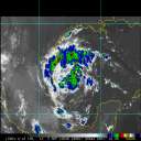
Julia made landfall near Laguna de Perlas, Nicaragua at 3:15 AM EDT Sunday, Oct 9, with maximum sustained estimated to be 85 MPH.
Much of the remnants of former Hurricane Julia have merged with a preexisting area of low pressure in the region, now draped from the southwestern Gulf in the Atlantic into the Gulf of Tehuantepec in the eastern Pacific. That system will likely not be classified as Julia as the low-level circulation of former Julia as best it can be tracked is still in the eastern Pacific. Furthermore, these remnants of Julia have merged with the broader area of low pressure mentioned above.
Where Julia's ghost surface circulation appears to still be, in the east Pac, there might be a better argument for name continuation in that basin, but once again, that is already more of a merger and less of a coherent continuation, also.
This entry has been updated with recent, timely scatterometer analysis. - Ciel
Edited by cieldumort (Tue Oct 11 2022 10:53 AM)
|
|


 Threaded


