MikeC
Admin
Reged:
Posts: 4570
Loc: Orlando, FL
|
|
12GFS has landfall of a depression or weak TS near vero beach Thursday afternoon, moving quickly but bringing quite a bit of rain. This is a shift to match what euro was more or less showing, Florida East coast and Georgia should watch it closely in case it develops more, but right now it's expected to be just a rain event.
Icon shows something similar,
|
MikeC
Admin
Reged:
Posts: 4570
Loc: Orlando, FL
|
|
The 12Z euro has greatly backed off on this area, and sends just a little bit of unorganized rain much further north (SC), vastly different than yesterday's runs.
|
MikeC
Admin
Reged:
Posts: 4570
Loc: Orlando, FL
|
|
06z forms the system within 48 hours and moves it near Wilmington, NC. and the 0z euro never really develops it now. still at 30% overnight.
|
GeorgeN
Weather Watcher

Reged:
Posts: 35
Loc: Wesley Chapel FL
|
|
|
IsoFlame
Weather Analyst

Reged:
Posts: 303
Loc: One block off the Atlantic Oce...
|
|
Here in central coastal Volusia, in half-way through the first month of the wet season with less than half of normal rainfall. Area now in moderate drought after a very dry April/May. Could use several days of soaking tropical showers here but given how fast whatever becomes of PTD#2 and the likely dry air in the mid-levels that it will likely pull southward down the Fla peninsula and ingest on approach, I'm not expecting much other than a brief/light coastal shower or two.
--------------------
CoCoRaHS Weather Observer (FL-VL-42) & Surf Forecaster: https://www.surf-station.com/north-florida-surf-forecast-3/
|
IsoFlame
Weather Analyst

Reged:
Posts: 303
Loc: One block off the Atlantic Oce...
|
|
On the positive side, we should have a decent-size, choppy easterly wind swell to surf for several days.
--------------------
CoCoRaHS Weather Observer (FL-VL-42) & Surf Forecaster: https://www.surf-station.com/north-florida-surf-forecast-3/
|
bob3d
Weather Watcher

Reged:
Posts: 43
Loc: Pasco County, Florida
|
|
Most areas of Central to South Florida could use a good soaking. Too bad the area of disturbed weather is not going to hit near us.
|
MikeC
Admin
Reged:
Posts: 4570
Loc: Orlando, FL
|
|
Models yesterday went up to the Carolinas, today they are back down to Florida. Unlikely to develop, but the smallish area of rain still goes somewhere.
|
JMII
Weather Master

Reged:
Posts: 494
Loc: Margate, Florida
|
|
Quote:
Most areas of Central to South Florida could use a good soaking.
SFL got enough from last week's gulf low.
--------------------
South FL Native... experienced many tropical systems, put up the panels for:
David 79 - Floyd 87 - Andrew 92 - Georges 98 - Frances 04 - Wilma 05 - Matthew 16 - Irma 17
Lost our St James City rental property to Ian 22
|
bob3d
Weather Watcher

Reged:
Posts: 43
Loc: Pasco County, Florida
|
|
Quote:
Quote:
Most areas of Central to South Florida could use a good soaking.
SFL got enough from last week's gulf low.
Then I guess it's just Central Florida that still needs the rain.
|
IsoFlame
Weather Analyst

Reged:
Posts: 303
Loc: One block off the Atlantic Oce...
|
|
The start of the wet season is typically hit or miss in central Florida, and this year the sea breeze has kept much of the rain from making it back to the coast. Last year we had a very wet June (16") when the steering flow from the west allowed inland thunderstorms to push back to and across the coast.
I have a friend in North Brevard County, jueast st 35 miles to the south of Daytona Beach Shores, that measured 8" in 3 days during the week that South Florida received flooding rains. I was lucky to get 0.99" (the bulk of my June total to date) in one day during that week. Relatives a few miles to the NW of me had only 0.25". I'm seeing shrubs in the landscape that have been in the ground for years where there is no lawn irrigation dying. Unirrigated lawns are toasty brown.
--------------------
CoCoRaHS Weather Observer (FL-VL-42) & Surf Forecaster: https://www.surf-station.com/north-florida-surf-forecast-3/
|
GeorgeN
Weather Watcher

Reged:
Posts: 35
Loc: Wesley Chapel FL
|
|
Quote:
Quote:
Quote:
Most areas of Central to South Florida could use a good soaking.
SFL got enough from last week's gulf low.
Then I guess it's just Central Florida that still needs the rain.
Brooksville got 4.5 inches last week, but only 1.5 inches here in Wesley Chapel.
Like normal years, sometimes you get little rain and sometimes you get drenched. I hate it when it comes in 2-3 inch dumps.
This system will hopefully push some rain to my area without flooding areas that were flooded recently
--------------------
Wesley Chapel FL - since 1990
Previous resident of North Miami and Merritt Island
|
MikeC
Admin
Reged:
Posts: 4570
Loc: Orlando, FL
|
|
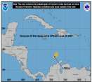
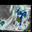
This has looked better on satellite today, and is now being tracked as invest 92L.
This is a relatively small area so it has a little bit of a chance to ramp up before a potential landfall if it holds together. Could fall apart just as quickly, but should watch it closely along the FL East coast (probably Brevard Northward)
2012's Tropical Storm Beryl wound up in a similar location as this one may wind up (next name on the list is Beryl), but developed in late may.
|
IsoFlame
Weather Analyst

Reged:
Posts: 303
Loc: One block off the Atlantic Oce...
|
|
92L chance of developmenrtnow at 40% as of 8am Thursday 6/20/24.
While Alberto's huge windfield and tidal salt water "surge" impact is rightfully the top news today, and not that it will happen this time...
In the 40+ years that I have lived along the coast of east central Florida near the Cape, I have seen several "no name" systems similar to this one come in off the Atlantic from the SE, hit the warm near-shore waters and have quite an impact on the area's coastal waters with short-notice tropical storm to hurricane force wind gusts and a surge of 2-3' in the Mosquito Lagoon and north Indian River Lagoon.
--------------------
CoCoRaHS Weather Observer (FL-VL-42) & Surf Forecaster: https://www.surf-station.com/north-florida-surf-forecast-3/
|
MikeC
Admin
Reged:
Posts: 4570
Loc: Orlando, FL
|
|
Recon found some weak westerly winds and 40knot winds in the Northeast quadrant of Invest 92L. Wouldn't be shocked to see at least potential tropical cyclone advisories at 5pm.
|
MikeC
Admin
Reged:
Posts: 4570
Loc: Orlando, FL
|
|
Special outlook out,they keep it at 40% mentioning the possibility of a Tropical Depression (but not storm)
|
IsoFlame
Weather Analyst

Reged:
Posts: 303
Loc: One block off the Atlantic Oce...
|
|
A special tropical weather outlook issued to update the
discussion of the low pressure system northeast of the Bahamas.
Southwestern Atlantic Ocean (AL92) Updated:
Data from an Air Force Reserve reconnaissance aircraft indicates
that the small area of low pressure located about 150 miles
northeast of the northernmost Bahamas does not have a well-defined
surface circulation. Environmental conditions remain marginally
conducive for further development and this system could become a
tropical depression while the low moves west-northwestward at 10 to
15 mph. The system is expected to approach the northeastern coast
of Florida or the Georgia coast early on Friday. Another Air Force
Reserve reconnaissance mission is planned for Friday morning, if
necessary.
* Formation chance through 48 hours...medium...40 percent.
* Formation chance through 7 days...medium...40 percent.
--------------------
CoCoRaHS Weather Observer (FL-VL-42) & Surf Forecaster: https://www.surf-station.com/north-florida-surf-forecast-3/
|
MikeC
Admin
Reged:
Posts: 4570
Loc: Orlando, FL
|
|
Up to 50% at the 8pm.
|
cieldumort
Moderator

Reged:
Posts: 2338
Loc: Austin, Tx
|
|
Overnight and predawn this morning, 92L remains cocooned from nearby dry air and is tracking through and into a region of milder shear. Along with the Gulf Stream and being small, 92L has ingredients to surprise on the upside, albeit within a small radius.
|
MikeC
Admin
Reged:
Posts: 4570
Loc: Orlando, FL
|
|
Recon is again this morning checking it out, I'm not fully convinced they will pull the trigger for advisories, but it'll be close either way. So we may know by am if they do so or not based on the recon there. The convection is offshore, two records (Radar and a palm coast webcam) are on the image recordings section of this site for this system.
Convection is better on the south side than I expected this morning, however.
A bunch of other landfall area webcams
|


 Threaded


