cieldumort
Moderator

Reged:
Posts: 2497
Loc: Austin, Tx
|
|
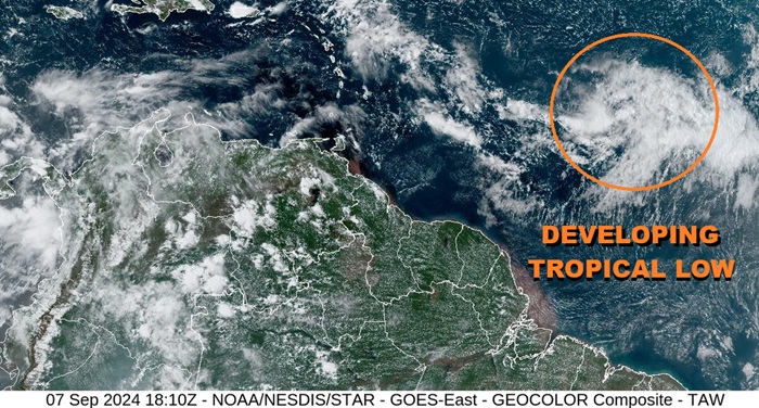
Above: Central Atlantic Tropical Low Invest TBD
An area of formerly very elongated low pressure in the Main Development Region of the Atlantic well east of the Antilles has continued to consolidate and as of this afternoon has begun to take on a much more upright cylindrical look, classic of the very early stages of development into a tropical cyclone. This feature has increasing model support to potentially become the first serious TC born out of the MDR since record-setting Beryl back in June, and we are starting a Lounge on it at this time.
While this Low is not yet Invest-tagged it could easily be tagged later today or tomorrow, and the title will be updated accordingly. development odds within 7 days are presently 40% and this could be conservative.
More details to come
This tropical low has been Invest-tagged this evening, 92L, and the title has been updated accordingly.
2024-09-08 00:00 12.7 -42.4 25
Ciel
Edited by cieldumort (Fri Sep 20 2024 02:42 PM)
|
cieldumort
Moderator
Reged:
Posts: 2497
Loc: Austin, Tx
|
|
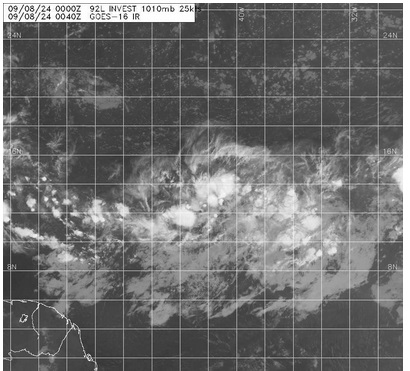
The Tropical Low in the Central Atlantic MDR has been Invest tagged tonight, 92L, and vort-centric model runs will be coming soon. With recon flying multiple rounds into the SW Gulf's 91L during the day on Sunday and with some time before this system could affect land, we shouldn't expect to see any missions into it until early next week or so, unless it recurves. Early guidance suggests that a track more west-northwest for a few days is most likely however, and interests in the Antilles may want to begin paying close attention.
NHC 7-day odds are now up to 50% tonight and this could still be conservative.
|
IsoFlame
Weather Analyst

Reged:
Posts: 370
Loc: One block off the Atlantic Oce...
|
|
Latest loop showing a core of consolidated, continuous convection steadily tracking west along 15N, approaching 50W has my undivided attention:
92L loop
Could become Gordon sometime next week if the low forecast to form off the Carolinas late in the weekend doesn't get the name first.
--------------------
CoCoRaHS Weather Observer (FL-VL-42) & Surf Forecaster: https://www.surf-station.com/north-florida-surf-forecast-3/
|


 Threaded


