MikeC
Admin
Reged:
Posts: 4838
Loc: Orlando, FL
|
|
Just showing some model runs here, general idea is it's the only one with a really decent chance to develop on the outlook, no invest yet but could be tagged today or tomorrow.
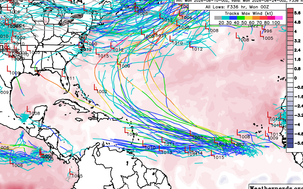
GFS Ensembles, show the first wave remaining weak, second wave mostly going north, but a few ne runners. Takeaway is that it'll probably move north of the Caribbean, and wind up somewhat near Bermuda.
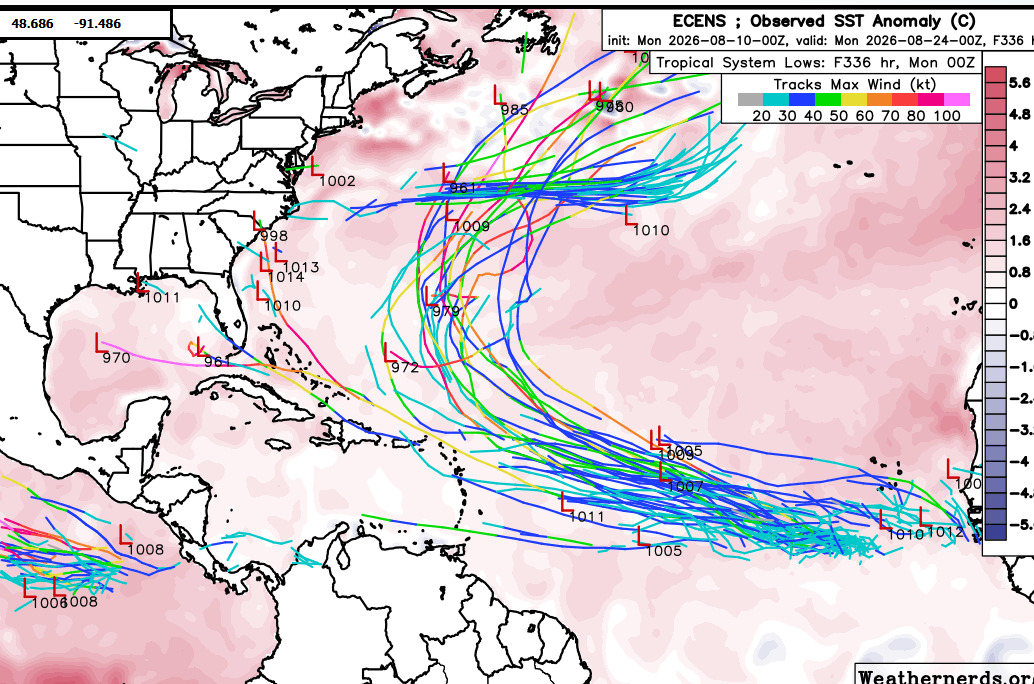
Euro is less likely to develop the western wave, but the eastern one does develop, more than likely staying east of the Caribbean islands, and getting relatively close to Bermuda.
Deep mind shows more impacts to the Eastern Caribbean, although weaker, if the storm remains weak the more of chance it has to become less, still odds favor it staying east of the US and relatively close to Bermuda here also.
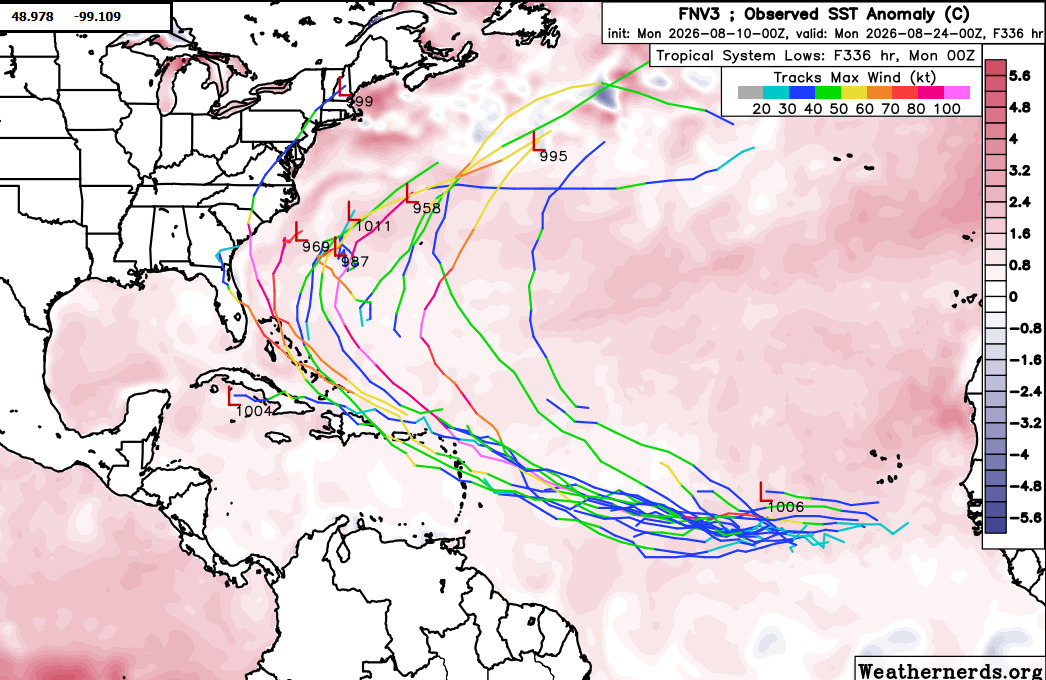
0z Primary Euro has it missing the Caribbean and getting close enough to Bermuda to feel the western edge.
6z keeps it away from the Caribbean and comfortably east of Bermuda.
0z Canadian gets it into the Caribbean and curves it over the turks and caicos islands and out to sea, but it could get close to Bermuda there also.
Right now it's observe phase to watch for settling with model trends, and also awaiting invest tagging for later to help improve the overall forecast. Nothing concerning yet, other than saying hey Caribbean, watch this and see what happens. There's still quite a bit of shear ahead and most of the ensembles don't get too strong with the system.
Edited by CFHC (Mon Aug 10 2026 10:37 AM)
|
CFHC

Reged:
Posts: 213
Loc: East Central Florida
|
|
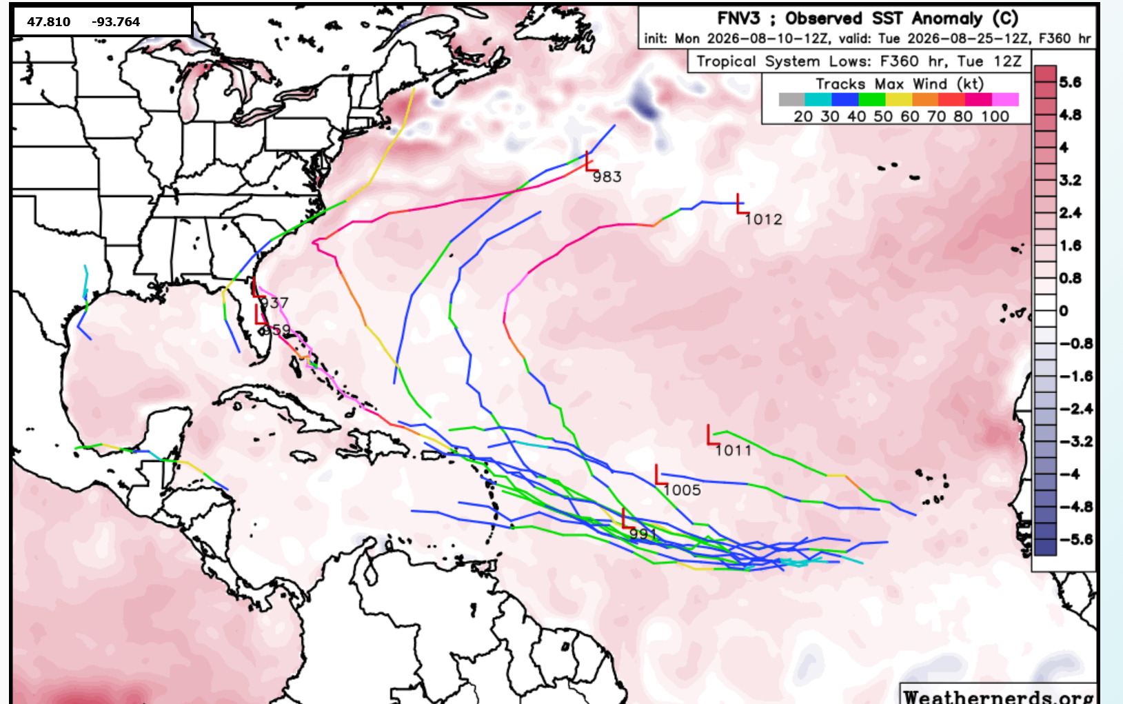
Newer deep mind is a bit mixed. 12Z moves it into the Caribbean islands and it falls apart.
|
cieldumort
Moderator

Reged:
Posts: 2747
Loc: Austin, Tx
|
|
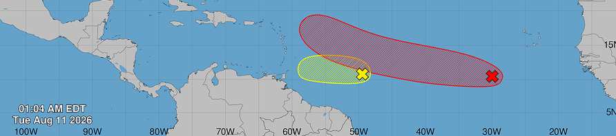
E ATL AOI presently centered about 10N 30W per as of 1AM EDT today, as seen above as a red x.
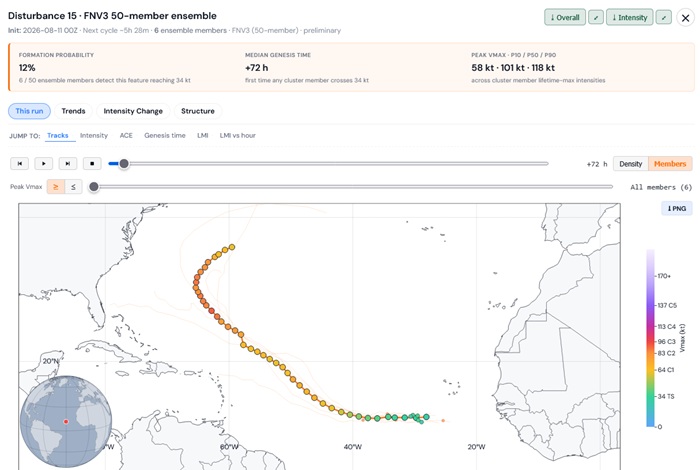
8/11/26/0z run of the Google DeepMind FNV3 ensembles shows only a handful of the primary 50 members developing a TC in the tropical Atlantic at all, and it is actually not clear if what these ensemble runs are developing is even this particular area of low pressure (Disturbance 15).
No development at 48 hours out (8/13/26/0z)
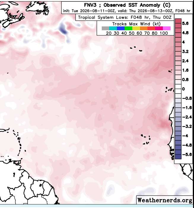
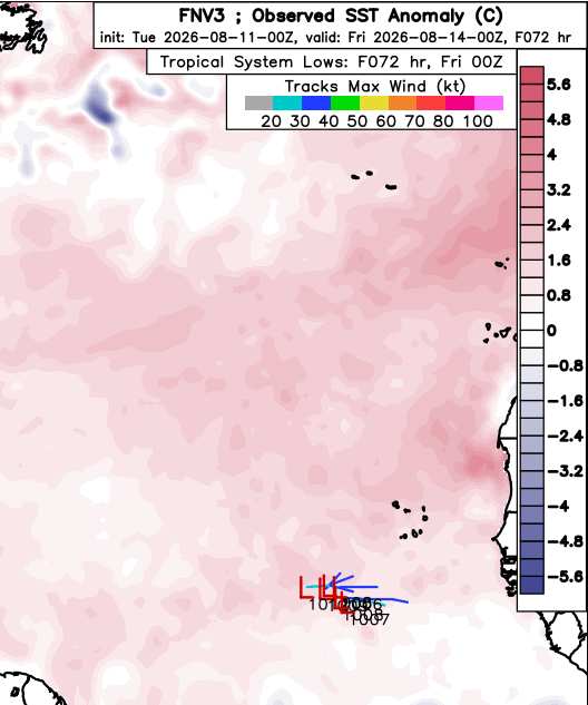
A handful of ensemble members kick off development well east of the red x,
all the way out to south of the Cabo Verde Islands, roughly near 10.5 to 11N, 24 to 26W.
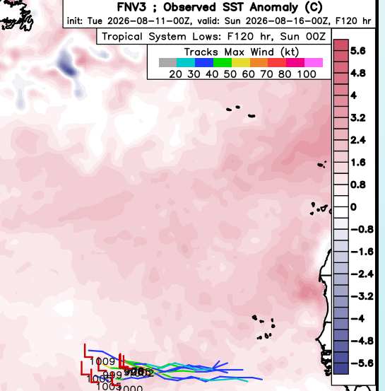
By 120 hours out (five full days), a few more members generate a TC around 38W. The image
below includes both those that developed sooner and south of the Cabo Verdes and those that
developed later, near 38W, making it look as if there is some overwhelming consensus of models
forming a tropical storm, when really it is still just a modest percent of members.
Going out a full ten days (240 hours), a still modest percentage of these ensemble members did develop a tropical cyclone in the central Atlantic.
Of those that did, a healthy percentage do find the survivor candidates mostly strong or even intense tropical cyclones by this time,
most with a tendency to begin gaining a lot more latitude.
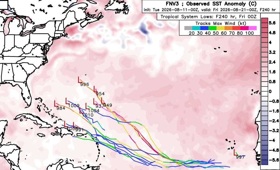
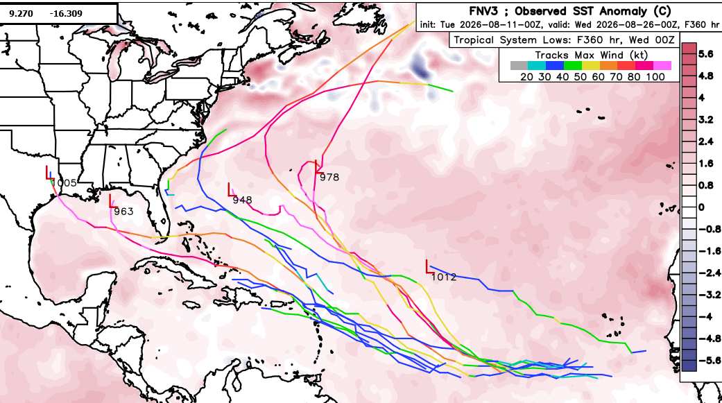
Going all the way out to the end of this run (360 hours), a small handful of these surviving candidates are left, only the strongest, most of which have recurved. Three threaten the US.
TC-ATLAS' FNV3 50-member overview of Disturbance 15
|
|



 Previous
 Index
Index
 Next
Next
 Threaded


 Edit
Edit
 Reply
Reply
 Quote
Quote


