Current Radar or Satellite Image

Flhurricane.com - Central Florida Hurricane Center - Tracking Storms since 199531 Years of Hurricanes Without the Hype - Since 1995


93C in the Central Pacific is now PTC ONE. NHC Advisories for Hawaii are being created. Elsewhere, Atlantic Invest 93L is now Tropical Storm Cristobal, out at sea.
Days since last Hurricane Landfall — US Any: 671 (Milton), US Major: 671 (Milton), FL Any: 671 (Milton), FL Major: 671 (Milton)
FlHurricane Atlantic Tropical Cyclone Tracking 🌀 Since 1995
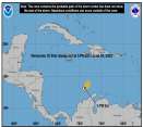
36.7N -43.0W
Wind: 45MPH
Pres: 1008mb
Moving:
Present movement...e or 90 degrees at 25 mph...41 km/h
Click for Storm Spotlight
Invest 92LClick for Invest Information from CIMSS
HypeScale:
2.00
0510
Communication
Storm Data
Content
Follow & Connect


General Discussion >> Other Storm Basins

Jump to first unread post. Pages: 1
cieldumortModerator
Moderator


Reged:
Posts: 2754
Loc: Austin, Tx
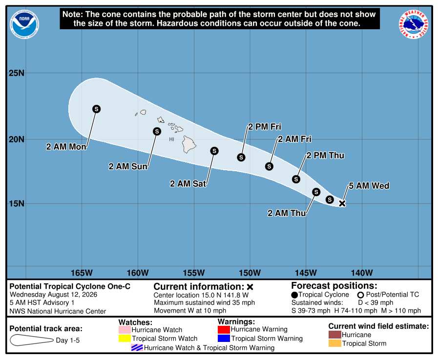
Potential Tropical Cyclone One-C
      #116100 - Mon Aug 10 2026 04:22 PM

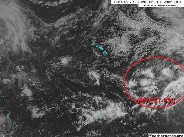
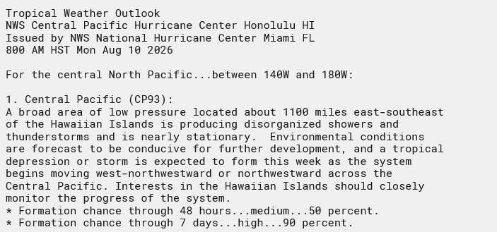
We are now starting a Forecast Lounge on Invest 93C in the Central Pacific as this system is likely to impact the Hawaiian islands.

Base satellite image credit: Weathernerds.org


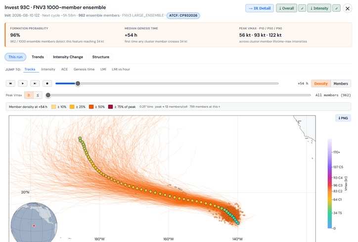
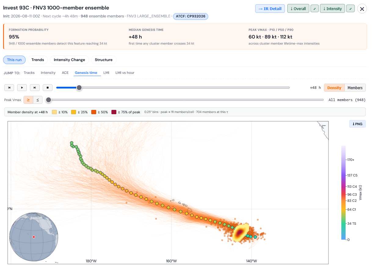
FNV3 1000 member ensembles for 93C. Credits: TC-ATLAS


8/10/26/9PM HST Title updated to Likely Hawaiian Impact
Ciel

8/12/26 5AM HST. NHC has designated 93C Potential Tropical Cyclone One-C and the title has been updated.
Ciel

Edited by cieldumort (Wed Aug 12 2026 11:34 AM)


Post Extras: Print Post   Remind Me!   Notify Moderator  
cieldumortModerator
Moderator


Reged:
Posts: 2754
Loc: Austin, Tx
Re: Invest 93C - Ptnl Hawaiian Impact [Re: cieldumort]
      #116101 - Mon Aug 10 2026 06:49 PM


Post Extras: Print Post   Remind Me!   Notify Moderator  
cieldumortModerator
Moderator


Reged:
Posts: 2754
Loc: Austin, Tx
Re: Invest 93C - Likely Hawaiian Impact [Re: cieldumort]
      #116103 - Tue Aug 11 2026 03:35 AM

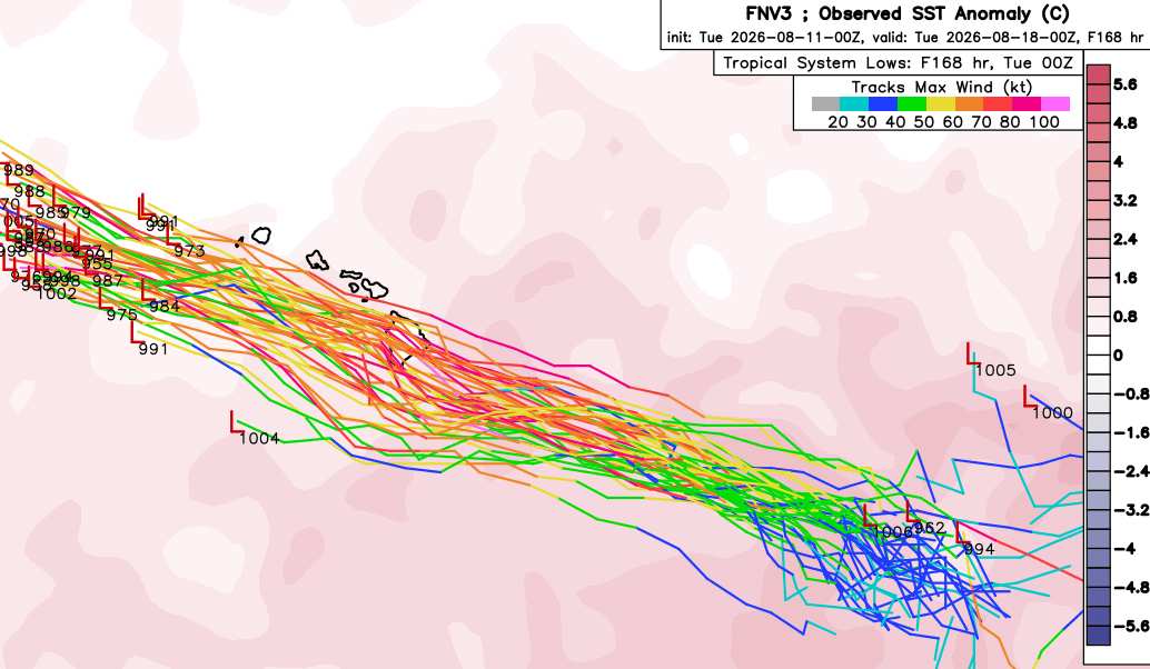
The most recent run of the high-quality Google DeepMind ensembles for Invest 93C paint an increasingly ominous picture for the Hawaiian islands.

Of these runs, most of those that even take the center fairly south of the islands, still are close enough to place Hawaii under the right-front quadrant, where the strongest winds
and heaviest rains would be favored to occur. Several drive 93C directly over the Big Island as a potentially devastating hurricane.

Credit: Weathernerds.org


Invest 93C FNV3 1000-member suite cr: TC-ATLAS


Post Extras: Print Post   Remind Me!   Notify Moderator  
cieldumortModerator
Moderator


Reged:
Posts: 2754
Loc: Austin, Tx
Re: Invest 93C - Likely Hawaiian Impact [Re: cieldumort]
      #116104 - Tue Aug 11 2026 03:59 AM

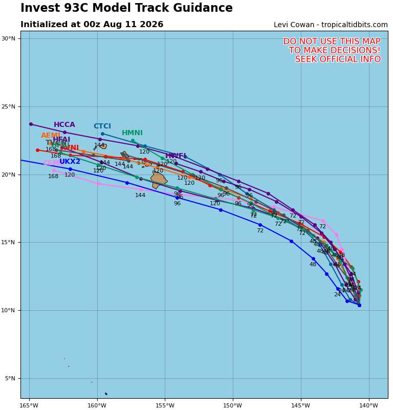
8/11/26/0z Global+Hurricane Models

Credit: Tropical Tidbits


Post Extras: Print Post   Remind Me!   Notify Moderator  
cieldumortModerator
Moderator


Reged:
Posts: 2754
Loc: Austin, Tx
Re: Potential Tropical Cyclone One-C [Re: cieldumort]
      #116112 - Wed Aug 12 2026 11:36 AM


Post Extras: Print Post   Remind Me!   Notify Moderator  
Pages: 1


Extra information
0 registered and 7 anonymous users are browsing this forum.

Moderator:  CFHC, Ed Dunham, Colleen A., danielw, Clark, RedingtonBeachGuy, SkeetoBite, Bloodstar, tpratch, typhoon_tip, cieldumort 

Print Topic

Forum Permissions
      You cannot start new topics
      You cannot reply to topics
      HTML is disabled
      UBBCode is enabled

Rating:
Topic views: 274

Rate this topic

Jump to