Current Radar or Satellite Image

Flhurricane.com - Central Florida Hurricane Center - Tracking Storms since 199531 Years of Hurricanes Without the Hype - Since 1995


Hurricane Warning issued for the Big Island. Life-threatening flooding and mudslides are likely in addition to damaging winds, surge and surf.
Days since last Hurricane Landfall — US Any: 674 (Milton), US Major: 674 (Milton), FL Any: 674 (Milton), FL Major: 674 (Milton)
FlHurricane Atlantic Tropical Cyclone Tracking 🌀 Since 1995
HypeScale:
5.85
0510
Communication
Storm Data
Content
Follow & Connect


General Discussion >> 2026 Forecast Lounge

Jump to first unread post. Pages: 1
cieldumortModerator
Moderator


Reged:
Posts: 2761
Loc: Austin, Tx
94L Lounge
      #116107 - Tue Aug 11 2026 09:20 PM


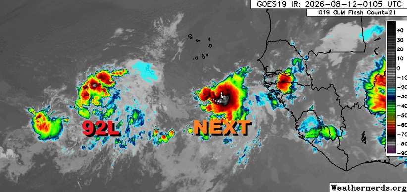
Above: Invest 92L and to the east of 92L, the next wave to have rolled off Africa. Base satellite map credit: Weathernerds.org

Another very stout wave, and one already associated with deep convection, is now being monitored by NHC with an opening bid of 20%, which could be conservative. Model runs strongly suggest that if it becomes stronger, sooner, a recurve that could put Bermuda in play looks very possible. On the other hand, model runs that suggest it develops but stays on the relatively weaker side, interests in and around the eastern Caribbean may see impacts. Considering the sudden bloom of TCs across both basins and improving conditions for additional development in the Atlantic, we are already giving this feature close attention and starting a Forecast Lounge on it now. Invest TBD.

It would not be surprising to see this feature get Invest tagged as soon as within the next 24 hours.

The convectively active wave located east of 92L has been Invest-tagged, 94L, and the title has been updated accordingly.
2026-08-13 00:00 10.3N 24.8W 25KTS
Ciel

Edited by cieldumort (Wed Aug 12 2026 09:17 PM)


Post Extras: Print Post   Remind Me!   Notify Moderator  
cieldumortModerator
Moderator


Reged:
Posts: 2761
Loc: Austin, Tx
Re: New East ATL Wave Invest TBD [Re: cieldumort]
      #116110 - Tue Aug 11 2026 11:26 PM

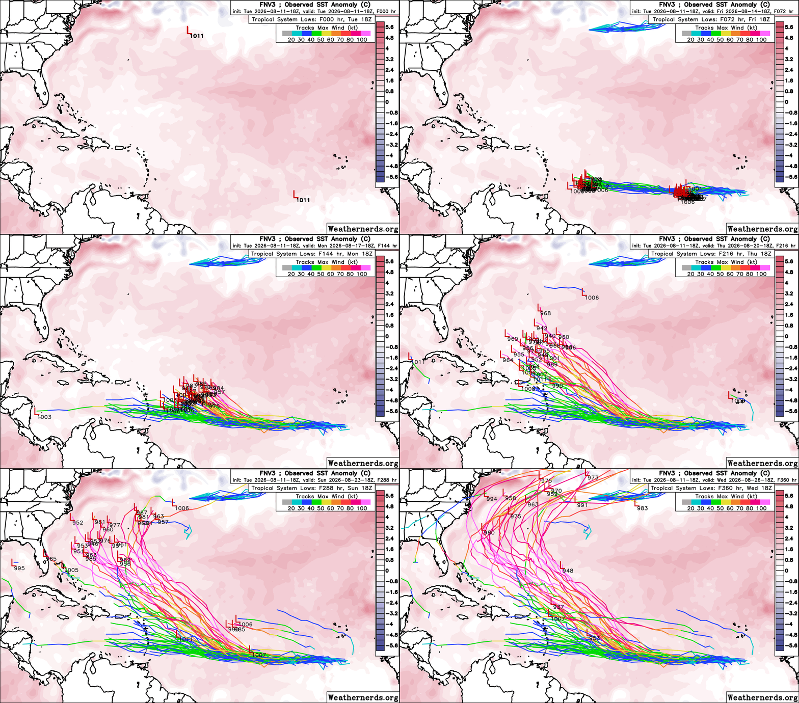
This next wave behind Invest 92L turns out to be the wave that the Google DeepMind FNV3 ensemble members have been bullish on.

As can be seen below, members that develop 92L wash it out just prior to it reaching or just after entering the eastern Caribbean, while behind 92L, this next wave seems to encounter a much more favorable environment for strengthening.


Post Extras: Print Post   Remind Me!   Notify Moderator  
cieldumortModerator
Moderator


Reged:
Posts: 2761
Loc: Austin, Tx
Re: New East ATL Wave Invest TBD [Re: cieldumort]
      #116111 - Wed Aug 12 2026 02:18 AM

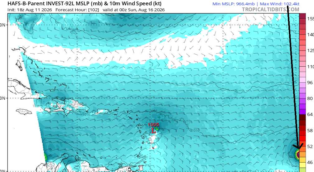
We have an early lead on what the hurricane model HAFS-B is thinking about what will probably be tagged Invest 94L soon.

In the far lower right-hand corner of the image below, we can see that HAFS-B ramps this wave up to a Major by Saturday night


Post Extras: Print Post   Remind Me!   Notify Moderator  
cieldumortModerator
Moderator


Reged:
Posts: 2761
Loc: Austin, Tx
Re: 94L Lounge [Re: cieldumort]
      #116117 - Fri Aug 14 2026 02:53 AM

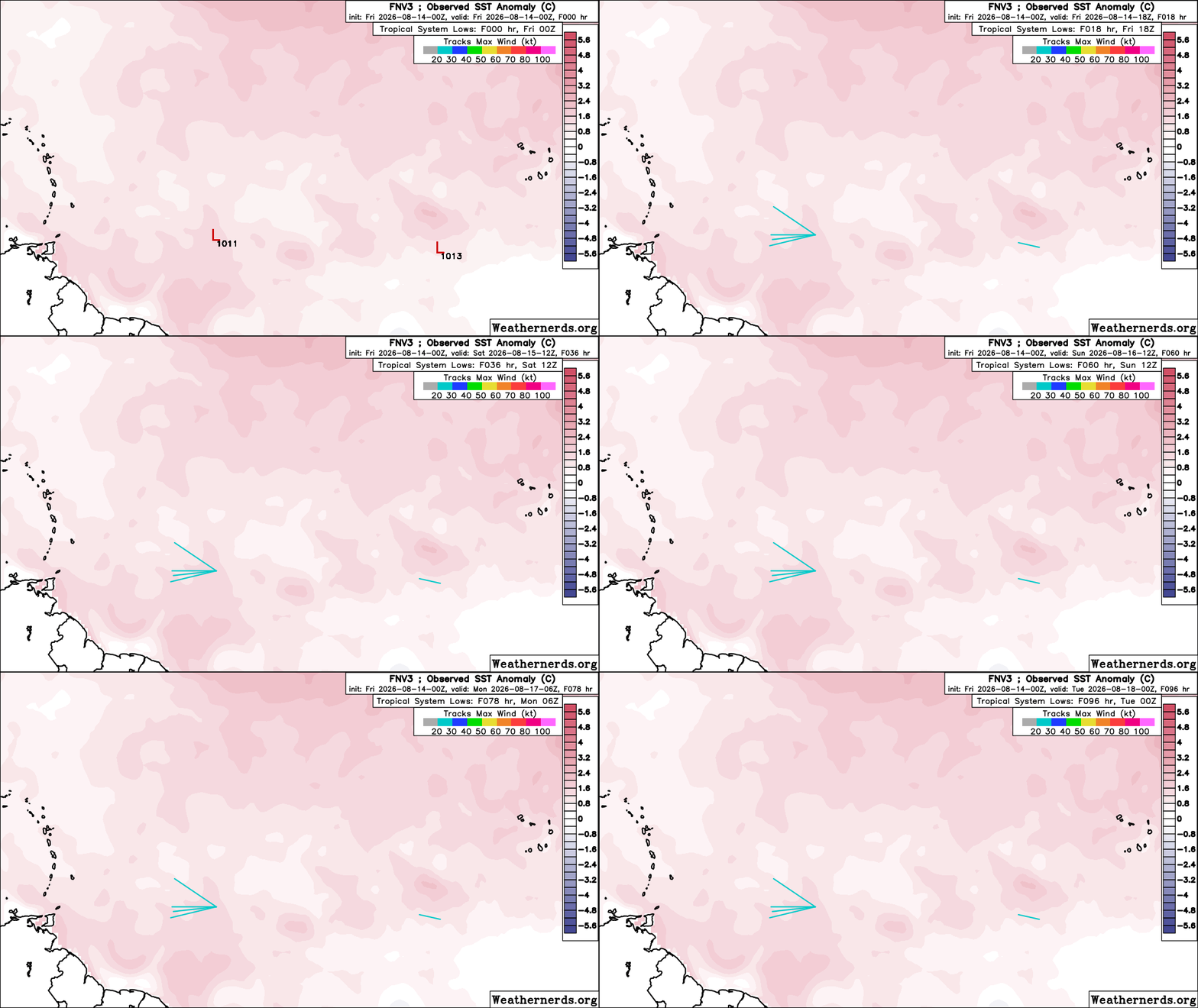
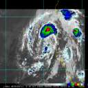
I believe the correct meteorological word for this is "poof"

Sometimes also referred to as the "Chris Farley Effect"


Post Extras: Print Post   Remind Me!   Notify Moderator  
Pages: 1


Extra information
0 registered and 2 anonymous users are browsing this forum.

Moderator:  CFHC, MikeC, Ed Dunham, Colleen A., Atricks, danielw, Clark, Christine H, RedingtonBeachGuy, SkeetoBite, Bloodstar, tpratch, typhoon_tip, cieldumort, Jackie M, Wigeon, Hank Buck 

Print Topic

Forum Permissions
      You cannot start new topics
      You cannot reply to topics
      HTML is disabled
      UBBCode is enabled

Rating:
Topic views: 571

Rate this topic

Jump to