cieldumort
Moderator

Reged:
Posts: 2761
Loc: Austin, Tx
|
|
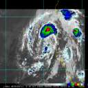
We are now starting a Forecast Lounge on Invest 93C in the Central Pacific as this system is likely to impact the Hawaiian islands.
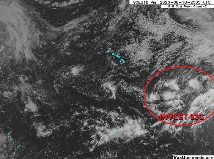
Base satellite image credit: Weathernerds.org
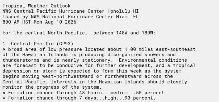
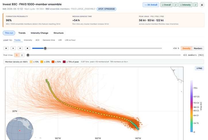
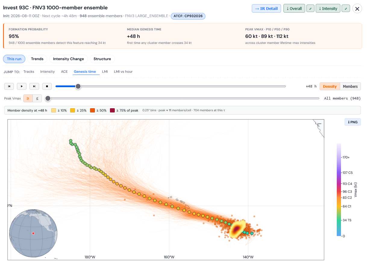
FNV3 1000 member ensembles for 93C. Credits: TC-ATLAS
8/10/26/9PM HST Title updated to Likely Hawaiian Impact
Ciel
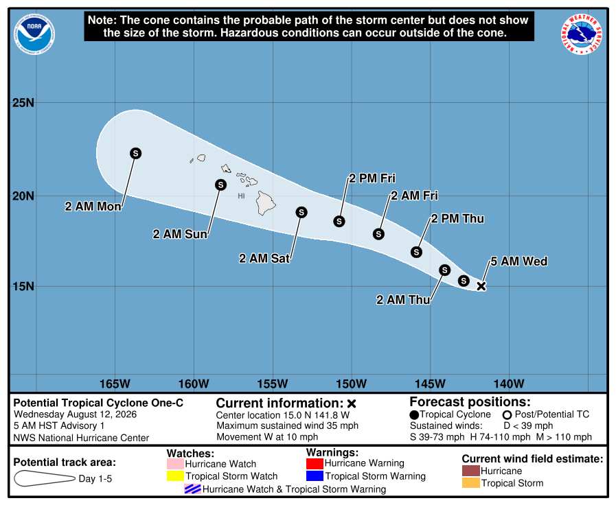
8/12/26 5AM HST. has designated 93C Potential Tropical Cyclone One-C and the title has been updated.
Ciel
8/13/26 5AM HST Storm One-C has become a tropical cyclone and is now Tropical Storm Lala. The title has been updated.
Ciel
Edited by cieldumort (Thu Aug 13 2026 11:10 AM)
|
cieldumort
Moderator
Reged:
Posts: 2761
Loc: Austin, Tx
|
|
|
cieldumort
Moderator
Reged:
Posts: 2761
Loc: Austin, Tx
|
|
The most recent run of the high-quality Google DeepMind ensembles for Invest 93C paint an increasingly ominous picture for the Hawaiian islands.
Of these runs, most of those that even take the center fairly south of the islands, still are close enough to place Hawaii under the right-front quadrant, where the strongest winds
and heaviest rains would be favored to occur. Several drive 93C directly over the Big Island as a potentially devastating hurricane.
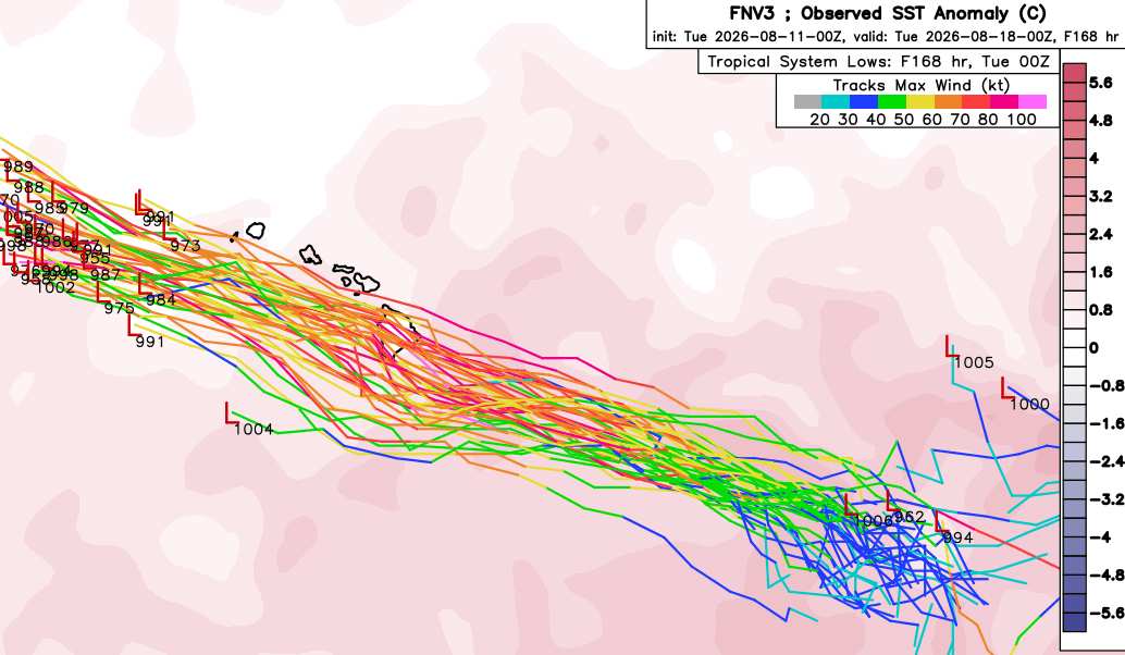
Credit: Weathernerds.org
Invest 93C FNV3 1000-member suite cr: TC-ATLAS
|
cieldumort
Moderator
Reged:
Posts: 2761
Loc: Austin, Tx
|
|
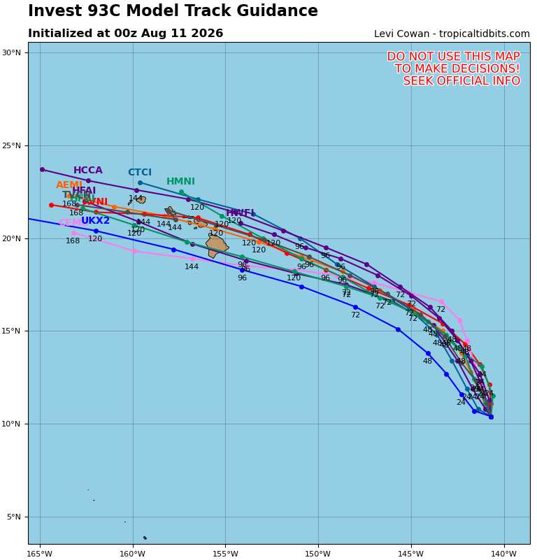
8/11/26/0z Global+Hurricane Models
Credit: Tropical Tidbits
|
cieldumort
Moderator
Reged:
Posts: 2761
Loc: Austin, Tx
|
|
|
cieldumort
Moderator
Reged:
Posts: 2761
Loc: Austin, Tx
|
|
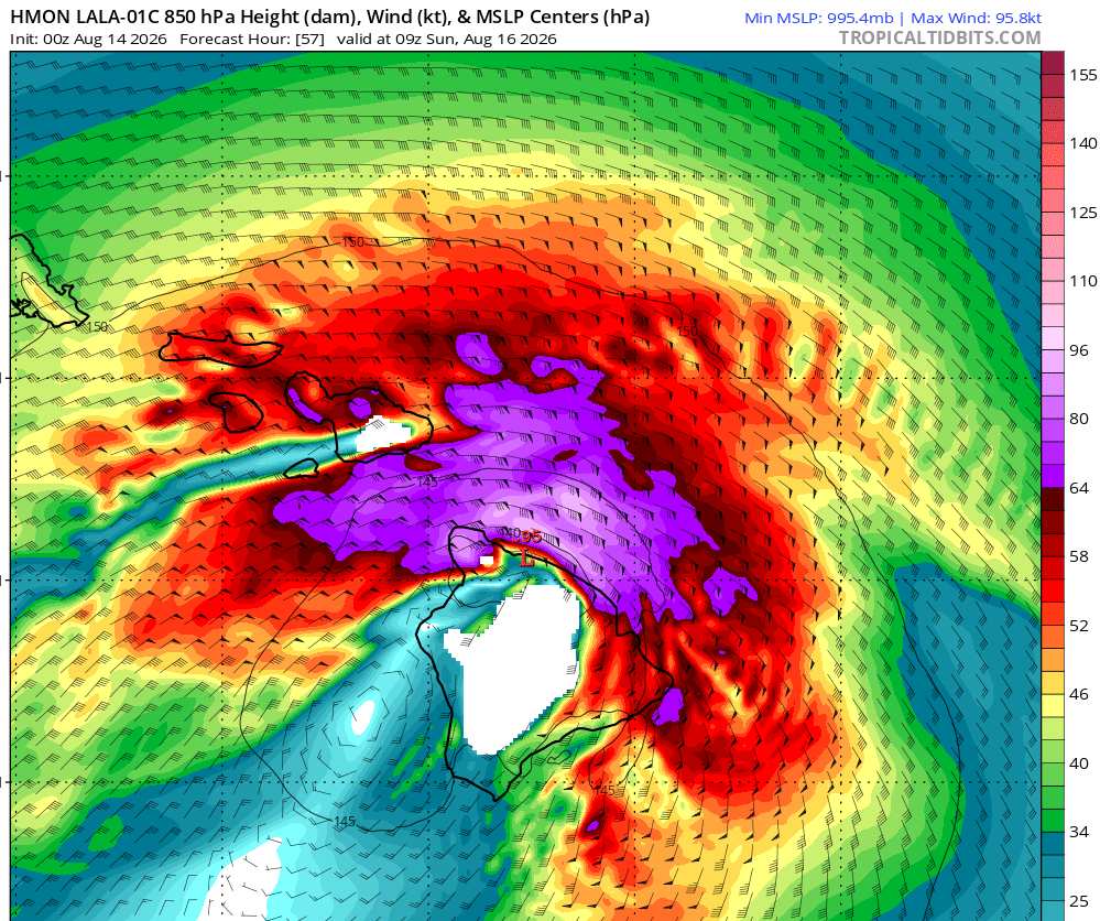
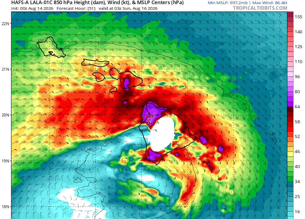
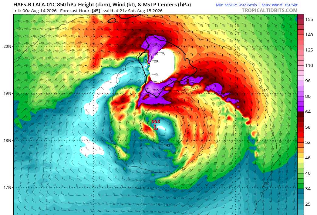
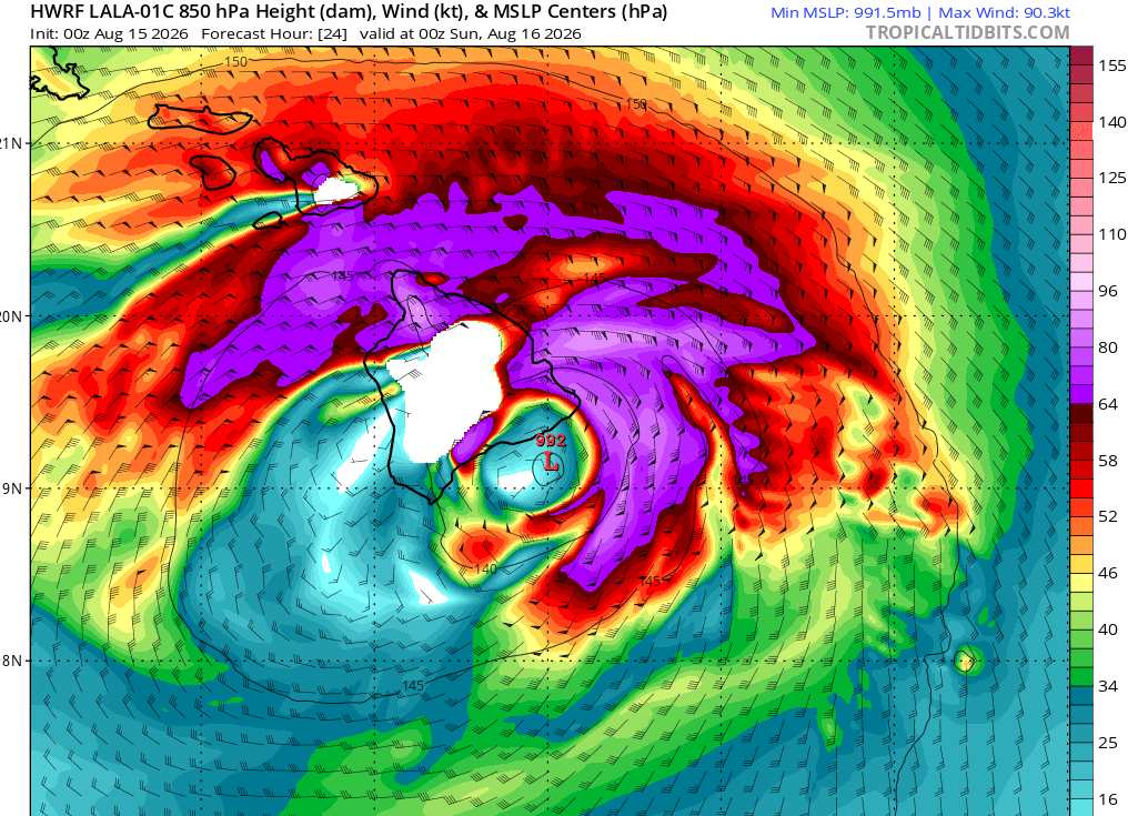
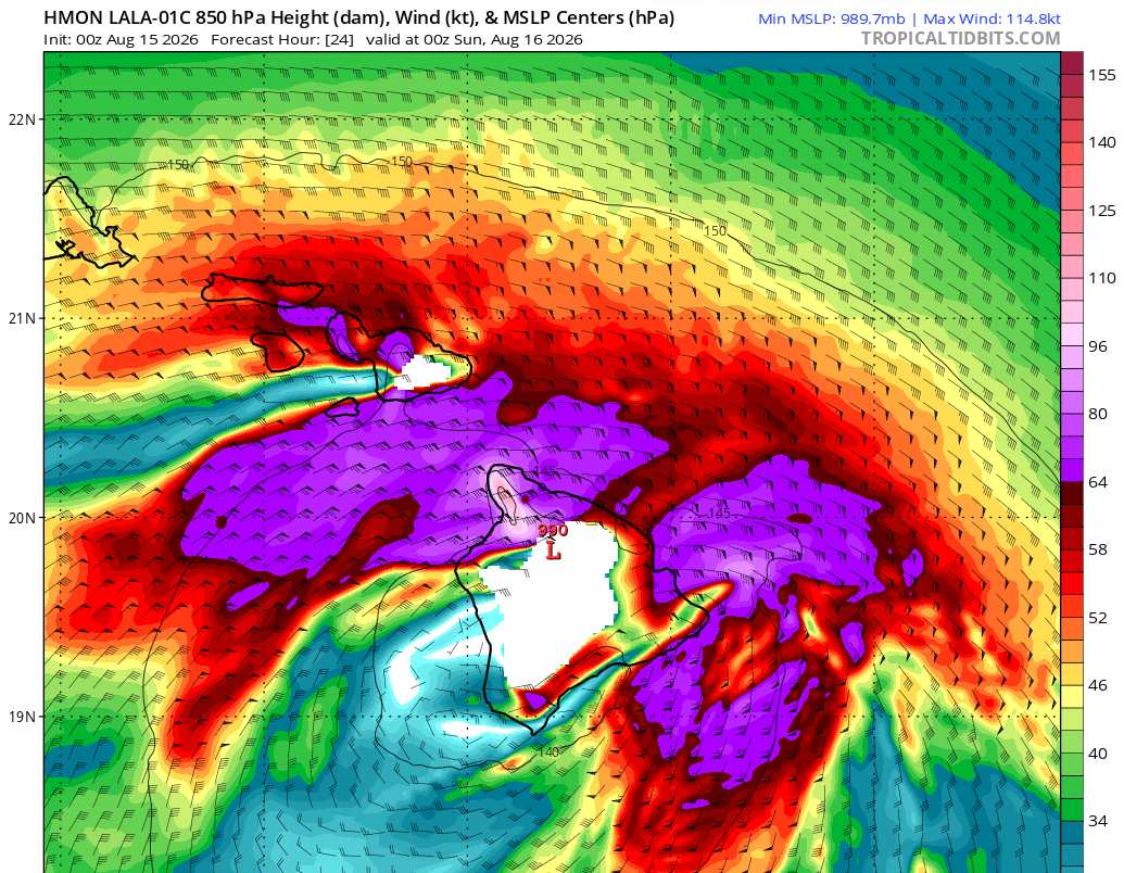
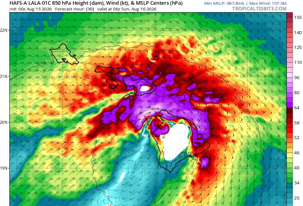
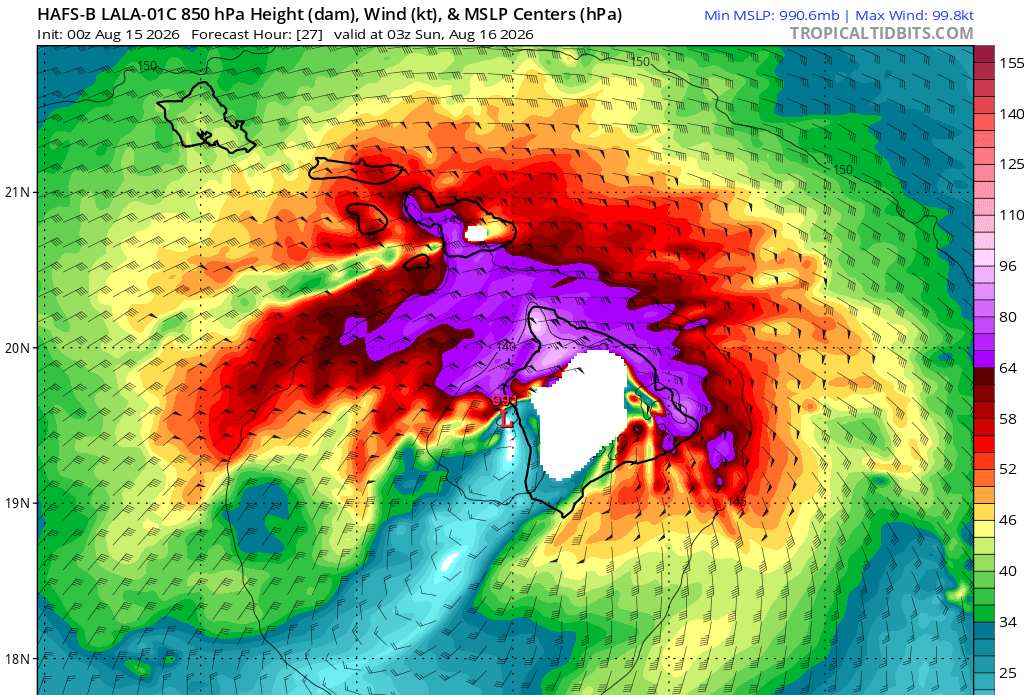
The 8/14/0z runs are coming in and giving us an idea of what the models think maximum sustained winds at an elevation of roughly 5,000 feet (850mb level) will be, which is still well less than half the altitude of the tallest point on the Big Island, at 13,803. Roughly 18% of the Big Island is at or above 5,000, meaning maximum sustained winds of these speeds are expected by these runs over much of the higher terrain of the Big Island.
Some portions of the models leave the island blank (white). This is an artifact of not colorizing the higher terrain, and in no way actually indicates a lack of wind.
This group of hurricane models have had the initial recon missions' data ingested.
HWRF - Max sustained winds at roughly 5,000' elevation of at least 80 MPH within the strongest bands and/or core
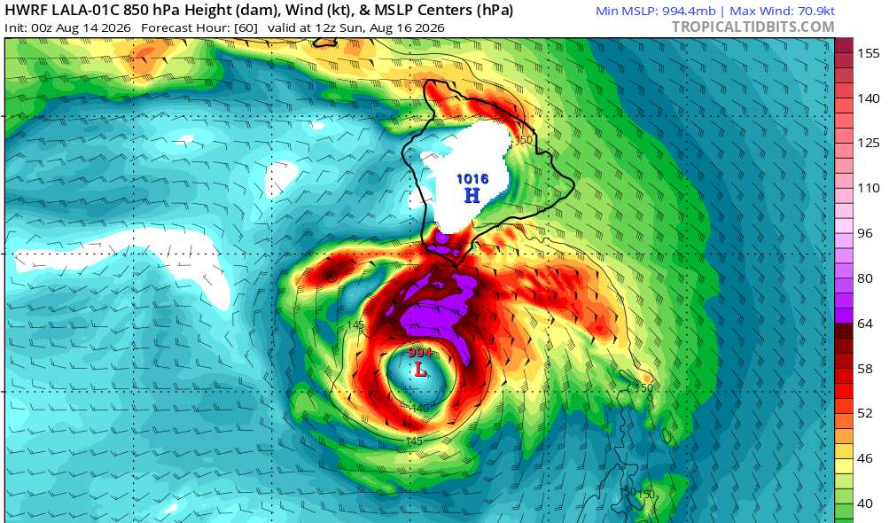
HMON - Max sustained winds at roughly 5,000' elevation of at least 110 MPH within the strongest bands and/or core
HAFS-A - Max sustained winds at roughly 5,000' elevation of at least 99 MPH within the strongest bands and/or core
HAFS-B - Max sustained winds at roughly 5,000' elevation of at least 102 MPH within the strongest bands and/or core
Hurricane model screenshots credit and courtesy: Tropical Tidbits
|
cieldumort
Moderator
Reged:
Posts: 2761
Loc: Austin, Tx
|
|
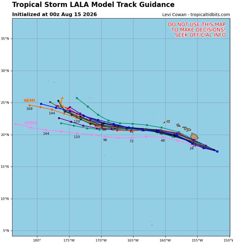
Latest 0z runs are starting to come in and so far suggest a building consensus exists that the center of Lala will either pass just south, or skirt the southern coast of, the Big Island. Obviously not a good thing, as tropical cyclones are not a thunderstorm or tornado (contrary to many social media posts along these lines). This track would place all of the Hawaiian islands within the much stronger right-front quadrant of the cyclone and also potentially limit any meaningful disruption from interaction with the tall mountains of the Big Island.
|
cieldumort
Moderator
Reged:
Posts: 2761
Loc: Austin, Tx
|
|
Most recent 0z hurricane model runs have come in and continue a trend of both a closer approach, if not outright direct landfall, for the Big Island, as well as a somewhat stronger cyclone that is producing sustained winds of up to 132 MPH at 5,000' elevation (roughly 18% or so of the Big Island is at least this high). Generally in a tropical cyclone, the higher the altitude, the stronger the winds (tho not always, and for a number of different reasons). In any event, the runs below depict these models' expectations for maximum sustained winds at roughly 5,000' Ignore the white portions as those are merely artifacts of the models.
|



 Previous
 Index
Index
 Next
Next
 Threaded


 Edit
Edit
 Reply
Reply
 Quote
Quote


