Current Radar or Satellite Image

Flhurricane.com - Central Florida Hurricane Center - Tracking Storms since 199531 Years of Hurricanes Without the Hype - Since 1995


Hurricane Warning for the Papahanaumokuakea Marine National Monument as Hurricane Lala tracks towards that portion of Hawaii. Also now monitoring 90E for Hawaii.
Days since last Hurricane Landfall — US Any: 679 (Milton), US Major: 679 (Milton), FL Any: 679 (Milton), FL Major: 679 (Milton)
FlHurricane Atlantic Tropical Cyclone Tracking 🌀 Since 1995
None
HypeScale:
2.50
0510
Communication
Storm Data
Content
Follow & Connect


General Discussion >> Other Storm Basins

Jump to first unread post. Pages: 1
cieldumortModerator
Moderator


Reged:
Posts: 2772
Loc: Austin, Tx
Invest 90E - Hawaii Threat
      #116125 - Wed Aug 19 2026 01:02 PM

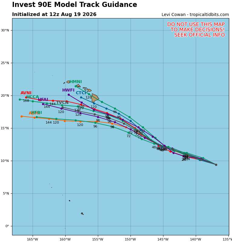
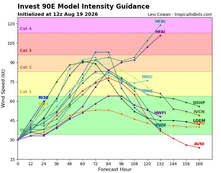
A third system to potentially threaten the state of Hawaii in as many weeks is largely expected by the best models to become a tropical cyclone within the next 48 hours and track generally in the direction of within 150 miles of the islands within the next seven days. As such, we are starting a Lounge on Invest 90E at this time.


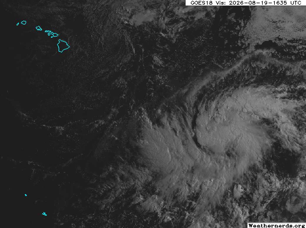
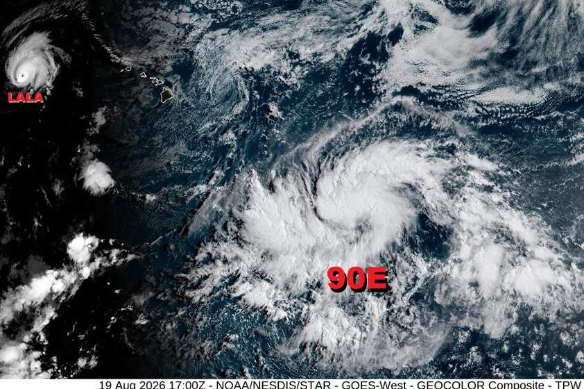
As can be seen in the visible image of 90E below from dawn today, August 19, located well east-southeast of the Hawaiian islands, 90E is a fairly large and sprawling system, unlikely to ramp up quickly at first, but it does find itself in a favorable environment for development. NHC odds for its formation into a tropical cyclone are now at 80% and going up. Assuming it does become a tropical cyclone, it could exacerbate storm damage and recovery efforts in Hawaii even without a direct hit.


Invest 90E 8/19/26/1635z image credit: Weathernerds.org


Post Extras: Print Post   Remind Me!   Notify Moderator  
cieldumortModerator
Moderator


Reged:
Posts: 2772
Loc: Austin, Tx
Re: Invest 90E - Hawaii Threat [Re: cieldumort]
      #116126 - Wed Aug 19 2026 01:08 PM


Post Extras: Print Post   Remind Me!   Notify Moderator  
cieldumortModerator
Moderator


Reged:
Posts: 2772
Loc: Austin, Tx
Re: Invest 90E - Hawaii Threat [Re: cieldumort]
      #116127 - Wed Aug 19 2026 01:29 PM

Wide view that includes both now Major Hurricane Lala nearing the far northwestern islands and 90E to the east-southeast of the Big Island.


Post Extras: Print Post   Remind Me!   Notify Moderator  
cieldumortModerator
Moderator


Reged:
Posts: 2772
Loc: Austin, Tx
Re: Invest 90E - Hawaii Threat [Re: cieldumort]
      #116130 - Wed Aug 19 2026 06:54 PM

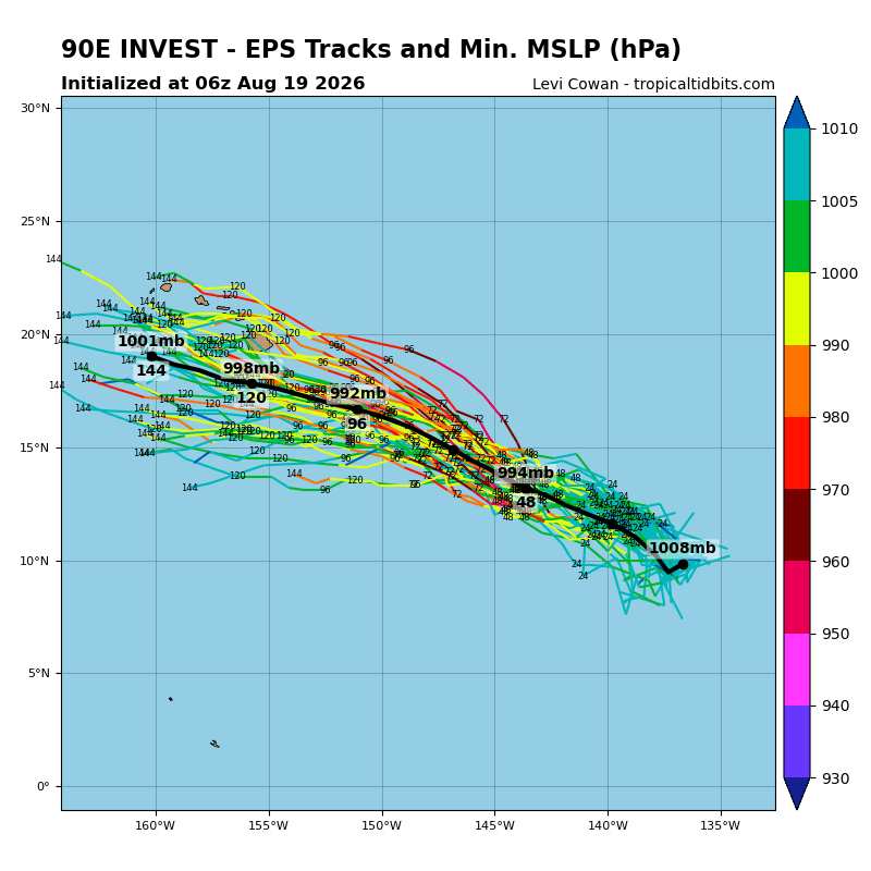
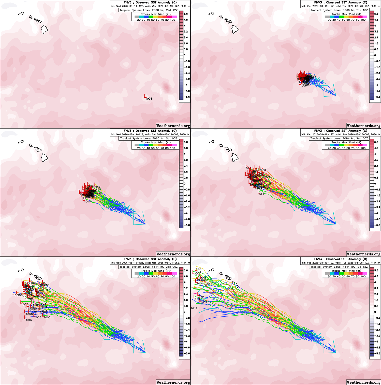
Google DeepMind FNV3 50-member ensembles that performed well with regard to Lala's track are, at this early stage, suggesting a more southerly route for 90E (Likely future Tropical Storm and/or Hurricane Moke).

The 12Z members do indicate that if future-Moke were to be stronger, sooner, then it would tend to be drawn poleward towards the Big Island, and is definitely worth monitoring regardless, as impacts are becoming likely no matter what the precise track. 90E is a large and sprawling system reminiscent of the kind of pre-typhoon gyres found in the western Pacific. Its size alone will favor bringing rains to areas of the Hawaiian islands still cleaning up after Lala's extreme rainfall totals.


Post Extras: Print Post   Remind Me!   Notify Moderator  
Pages: 1


Extra information
0 registered and 0 anonymous users are browsing this forum.

Moderator:  CFHC, Ed Dunham, Colleen A., danielw, Clark, RedingtonBeachGuy, SkeetoBite, Bloodstar, tpratch, typhoon_tip, cieldumort 

Print Topic

Forum Permissions
      You cannot start new topics
      You cannot reply to topics
      HTML is disabled
      UBBCode is enabled

Rating:
Topic views: 167

Rate this topic

Jump to