cieldumort
Moderator

Reged:
Posts: 2774
Loc: Austin, Tx
|
|
A third system to potentially threaten the state of Hawaii in as many weeks is largely expected by the best models to become a tropical cyclone within the next 48 hours and track generally in the direction of within 150 miles of the islands within the next seven days. As such, we are starting a Lounge on Invest 90E at this time.
As can be seen in the visible image of 90E below from dawn today, August 19, located well east-southeast of the Hawaiian islands, 90E is a fairly large and sprawling system, unlikely to ramp up quickly at first, but it does find itself in a favorable environment for development. odds for its formation into a tropical cyclone are now at 80% and going up. Assuming it does become a tropical cyclone, it could exacerbate storm damage and recovery efforts in Hawaii even without a direct hit.
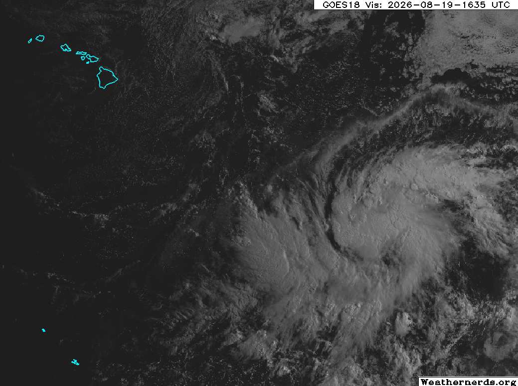
Invest 90E 8/19/26/1635z image credit: Weathernerds.org
As of 5AM HST 8/20/26, this system has become Tropical Depression Two-C, and the title has been updated.
Ciel
Edited by cieldumort (Thu Aug 20 2026 11:09 AM)
|
cieldumort
Moderator
Reged:
Posts: 2774
Loc: Austin, Tx
|
|
|
cieldumort
Moderator
Reged:
Posts: 2774
Loc: Austin, Tx
|
|
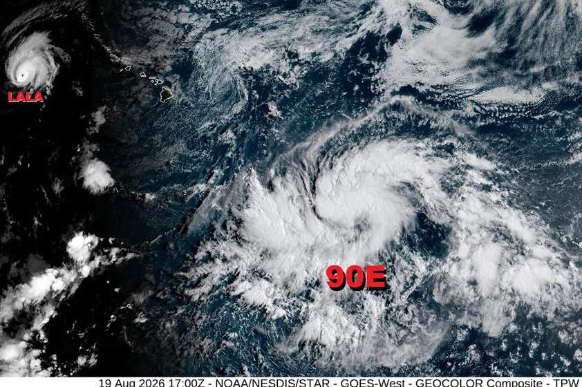
Wide view that includes both now Major Hurricane Lala nearing the far northwestern islands and 90E to the east-southeast of the Big Island.
|
cieldumort
Moderator
Reged:
Posts: 2774
Loc: Austin, Tx
|
|
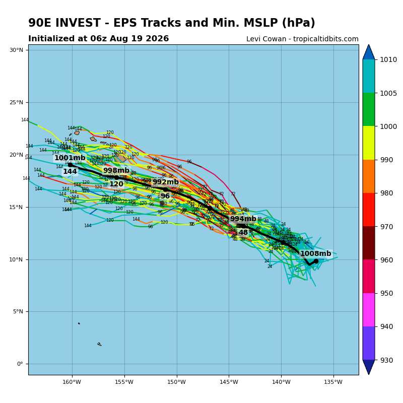
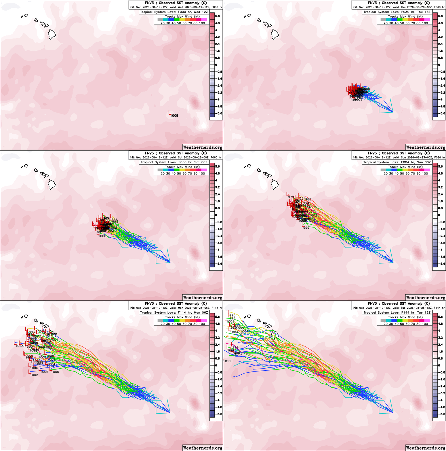
Google DeepMind FNV3 50-member ensembles that performed well with regard to Lala's track are, at this early stage, suggesting a more southerly route for 90E (Likely future Tropical Storm and/or Hurricane Moke).
The 12Z members do indicate that if future-Moke were to be stronger, sooner, then it would tend to be drawn poleward towards the Big Island, and is definitely worth monitoring regardless, as impacts are becoming likely no matter what the precise track. 90E is a large and sprawling system reminiscent of the kind of pre-typhoon gyres found in the western Pacific. Its size alone will favor bringing rains to areas of the Hawaiian islands still cleaning up after Lala's extreme rainfall totals.
|
cieldumort
Moderator
Reged:
Posts: 2774
Loc: Austin, Tx
|
|
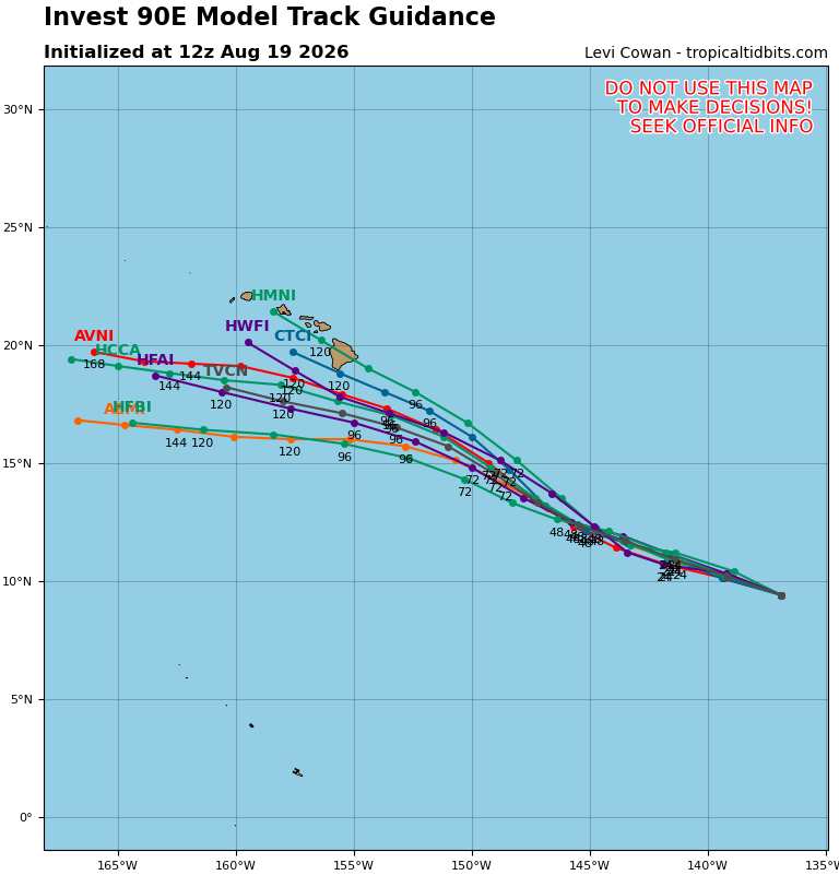
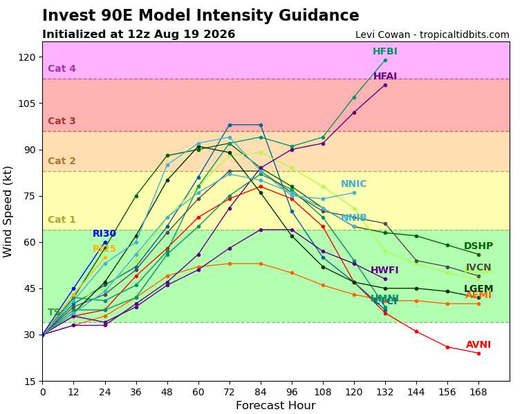
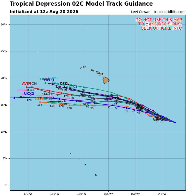
Now that the disturbance is becoming better organized, models are getting a better handle on its initial position and future track. A direct hit on Hawaii is no longer a high possibility. It will probably, however, bring heavy rains to portions of the Hawaiian islands.
NHC official forecast track "OFCL" is on the northern side of the model guidance envelope below:
|



 Previous
 Index
Index
 Next
Next
 Threaded


 Edit
Edit
 Reply
Reply
 Quote
Quote


