cieldumort
Moderator

Reged:
Posts: 2789
Loc: Austin, Tx
|
|
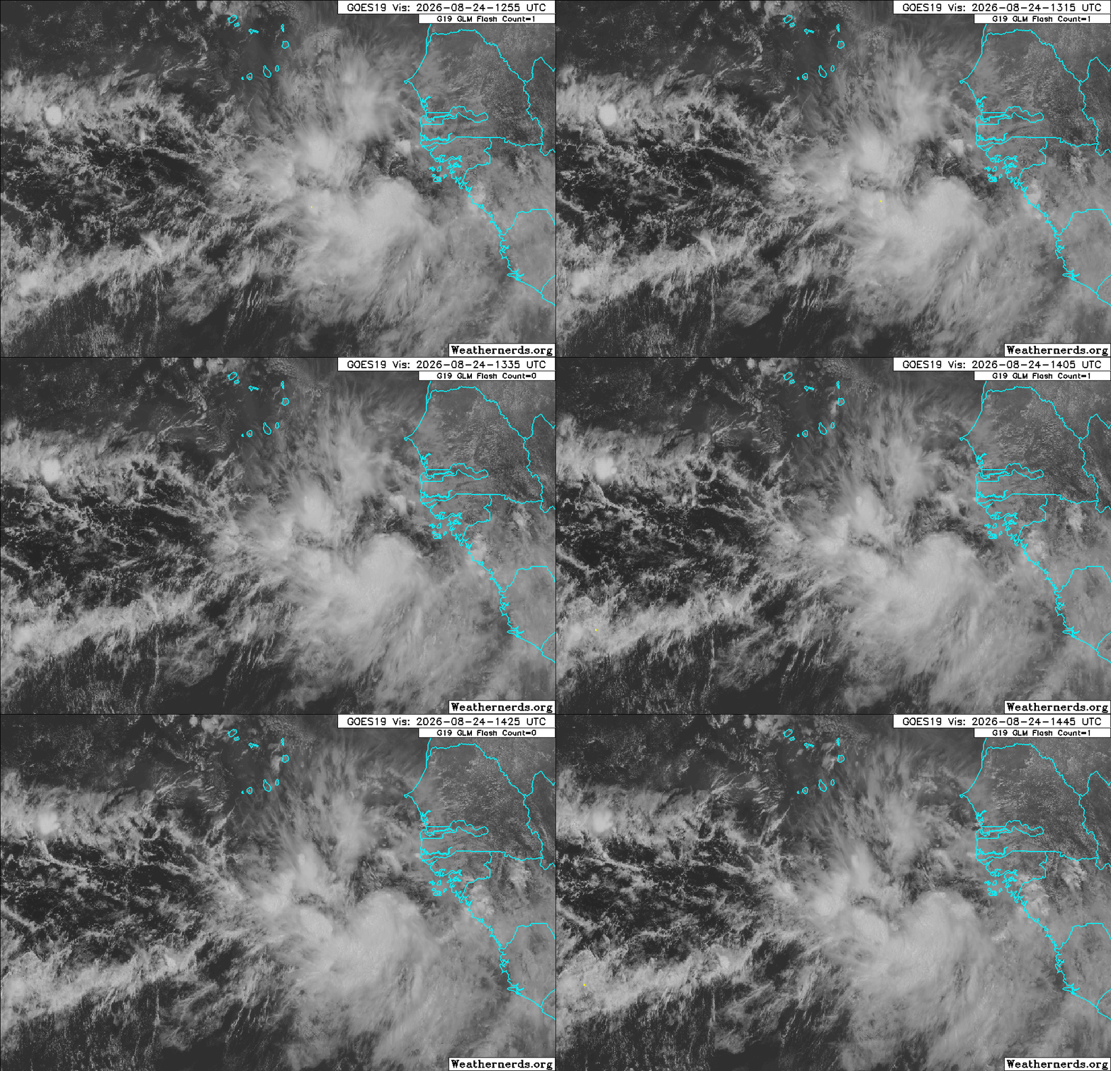
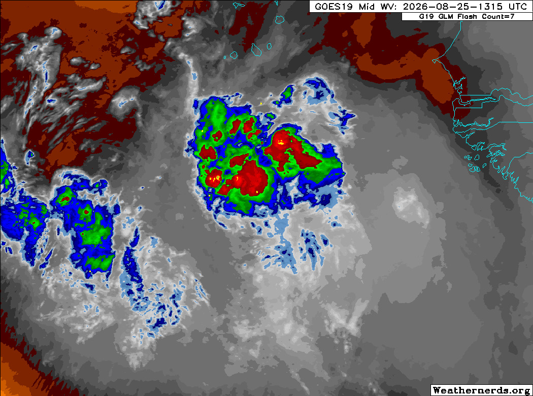
A robust tropical wave that has just rolled into the far eastern Atlantic from western Africa is being closely monitored by for development potential. Conditions for development in the Tropical Atlantic extending out to western Africa are less hostile than they had been over the prior days during the month of August, and it seems like this one has a better chance. Model support is pretty warm overall, but there has been some back and forth, and it is not yet entirely clear that the low several runs want to develop are in fact this exact disturbance.
Considering that this wave is expected to track further west under high pressure to its north, could perhaps impact some land in the very extended range, and is more likely than not to become a named storm, we are starting a Lounge on it at this time. There is not yet an Invest tag, but this should be assigned any day now. odds are 60% within 5 days for tropical cyclogenesis.
The robust wave we have been monitoring has been Invest-tagged this afternoon, 96L, and the title has been updated accordingly.
2026-08-24 18:00 11.0N 18.5W 20 KTS
Ciel
|
cieldumort
Moderator
Reged:
Posts: 2789
Loc: Austin, Tx
|
|
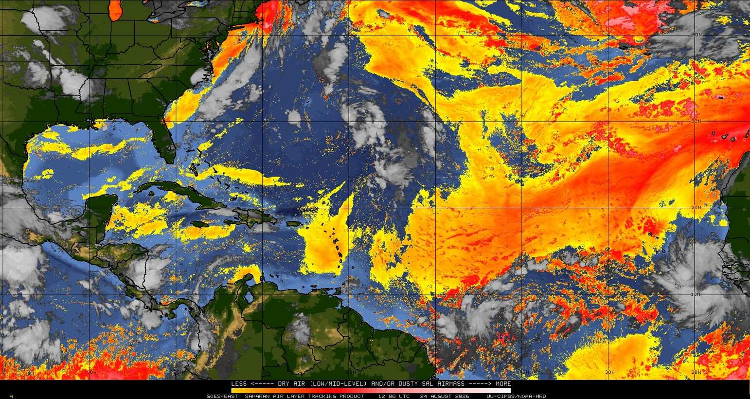
There is still quite a lot of dry, dusty air out there today. Some forecasts suggest that this wave should be tracking west while cocooned from most of it and/or that the amount of dry, dusty air will subside basin-wide this week.
|
cieldumort
Moderator
Reged:
Posts: 2789
Loc: Austin, Tx
|
|
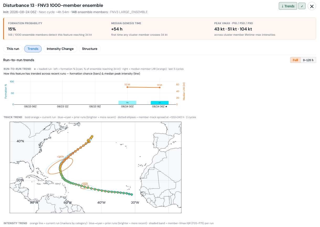
The most recent full 1,000 member run of Google's DeepMind FNV3 advertises only a 15% chance of becoming a named storm, and if it does, it would favor recurving prior to a direct hit on land.
Image/graphic credit: TC-ATLAS
|
cieldumort
Moderator
Reged:
Posts: 2789
Loc: Austin, Tx
|
|
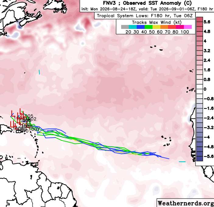
18z FNV3 out to 180 hours - Only a handful of members ramp up to at least 34 knots
|
CFHC

Reged:
Posts: 214
Loc: East Central Florida
|
|
Google's deep mind is less enthusiastic about 96L this morning, but it's looking decent on satellite and the vorticity charts, so it may develop into something (70%) is pretty good right now.
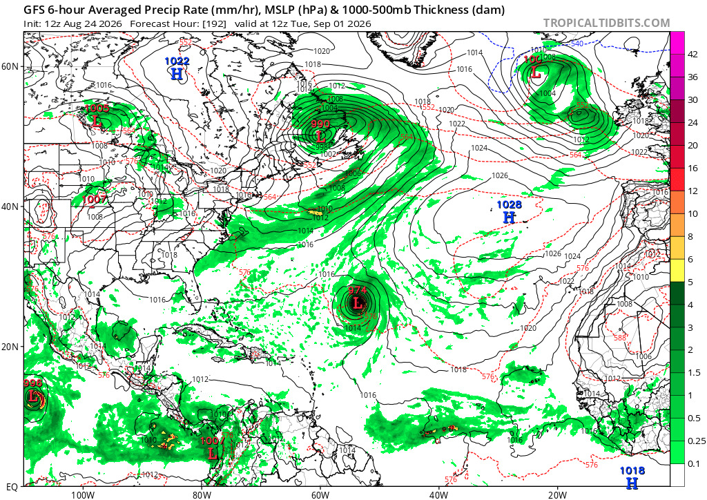
The is the most agressive, the deep mind is one of the weaker ones (only a few even develop it),
Euro doesn't develop 96L at all, some ofthe ensembles do, but not the majority.
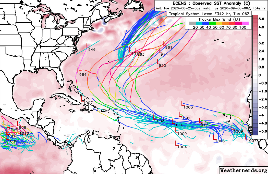
Overall if it develops strongly, it'll likely turn out to east of Bermuda, if it stays weaker it may/may not develop later, Bermuda needs to watch. It's extremely Unlikely to get to the Caribbean or US, but not impossible.
|
cieldumort
Moderator
Reged:
Posts: 2789
Loc: Austin, Tx
|
|
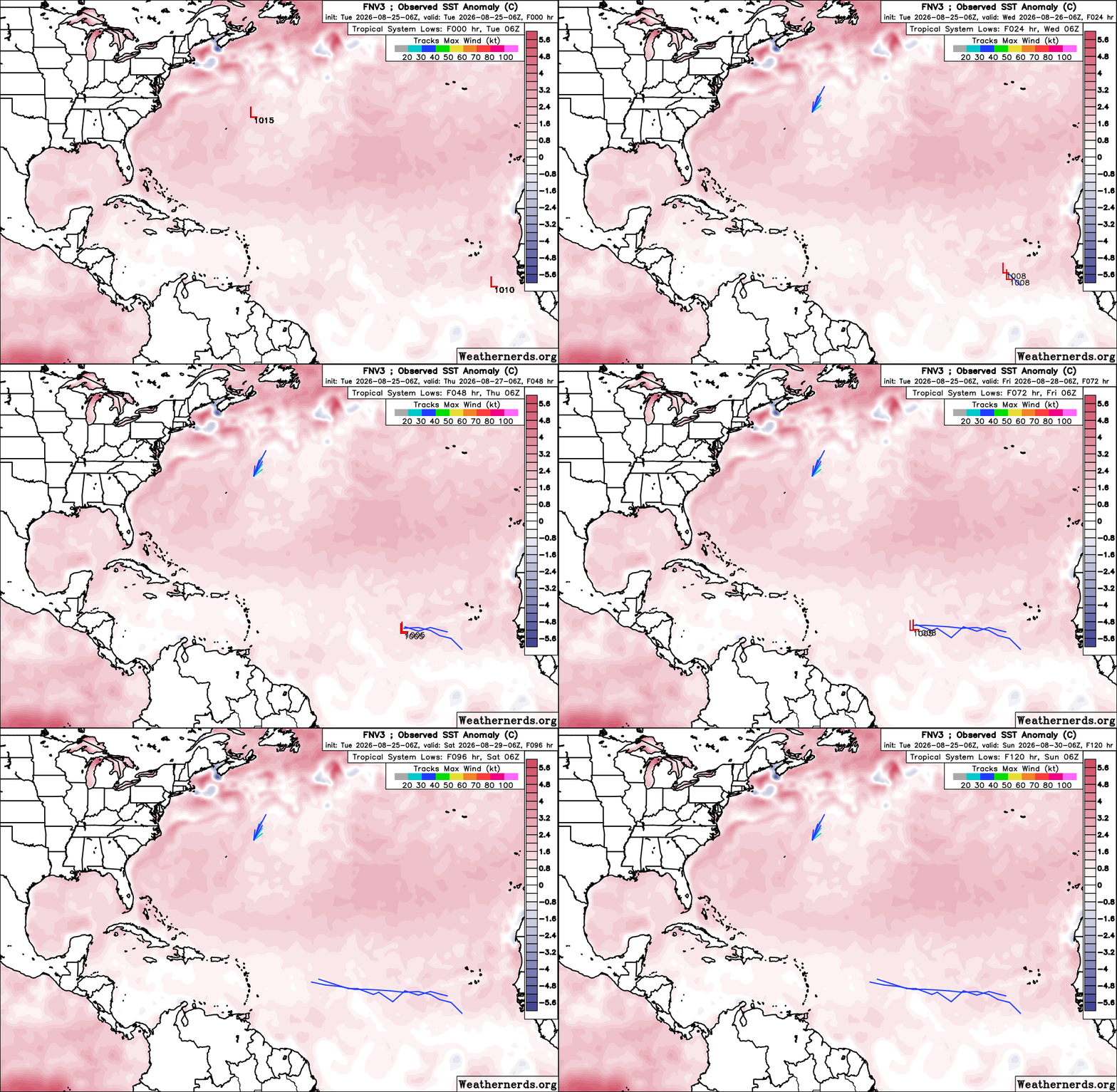
The most recent (Google) FNV3 ensembles advertise about a 4% chance 96L becomes a TD and close to 0% chance of getting a name over the next five days.
96L appeared to have a tight LLC overnight that has since fall apart. Convection never really organized around the fleeting well-defined surface circulation center and convection has been displaced even further to the south-southwest. Dry, stable air abounds to its north.
|
cieldumort
Moderator
Reged:
Posts: 2789
Loc: Austin, Tx
|
|
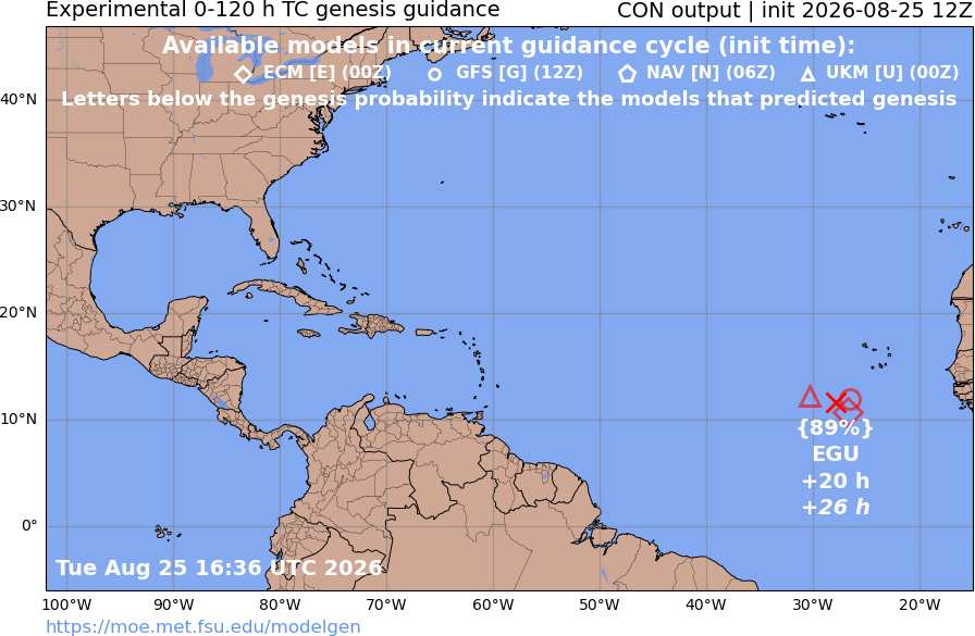
The most recent old-school models (Classic EURO, Classic , NAV, UKM) develop 96L into at least a depression. This experimental genesis product assigns an 89% chance for that.
It is worth highlighting that these models are becoming antiquated, and the , in particular, has performed astonishingly poor when it comes to TC formation, strength and track over the past year or so.
|
cieldumort
Moderator
Reged:
Posts: 2789
Loc: Austin, Tx
|
|
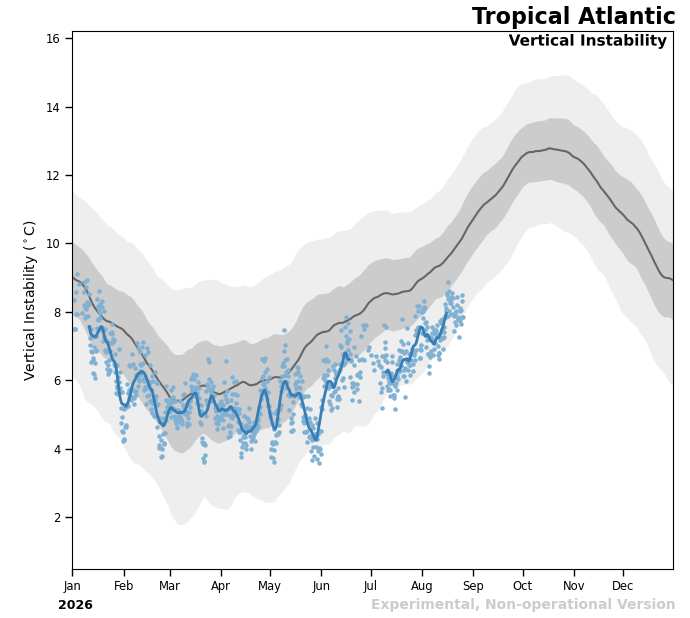
Looking at some of the conditions ahead for 96L, vertical instability in the Tropical Atlantic is starting to head up with climatology, but remains well below normal.
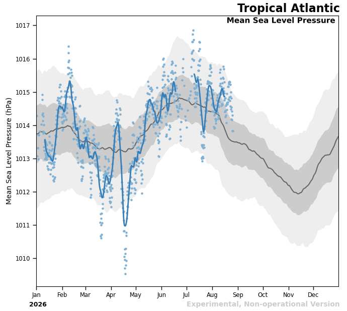
Area-wide sea level pressures remain above normal.
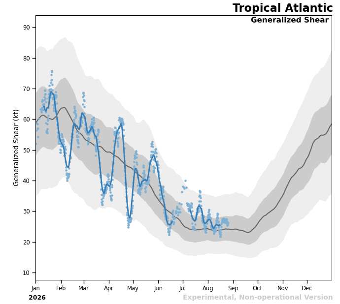
However, area-wide, shear is starting to approach normally climatologically favorable levels
In addition, thus far the cocoon of less dry to even moist air is holding. The system has a window of perhaps two or three days to pull it together, but after that, conditions for genesis may prove too difficult. Overnight tonight through tomorrow night may be the best window, tho genesis could occur as soon as later today. I think FNV3 is being far too bearish on its prospects, whereas is far too bullish. Probably give this one close to a coin toss of forming, personally. If it develops and stays weak enough to travel further west, those in the Antilles may be at some risk later this weekend and/or into next week.
|
cieldumort
Moderator
Reged:
Posts: 2789
Loc: Austin, Tx
|
|
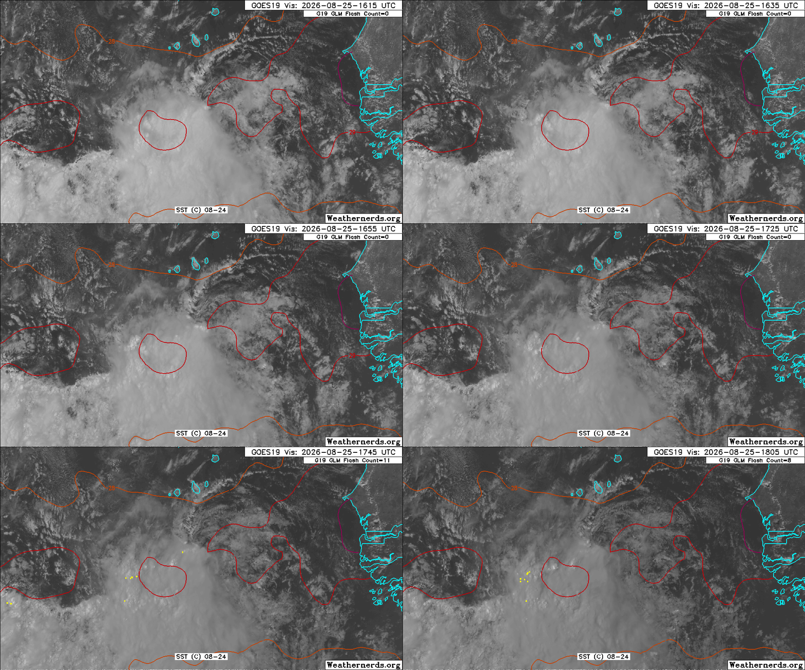
Last frame of the most recent Visible loop of 96L clearly shows the elongated low level swirl once again losing its tenuous grip on the deep convection displaced by shear to the south and south-southwest. The disturbance still has some work to do, but all in all, maybe slightly better than a coin toss to get a name.
|



 Previous
 Index
Index
 Next
Next
 Threaded


 Edit
Edit
 Reply
Reply
 Quote
Quote


