cieldumort
Moderator

Reged:
Posts: 2832
Loc: Austin, Tx
|
|
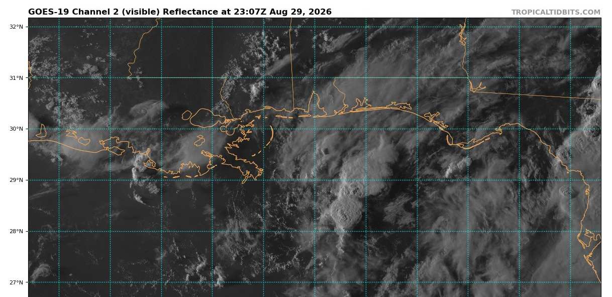
A fairly well-defined low pressure area has formed in the northern Gulf, presently about 125 miles south of Pensacola, Fl as of this update. Conditions are not especially favorable for further development at the moment, but are gradually improving, and given how close to land 97L is already, we are starting a Lounge on this Invest at this time. odds have just increased from 10% to 20% for development within 7 days (and realistically could be as soon as very early next week).
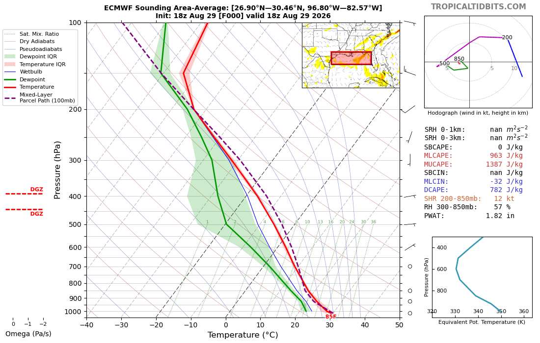
ECMWF analyzed area-average shear across the northern gulf has been around 12 knots today, with 300-850mb RH of 57%.
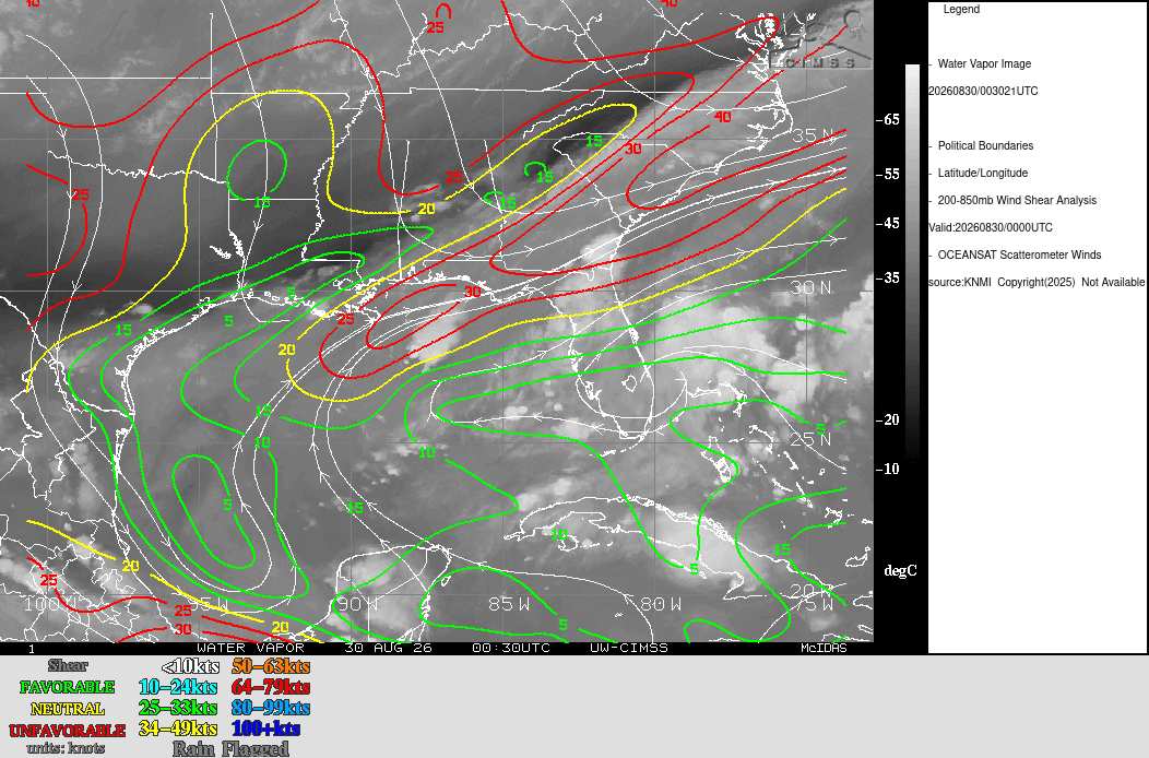
However, net effective shear over the Low itself has been much higher, as can be seen in this 200-850mb shear analysis below:
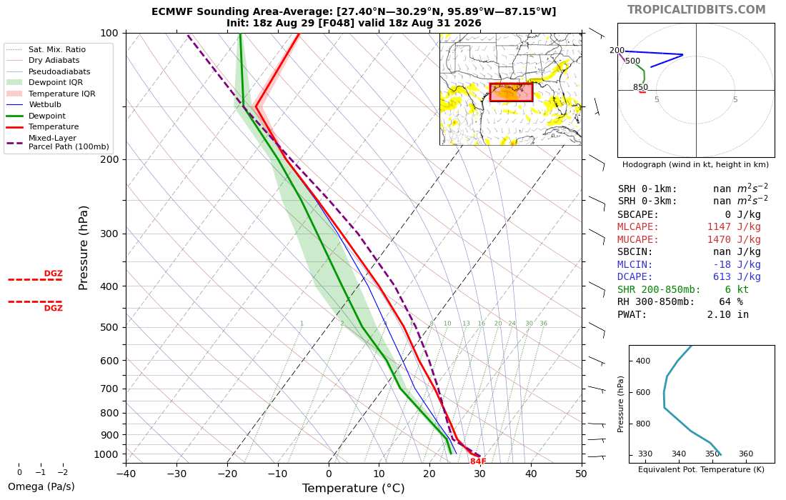
As 97L tracks further west or west-northwest, conditions for development may significantly improve.
The latest forecast for 18Z Monday calling for just 6 knots of area-averaged shear and a moist 64% RH in the 300-850mb layer.
Earlier today, Aug 31, has designated Invest 97L a Potential Tropical Cyclone, and Advisories have begun on FIVE. The title is updated accordingly.
Ciel
With the 7PM CT Aug 31 Advisory, FIVE has become a Tropical Storm, Edouard, and the title has been updated accordingly.
Ciel
Edited by cieldumort (Mon Aug 31 2026 08:08 PM)
|
cieldumort
Moderator
Reged:
Posts: 2832
Loc: Austin, Tx
|
|
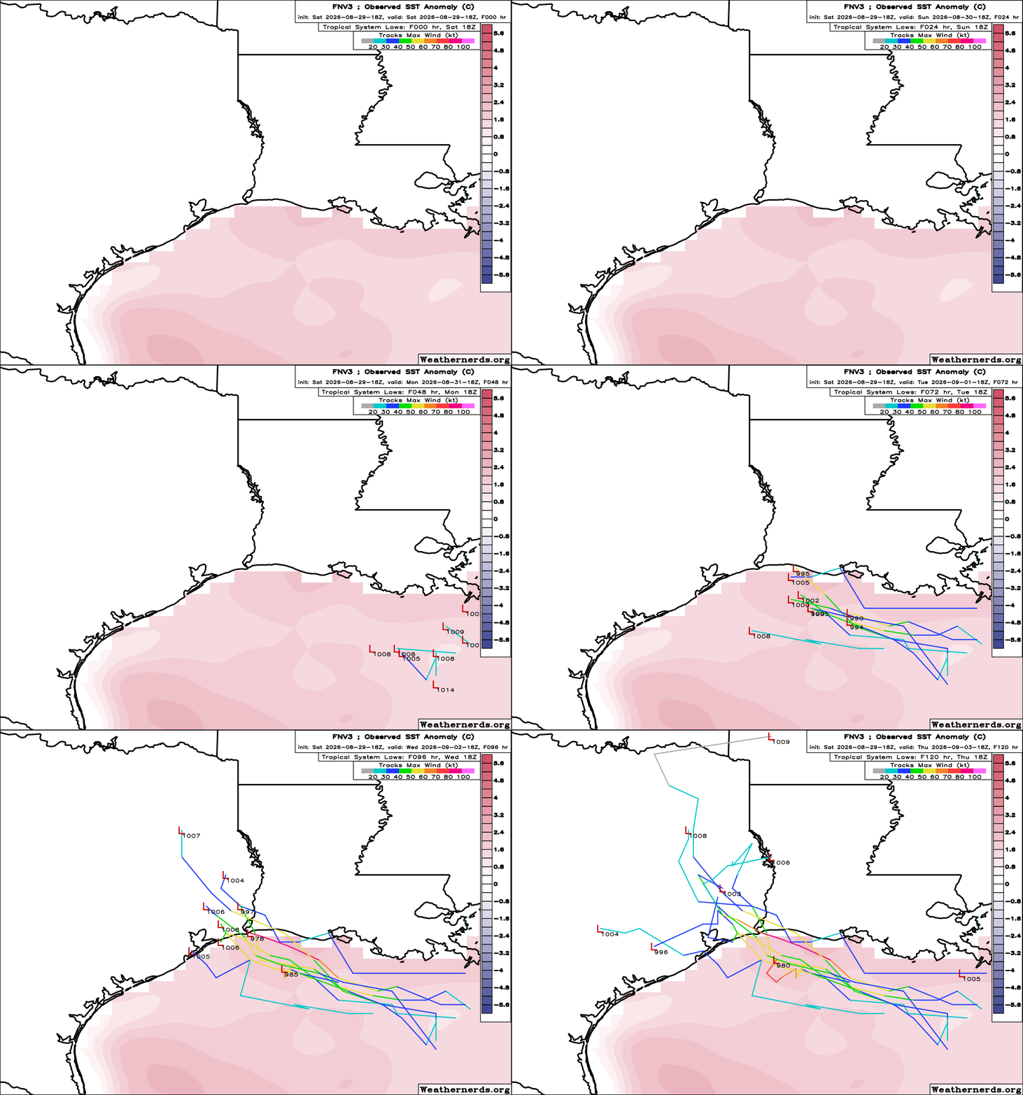
8-29-26 18Z FNV3 ensemble run out to 120 hours
Worth keeping in mind, these plots of are of members to actually develop 97L. Most do not.
|
cieldumort
Moderator
Reged:
Posts: 2832
Loc: Austin, Tx
|
|
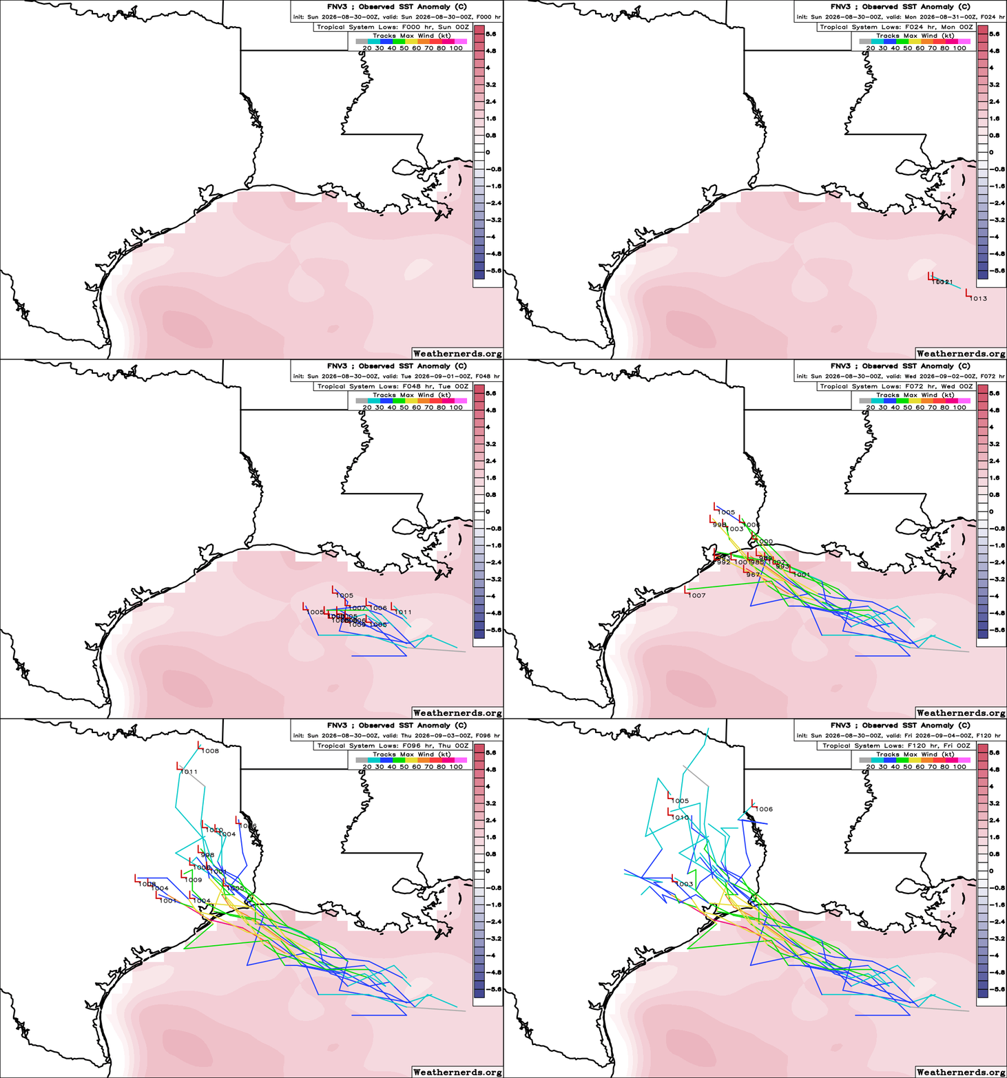
8/30/0z 50-member FNV3 run takes 97L a little further west, a little stronger, with several more members now developing.
15/50 develop into at least a tropical storm
|
cieldumort
Moderator
Reged:
Posts: 2832
Loc: Austin, Tx
|
|
Most recent Superensemble of modeling on 97L
Credit: PolarWx.com
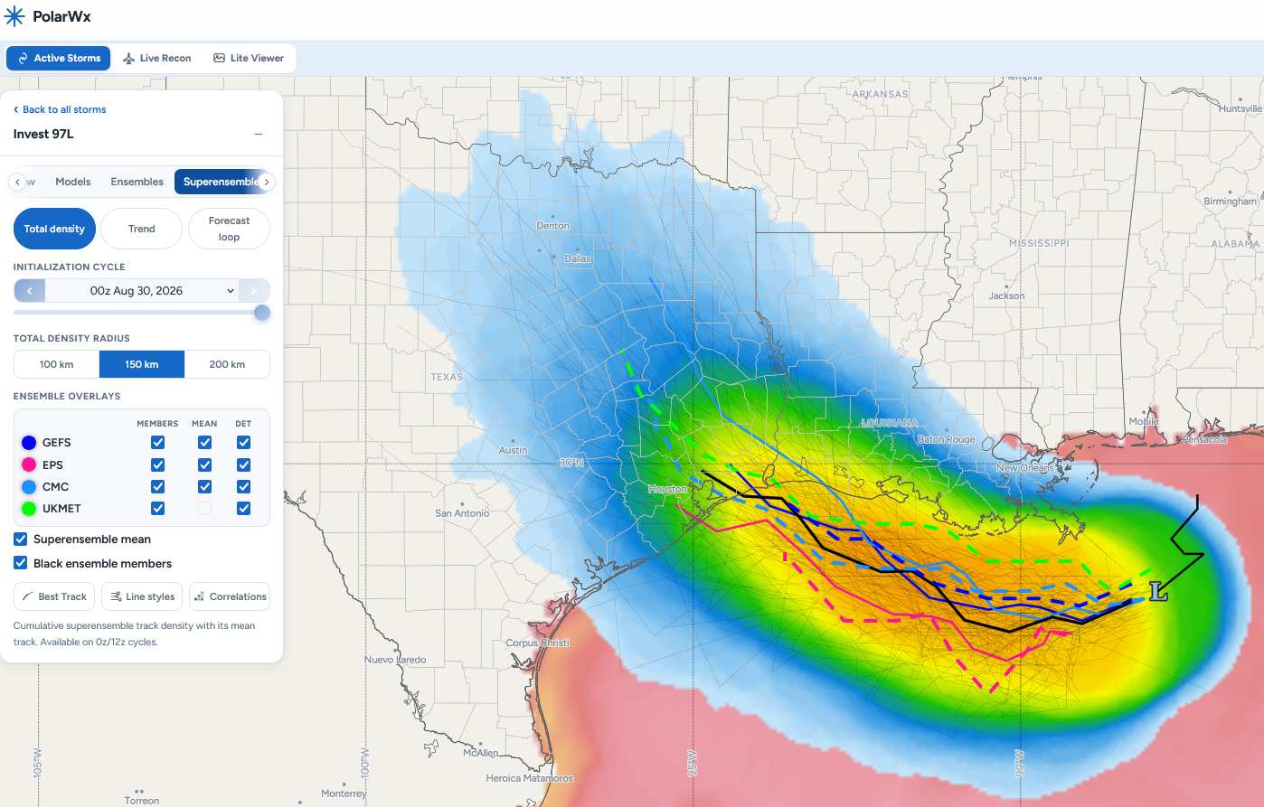
TRACK ONLY - NOT AN INTENSITY FORECAST - NOT OFFICIAL - GUIDANCE ONLY
|
cieldumort
Moderator
Reged:
Posts: 2832
Loc: Austin, Tx
|
|
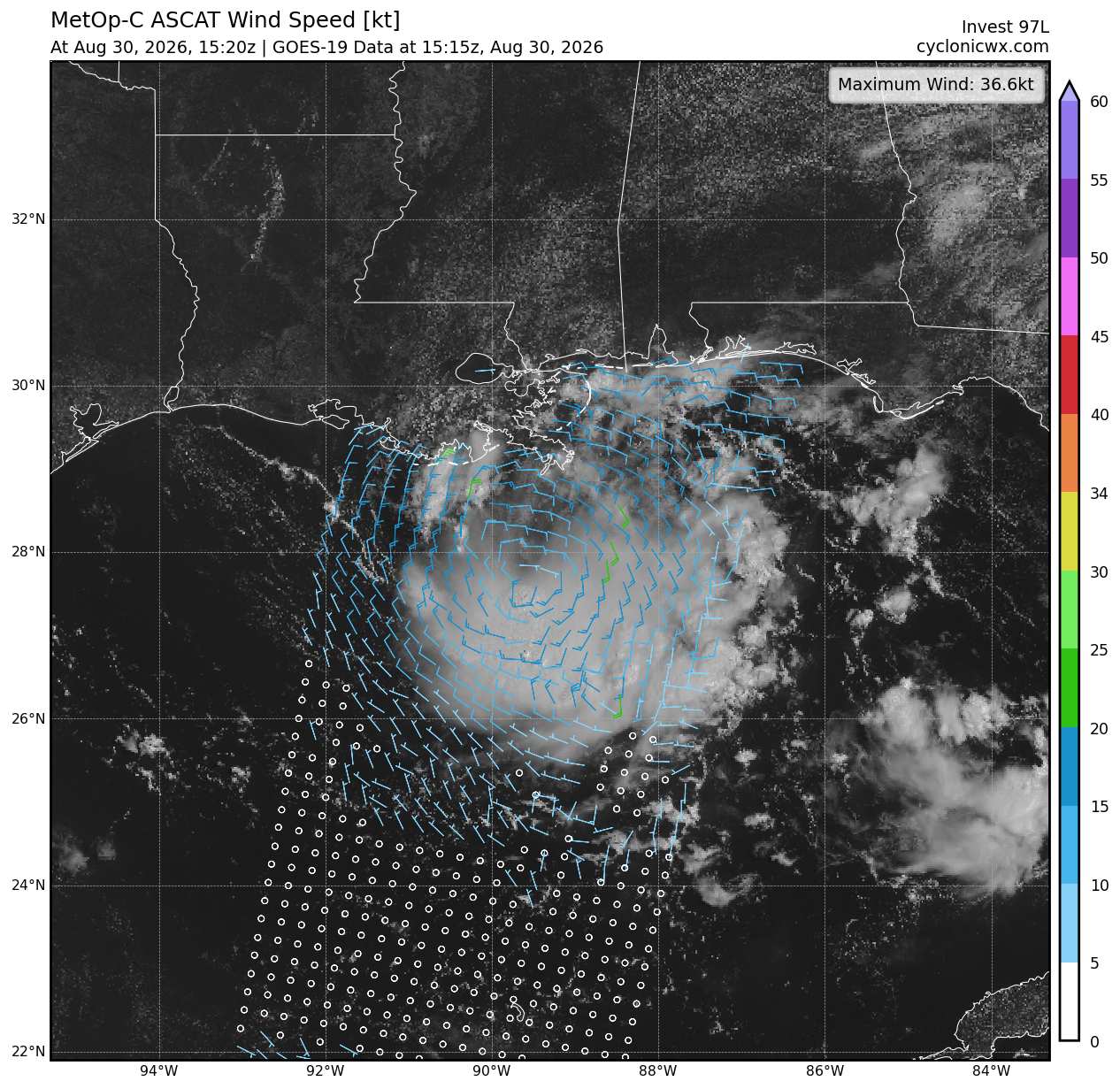
Just a little more organized convection to go. Very close to T.D. now. The next name on the list this year is Edouard.
|
cieldumort
Moderator
Reged:
Posts: 2832
Loc: Austin, Tx
|
|
|
cieldumort
Moderator
Reged:
Posts: 2832
Loc: Austin, Tx
|
|
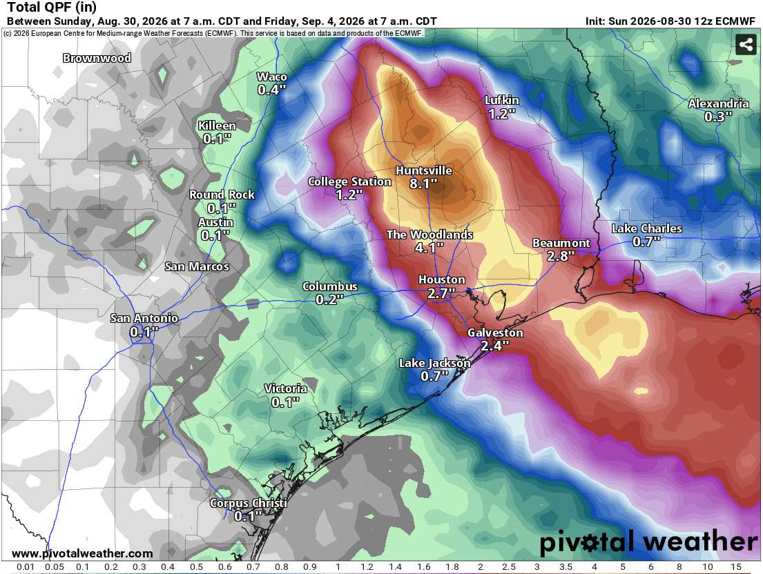
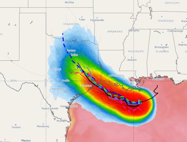
12z Superensemble is now out. Very much favoring an upper Texas coast - into eastern Texas track. This could bring some very welcome heat relief, but also potentially locally flooding rain.
Credit: PolarWx/Tomer Burg
|
danielw
Moderator

Reged:
Posts: 3528
Loc: Hattiesburg,MS (31.3N 89.3W)
|
|
Around the western side of the Southeast and Bermuda High pressure ridge it appears.
|
MikeC
Admin
Reged:
Posts: 4859
Loc: Orlando, FL
|
|
Recon is heading out, not too much on the reports available, 10-15 knots around the weak center. Models have kind of backed off on the idea of a tropical storm, just not enough time. 's holding off on doing much until recon, probably wisely. Not expecting much with this. 2026 = continuing the general theme of concern level low.
|
cieldumort
Moderator
Reged:
Posts: 2832
Loc: Austin, Tx
|
|
These are some pretty high pressures recon is finding in what has been hyped up to death on some social media, to be frank. I do think that there is a chance 97L does not move inland as quickly as forecast and spends more time over water, which would probably be its best chance to become something other than a rain-maker, as it is in the slow cooker right now. Maybe even just on a plate warmer.
|
cieldumort
Moderator
Reged:
Posts: 2832
Loc: Austin, Tx
|
|
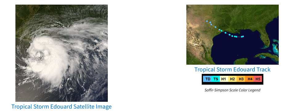
If you'd like to see a spooky good analog to the official forecast for Tropical Storm Edouard, I present to you Tropical Storm Edouard (2008)
The Matrix has you.
|
cieldumort
Moderator
Reged:
Posts: 2832
Loc: Austin, Tx
|
|
FIVE's continued improving structure - including deep convection - during the diurnal min - especially given a) its small size b) low shear environment and c) exceptionally warm sea surface temperatures - have me leaning into greater potential for Rapid Intensification overnight tonight and possibly also heading into landfall, than officially forecast or captured by current model runs.
Now that we have had one recon pass and a bona fide tropical cyclone has formed, here are my initial best guesses for maximum intensity (not necessarily intensity at landfall) for FIVE
TD (Presently a TD): 1%
Low-end Tropical Storm: 8%
Mid-range Tropical Storm: 20%
High-end Tropical Storm: 26%
Cat 1 Hurricane: 28%
Cat 2 Hurricane: 16%
Major Hurricane: 1%
|
cieldumort
Moderator
Reged:
Posts: 2832
Loc: Austin, Tx
|
|
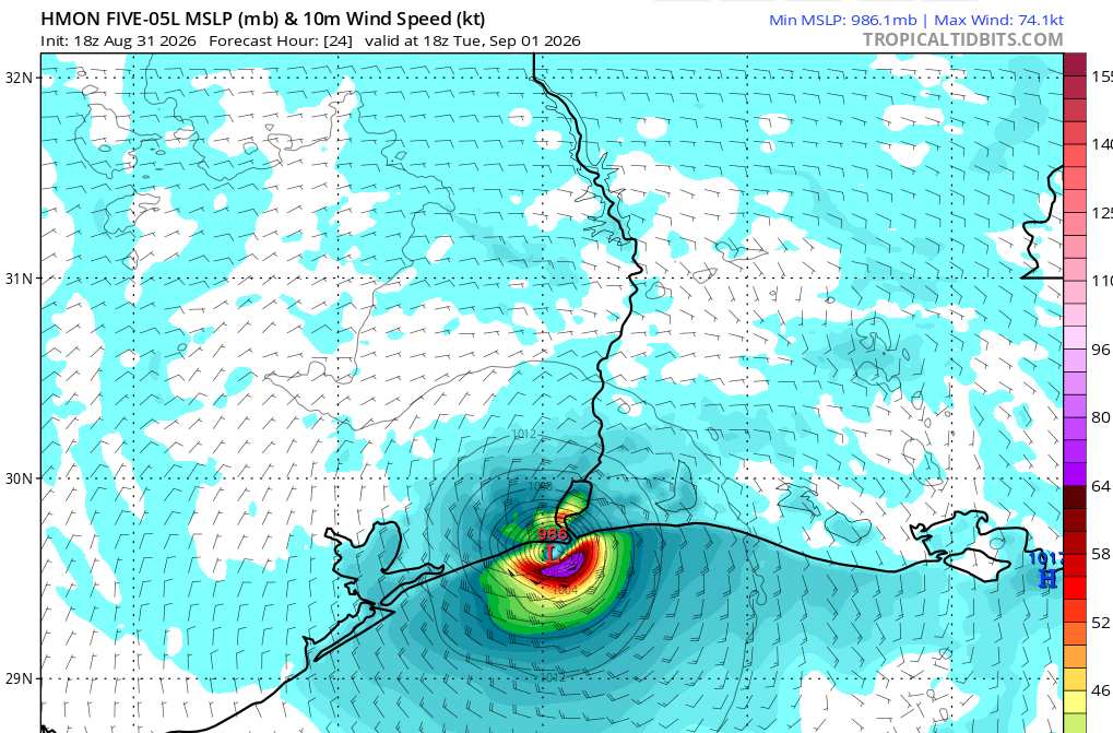
18z hurricane model runs are rolling in. The legacy hurricane models (HWRF and HMON) are probably more representative of this tropical cyclone's potential than are the HAFS bros (HAFS-A and HAFS-B), *as the HAFS handle and ingest GPS-sourced data and initializations through different architectural frameworks and have seemed to initialize more poorly with FIVE.
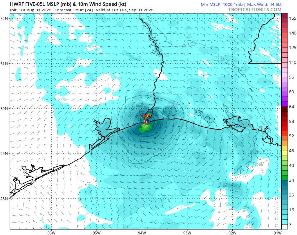
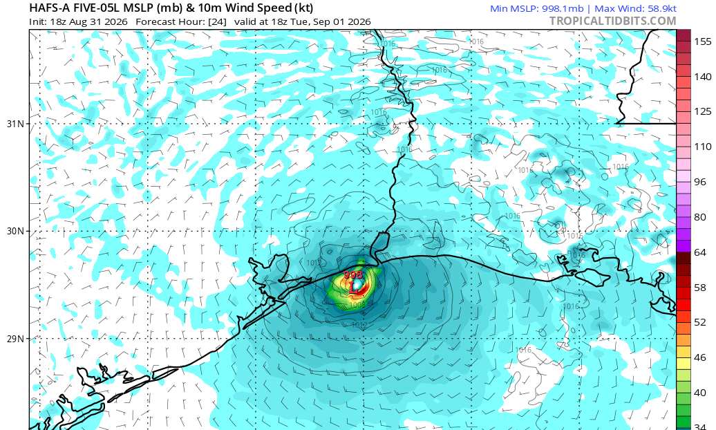
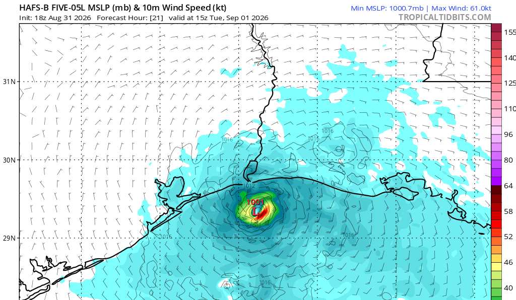
Edited for corrections
Ciel
Edited by cieldumort (Mon Aug 31 2026 08:30 PM)
|
MikeC
Admin
Reged:
Posts: 4859
Loc: Orlando, FL
|
|
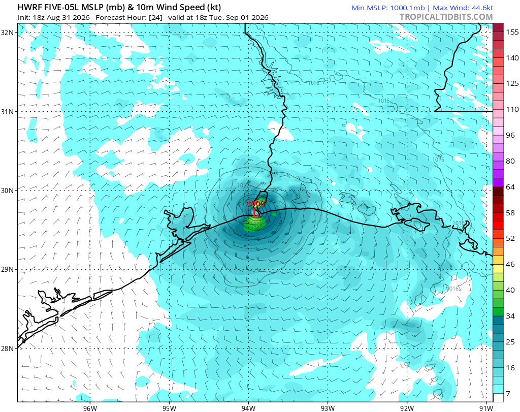
HWRF, HMON, and HAFS all rely on the model for their initial boundary conditions. The biggest difference is HAFS have the tuning to hit a lot of the old HWRF blind spot issues. It's the init that they share, nothing more though.
|
cieldumort
Moderator
Reged:
Posts: 2832
Loc: Austin, Tx
|
|
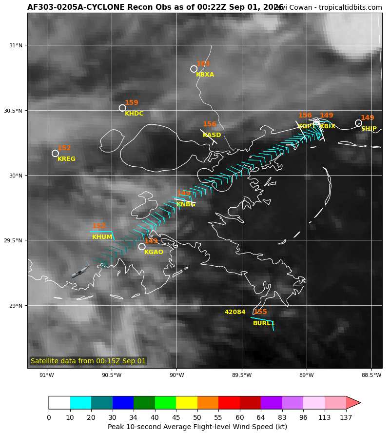
The second flight in has taken off.
There are a lot of questions that this flight in particular could help answer to provide models and thus with more certainty by tomorrow mornings' Advisories.
|
cieldumort
Moderator
Reged:
Posts: 2832
Loc: Austin, Tx
|
|
Going to be difficult for Rapid Intensification overnight tonight after ingesting some dry air. Despite this, the most recent pass through Edouard's center by recon noted an eyewall starting to form in the northwest quadrant, which goes to the point that more likely than not, an inner core is still in the process of establishing itself. The center is well south-southeast of the thick band already partially onshore in southern Louisiana.
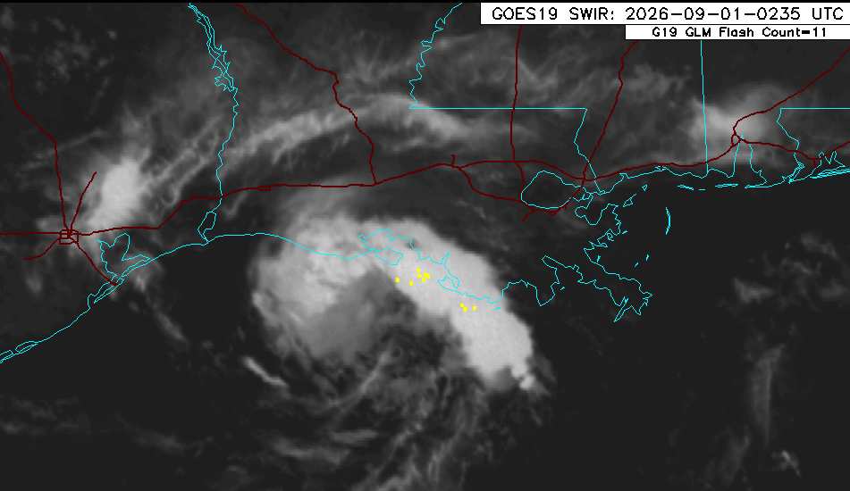
There may be two future opportunities for meaningful intensification. The first, late overnight tonight, provided dry air can get mixed out. The second, heading into and right into landfall, whenever that is. The main reasons for the second opportunity have to do with Edouard moving in to a region of the Gulf coast that encourages cyclonic flow - along with the tightening effects of friction from land. This latter opportunity is most favored by the models and ensembles that do ramp the system up to or or near hurricane status.
|
cieldumort
Moderator
Reged:
Posts: 2832
Loc: Austin, Tx
|
|
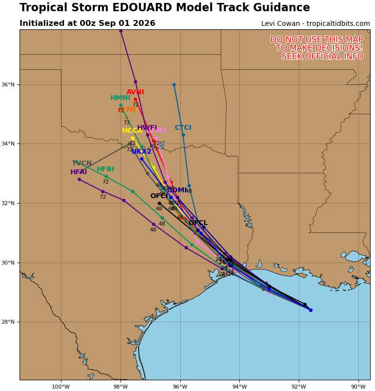
0z runs track-wise showing no major changes
|
cieldumort
Moderator
Reged:
Posts: 2832
Loc: Austin, Tx
|
|
Modeled Pressure/Wind for time of landfall. Only including models that have done a reasonable job at initialization.
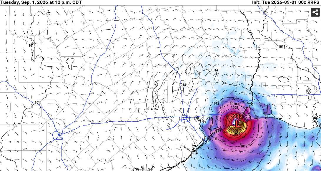
Above: 992MB/69 KTS
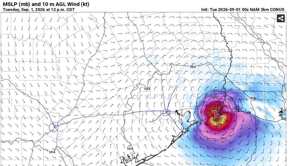
Above: 988MB/63 KTS
More to come
|



 Previous
 Index
Index
 Next
Next
 Threaded


 Edit
Edit
 Reply
Reply
 Quote
Quote


