cieldumort
Moderator

Reged:
Posts: 2858
Loc: Austin, Tx
|
|
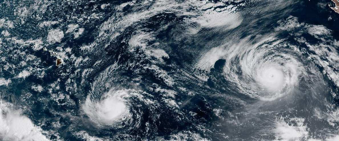
Above: True Color Visible of Lowell (left) and Karina (right) on August 31, 2026 at 1910UTC
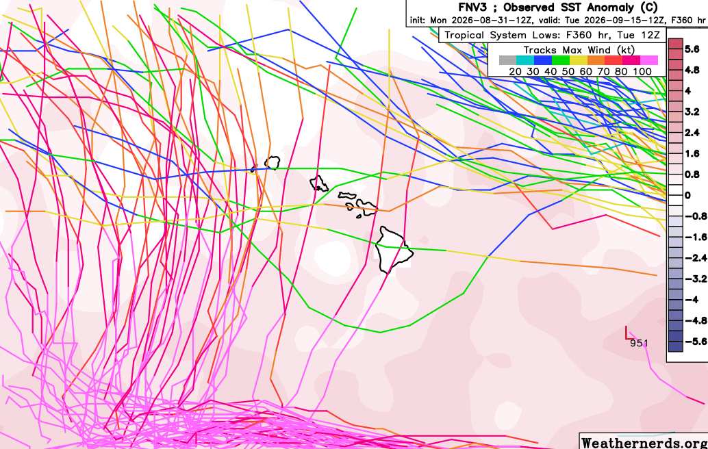
Two powerful tropical cyclones presently in the Eastern Pacific, both heading generally west, may draw close enough to each other to help tug one or both closer to the Hawaiian islands in the extended range. Several models keep picking up on this signal, with the bulk of those that do place Hawaii at risk pointing towards Lowell as having the greater risk of being pulled up towards or over the islands - also benefiting from response to steering that may already be in place. Even if a direct hit does not occur from one or both of these tropical cyclones, passage may come close enough to once again bring inclement weather to the great state of Hawaii, and so we are starting a Forecast Lounge at this time for both cyclones, Lowell and Karina, until such a time, if there is one, that one of these two becomes a clear threat.
Recon has already been tasked

9/2/26 9PM HST Lowell has become a potentially very serious threat to Hawaii and have opted to turn this into a full Lounge (like we have for Atlantic systems). The island is still cleaning up and recovering after the direct hit from powerful Hurricane Lala. Lowell has modeling that supports landfall as intense as Major. Interests in the great state of Hawaii may want to begin following along and taking some initial preparedness now, before any rushes begin, if they do. We will need to closely monitor how far east it gets before it begins tracking north.
Ciel
|
cieldumort
Moderator
Reged:
Posts: 2858
Loc: Austin, Tx
|
|
|
cieldumort
Moderator
Reged:
Posts: 2858
Loc: Austin, Tx
|
|
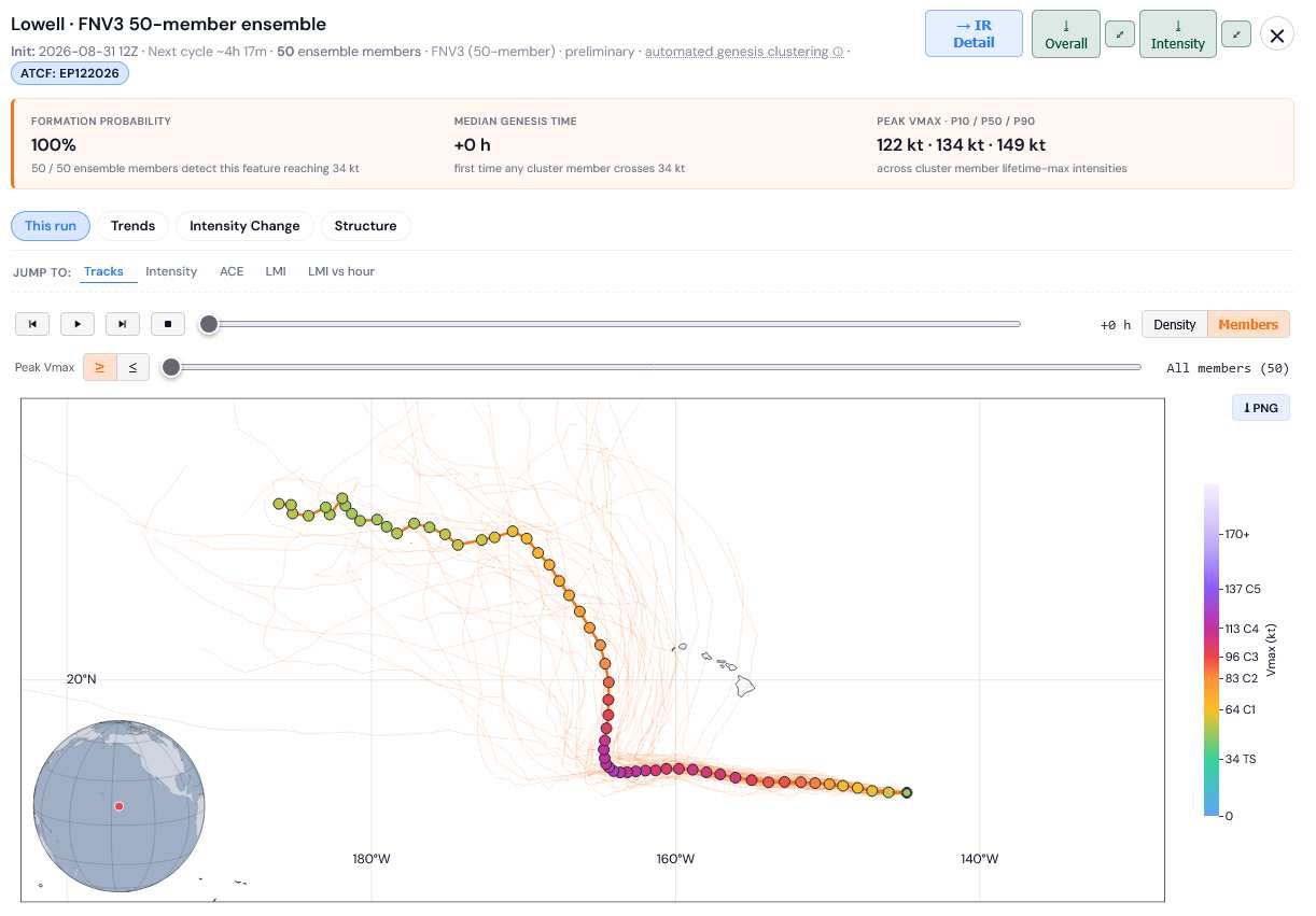
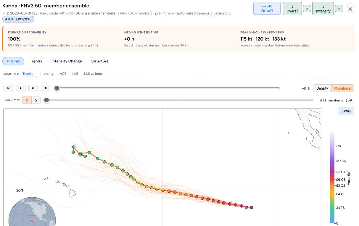
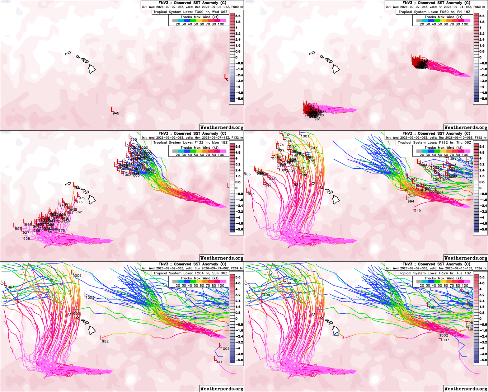
The most recent FNV3 has backed off potential for significant interaction between Karina and Lowell, taking Karina on a more northerly course. Lowell, however, could pose a direct threat to the islands, based on this high quality model's recent run.
|
cieldumort
Moderator
Reged:
Posts: 2858
Loc: Austin, Tx
|
|
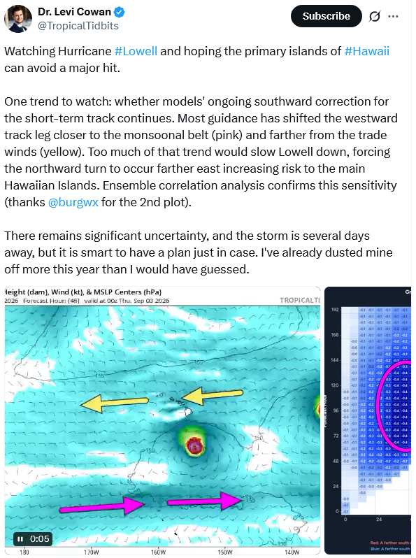
Tropical Tidbits on X
|
MikeC
Admin
Reged:
Posts: 4861
Loc: Orlando, FL
|
|
New early model viewer being worked on, good for lowell:
https://flhurricane.com/throwbackspaghetti.php#storm=EP122026
|
cieldumort
Moderator
Reged:
Posts: 2858
Loc: Austin, Tx
|
|
Lowell continues a trend of tracking to the right of forecast.
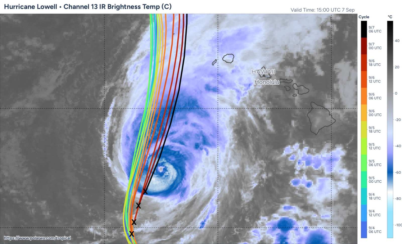
Image credit: polarwx.com
|
cieldumort
Moderator
Reged:
Posts: 2858
Loc: Austin, Tx
|
|
The high-quality DeepMind FNV3 50-ensemble suite largely suggests that a stronger Lowell will favor a track to the right of the ensemble mean, which is also what we are continuing to see today. The strongest ensemble members from today's 12Z run threaten western Hawaii with Lowell as a borderline Major. Real-time satellite and recon data suggests that Lowell is possibly stronger than forecast for this time.
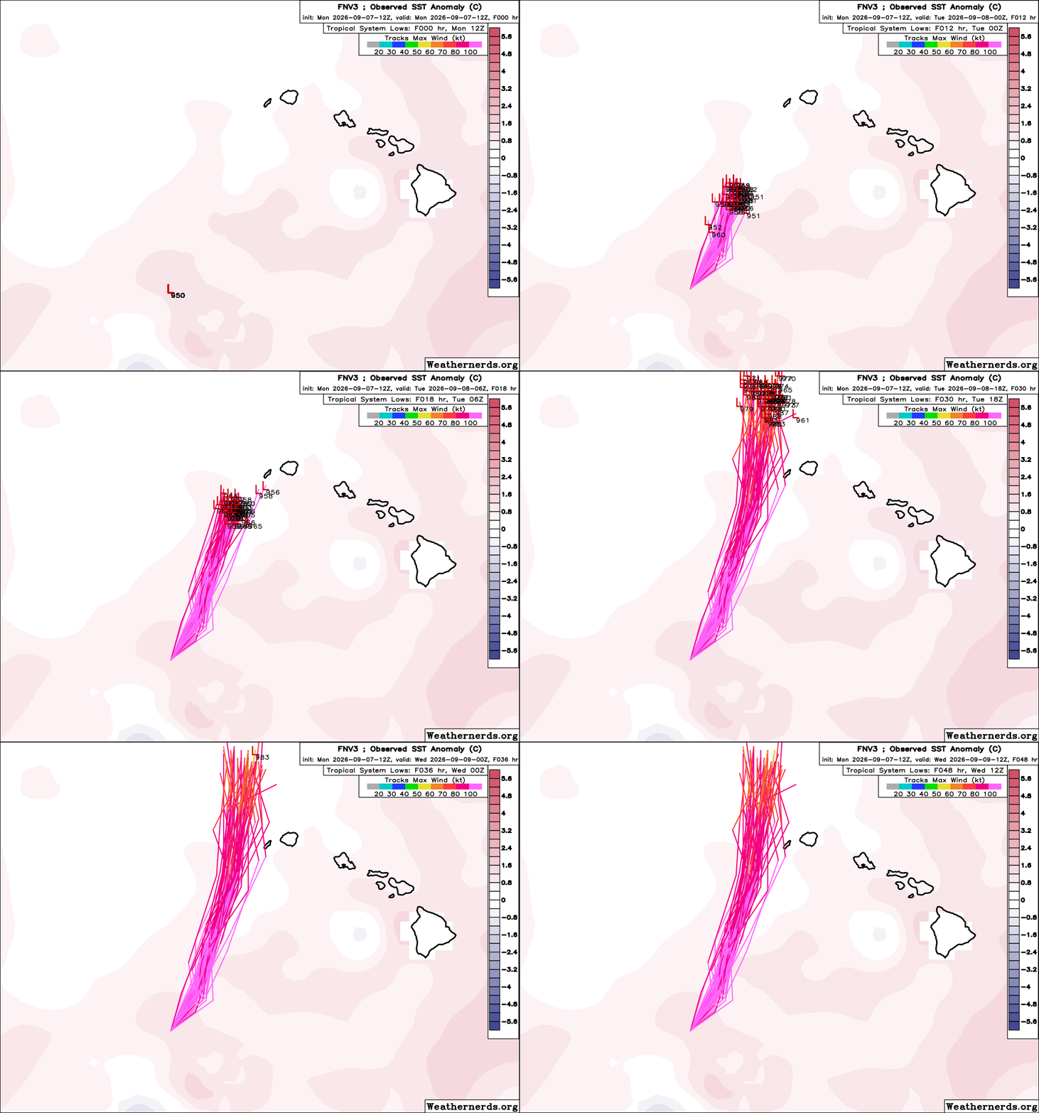
GIF Credit: Weathernerds.org
|
cieldumort
Moderator
Reged:
Posts: 2858
Loc: Austin, Tx
|
|
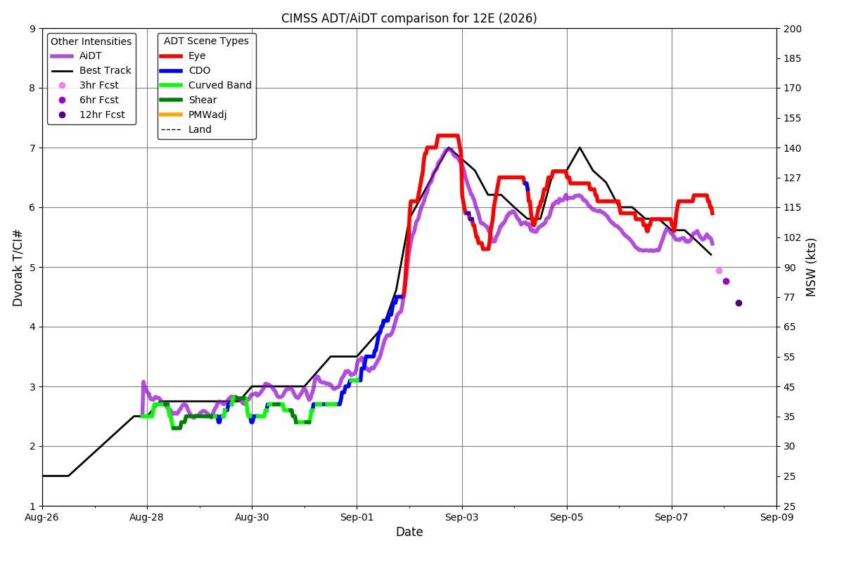
ADT/AiDT current intensity estimates, forecasts and official Best Track. Image credit: CIMSS
|
cieldumort
Moderator
Reged:
Posts: 2858
Loc: Austin, Tx
|
|
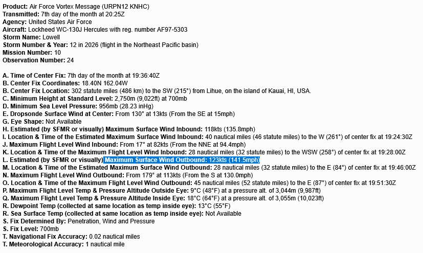
Recon continues finding Lowell remarkably strong
|
cieldumort
Moderator
Reged:
Posts: 2858
Loc: Austin, Tx
|
|
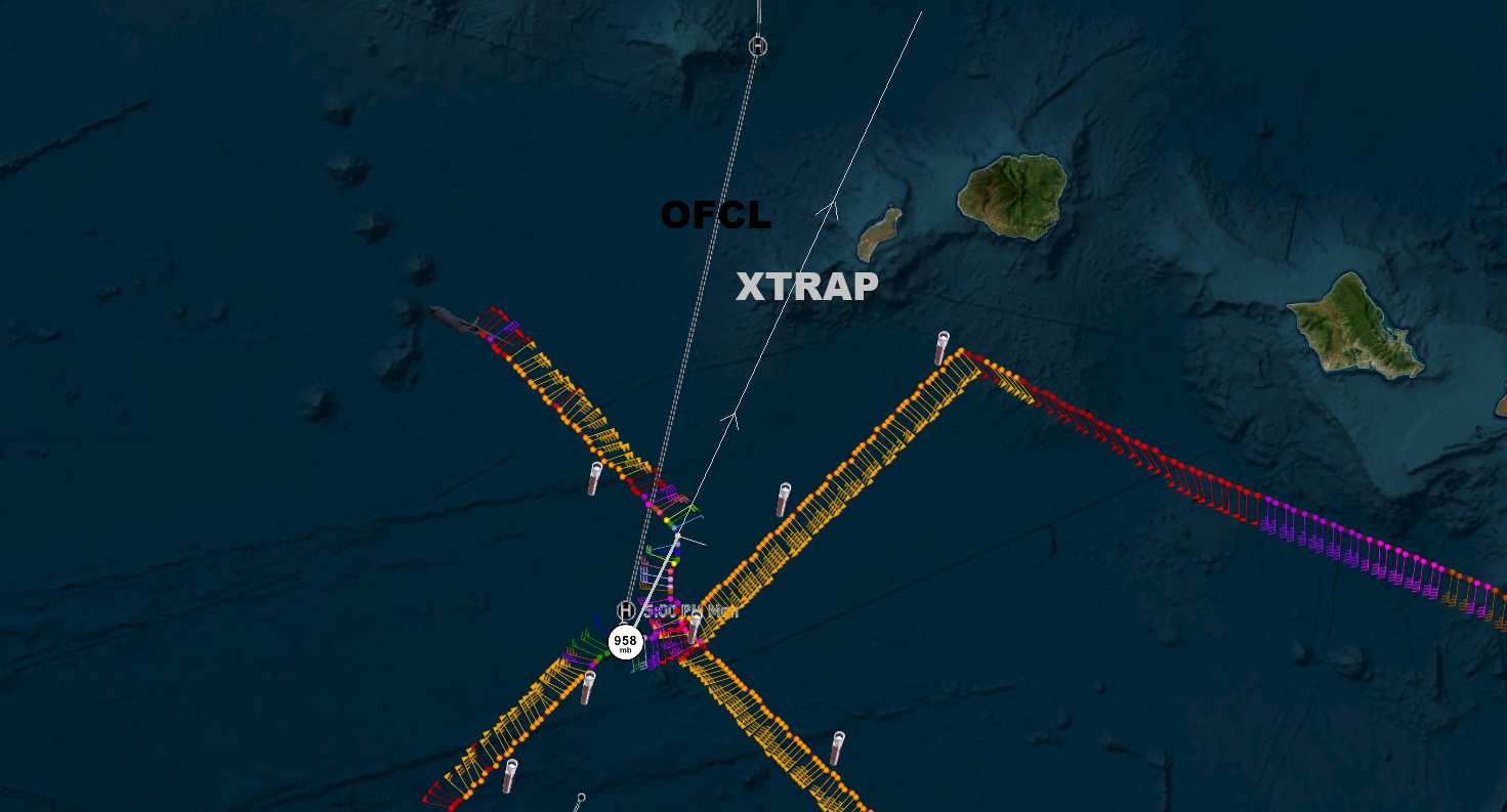
Lowell may still be trending right of forecast ('OFCL')
|



 Previous
 Index
Index
 Next
Next
 Threaded


 Edit
Edit
 Reply
Reply
 Quote
Quote


