cieldumort
Moderator

Reged:
Posts: 2883
Loc: Austin, Tx
|
|
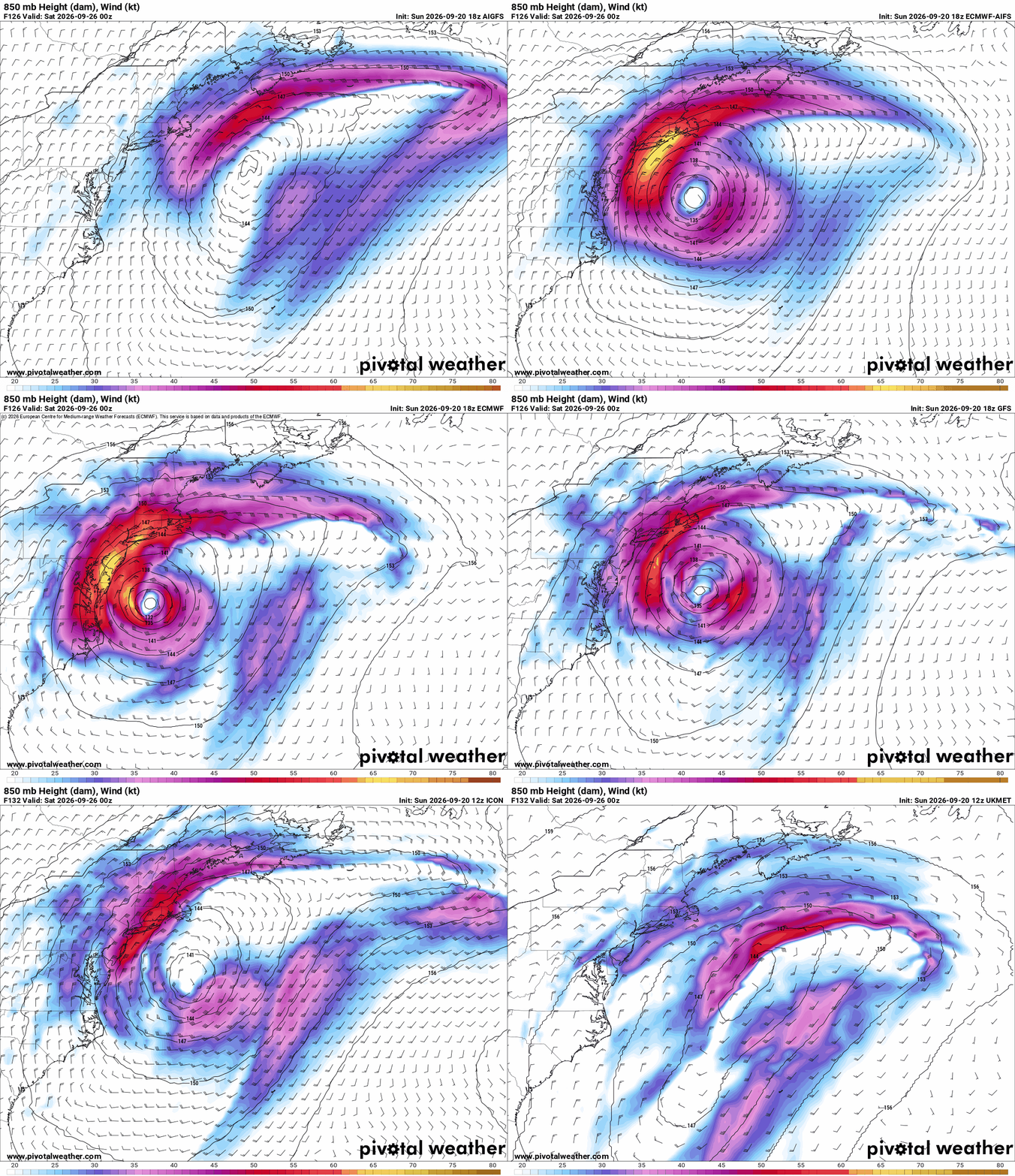
A number of models are increasingly keen on the formation of a hybrid wet Nor'easter to fully tropical and potentially wet Sandy-like hurricane forming off the Mid Atlantic late in the coming week and/or into the coming weekend. While is not yet outlining this area, the signal is so significant and potentially serious (right now, lower odds but high ceiling on the impact scale) that we are opening up a Lounge on this forecast future cyclone, Invest TBD.
More to come.
|
cieldumort
Moderator
Reged:
Posts: 2883
Loc: Austin, Tx
|
|
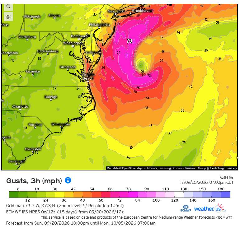
ECMWF Forecast gusts for Friday Sep 25 at 8PM EDT
Credits: Weather.US and
|
cieldumort
Moderator
Reged:
Posts: 2883
Loc: Austin, Tx
|
|
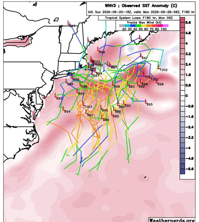
Today's 18Z DeepMind WNv3 Ensembles out to 180 Hr mostly keeping offshore
|
cieldumort
Moderator
Reged:
Posts: 2883
Loc: Austin, Tx
|
|
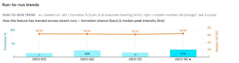
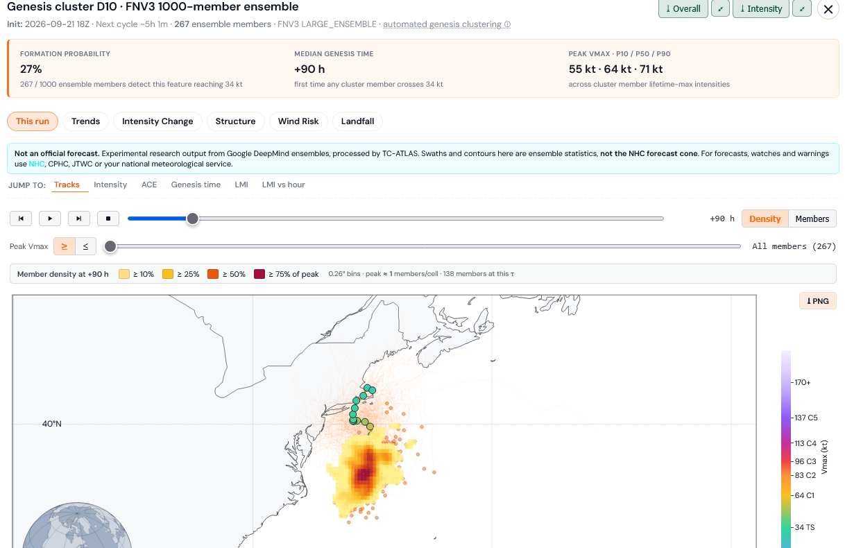
The DeepMind FNv3 ensembles, which attempt to forecast the formation of warm-cored, tropical cyclones (as opposed to classic Nor'easters), most recently has increased implied chances of tropical cyclone formation in or around the Gulf Stream with this system to 27%, with a mean genesis time of 90 hours out from 18Z today.
Credit: TC-ATLAS
Credit: TC-ATLAS
|
cieldumort
Moderator
Reged:
Posts: 2883
Loc: Austin, Tx
|
|
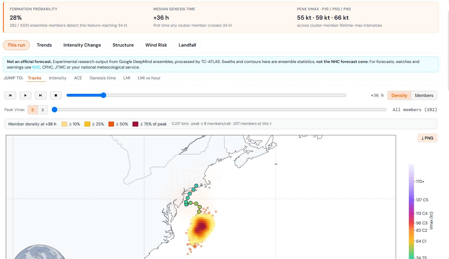
DeepMind FNv3 ensembles continuing indicating about a 20-30% chance that this Nor'easter acquires tropical cyclone characteristics at some point during its approach towards the coast. While not highlighted by , most likely to prevent any confusion and mixing of public messaging, the internal structure of the forecast strong storm may affect future impacts in some subtle and potentially not so subtle ways.
|
cieldumort
Moderator
Reged:
Posts: 2883
Loc: Austin, Tx
|
|
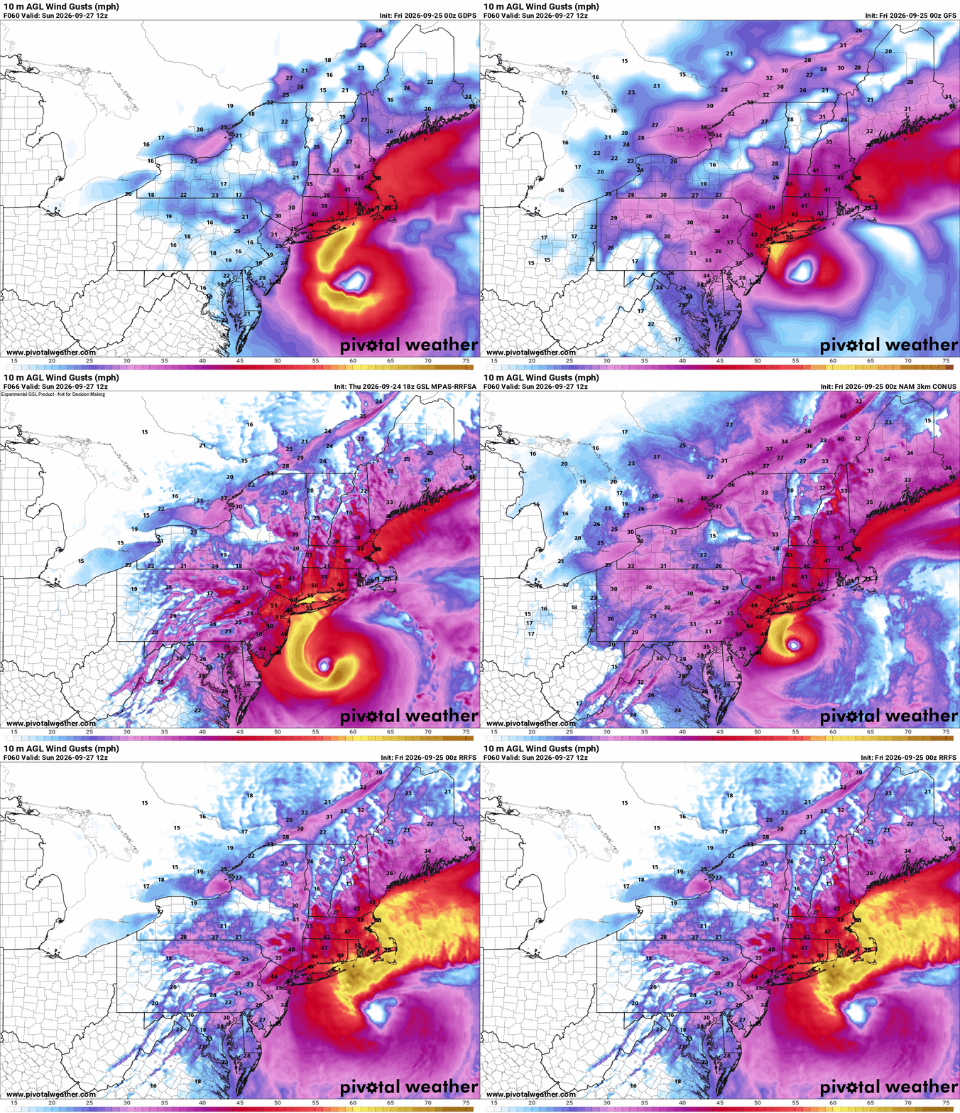
0z runs fro 09/25 strongly supporting something quasi-tropical (likely warm seclusion that at least attempts to become more classically tropical). Strong tropical storm to hurricane-force gusts advertised as likely if not certain in these runs.
Combined with a full moon, coastal flooding could become serious. Further inland, with lots of leaves still on trees, 50-80 MPH gusts will easily take down many branches with the combination of wind and rain.
|
cieldumort
Moderator
Reged:
Posts: 2883
Loc: Austin, Tx
|
|
|
cieldumort
Moderator
Reged:
Posts: 2883
Loc: Austin, Tx
|
|
Models increasingly want to transition this into a full hybrid trending tropical heading into landfall.
The most recent HAFS-A run strongly implies hurricane-force wind gusts, potentially locally at or above 90 MPH, by Saturday afternoon just offshore of New Jersey, New York, Connecticut and Rhode Island. By later Saturday night and into Sunday morning, coastal inundation could become locally pronounced and even dangerous in spots. Wind gusts at or above 60 MPH pushing well inland this time of year with lots of leaves on trees may result in sporadic to widespread fallen branches, shingle loss, etc. Power outages depending on network build, but increasingly a risk.
Not out of the question that this transitions to mostly tropical for a duration. Hurricane-like conditions almost certain in some areas, regardless, per HAFS-A.
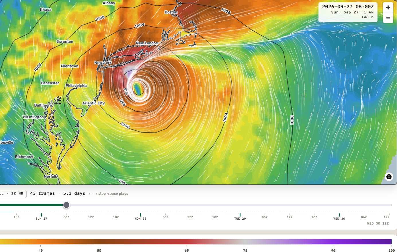
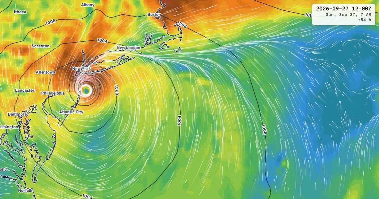
Graphics credit: Ryan Maue/tropics.earth
|




 Previous
 Index
Index
 Next
Next
 Threaded


 Edit
Edit
 Reply
Reply
 Quote
Quote


