Current Radar or Satellite Image

Flhurricane.com - Central Florida Hurricane Center - Tracking Storms since 199531 Years of Hurricanes Without the Hype - Since 1995


HURRICANE AND STORM SURGE WATCHES ISSUED FOR PORTIONS OF THE NORTHERN GULF COAST FOR STRENGTHENING ISAIAS

Days since last Hurricane Landfall — US Any: 727 (Milton), US Major: 727 (Milton), FL Any: 727 (Milton), FL Major: 727 (Milton)
FlHurricane Atlantic Tropical Cyclone Tracking 🌀 Since 1995
22.7N 92.9W
Wind: 65MPH
Pres: 994mb
Moving:
Present movement...ene or 65 degrees at 8 mph...13 km/h
Click for Storm Spotlight
HypeScale:
6.00
0510
Communication
Storm Data
Content
Follow & Connect


General Discussion >> Other Storm Basins

Jump to first unread post. Pages: 1
cieldumortModerator
Moderator


Reged:
Posts: 2922
Loc: Austin, Tx
Hurricane Rachel Potential SoCal and Desert SW
      #116318 - Wed Oct 07 2026 12:20 PM

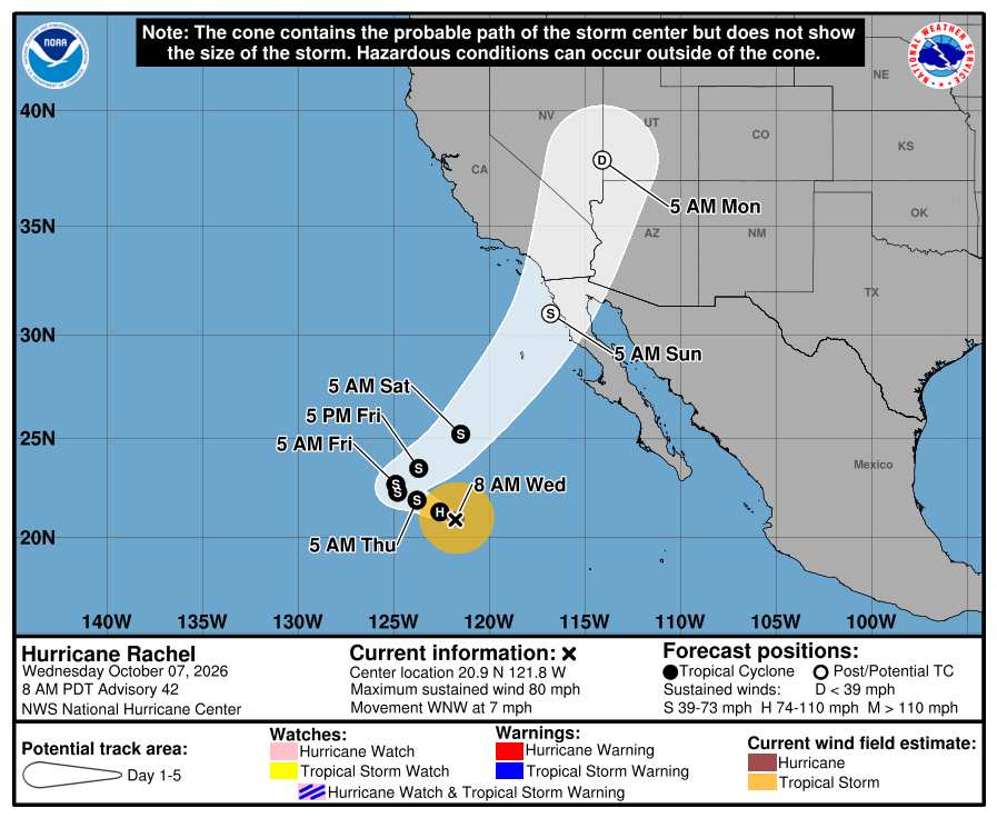
Hurricane Rachel in the east Pac offshore of western Mexico is likely to begin recurving and models increasingly put SoCal and locations possibly including Las Vegas, NV at risk for what would in this part of the country be a potentially significant flood risk, not to mention potential damaging wind gusts especially at higher elevations and within canyons. As such, we are starting a de facto Lounge on yet another eastern Pacific hurricane at this time.


More to come


Post Extras: Print Post   Remind Me!   Notify Moderator  
cieldumortModerator
Moderator


Reged:
Posts: 2922
Loc: Austin, Tx
Re: Hurricane Rachel Potential SoCal and Desert SW [Re: cieldumort]
      #116319 - Wed Oct 07 2026 12:22 PM

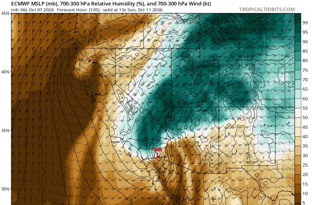
The most recent EURO has a significant surge of Rachel moisture rushing into SoCal and into the Four Corners region over the weekend


Post Extras: Print Post   Remind Me!   Notify Moderator  
cieldumortModerator
Moderator


Reged:
Posts: 2922
Loc: Austin, Tx
Re: Hurricane Rachel Potential SoCal and Desert SW [Re: cieldumort]
      #116320 - Wed Oct 07 2026 05:42 PM

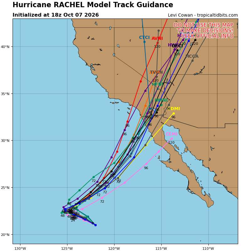
Today's 18Z Globals + Hurricane Models for Rachel.

Rachel is forecast to be post-tropical by the time landfall on either the northwestern Baja California or Southern California coast occurs, but this is not certain, and there are many models that carry the cyclone inland at or above 35 knots (storm strength). Depending on structure, Tropical Storm Watches and even Warnings could be required for a portion of SoCal and northwestern Baja. Regardless of technical classification, interests in these areas and into southern Nevada, western Arizona and Utah should be paying close attention. The main threat will be from flash flooding.


Post Extras: Print Post   Remind Me!   Notify Moderator  
Pages: 1


Extra information
0 registered and 0 anonymous users are browsing this forum.

Moderator:  CFHC, Ed Dunham, Colleen A., danielw, Clark, RedingtonBeachGuy, SkeetoBite, Bloodstar, tpratch, typhoon_tip, cieldumort 

Print Topic

Forum Permissions
      You cannot start new topics
      You cannot reply to topics
      HTML is disabled
      UBBCode is enabled

Rating:
Topic views: 149

Rate this topic

Jump to