cieldumort
Moderator

Reged:
Posts: 2929
Loc: Austin, Tx
|
|
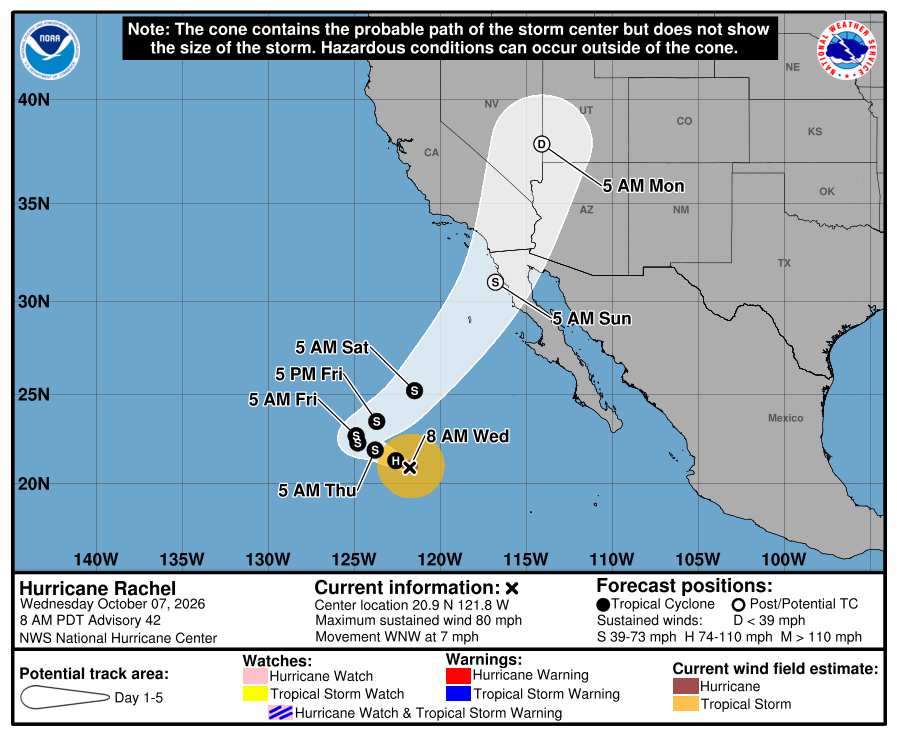
Hurricane Rachel in the east Pac offshore of western Mexico is likely to begin recurving and models increasingly put SoCal and locations possibly including Las Vegas, NV at risk for what would in this part of the country be a potentially significant flood risk, not to mention potential damaging wind gusts especially at higher elevations and within canyons. As such, we are starting a de facto Lounge on yet another eastern Pacific hurricane at this time.
More to come
|
cieldumort
Moderator
Reged:
Posts: 2929
Loc: Austin, Tx
|
|
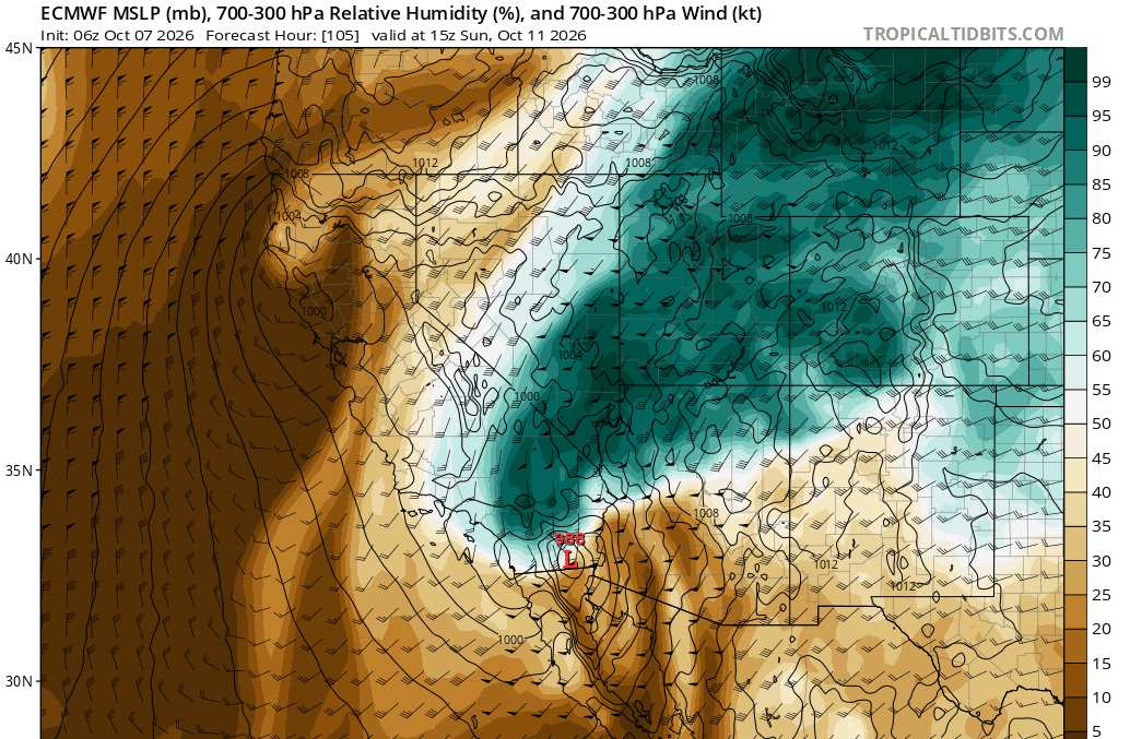
The most recent EURO has a significant surge of Rachel moisture rushing into SoCal and into the Four Corners region over the weekend
|
cieldumort
Moderator
Reged:
Posts: 2929
Loc: Austin, Tx
|
|
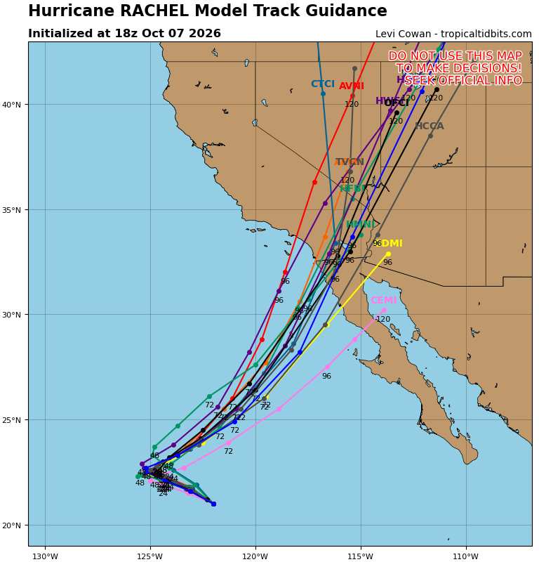
Today's 18Z Globals + Hurricane Models for Rachel.
Rachel is forecast to be post-tropical by the time landfall on either the northwestern Baja California or Southern California coast occurs, but this is not certain, and there are many models that carry the cyclone inland at or above 35 knots (storm strength). Depending on structure, Tropical Storm Watches and even Warnings could be required for a portion of SoCal and northwestern Baja. Regardless of technical classification, interests in these areas and into southern Nevada, western Arizona and Utah should be paying close attention. The main threat will be from flash flooding.
|
cieldumort
Moderator
Reged:
Posts: 2929
Loc: Austin, Tx
|
|
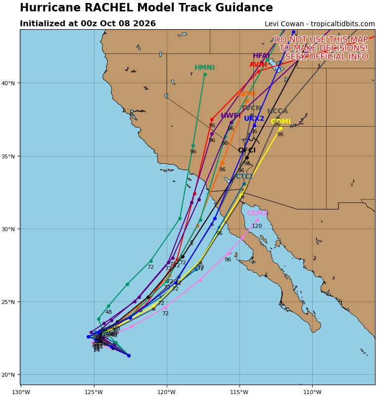
08 0z Runs
DeepMind the furthest east. If it verifies, Las Vegas could be spared the worst flash flood risks. *Could*
Possibly not so for Arizona and Utah, however.
|
cieldumort
Moderator
Reged:
Posts: 2929
Loc: Austin, Tx
|
|
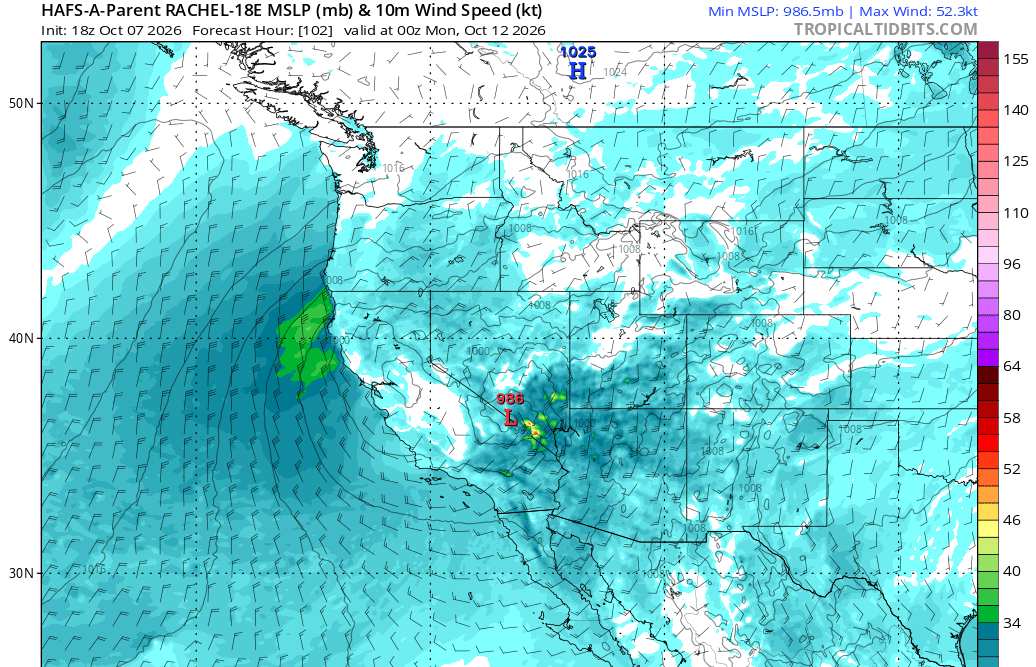
0z HAFS-A not at all friendly to SoCal as well as Las Vegas, NV
Almost an unbelievable run. Would need to see a lot of confirmation in real time and subsequent runs before buying into this.
|
cieldumort
Moderator
Reged:
Posts: 2929
Loc: Austin, Tx
|
|
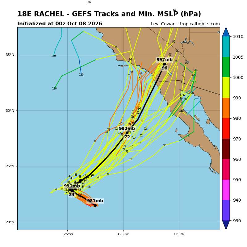
Several ensemble members are also warm to the idea of reintensification upon approach to the coast of SoCal and/or NW Baja. Waters are anomalously warm around there, but not outright tropical cyclone favorable. Likely some upper-air dynamics going on at this time in these runs as well.
Anything verifying close to the more aggressive runs would likely necessitate Watches and/or Warnings. The last and only time has ever issued a Tropical Storm Watch (and later upgraded to Warning) for any portion of southern California was in August 2023 with Hilary.
|
cieldumort
Moderator
Reged:
Posts: 2929
Loc: Austin, Tx
|
|
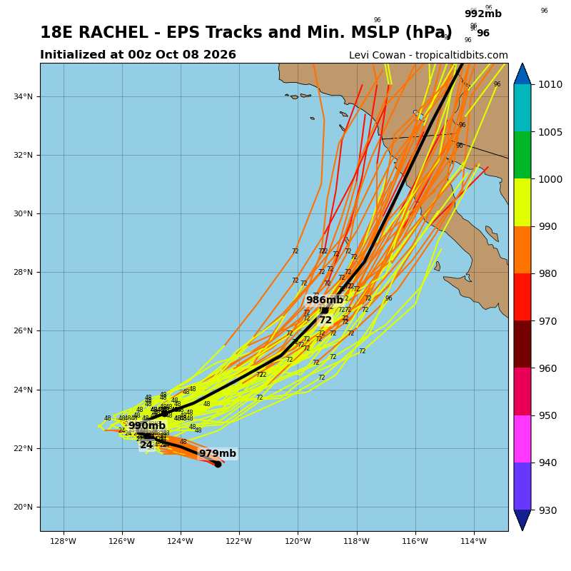
0z EURO ensemble is out
This might need to be taken seriously
|




 Previous
 Index
Index
 Next
Next
 Threaded


 Edit
Edit
 Reply
Reply
 Quote
Quote


