Current Radar or Satellite Image

Flhurricane.com - Central Florida Hurricane Center - Tracking Storms since 199531 Years of Hurricanes Without the Hype - Since 1995


PTC Isaias flooding rains in Southern Appalachians and the Southeast. Tropical Storm Watch in SoCal from Rachel.

Days since last Hurricane Landfall — US Any: 1 (Isaias), US Major: 731 (Milton), FL Any: 1 (Isaias), FL Major: 731 (Milton)
FlHurricane Atlantic Tropical Cyclone Tracking 🌀 Since 1995
32.0N 86.5W
Wind: 35MPH
Pres: 1002mb
Moving:
Present movement...n or 360 degrees at 14 mph...22 km/h
Click for Storm Spotlight
HypeScale:
2.00
0510
Communication
Storm Data
Content
Follow & Connect


General Discussion >> 2026 Forecast Lounge

Jump to first unread post. Pages: 1 | 2 | 3 | (show all)
OrlandoDan
Weather Master


Reged:
Posts: 462
Loc: Longwood, FL
Re: NINE Lounge [Re: IsoFlame]
      #116336 - Fri Oct 09 2026 03:31 PM

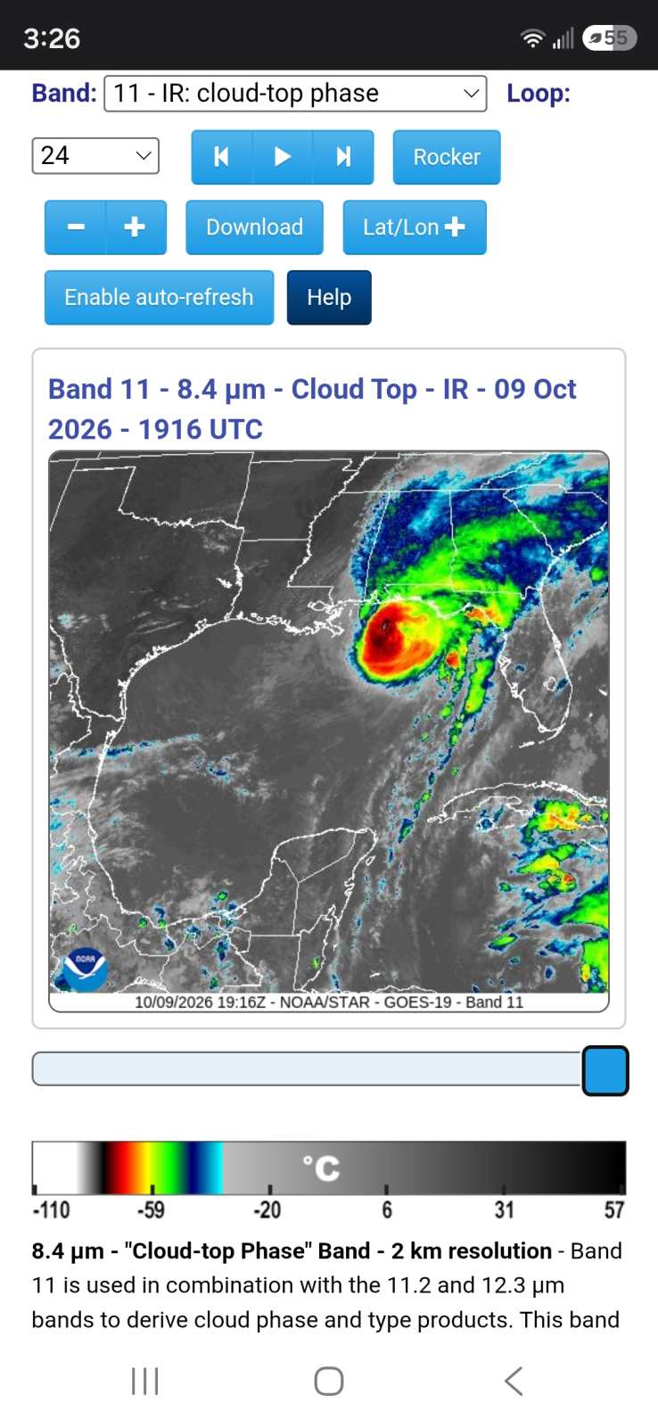
I'm impressed by the IR Cloud Top satellite pic at this time. Notice the prominent definition to the west.


Post Extras: Print Post   Remind Me!   Notify Moderator  
JMII
Weather Master


Reged:
Posts: 552
Loc: Cape Coral, FL
Re: NINE Lounge [Re: OrlandoDan]
      #116337 - Fri Oct 09 2026 04:19 PM

Despite being all the way down in Cape Coral the tide is running 1 foot above normal.
Here is a link of the storm's path and various tide stations to monitor surge:
https://tidesandcurrents.noaa.gov/inundationdb/cidstorm.html?stormname=Isaias

--------------------
South FL Native... experienced many tropical systems, put up the panels for:
David 79 - Floyd 87 - Andrew 92 - Georges 98 - Frances 04 - Wilma 05 - Matthew 16 - Irma 17
Lost our St James City rental property to Ian 22


Post Extras: Print Post   Remind Me!   Notify Moderator  
OrlandoDan
Weather Master


Reged:
Posts: 462
Loc: Longwood, FL
Re: NINE Lounge [Re: JMII]
      #116341 - Sat Oct 10 2026 06:46 PM

We are getting that typical long feeder band of the long comma shaped tail in east central Florida. I got 1.39 inches so far and it's still raining. I got a rain rate of 3.9//hr about 3 hours ago. I would say this is typical for a post tropical system landing where it did compared to east central Florida. I expected this.

Post Extras: Print Post   Remind Me!   Notify Moderator  
Pages: 1 | 2 | 3 | (show all)


Extra information
0 registered and 0 anonymous users are browsing this forum.

Moderator:  CFHC, MikeC, Ed Dunham, Colleen A., Atricks, danielw, Clark, Christine H, RedingtonBeachGuy, SkeetoBite, Bloodstar, tpratch, typhoon_tip, cieldumort, Jackie M, Wigeon, Hank Buck 

Print Topic

Forum Permissions
      You cannot start new topics
      You cannot reply to topics
      HTML is disabled
      UBBCode is enabled

Rating:
Topic views: 7148

Rate this topic

Jump to