IsoFlame
Weather Analyst

Reged:
Posts: 420
Loc: One block off the Atlantic Oce...
|
|
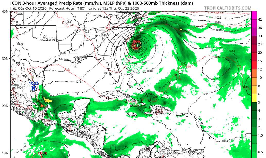
Given the pattern of fronts pushing into Florida on a weekly basis (but not yet scouring out moisture for more than a day or two), followed by high pressure setting up strong onshore flow across the peninsula, it would not be an "October surprise" to see models start to lock in on a hybrid system spinning up in the Atlantic east of Florida and north of the Abacos later in October. Several recent model runs hint at this.
Regardless of cyclogenesis, multi-day episodes of strong onshore winds, especially during the last week of the month when King tides peak, could be very impactful along Florida's east coast.
I was 26 living on a sailboat working at a county park just north of Sebastian Inlet... the analog storm still etched in my memory: Nov_1984_storm.pdf
--------------------
CoCoRaHS Weather Observer (FL-VL-42) & Surf Forecaster: https://www.surf-station.com/north-florida-surf-forecast-3/
|
cieldumort
Moderator

Reged:
Posts: 2949
Loc: Austin, Tx
|
|
The most recent ICON run (15/0z) which this model sometimes sniffs out future development where other models miss earlier on, is definitely on board with the general idea, albeit perhaps a bit further north.
So, remarkably, despite the headwinds coming out of the eastern Pacific, the overall state of the Atlantic basin is one I wouldn't write off the rest of this month. Gulf stream probably bears some monitoring.
|
cieldumort
Moderator
Reged:
Posts: 2949
Loc: Austin, Tx
|
|
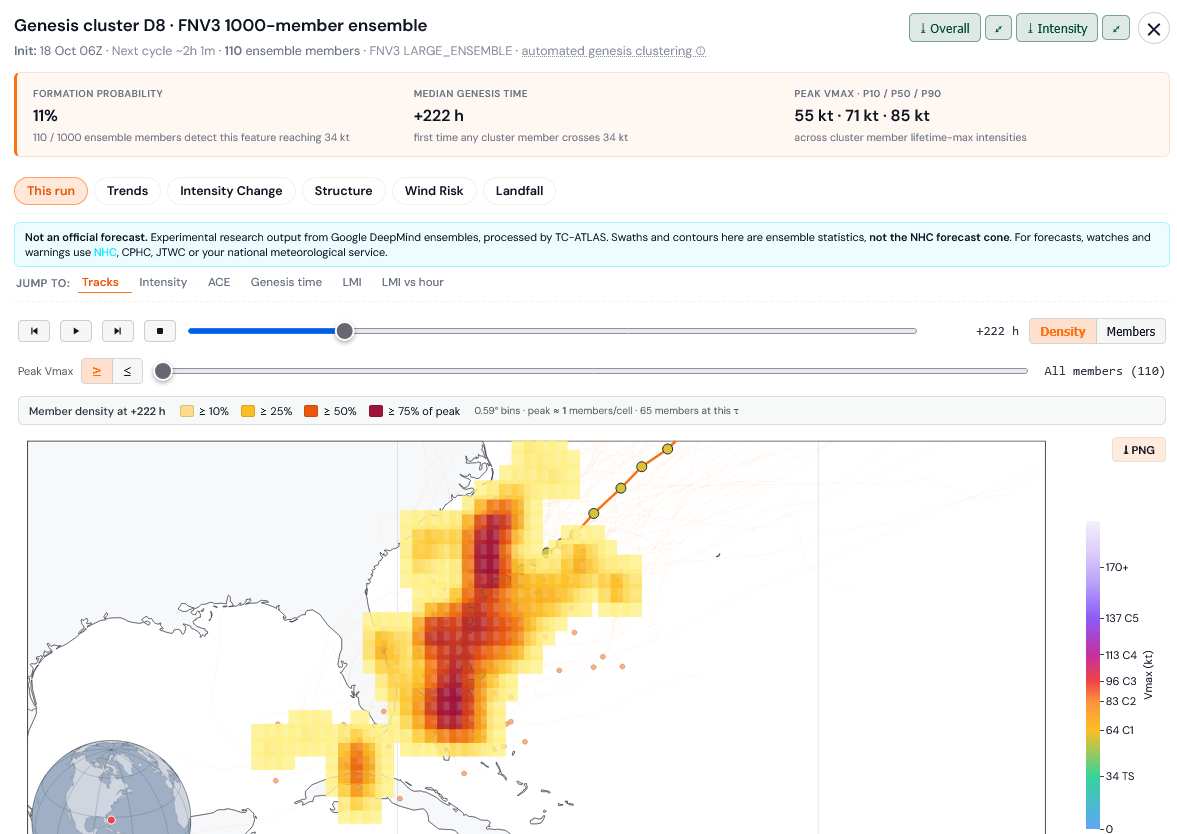
This appears to be the feature hinted at by some long-range runs mentioned in the original post. FNv3 has caught on to it now, although with not very good odds of development, as of yet.
|
cieldumort
Moderator
Reged:
Posts: 2949
Loc: Austin, Tx
|
|
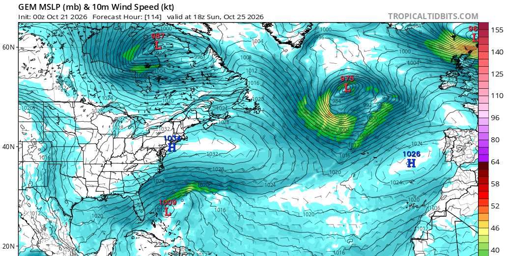
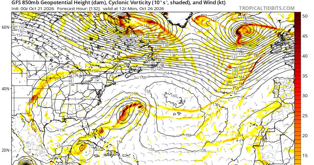
More Globals are picking up on this now. Conditions for development in the Atlantic basin are, on a relative basis, favorable this month, despite the very strong El Niño, and this potential Area of Interest deserves to be watched.
0z Canadian
0z AI
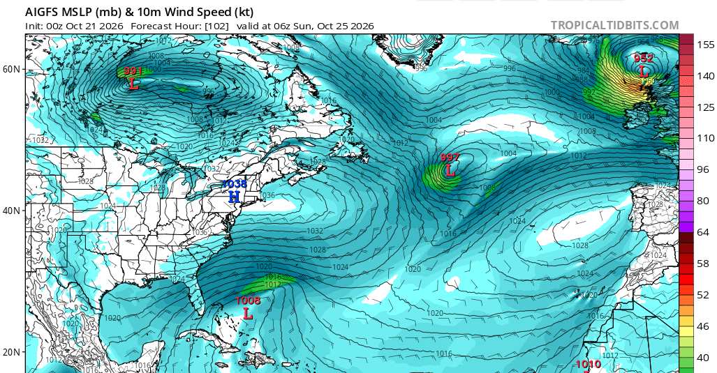
0z being spawns three. General idea of genesis remains.
|
IsoFlame
Weather Analyst
Reged:
Posts: 420
Loc: One block off the Atlantic Oce...
|
|
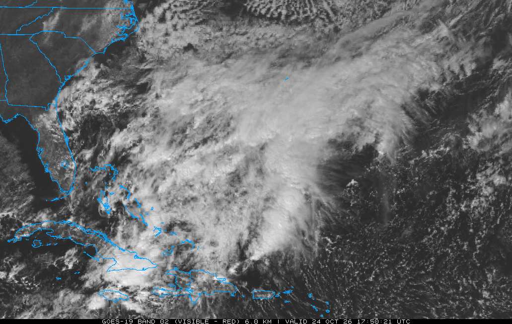
None of the models have the elongated trough of low pressure stretching from eastern tip of Cuba N/NE through the Bahamas closing off until well out in the Atlantic. Given dry air in place over the Fla peninsula and the distance of the trough/potential low well east of Florida, precip will be limited to a spattering of fast-moving coastal showers. Still, the NE gradient will be tight over the weekend into the middle of next week as the king tides peak, so saltwater flooding along low-lying portions of Florida's east coast and significant beach erosion/overwash will be the greatest threats.
--------------------
CoCoRaHS Weather Observer (FL-VL-42) & Surf Forecaster: https://www.surf-station.com/north-florida-surf-forecast-3/
Edited by IsoFlame (Fri Oct 23 2026 09:59 AM)
|
cieldumort
Moderator
Reged:
Posts: 2949
Loc: Austin, Tx
|
|
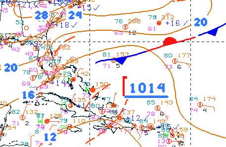
Pretty sloppy in the SW ATL, but some gradual development (more likely of a hybrid nature if it happens) remains slightly possible during the window mentioned in OP. DeepMind has been running roughly 5-10% odds of something nameable.
|
IsoFlame
Weather Analyst
Reged:
Posts: 420
Loc: One block off the Atlantic Oce...
|
|
While we haven't seen a tropical or hybrid system, late October and early November coastal weather events along central Florida's east coast is setting records. Last week around the time of the full moon we had strong onshore winds and King tides setting record non-tropical system high tide levels. The past 24 hours (and ongoing) Brevard County is experiencing Harvey-like rainfall with up to two feet of rainfall with catastrophic flooding due to a quasi-stationary warm front lifting up the east Florida coast combining with a mid-level low pressure area over the center of the peninsula. Training coastal showers (with rainfall rate of 2-3 inches per hour) continue to come in off the Atlantic in central and south Brevard County.
Barely 70 miles separates my coastal Volusia County location from this 200-yr rainfall event. As of 7 am this morning I recorded 1.51 inches of rain, with most occurring in a 45-minute period between 2:15-3 am.
National Weather Service Melbourne FL
104 PM EST Mon Nov 2 2026
- A Flood Watch remains in effect through 7 PM this evening. Heavy rainfall amounts up to 16 to 22 inches across southern Brevard County since midnight have led to widespread flooding from the Melbourne area south to Grant-Valkaria.
--------------------
CoCoRaHS Weather Observer (FL-VL-42) & Surf Forecaster: https://www.surf-station.com/north-florida-surf-forecast-3/
|


 Previous
 Index
 Next
 Threaded


 Edit
 Reply
 Quote


