cieldumort
Moderator

Reged:
Posts: 2956
Loc: Austin, Tx
|
|
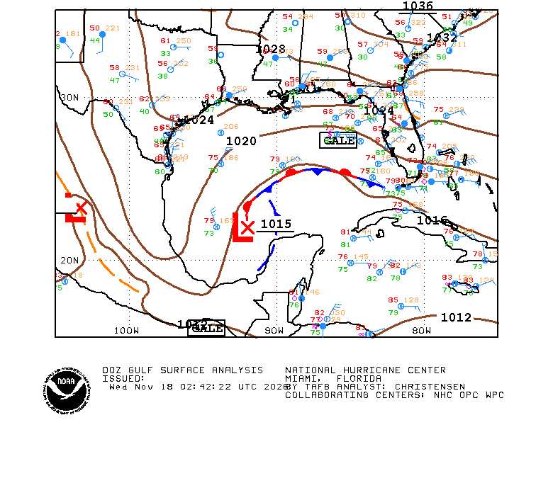
The complex non-tropical surface low pressure system southwest of Florida and responsible for draping the stationary front across or near the southern peninsula with locally torrential rain and flooding, is increasingly forecast by models, including an increasing number of the high-quality DeepMind ensembles, to acquire sub-tropical to tropical characteristics once it re-emerges or reforms over the Gulf Stream this weekend into next week. In addition, several models and/or their ensembles now take this low, which is likely to take shape regardless of classification, up the eastern seaboard. Given these trends, we are starting a Lounge on this feature at this time, Invest TBD.
More details to come
|
cieldumort
Moderator
Reged:
Posts: 2956
Loc: Austin, Tx
|
|
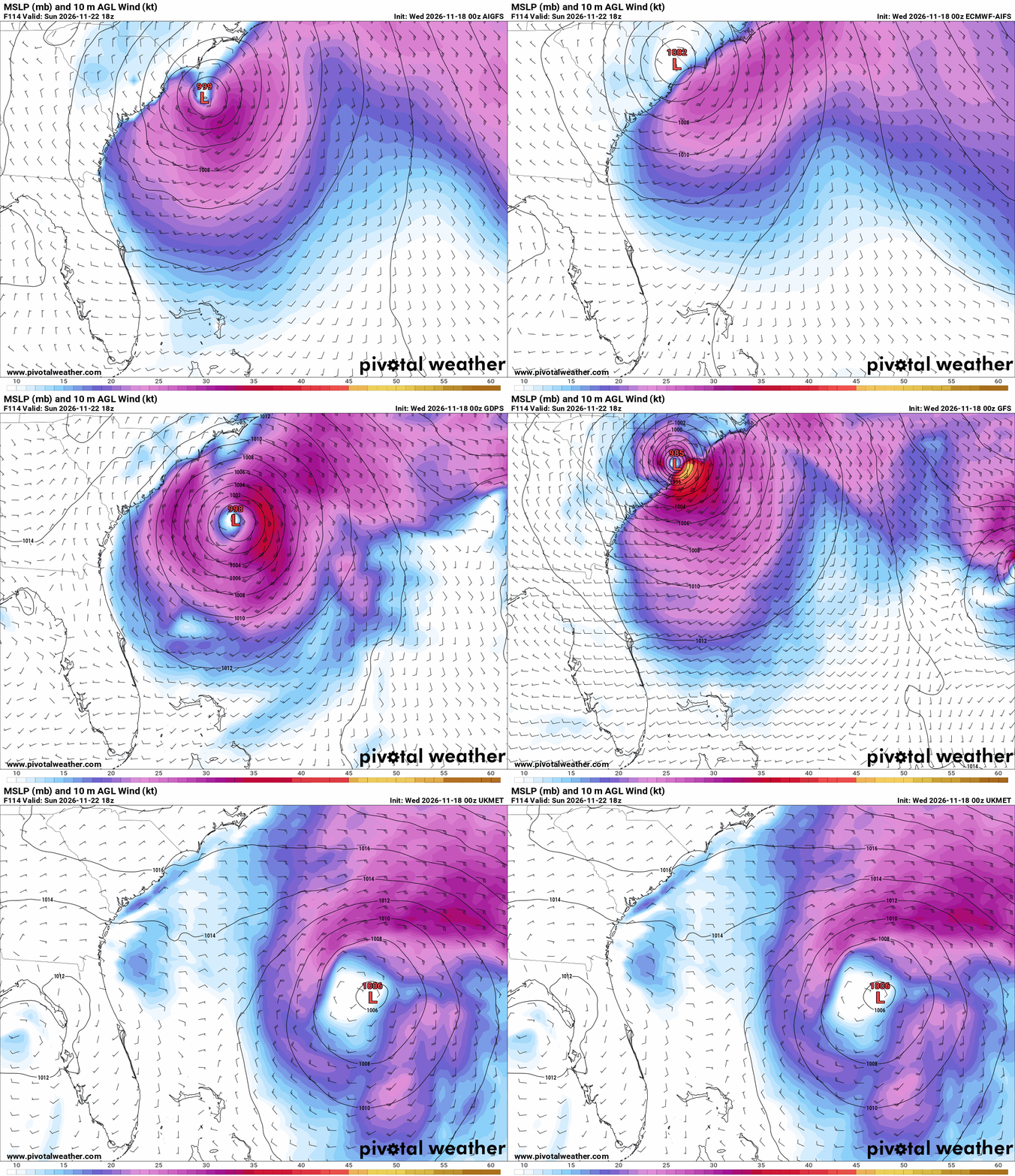
18/0z Globals coming in with what is one of the stronger signals one would ever see during a November for potential nameable development in the Atlantic basin, by way of our complex frontal low pressure area reforming or splitting off with its stronger lobe revving up off the southeast coast. The models advertising stronger solutions are further west, across the Gulf Stream, weaker solutions forming further east.
|
IsoFlame
Weather Analyst

Reged:
Posts: 424
Loc: One block off the Atlantic Oce...
|
|
3 inches of rain last night, 5 inches today (as of 8pm). Sustained wind in 20-30 mph range with wind gusts of 50 mph in training rain bands off the Atlantic. If Kyle does form late in the week, it will hopefully be far enough offshore not to add to the flooding rains we are having in coastal Volusia.
--------------------
CoCoRaHS Weather Observer (FL-VL-42) & Surf Forecaster: https://www.surf-station.com/north-florida-surf-forecast-3/
|
IsoFlame
Weather Analyst
Reged:
Posts: 424
Loc: One block off the Atlantic Oce...
|
|
Another 2.5 inches last night here with light to moderate rain still falling late . this morning My running total for this week is nearing 9 inches. 50 or so miles to the south of me 10-15 inches in 24 hours in northern Brevard County with the bullseye in north Merritt Island.
--------------------
CoCoRaHS Weather Observer (FL-VL-42) & Surf Forecaster: https://www.surf-station.com/north-florida-surf-forecast-3/
|
IsoFlame
Weather Analyst
Reged:
Posts: 424
Loc: One block off the Atlantic Oce...
|
|
Based on radar, a low is forming in the Fla straits just south of the middle Keys. In my area, the area of coastal convergence responsible for the heavy rain in North Brevard is now setting up over east Volusia. Wind and rain are picking up at my location along the coast in central Volusia. Several major roads on the mainland side of the causeway are experiencing ongoing flooding. The rain rate has increased from 1/2" per hour to 1.5-2" per hour as of 10:45 am at my location in a training band coming in from the east off the Atlantic Ocean.
--------------------
CoCoRaHS Weather Observer (FL-VL-42) & Surf Forecaster: https://www.surf-station.com/north-florida-surf-forecast-3/
|
cieldumort
Moderator
Reged:
Posts: 2956
Loc: Austin, Tx
|
|
As where and how the cyclone develops is becoming clearer, models over the past 12 or so hours have dramatically backed off the possibility of a purely tropical system, and now tend to lean more in the direction of a hybrid-nor'easter. Regardless of where it runs on the spectrum from nor'easter to tropical cyclone, proximity to the coast with onshore flow as well as a possible track right up the coast or even inland, are sure to bring more inclement weather.
DeepMind implied odds of a name now just 4%
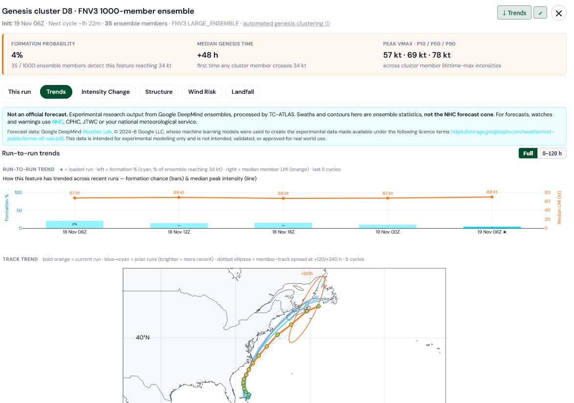
Credit: TC-ATLAS
|
cieldumort
Moderator
Reged:
Posts: 2956
Loc: Austin, Tx
|
|
|
IsoFlame
Weather Analyst
Reged:
Posts: 424
Loc: One block off the Atlantic Oce...
|
|
Looks like a spin is developing a dozen or two miles offshore from Ponce Inlet. Here in DBS a block off the Atlantic Ocean at 11 am I'm observed sustained ENE wind of 35 mph with gusts near 50 mph.The heavy rain bands just lifted up the coast to the north so unless we get wrap-around rain on the backside of the departing circulation, the worst of the rain is over. My 24-hr rf gauge dump at 7am measured just under 6 inches, and an additional 2 inches measured at 11 am this morning for a 2-day total of nearly 15 inches.
--------------------
CoCoRaHS Weather Observer (FL-VL-42) & Surf Forecaster: https://www.surf-station.com/north-florida-surf-forecast-3/
|
cieldumort
Moderator
Reged:
Posts: 2956
Loc: Austin, Tx
|
|
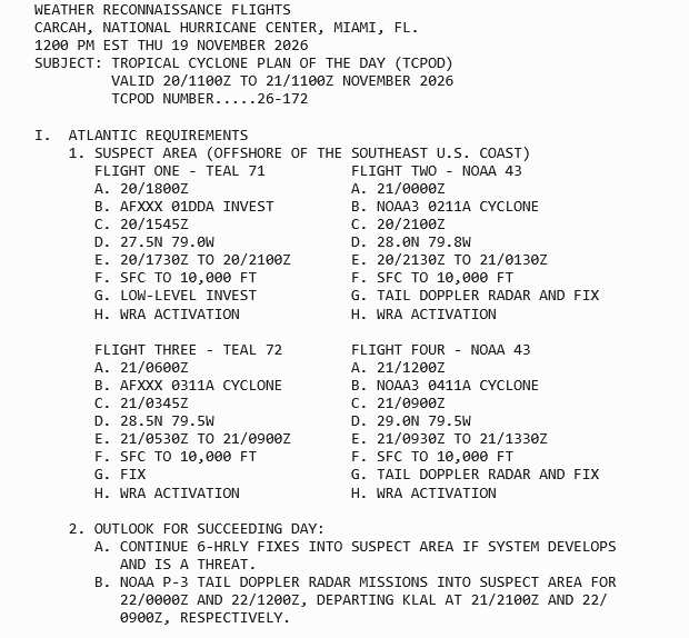
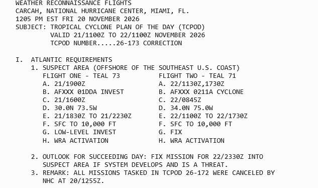
DeepMind models now down to effectively zero chance of tropical storm development over the next few days in the Atlantic basin. However, several of the more traditional physics-based models and ensembles do show potential of one or more additional surface lows that form out of the larger, sprawling, non-tropical weather complex to acquire tropical characteristics, and it would not be surprising to see some DeepMind runs start show this as well. The current 50% outline for 7 days may make sense, but probably not for the surface low now running up the Florida east coast.
|
cieldumort
Moderator
Reged:
Posts: 2956
Loc: Austin, Tx
|
|
|
cieldumort
Moderator
Reged:
Posts: 2956
Loc: Austin, Tx
|
|
|


 Previous
 Index
 Next
 Threaded


 Edit
 Reply
 Quote


