Anonymous
Unregistered
|
|
URNT11 KNHC 100653
97779 06534 30246 88500 15600 15026 18098 /2550
RMK AF963 0402A BONNIE OB 09
|
BugsBunny
Weather Watcher

Reged:
Posts: 42
Loc: Florida
|
|
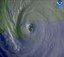
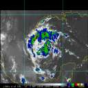
has anyone else noticed that the low clouds on the western edge and the thunderstorms west of the are racing AWAY from the center of TD3?
degenerating?
look closely on the western edge
Also, ALL of the Caribbean observations are out of the east, indicating the depression has likely not survived the graveyard, and has already degenerated to a tropical wave.
wrong twice in a row:
I was wrong when I said TD2 wouldn't regenerate
I was wrong when I said TD3 would strengthen
--------------------
forecast: 17/14/9/5
to date: 3/3/2/1
|
BugsBunny
Weather Watcher

Reged:
Posts: 42
Loc: Florida
|
|
I am going to bed now
I would be surprised to see a tropical storm at all when I wake up (the depression is degenerating; bonnie is weakening)
--------------------
forecast: 17/14/9/5
to date: 3/3/2/1
|
Anonymous
Unregistered
|
|
Give me a freaking break! It looks like its a weak tropical storm with the forming right over the center of cirulation. It also has perfect outflow plus perfect banding around the center. This will be a very powerful hurricane with in 72 hours. By no means is that system you see in that satellite a tropical wave not a chance in hell! It might even be stronger then Bonnie! 
|
WeatherNLU
Meteorologist

Reged:
Posts: 212
Loc: New Orleans, LA
|
|
Maybe I am just missing something. Is this a joke? This has to be a joke. Bonnie is weakening and TD3 which is about to get named is degenerating? Naaa, this must be a joke.
--------------------
I survived Hurricane Katrina, but nothing I owned did!
|
BugsBunny
Weather Watcher

Reged:
Posts: 42
Loc: Florida
|
|
there is a very strong mid level circulation, but there is no evidence at the surface that any of the wind is comming back from the west
--------------------
forecast: 17/14/9/5
to date: 3/3/2/1
|
Anonymous
Unregistered
|
|
http://vortex.plymouth.edu/hur_dir/2004/atl_01_alex04_rad.mpg
http://vortex.plymouth.edu/hur_dir/2004/atl_01_alex04_rv.mpg
http://vortex.plymouth.edu/hur_dir/2004/alex04_vis_an.html
|
WeatherNLU
Meteorologist

Reged:
Posts: 212
Loc: New Orleans, LA
|
|
I am going to refrain from commenting based on the fact that I like it here and I don't want to get thrown off. I would suggest though that the admins of this site have a chat with people who don't have a clue.
--------------------
I survived Hurricane Katrina, but nothing I owned did!
|
Anonymous
Unregistered
|
|
looking at sat.... bonnie went through a phase and now appears to be comin bck..... i noticed on the eastside in last hr and half she is starting to show more banding out.... i think east side shear is fading out.... recon is finding just TS winds....but it looks like she is expanding in all directions and the storm outflows in last 2hrs are looking alot better now..... she may have jumped around a little on center cir, but outflow on the system looks better, looks like storms are forming again near center...... lookn good.....
|
Anonymous
Unregistered
|
|
Hmmmmmmmmmmmmm!!!! It looks like are tropical wave is going to be upgraded to a tropical storm at the 5am.
000
WHXX01 KWBC 100649
CHGHUR
DISCLAIMER...NUMERICAL MODELS ARE SUBJECT TO LARGE ERRORS.
PLEASE REFER TO TPC/NHC OFFICIAL FORECASTS FOR TROPICAL CYCLONES.
National Hurricane Center NORTH ATLANTIC OBJECTIVE AIDS FOR
TROPICAL STORM THREE (AL032004) ON 20040810 0600 UTC
...00 HRS... ...12 HRS... ...24 HRS... ...36 HRS...
040810 0600 040810 1800 040811 0600 040811 1800
LAT LON LAT LON LAT LON LAT LON
BAMD 12.7N 65.3W 13.8N 68.9W 14.8N 72.0W 15.7N 74.8W
BAMM 12.7N 65.3W 13.9N 68.9W 14.9N 72.0W 16.0N 74.7W
A98E 12.7N 65.3W 13.7N 69.3W 14.5N 72.9W 15.1N 76.2W
LBAR 12.7N 65.3W 13.8N 68.9W 14.9N 72.4W 15.8N 75.6W
SHIP 35KTS 44KTS 53KTS 61KTS
DSHP 35KTS 44KTS 53KTS 61KTS
...48 HRS... ...72 HRS... ...96 HRS... ..120 HRS...
040812 0600 040813 0600 040814 0600 040815 0600
LAT LON LAT LON LAT LON LAT LON
BAMD 16.5N 77.1W 18.2N 81.6W 20.7N 85.0W 23.5N 86.9W
BAMM 16.9N 77.2W 18.7N 81.8W 21.3N 85.0W 24.6N 86.5W
A98E 15.6N 79.1W 17.0N 83.7W 18.7N 87.4W 20.6N 90.4W
LBAR 16.8N 78.6W 19.0N 83.2W 23.2N 85.4W 28.9N 84.8W
SHIP 70KTS 86KTS 97KTS 101KTS
DSHP 70KTS 86KTS 97KTS 101KTS
...INITIAL CONDITIONS...
LATCUR = 12.7N LONCUR = 65.3W DIRCUR = 285DEG SPDCUR = 21KT
LATM12 = 11.7N LONM12 = 61.1W DIRM12 = 282DEG SPDM12 = 20KT
LATM24 = 11.2N LONM24 = 57.3W
WNDCUR = 35KT RMAXWD = 25NM WNDM12 = 30KT
CENPRS = 1007MB OUTPRS = 1012MB OUTRAD = 125NM SDEPTH = D
RD34NE = 50NM RD34SE = 0NM RD34SW = 0NM RD34NW = 50NM
I think this system is going to become a very powerful hurricane, with a better then fair chance of making landfall in the United states.
|
BugsBunny
Weather Watcher

Reged:
Posts: 42
Loc: Florida
|
|
http://www.ssd.noaa.gov/PS/TROP/DATA/RT/float2-vis-loop.html
there are storms racing away from the center
the low clouds on the western edge of the depression are also racing westward
the flow southeast of the center that should be southwest is southeast
there is no evidence from any of the observation stations that the wind is circling back around. Note how the clouds are elongating just like TD2 (which everyone disagreed with me on at the beginning) when it was in the same spot
Every system I have seen in the last 12 years that has exhibited the above mentioned characteristics has at very least weakened if not opened up to a wave. 97L had the appearance of a tropical storm for quite a while, but was no more than a wave. Remember Chantal in 2001 that had the appearance of a tropical cyclone, but lacked the LLC needed for classification at the time of this satellite image. I could be wrong (and believe me I want to be), but I am going on experience of what has happened in the past. This will have to wait to get into the western Caribbean before it can strengthen.
--------------------
forecast: 17/14/9/5
to date: 3/3/2/1
|
Anonymous
Unregistered
|
|
LAT=10.6N LON= 67.0W
wind report from north.... would be almost southwest of TD3
light wind less than 5
|
danielw
Moderator

Reged:
Posts: 3527
Loc: Hattiesburg,MS (31.3N 89.3W)
|
|
Satellite images suggest that Andrew produced deep convection only sporadically for several days, mainly in several bursts of about 12 hours duration. Also, the deep convection did not persist. Instead, it was stripped away from the low-level circulation by the strong southwesterly flow at upper levels. Air Force Reserve unit reconnaissance aircraft investigated Andrew and, on the 20th, found that the cyclone had degenerated to the extent that only a diffuse low-level circulation center remained. Andrew's central pressure rose considerably (Fig. 2 [87K GIF]). Nevertheless, the flight-level data indicated that Andrew retained a vigorous circulation aloft. Wind speeds near 70 kt were measured at an altitude of 1500 ft near a convective band lying to the northeast of the low-level center. Hence, Andrew is estimated on 20 August to have been a tropical storm with 40 kt surface winds and an astonishingly high central pressure of 1015 mb (Figs. 2 and 3 [87K GIF]).
http://www.publicaffairs.noaa.gov/andrew92.html
|
Anonymous
Unregistered
|
|
may just be me, but i think TD3 is about to explode this morning......
look at IR from nasa for 20+ frame real large storm about to be born
|
danielw
Moderator

Reged:
Posts: 3527
Loc: Hattiesburg,MS (31.3N 89.3W)
|
|
IMHO, as long as you have more than one area of deep convection(bright white), there shouldn't be much of a change going on. Other than satellite position estimates.
Both storms at 0730Z have 2 lobes or more of convection, they also have at least one area of minus70-75C cloud tops. So they may just be in a transitional period. Again.
Edited by danielw (Tue Aug 10 2004 04:08 AM)
|
Anonymous
Unregistered
|
|
anyone have any good links to radar data.....college links to nexrad data?
besides using NWS.noaa.gov
|
BugsBunny
Weather Watcher

Reged:
Posts: 42
Loc: Florida
|
|
bonnie
that, unfortunately, is about as good as we can get at the time for the tropical systems; they are both too far from land at the moment; Bonnie seems to be in the tiny area with no coverage in the central Gulf
here are the radar sites around the tropics
td3
if that helps
--------------------
forecast: 17/14/9/5
to date: 3/3/2/1
|
danielw
Moderator

Reged:
Posts: 3527
Loc: Hattiesburg,MS (31.3N 89.3W)
|
|
Okay here's a IR link with good contrast. You be the judge. I am seeing a lot of changes taking place as of 0825Z.
http://adds.aviationweather.gov/satellit...ig&itype=ir
|
danielw
Moderator

Reged:
Posts: 3527
Loc: Hattiesburg,MS (31.3N 89.3W)
|
|
000
URNT12 KNHC 100800
VORTEX DATA MESSAGE
A. 10/0726Z
B. 23 DEG 34 MIN
89 DEG 58 MIN
C. 850 MB 1480 M
D. NA
E. NA
F. 145 DEG 49 KT
G. 55 DEG 8 NM
H. 1007 MB
I. 17 C/ 1559 M
J. 21 C/ 1556 M
K. 16 C/ NA
L. OPEN SW
M. C10
N. 12345/8
O. 0.5/1.0 NM
P. AF963 0402A BONNIE OB 10
MAX FL WIND 49 KT NE QUAD 0723Z.
|
BugsBunny
Weather Watcher

Reged:
Posts: 42
Loc: Florida
|
|
looks better organized than a few hours ago
does appear to be moving due west. Look closely on eastern edge--you can see gravity waves from the turbulance in the clouds. This has definately got to be one of the smallest systems I've ever seen
--------------------
forecast: 17/14/9/5
to date: 3/3/2/1
|


 Threaded


