apm
Registered User
Reged:
Posts: 1
|
|
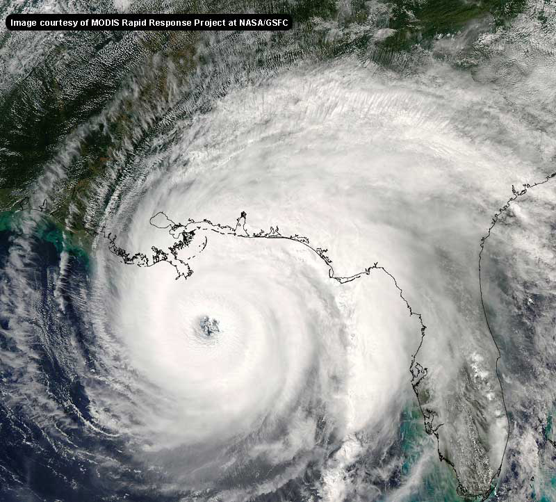
It has been undercut slightly by mid level shear from the SW and has been lacking good inflow as evidenced by the emission of arc clouds to the southwest this afternoon. Both of these conditions appear to be abating now.
|
hurricane_run
Storm Tracker

Reged:
Posts: 366
Loc: USA
|
|
its weakend some but still may be a hurricane breifly tomorrow morning. we just have to wait and see.
 or not only time will tell hr or not only time will tell hr
|
Steve Hirschb.
Unregistered
|
|
Agree Kevin, its gaining some latitude now. Southern Brevard County is expecting 45 - 55 mph winds Friday, with gusts to hurricane force. This is based on the current track and intensity. I believe again that once 's circulation clears Jamaica he'll begin a fairly rapid intensification process. He has been restricted in some ways during the last 48 hours, but should have breathing room soon to fill that envelope. Which, if he is on stays on the projected path is not good news. The is admittedly being conservative with intensity.
|
danielw
Moderator

Reged:
Posts: 3525
Loc: Hattiesburg,MS (31.3N 89.3W)
|
|
The cool front that is pushing Bonnie eastward in dropping very heavy rain on the LA/MS border north of New Orleans.
Latest 1 hr rainfall estimates from KLIX radar indicate 5-6 inches has fallen in the last hour.
The boundary is drifting slowly southeastward.
|
SirCane
Storm Tracker

Reged:
Posts: 249
Loc: Pensacola, FL
|
|
Looks like the front is having some bad effects on Bonnie. Looks pretty raggid and the pressure has risen. Looks like Apalachicola is going to get it. As for , tomorrow will tell the tale on him. As we've seen in the past, sometimes these Hurricanes and Tropical Storms will do some surprising things. It does look like the Western Peninsula will be under the gun. But just remember Elena. 
|
danielw
Moderator

Reged:
Posts: 3525
Loc: Hattiesburg,MS (31.3N 89.3W)
|
|
The latest advisories for Bonnie and are UP.
http://www.nhc.noaa.gov
|
BugsBunny
Weather Watcher

Reged:
Posts: 42
Loc: Florida
|
|
think you are right about the movement javlin--has been moving WNW all day, now the position has increased more north than west--moving more NW than WNW now
I live near Cape Canaveral; I'm thinking I may see some hurricane winds by Friday or Saturday
need to find my camera 
--------------------
forecast: 17/14/9/5
to date: 3/3/2/1
Edited by BugsBunny (Thu Aug 12 2004 03:01 AM)
|
EMS
Weather Hobbyist
Reged:
Posts: 55
Loc: St. Petersburg, Florida
|
|
Where is the new discussion?
|
LI Phil
User

Reged:
Posts: 2637
Loc: Long Island (40.7N 73.6W)
|
|
Hey, where you been all day?
Saw you checkin' in earlier but you didn't post. Think Bonnie will make Hurricane status before landfall? My heart says yes, but my mind (small one at that) says no.
Don't forget to update your "so far" numbers. became a hurricane earlier.
Peace mi amigo,
LI Phil
--------------------
2005 Forecast: 14/7/4
BUCKLE UP!
"If your topic ain't tropic, your post will be toast"
|
danielw
Moderator

Reged:
Posts: 3525
Loc: Hattiesburg,MS (31.3N 89.3W)
|
|
HURRICANE DISCUSSION NUMBER 11
NWS TPC/NATIONAL HURRICANE CENTER MIAMI FL
11 PM EDT WED AUG 11 2004
DATA FROM A RECONNAISSANCE PLANE INDICATE THAT HAS CHANGED
LITTLE DURING THE PAST FEW HOURS. THE MINIMUM PRESSURE HAS BEEN
OSCILLATING AROUND 992 AND 993 MB. FLIGHT-LEVEL PEAK WIND WAS 76
KNOTS WITH A SMALL CLOSED EYEWALL OF 8 N MI. INITIAL INTENSITY
REMAINS AT 65 KNOTS. SINCE THE OUTFLOW HAS IMPROVED...THE SHEAR IS
LOW...AND THE FACT THAT THE HURRICANE IS FORECAST TO MOVE OVER AN
AREA OF HIGH OCEANIC HEAT CONTENT...INTENSIFICATION IS
FORECAST...IN AGREEMENT WITH SHIPS MODELS. THE IS MORE
AGGRESSIVE AND MAKES A 106-KNOT HURRICANE AS IT CROSSES
WESTERN CUBA.
THERE HAS BEEN NO SIGNIFICANT CHANGE IN THE TRACK. THE HURRICANE IS
MOVING TOWARD THE WEST-NORTHWEST OR 300 DEGREES AT 15 KNOTS. A
GRADUAL TURN TO THE NORTHWEST AND NORTH IS EXPECTED TO BEGIN SOON
AS A LARGE MID TO UPPER LEVEL TROUGH BECOMES ESTABLISHED IN THE
GULF OF MEXICO. THIS IS CONSISTENT WITH THE CONSENSUS OF THE GLOBAL
MODELS AND VERY CLOSE TO THE .
FORECASTER AVILA
|
MikeC
Admin
Reged:
Posts: 4544
Loc: Orlando, FL
|
|
Here's the discussion, I'm posting it here because the automated stuff is kinda having fits now (it should be there momentarily too)
HURRICANE DISCUSSION NUMBER 11
NWS TPC/NATIONAL HURRICANE CENTER MIAMI FL
11 PM EDT WED AUG 11 2004
DATA FROM A RECONNAISSANCE PLANE INDICATE THAT HAS CHANGED
LITTLE DURING THE PAST FEW HOURS. THE MINIMUM PRESSURE HAS BEEN
OSCILLATING AROUND 992 AND 993 MB. FLIGHT-LEVEL PEAK WIND WAS 76
KNOTS WITH A SMALL CLOSED EYEWALL OF 8 N MI. INITIAL INTENSITY
REMAINS AT 65 KNOTS. SINCE THE OUTFLOW HAS IMPROVED...THE SHEAR IS
LOW...AND THE FACT THAT THE HURRICANE IS FORECAST TO MOVE OVER AN
AREA OF HIGH OCEANIC HEAT CONTENT...INTENSIFICATION IS
FORECAST...IN AGREEMENT WITH SHIPS MODELS. THE IS MORE
AGGRESSIVE AND MAKES A 106-KNOT HURRICANE AS IT CROSSES
WESTERN CUBA.
THERE HAS BEEN NO SIGNIFICANT CHANGE IN THE TRACK. THE HURRICANE IS
MOVING TOWARD THE WEST-NORTHWEST OR 300 DEGREES AT 15 KNOTS. A
GRADUAL TURN TO THE NORTHWEST AND NORTH IS EXPECTED TO BEGIN SOON
AS A LARGE MID TO UPPER LEVEL TROUGH BECOMES ESTABLISHED IN THE
GULF OF MEXICO. THIS IS CONSISTENT WITH THE CONSENSUS OF THE GLOBAL
MODELS AND VERY CLOSE TO THE .
FORECASTER AVILA
FORECAST POSITIONS AND MAX WINDS
INITIAL 12/0300Z 17.8N 78.7W 65 KT
12HR VT 12/1200Z 19.6N 80.9W 75 KT
24HR VT 13/0000Z 22.5N 82.3W 85 KT...NEARING CUBA
36HR VT 13/1200Z 25.5N 82.5W 90 KT...OVER WATER
48HR VT 14/0000Z 29.5N 81.5W 50 KT...INLAND
72HR VT 15/0000Z 38.0N 77.5W 40 KT...INLAND
96HR VT 16/0000Z 46.5N 68.0W 35 KT...EXTRATROPICAL
120HR VT 17/0000Z 51.5N 53.0W 25 KT...EXTRATROPICAL
|
Alex K
Unregistered
|
|
Im not sure if Bonnie will become a hurricane before landfall; its certainly possible. It looks like the convection isnt quite as ragged as an hour or two ago. It depends what kind of convection it can keep over its center.
|
danielw
Moderator

Reged:
Posts: 3525
Loc: Hattiesburg,MS (31.3N 89.3W)
|
|
Here is an edited version of an email I received from Dr Chris Landsea at the Hurricane Research Division.
----- Original Message -----
Date: Tuesday, June 29, 2004 10:19 pm
Subject: Rain and Wind prior to Landfall
> I'm curious as to whether
> the amount
> of rainfall, prior to a tropical cyclone's landfall, effects the
> type and
> amount of trees that succumb to the wind field.
Yes, if the hurricane is preceeded by wet conditions in the days
or weeks before the storm's landfall, the impact and trees lost
is much worse. This happened last year in Virginia and Maryland,
as it was quite wet during the summer, then hurricane Isabel's
landfall leveled thousands of trees. It is certain that the amount
lost were much more because of the preconditioned wet l.
best regards,
chris
***********************************************************************
Chris Landsea
NOAA AOML/Hurricane Research Division
|
BugsBunny
Weather Watcher

Reged:
Posts: 42
Loc: Florida
|
|
Dont think Bonnie will become a hurricane--not with that pressure. I didnt really think it would form either though, but it looks like it will only be around 60 mph at landfall
as for where I was, I am writing a book (PM me if you would like copies of the chapters) I was stuck on a chapter and was having computer troubles (namely MS Word troubles)
--------------------
forecast: 17/14/9/5
to date: 3/3/2/1
|
Rasvar
Weather Master

Reged:
Posts: 571
Loc: Tallahassee, Fl
|
|
I really do not think Bonnie will be able to gather herself enough to reach hurricane. Storms do not traditionally strengthen in this area prior to landfall. I think she is pretty close to what she will be at landfall.
Charley still worries me with the possibility of rapid strengthening. He could bomb out after crossing Cuba. If landfall ends up further up the coast then currently forecast, it could be a signifcant disaster. I would hate to think what a high Cat 2 could do sliding into or very nearby Tampa Bay. Especially throwing in the rain.
|
Floridacane
Weather Guru

Reged:
Posts: 110
Loc: Palm Bay, Florida
|
|
I have about 17 Queen palms in my backyard, as of right now. With all the recent rain, 3 of them are tilting severly.. Looks like I will spend part of tomorrow taken them out all together until the storm passes. The trees are about 10 feet tall.
Prior rainfall to a tropical storm/Hurricane definitely has it's impact on whether the trees are gonna be there afterward.
--------------------
What's brewin' everyone?
Lori
|
LI Phil
User

Reged:
Posts: 2637
Loc: Long Island (40.7N 73.6W)
|
|
Gotta say...I gave up on it too. My crow was rather bittersweet, although Frank P. hooked me up with a GREAT recipe. I'm still thinking she (bonnie) can ramp up to a weak CAT I before landfall tomorrow. If you're out there, shout out to JK, andy1 & coop. Be safe you guys.
Charley is what concerns me...though. Got it on good authority that he's gonna put a CAT III+ world of hurt on the gulf coast of FL, probably near Tampa.
Sorry to all the folks who live there, but if you do, if they say LEAVE, then by all means GO!
Lotsa weather in the next 24-48. Bugs, where do you see late Friday? Think it's a West FL problem or a serious danger?
--------------------
2005 Forecast: 14/7/4
BUCKLE UP!
"If your topic ain't tropic, your post will be toast"
|
Steve Hirschb.
Unregistered
|
|
I say again that the intensity forecast is quite conservative from . Noticed also that this track is a hair east of 5PM, as it had 26N/82.5W, now 25.5N/82.5 west. Yes Bugs that puts it damn close to you and the space center. If this intensifies more in line with the you've got a problem Bugsy; I'm 30 miles south of there and not as concerned. But that could change. BTW, did the Gulfstream IV go out to sample UL conditions today???
|
Steve Hirschb.
Unregistered
|
|
Phil, who's good authority in I may ask??? Inquiring minds want to know 
(Its coming via a PM=can you somehow logon...can't post it yet)
Edited by LI Phil (Thu Aug 12 2004 03:39 AM)
|
Cycloneye
Storm Tracker
Reged:
Posts: 373
Loc: Puerto Rico
|
|
The global models will factor in that data and at 5 AM advisory let's see what changes if any on the tracks will occur.
--------------------
My 2004 hurricane season forecast=13/8/3
|


 Threaded


 or not only time will tell hr


