RONJON
Unregistered
|
|
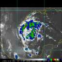
Doppler estimates for total storm rainfall for most of Polk County are now 4-6 inches. A small area near Lakeland ranges from 6-8 inches. And rainfall rates of 1-2 in/hr continue. With the storms forward motion slowing, I'm getting concerned about major flooding in Polk County.
|
RevUp
Weather Guru
Reged:
Posts: 181
Loc:
|
|
Quote:
Quote:
YES! i was just going to post about the NNW movement i see on the MLB radar. It almost looks north, but it's probably just a wobble
Can you post a link? Thanks. All my bookmarks are on my office computer.
From links posted above ...
Tampa Bay Radar
--------------------
"Let tomorrow worry about itself. Each day has enough trouble of its own."
|
Lurker99
Unregistered
|
|
My daughter at thismomoent is diving her Jeep Wrangler in NE Hillsborough County, trying to get to her Dad's home. How much danger is she in right now, considering the location and the vehicle?
|
Ocala
Weather Watcher
Reged:
Posts: 33
Loc: Ocala, FL
|
|
Thanks for the links. Channel 2 in Orlando is saying it looks like it is slowing down, maybe indicative that it might be changing direction. 
|
dwlobo
Verified CFHC User

Reged:
Posts: 21
Loc: Palmetto, FL
|
|
Here in Palmetto, the wind is holding steady at 45, with gusts to 60. More branches coming down from the oak trees. Getting a wicked rain band now. Pressure is still going down, now at 29.17.
I sail a lot and we talk about the wind blowing the dog off the chain... it almost literally happened to my sheltie this am when I took him for a walk, until I could get into the lee side of the house.
|
MrSpock
Storm Tracker
Reged:
Posts: 296
|
|
It would be interesting to see what the ground truth is in those areas you mentioned, because Doppler estimates can be off. I don't know if this is still the case, but I am assuming it is, but tropical systems tended to be under-reported by Doppler estimates due to droplet size I believe. Just like storms with hail were over-estimated.
If this is no longer true, please feel free to correct me.
Either way, as time goes on, this becomes a story of flood potential and tornadoes. The winds don't seem to have decreased that quickly though, so winds are still an issue in Florida.
|
RONJON
Unregistered
|
|
yeah, looks like on the 88D that shes slowed and drifted north..probably a temporary wobble but who knows
|
RevUp
Weather Guru
Reged:
Posts: 181
Loc:
|
|
I posted this yesterday morning, but I knew we were in trouble in Tampa when Jacksonville cancelled school for Monday. Maybe that's the jinx necessary to keep these hurricanes away? 
--------------------
"Let tomorrow worry about itself. Each day has enough trouble of its own."
|
CentralFlorida
Weather Watcher
Reged:
Posts: 27
Loc: Port Richey FL
|
|
not alot of our regulars on here today they must be without power... looks like thats whats headed our way here in florida
--------------------
Survived Charley, Jeanne, Frances, Ivan and my Wife
|
RevUp
Weather Guru
Reged:
Posts: 181
Loc:
|
|
Quote:
yeah, looks like on the 88D that shes slowed and drifted north..probably a temporary wobble but who knows
Jerve on TV here still insisting on a west movement, but I could swear I see the beginning of a significant northward shift. 
--------------------
"Let tomorrow worry about itself. Each day has enough trouble of its own."
|
MrSpock
Storm Tracker
Reged:
Posts: 296
|
|
yeah, I haven't heard from richisurf since he PM'd me last night, so I have been wondering about him as well.
Phil, have you heard from him?
|
CentralFlorida
Weather Watcher
Reged:
Posts: 27
Loc: Port Richey FL
|
|
I believe last night he lost power but he was ok....think it was posted late last night
--------------------
Survived Charley, Jeanne, Frances, Ivan and my Wife
|
RONJON
Unregistered
|
|
Mr Spock:
Absolutely, doppler estimates tend to under estimate rainfall with tropical systems...that's why it's disconcerting to see this much rain already with it probably being under reported. The hydrologic conditions are already at extreme high levels, now we're adding possibly 8-12 in of rain on top of that..Lakeland looks to have some serious flooding..I'm thinking winds wil slowly wind down (now 85 sustained) to tropical storm force within the next 4-6 hours.
|
rule
Weather Guru
Reged:
Posts: 132
Loc: Ocala, Florida
|
|
While I think this is just a wobble, I have to agree the North shift is taking it's time to go back Westward.
That last "band" that came over here actually decreased our winds. More rain, but the wind actually stopped several times and is still diminished.
|
LadyStorm
Weather Guru

Reged:
Posts: 154
Loc: United States
|
|
Is it possible that it is just another and not a turn to the north?
Quote:
Quote:
yeah, looks like on the 88D that shes slowed and drifted north..probably a temporary wobble but who knows
Jerve on TV here still insisting on a west movement, but I could swear I see the beginning of a significant northward shift. 
--------------------
"The significant problems we face cannot be solved at the same level of
thinking we were at when we created them"
..........Albert Einstein
|
recmod
Weather Guru

Reged:
Posts: 188
Loc: Orlando, FL
|
|
Channel 2 News Met (Mike O'Lenick, I think) are now reporting that Jeanne has turned North and that will mean a much longer duration of severe weather here in the Orlando area. He drew a line on the radar map showing a "new projected" path up the center of the peninsula. I don't know if this is an official change or are the TV mets doing their own thing again???
As for the weather here in Casselberry (Seminole County)...things remain very bad. The rain has gotten even heavier in the past 30 minutes. I stood on my front porch for a few minutes (tryingto get a few pictures  ). The wind was so strong that I could not hold the front door closed....I could feel the metal handle "giving way" under the gusts. Needless to say, I ran inside very quickly and slapped the deadbolt back on. ). The wind was so strong that I could not hold the front door closed....I could feel the metal handle "giving way" under the gusts. Needless to say, I ran inside very quickly and slapped the deadbolt back on.
Looks like this could last for much of the day.
--Lou
|
OrlandoDan
Weather Master

Reged:
Posts: 456
Loc: Longwood, FL
|
|
It definitely looks like a jog north:
http://www.28news.com/images/weather/radar.jpg
|
MrSpock
Storm Tracker
Reged:
Posts: 296
|
|
Thanks, I must have missed that as I just skimmed all the posts. I remember reading wxrichie had contacted Phil I think also.
I am a little surprised the winds are still as high as they are considering it has been over land for 12 hours. The outflow is still very impressive, which must be slowing the weakening, as it is still evacuating the air spiraling in to the center.
One discussion I read this morning (I think it was the disc.) mentioned that the heavy rain threat was shifting to the north of the center, and in a couple of days, to the north and west of the center due to strong upslope inflow. With the frontal boundary acting as a focusing mechanism in a couple of days, this should remain a very efficient rain (flood) producer even after the winds subside.
I might add a little bit of hindcasting here. The storm moved farther west than the model guidance as a whole, as it has with the last few. The ETA is not one forecasters look at for tropical systems, as it does a poor job, so I am excluding that one. I think the monsters are the ones that give these models fits.
Edited by MrSpock (Sun Sep 26 2004 10:29 AM)
|
rule
Weather Guru
Reged:
Posts: 132
Loc: Ocala, Florida
|
|
Three weeks ago at this time I remember hearing all the transformers blowing up in the neighborhood. I haven't heard a single one yet now.
Actually a blessing for us to have clear the weak stuff out.
Ocala: Here's a link you might could use: http://www.srh.noaa.gov/data/obhistory/KOCF.html
Edited by rule (Sun Sep 26 2004 10:30 AM)
|
vvvteddybearvvvv
Unregistered
|
|
whens a good approxment time for when this thing is gonna be done for the winter springs oviedo aera
|


 Threaded


 ). The wind was so strong that I could not hold the front door closed....I could feel the metal handle "giving way" under the gusts. Needless to say, I ran inside very quickly and slapped the deadbolt back on.