Kimberley Clark
Weather Watcher
Reged:
Posts: 44
Loc: Mobile, Alabama
|
|
Thanks.
You're welcome. I just sent you a PM with today's JB rants.
--------------------
Kimberley Clark
Mobile, Alabama
Weather Watcher
Edited by LI Phil (Fri Oct 08 2004 03:57 PM)
|
anony
Unregistered
|
|
35 kts ..may be Matthew...1004....
sc 
|
LI Phil
User

Reged:
Posts: 2637
Loc: Long Island (40.7N 73.6W)
|
|
Sure, why bother to classify it as a TD when it was YESTERDAY...just go straight to Matthew...I'm sure all Gulf Coasters are glad for the delay...people without rooves (or worse) from don't need the head's up or anything.
--------------------
2005 Forecast: 14/7/4
BUCKLE UP!
"If your topic ain't tropic, your post will be toast"
|
LI Phil
User

Reged:
Posts: 2637
Loc: Long Island (40.7N 73.6W)
|
|
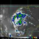
Storm INVEST: Observed By AF #966
Storm #DD in Atlantic Ocean1
Maximum Flight Level Winds Were 41KT (47.2mph 75.9km/h) In E Quadrant At 1900Z
Estimated Max Surface Winds 36.9KT (42.4mph 68.3km/h) *
Misc Remarks: SLP EXTRAP FROM 1500FT. MAX FL TEMP 27 DEG C 160/32 NM FROM FL CENTER.
Date/Time of Recon Report: Friday, October 08, 2004 3:19:00 PM (Fri, 8 Oct 2004 19:19:00 UTC)
Position of the center: 24° 21' N 94° 04' W (24.4°N 94.1°W)
Surface Winds Were Estimated At: 35KT (40.25MPH 64.8km/h)
Estimated Surface Winds Were Measured 015nm (17.25miles) From Center At Bearing 105°
Maximum Flight Level Winds Near Center Were 038KT (43.7mph 70.4km/h) From 130°
Maximum Flight Level Winds Were Measured 026nm (29.9 miles) From Center At Bearing 145°
Minimum pressure: 1004mb (29.65in) -- Extrapolated
Eye Wall Characterization Not Reported
Eye Did Not Have A Definable Form or was not reported
Center Fix Established Using: Penetration Wind Pressure Temperature
Center Fix Established At Level(s): Surface 1500ft
Navigational Accuracy Measured At 0.1nm
Meteorological Accuracy Measured At 2nm
* = Estimated Surface Winds are assumed 90% of Max Flight Level Winds
--------------------
2005 Forecast: 14/7/4
BUCKLE UP!
"If your topic ain't tropic, your post will be toast"
|
Rasvar
Weather Master

Reged:
Posts: 571
Loc: Tallahassee, Fl
|
|
Whats a weekend in Florida without storm watching?
Not sure what to make of this one. Truthfully, I have not been watching really close. It has been a "don't look. Maybe it will go away" type of deal. Hoping he is just a rain maker and nothing more.
--------------------
Jim
|
LI Phil
User

Reged:
Posts: 2637
Loc: Long Island (40.7N 73.6W)
|
|
Yep...straight to Matthew...
I know Ed doesn't like bashing, but THEY TOTALLY DROPPED THE BALL ON THIS ONE!
This thing was a TD yesterday...why they had to futz around with whether it will be subtropical, baroclinic yada yada yada. Now we have a friggin' Tropical Storm in the GOM...and they tell us on a Friday Afternoon at 5:00 on a Holiday Weekend! Thanks...
At least anyone on these boards had warning.
--------------------
2005 Forecast: 14/7/4
BUCKLE UP!
"If your topic ain't tropic, your post will be toast"
|
Kimberley Clark
Weather Watcher
Reged:
Posts: 44
Loc: Mobile, Alabama
|
|
I have been trying to tell the folks around my area, but they just think I'm a weather freak. I have been watching this thing for over a week now, telling my husband just to watch and see.
--------------------
Kimberley Clark
Mobile, Alabama
Weather Watcher
|
LI Phil
User

Reged:
Posts: 2637
Loc: Long Island (40.7N 73.6W)
|
|
MIKE HAS PUT UP A NEW THREAD
--------------------
2005 Forecast: 14/7/4
BUCKLE UP!
"If your topic ain't tropic, your post will be toast"
|
recmod
Weather Guru

Reged:
Posts: 188
Loc: Orlando, FL
|
|
Quote:
Tropical Storm MATTHEW
--------------------------------------------------------------------------------
Home Public Advisory Forecast/Advisory Probabilities Maps/Charts Archive
--------------------------------------------------------------------------------
000
WTNT34 KNHC 082045
TCPAT4
BULLETIN
TROPICAL STORM MATTHEW ADVISORY NUMBER 1
NWS TPC/NATIONAL HURRICANE CENTER MIAMI FL
4 PM CDT FRI OCT 08 2004
...THIRTEENTH TROPICAL STORM OF THE SEASON FORMS IN THE WESTERN GULF
OF MEXICO...
INTERESTS THROUGHOUT THE NORTHERN GULF OF MEXICO SHOULD MONITOR THE
PROGRESS OF MATTHEW.
AT 4 PM CDT...2100Z...THE CENTER OF TROPICAL STORM MATTHEW WAS
LOCATED NEAR LATITUDE 24.2 NORTH... LONGITUDE 93.8 WEST OR ABOUT
260 MILES EAST-SOUTHEAST OF BROWNSVILLE TEXAS.
MATTHEW IS MOVING TOWARD THE EAST NEAR 10 MPH. A TURN TO THE
EAST-NORTHEAST IS EXPECTED OVER THE NEXT 24 HOURS
hmmmm.......that movement is kind of alarming for Florida. I had thought the storm would be moving more NNE at this point, with a NE turn later on. If the present motion continues for some time, this could get very ugly for Central Florida once again. Even a big bend landfall would bring us on the right side of the circulation....with the resulting nastiest weather. A definite major flood threat is again in the making.
--Lou
|


 Threaded


